Clarendon Hills is a village in DuPage County, Illinois, United States. The population was 8,702 at the 2020 census. It is a south-west suburb of Chicago.
| Name: | Clarendon Hills village |
|---|---|
| LSAD Code: | 47 |
| LSAD Description: | village (suffix) |
| State: | Illinois |
| County: | DuPage County |
| Incorporated: | 1924 |
| Elevation: | 728 ft (222 m) |
| Total Area: | 1.82 sq mi (4.71 km²) |
| Land Area: | 1.81 sq mi (4.69 km²) |
| Water Area: | 0.01 sq mi (0.03 km²) 0.55% |
| Total Population: | 8,702 |
| Population Density: | 4,808/sq mi (1,856.10/km²) |
| Area code: | 630 and 331 |
| FIPS code: | 1714572 |
| Website: | www.clarendonhills.us |
Online Interactive Map
Click on ![]() to view map in "full screen" mode.
to view map in "full screen" mode.
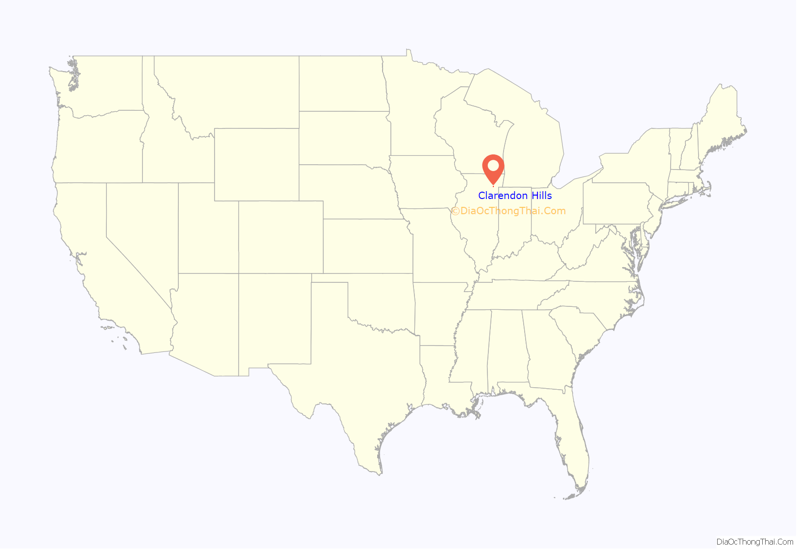
Clarendon Hills location map. Where is Clarendon Hills village?

History
The area that is now Clarendon Hills was a wide, rolling prairie bordering the east side of Westmont. Most of the older villages in Downers Grove Township were built on the same street grid as the Village of Downers Grove. Instead, Clarendon Hills was built to resemble nearby Riverside, a planned, park-like suburb designed by Fredrick Law Olmsted in the late 1800’s. Its long winding streets go with the natural contour of the land, rather than extending straight through from the neighboring towns. In 1923, at the time of incorporation, Clarendon Hills had a population of under 900 people. The area was incorporated to avoid annexation by the nearby affluent community of Hinsdale.
The Clarendon Hills Historical Society is tasked with retaining the town’s history and establishing a community center and a museum to display prominent artifacts pertaining to the history of the village.
In 1961, TWA Flight 529 crashed in Clarendon Hills, killing all 73 passengers on board.
On May 11, 2022, a Metra train collided with a box truck on the Prospect Avenue grade crossing; one person lost her life.
Clarendon Hills Road Map
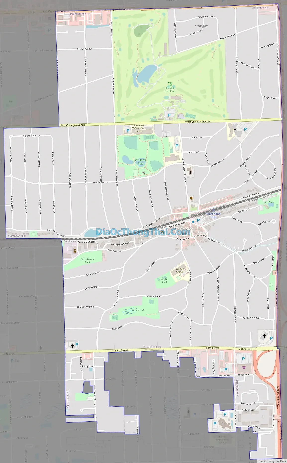
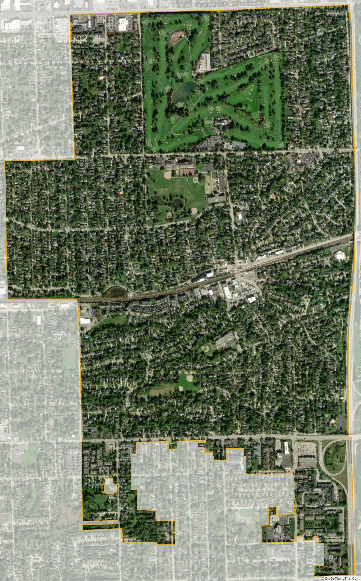
Clarendon Hills city Satellite Map
Geography
Clarendon Hills is located at 41°47′46″N 87°57′21″W / 41.79611°N 87.95583°W / 41.79611; -87.95583 (41.796030, -87.955960). It is approximately 18 miles southwest of Chicago.
According to the 2021 census gazetteer files, Clarendon Hills has a total area of 1.82 square miles (4.71 km), of which 1.81 square miles (4.69 km) (or 99.45%) is land and 0.01 square miles (0.03 km) (or 0.55%) is water.
See also
Map of Illinois State and its subdivision:- Adams
- Alexander
- Bond
- Boone
- Brown
- Bureau
- Calhoun
- Carroll
- Cass
- Champaign
- Christian
- Clark
- Clay
- Clinton
- Coles
- Cook
- Crawford
- Cumberland
- De Kalb
- De Witt
- Douglas
- Dupage
- Edgar
- Edwards
- Effingham
- Fayette
- Ford
- Franklin
- Fulton
- Gallatin
- Greene
- Grundy
- Hamilton
- Hancock
- Hardin
- Henderson
- Henry
- Iroquois
- Jackson
- Jasper
- Jefferson
- Jersey
- Jo Daviess
- Johnson
- Kane
- Kankakee
- Kendall
- Knox
- La Salle
- Lake
- Lake Michigan
- Lawrence
- Lee
- Livingston
- Logan
- Macon
- Macoupin
- Madison
- Marion
- Marshall
- Mason
- Massac
- McDonough
- McHenry
- McLean
- Menard
- Mercer
- Monroe
- Montgomery
- Morgan
- Moultrie
- Ogle
- Peoria
- Perry
- Piatt
- Pike
- Pope
- Pulaski
- Putnam
- Randolph
- Richland
- Rock Island
- Saint Clair
- Saline
- Sangamon
- Schuyler
- Scott
- Shelby
- Stark
- Stephenson
- Tazewell
- Union
- Vermilion
- Wabash
- Warren
- Washington
- Wayne
- White
- Whiteside
- Will
- Williamson
- Winnebago
- Woodford
- Alabama
- Alaska
- Arizona
- Arkansas
- California
- Colorado
- Connecticut
- Delaware
- District of Columbia
- Florida
- Georgia
- Hawaii
- Idaho
- Illinois
- Indiana
- Iowa
- Kansas
- Kentucky
- Louisiana
- Maine
- Maryland
- Massachusetts
- Michigan
- Minnesota
- Mississippi
- Missouri
- Montana
- Nebraska
- Nevada
- New Hampshire
- New Jersey
- New Mexico
- New York
- North Carolina
- North Dakota
- Ohio
- Oklahoma
- Oregon
- Pennsylvania
- Rhode Island
- South Carolina
- South Dakota
- Tennessee
- Texas
- Utah
- Vermont
- Virginia
- Washington
- West Virginia
- Wisconsin
- Wyoming