McAllen is the largest city in Hidalgo County, Texas, United States, and the 22nd-most populous city in Texas. It is located at the southern tip of the state in the Rio Grande Valley, on the Mexico–United States border. The city limits extend south to the Rio Grande, across from the Mexican city of Reynosa. McAllen is about 70 mi (110 km) west of the Gulf of Mexico. As of the 2020 census, McAllen’s population was 142,210. It is the fifth-most populous metropolitan area (McAllen–Edinburg–Mission) in the state of Texas, and the binational Reynosa–McAllen metropolitan area counts a population of more than 1.5 million.
From its settlement in 1904, the area around McAllen was largely rural and agricultural in character, but the latter half of the 20th century had steady growth, which has continued in the 21st century in the metropolitan area. The introduction of the maquiladora economy and the North American Free Trade Association led to an increase in cross-border trading with Mexico.
| Name: | McAllen city |
|---|---|
| LSAD Code: | 25 |
| LSAD Description: | city (suffix) |
| State: | Texas |
| County: | Hidalgo County |
| Elevation: | 121.4 ft (37.1 m) |
| Land Area: | 62.31 sq mi (161.37 km²) |
| Water Area: | 0.43 sq mi (1.11 km²) |
| Population Density: | 2,283/sq mi (881.3/km²) |
| Area code: | 956 |
| FIPS code: | 4845384 |
| GNISfeature ID: | 1374829 |
| Website: | www.mcallen.net |
Online Interactive Map
Click on ![]() to view map in "full screen" mode.
to view map in "full screen" mode.
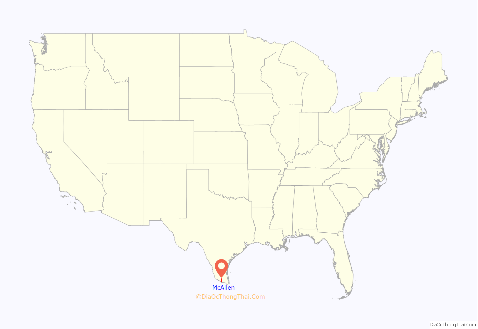
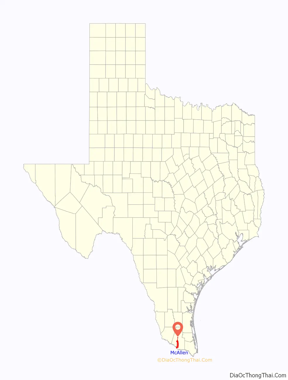
McAllen location map. Where is McAllen city?
History
In 1904, the Hidalgo and San Miguel Extension (now the Sam Fordyce Branch) of the St. Louis, Brownsville and Mexico Railway reached the Santa Anita Ranch. John McAllen and his son James had donated land to the railroad to guarantee it would cross this area. On December 5, 1904, the McAllen Townsite Company was formed by Uriah Lott, Leonidas C. Hill Sr., John McAllen, James Ballí McAllen, and John J. Young. The new community, which was named for John McAllen, had the depot nearest the county seat, Hidalgo, 8 mi (13 km) to the south.
By 1911, 5,000 acres (2,000 ha) were under cultivation in East McAllen: commodity crops of cotton, alfalfa, broom corn, citrus fruits, grapes, and figs were raised. East McAllen had an estimated population of 1,000 that year, and West McAllen had ceased to exist. In 1911, the town applied for and was issued a charter of incorporation under the name McAllen. In 1916, 20,000 New York state troops were stationed at McAllen to help quell border disturbances related to the Mexican Civil War. The resulting economic boom increased the population from 1,200 in 1916 to 6,000 in 1920.
McAllen adopted a home rule charter in 1927. Canning factories, a winery, tortilla plants, wood-working plants, and some oil exploration increased the population to 9,074 by 1930. In 1936, Hiram Garner opened the Valley Distillery, Incorporated, which produced wines from citrus juices. The town was a petroleum and farm chemurgic center with a population of 11,877 in 1940, by which time it had adopted the nickname “The City of Palms”. In 1941, a suspension bridge replaced the old bridge from Hidalgo to Reynosa in Tamaulipas; the new toll bridge was purchased by McAllen and was named the McAllen–Hidalgo–Reynosa International Bridge. Its construction resulted in increased tourist trade, making McAllen a winter resort and port of entry to Mexico.
The discovery of oil in the Reynosa area in 1947 attracted a large migration of people from the Mexican interior to jobs the region. They both constituted a new tourist market and a cheap labor supply for McAllen. The sister cities were linked as a result of the increased traffic between them. The population of McAllen was 20,005 in 1950 and 32,728 in 1960. In 1954 the McAllen–Hidalgo–Reynosa International Bridge was the number-two port of entry into Mexico.
McAllen was an agricultural, oil, and tourist center in 1970, when the population reached 37,636. By the start of the 1970s, McAllen had a 200-bed hospital and a new air-conditioned high school, the first school in the nation featuring on-site power generated by natural gas-powered turbines. The tourism industry continued to expand as people traveled to the area from both Mexico and the northern United States. The population continued to grow steadily through the 1970s, and reached 66,281 by 1980. During the late 1980s, the McAllen Foreign Trade Zone was an important general-purpose foreign trade zone. At the time, McAllen’s main industries were retail, tourism and farming, and each was in trouble. The devaluation of the Mexican peso in the 1980s put a damper on cross-border shopping; local tourism was down because of the recession. In 1983, a freeze took out much of the valley’s citrus crop.
In the mid-1980s, fueled by trade and the growth of the maquiladora (in which components are shipped to Mexico from the United States, assembled, and shipped back as finished products), the economy began to improve in Hidalgo County. McAllen sits across the border from Reynosa, a large manufacturing center. After the peso devalued, Mexico was more successful in attracting companies to run their plants in Mexico, with support operations in Texas.
Border crossing is a daily event for many and is a key component in the local economy. The city became a focal point for concerns about the border during the United States federal government shutdown of 2018–2019 over the Mexico–United States barrier. President Donald Trump held a briefing with the border agents at the patrol station here in January 2019. Homeland Security Secretary Kirstjen Nielsen also visited the Border Patrol station in March 2019. In order to deal with overcrowded facilities in 2019 resulting from the arrival of Central American migrant caravans, immigration authorities were releasing a few hundred asylum seekers daily to private groups that assist them with basic needs and travel arrangements.
The mayor emphasized how safe and secure the city is when U.S military troops were mobilized in the city to help the Border Patrol. Portions of the razor wire coils considered unnecessary by the city were removed after troops had placed it at the border. The troops assisted by using military helicopters to carry border patrol agents to and from locations along the Mexico–United States border and by maintaining vehicles. During these border support activities, they are prohibited from law enforcement activities, such as detaining migrants or seizing drugs. U.S. military troops are prohibited from carrying out law enforcement duties. The Marine Corps Commandant General Robert Neller expressed concerns about the impact of continuing border support on combat readiness for the troops.
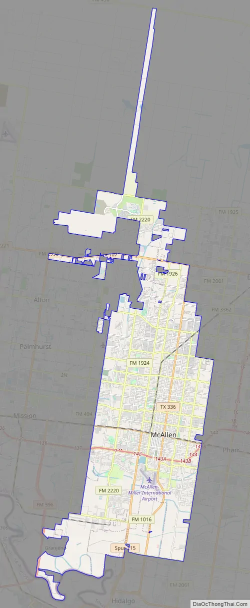
McAllen Road Map
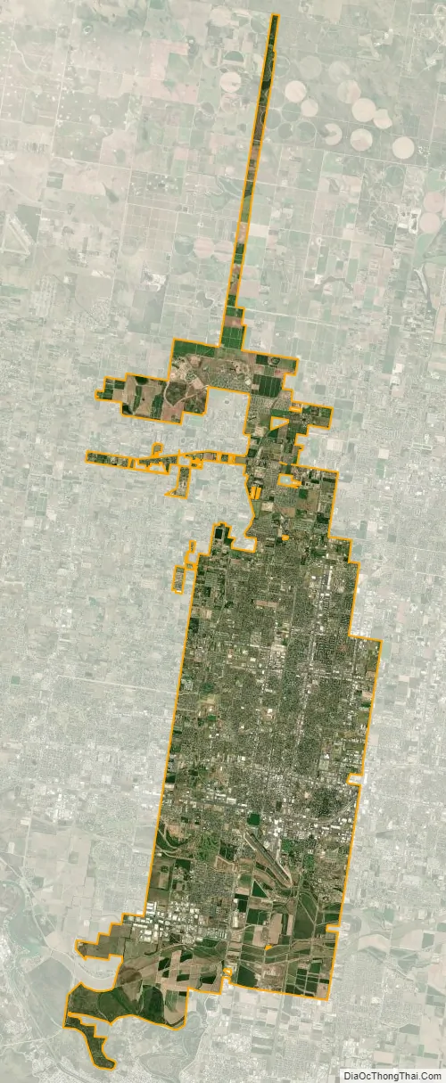
McAllen city Satellite Map
Geography
McAllen is located in southern Hidalgo County at 26°12′59″N 98°14′11″W / 26.21639°N 98.23639°W / 26.21639; -98.23639 (26.216263, −98.236385). It is bordered to the southwest by Granjeno; to the west by Mission, Palmhurst, and Alton; to the north by Edinburg, the Hidalgo county seat; to the east by Pharr; and to the south by Hidalgo. The McAllen city limits extend to the southwest as far as the Rio Grande, directly north of Reynosa, Tamaulipas, in Mexico. The Anzalduas International Bridge crosses the Rio Grande at this point, 11 mi (18 km) southwest of downtown McAllen.
McAllen is 238 mi (383 km) south of San Antonio, 148 mi (238 km) southeast of Laredo, 60 mi (97 km) northwest of Brownsville, and 150 mi (240 km) northeast of Monterrey.
According to the United States Census Bureau, the city has a total area of 48.6 square miles (126.0 km), of which 48.3 square miles (125.2 km) are land and 0.3 square miles (0.8 km), or 0.62%, is covered by water.
Although McAllen is named the “City of Palms”, tropical vegetation is only locally dominant. Many thorny shrubs and deciduous trees occur in the area, such as the Rio Grande ash (Fraxinus berlandieriana), cedar elm (Ulmus crassifolia), and honey mesquite (Prosopis glandulosa).
Climate
McAllen, like much of South Texas, has a subtropical climate. Under the Köppen climate classification, the city features a hot semiarid climate (BSh), featuring long, very hot and humid summers, and brief, warm winters. The city has two distinct seasons; a wet season from May to October and a dry season from November to April. The normal monthly mean temperature ranges from 62.8 °F (17.1 °C) in January to 89.3 °F (31.8 °C) in August. The warm season is extremely long, as average high temperatures from May through September are above 90 °F (32 °C) and average low temperatures are above 70 °F (21 °C), with relatively high dew point values, resulting in higher relative humidity values and heat index values. Heat indices consistently reach over 110 °F (43 °C) during these months. Winter temperatures in McAllen and surrounding Rio Grande Valley are some of the warmest in the contiguous United States outside of South Florida, and comparable to the Coachella and Imperial valleys and Yuma Desert, but with warmer nighttime lows and higher dew points.
Average annual precipitation is 22.31 inches (567 millimeters). Most precipitation occurs in the warm season, with the least precipitation distinctly occurring in the cooler winter. As September is the peak of the north Atlantic hurricane season and tropical storms and hurricanes occasionally drop copious amounts of rainfall on the region, this month tends by far to be the wettest, averaging 4.74 in (120 mm) of rain. The driest month is February, with only 0.66 in (17 mm) of precipitation. Since 1941, it has snowed twice, once when the city received 1.7 in (43 mm) on December 25, 2004.
Temperatures consistently rise above 100 °F (38 °C) from June through August, with exceptionally high humidity. The highest temperature ever recorded in McAllen was 111 °F (44 °C), set on June 22, 2017. The lowest temperature ever recorded in McAllen was 13 °F (−11 °C), on January 12, 1962.
While usually a hot, humid, but relatively dry climate, McAllen, Texas has received unusual weather phenomena. In 2013, McAllen, Texas received a large hail storm that destroyed many vehicles and buildings. The storm came suddenly and many people were unprepared. In December 2017, McAllen received almost 3 inches of snow, nearly 13 years after the previous snowfall which took place during the 2004 Christmas Eve United States winter storm. In February 2021, McAllen reached record low temperatures between 10 °F (−12 °C) and 20 °F (−7 °C) and lost power, heat, and water for a week due to Winter Storm Uri. Despite these fluke weather events, McAllen is prone to tropical storms, hurricanes such as Hurricane Dolly (2008) and Hurricane Hanna (2020), and heatwaves.
See also
Map of Texas State and its subdivision:- Anderson
- Andrews
- Angelina
- Aransas
- Archer
- Armstrong
- Atascosa
- Austin
- Bailey
- Bandera
- Bastrop
- Baylor
- Bee
- Bell
- Bexar
- Blanco
- Borden
- Bosque
- Bowie
- Brazoria
- Brazos
- Brewster
- Briscoe
- Brooks
- Brown
- Burleson
- Burnet
- Caldwell
- Calhoun
- Callahan
- Cameron
- Camp
- Carson
- Cass
- Castro
- Chambers
- Cherokee
- Childress
- Clay
- Cochran
- Coke
- Coleman
- Collin
- Collingsworth
- Colorado
- Comal
- Comanche
- Concho
- Cooke
- Coryell
- Cottle
- Crane
- Crockett
- Crosby
- Culberson
- Dallam
- Dallas
- Dawson
- Deaf Smith
- Delta
- Denton
- Dewitt
- Dickens
- Dimmit
- Donley
- Duval
- Eastland
- Ector
- Edwards
- El Paso
- Ellis
- Erath
- Falls
- Fannin
- Fayette
- Fisher
- Floyd
- Foard
- Fort Bend
- Franklin
- Freestone
- Frio
- Gaines
- Galveston
- Garza
- Gillespie
- Glasscock
- Goliad
- Gonzales
- Gray
- Grayson
- Gregg
- Grimes
- Guadalupe
- Hale
- Hall
- Hamilton
- Hansford
- Hardeman
- Hardin
- Harris
- Harrison
- Hartley
- Haskell
- Hays
- Hemphill
- Henderson
- Hidalgo
- Hill
- Hockley
- Hood
- Hopkins
- Houston
- Howard
- Hudspeth
- Hunt
- Hutchinson
- Irion
- Jack
- Jackson
- Jasper
- Jeff Davis
- Jefferson
- Jim Hogg
- Jim Wells
- Johnson
- Jones
- Karnes
- Kaufman
- Kendall
- Kenedy
- Kent
- Kerr
- Kimble
- King
- Kinney
- Kleberg
- Knox
- La Salle
- Lamar
- Lamb
- Lampasas
- Lavaca
- Lee
- Leon
- Liberty
- Limestone
- Lipscomb
- Live Oak
- Llano
- Loving
- Lubbock
- Lynn
- Madison
- Marion
- Martin
- Mason
- Matagorda
- Maverick
- McCulloch
- McLennan
- McMullen
- Medina
- Menard
- Midland
- Milam
- Mills
- Mitchell
- Montague
- Montgomery
- Moore
- Morris
- Motley
- Nacogdoches
- Navarro
- Newton
- Nolan
- Nueces
- Ochiltree
- Oldham
- Orange
- Palo Pinto
- Panola
- Parker
- Parmer
- Pecos
- Polk
- Potter
- Presidio
- Rains
- Randall
- Reagan
- Real
- Red River
- Reeves
- Refugio
- Roberts
- Robertson
- Rockwall
- Runnels
- Rusk
- Sabine
- San Augustine
- San Jacinto
- San Patricio
- San Saba
- Schleicher
- Scurry
- Shackelford
- Shelby
- Sherman
- Smith
- Somervell
- Starr
- Stephens
- Sterling
- Stonewall
- Sutton
- Swisher
- Tarrant
- Taylor
- Terrell
- Terry
- Throckmorton
- Titus
- Tom Green
- Travis
- Trinity
- Tyler
- Upshur
- Upton
- Uvalde
- Val Verde
- Van Zandt
- Victoria
- Walker
- Waller
- Ward
- Washington
- Webb
- Wharton
- Wheeler
- Wichita
- Wilbarger
- Willacy
- Williamson
- Wilson
- Winkler
- Wise
- Wood
- Yoakum
- Young
- Zapata
- Zavala
- Alabama
- Alaska
- Arizona
- Arkansas
- California
- Colorado
- Connecticut
- Delaware
- District of Columbia
- Florida
- Georgia
- Hawaii
- Idaho
- Illinois
- Indiana
- Iowa
- Kansas
- Kentucky
- Louisiana
- Maine
- Maryland
- Massachusetts
- Michigan
- Minnesota
- Mississippi
- Missouri
- Montana
- Nebraska
- Nevada
- New Hampshire
- New Jersey
- New Mexico
- New York
- North Carolina
- North Dakota
- Ohio
- Oklahoma
- Oregon
- Pennsylvania
- Rhode Island
- South Carolina
- South Dakota
- Tennessee
- Texas
- Utah
- Vermont
- Virginia
- Washington
- West Virginia
- Wisconsin
- Wyoming


