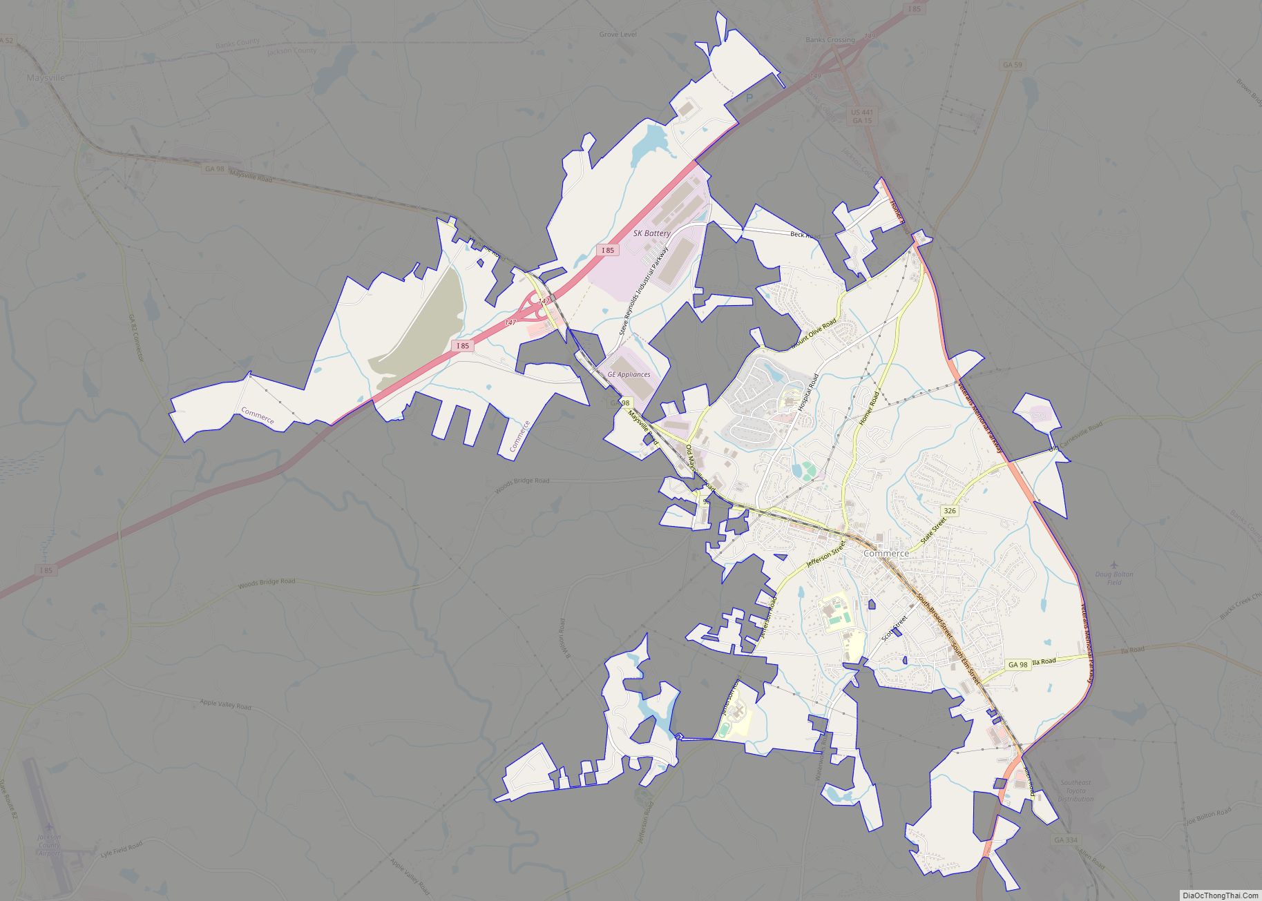
Commerce is a city in Jackson County, Georgia, 70 miles (110 km) northeast of Atlanta. As of the 2020 census, the city had a population of 7,387.
| Name: | Commerce city |
|---|---|
| LSAD Code: | 25 |
| LSAD Description: | city (suffix) |
| State: | Georgia |
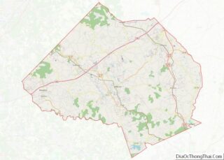
| County: | Jackson County |
| Elevation: | 912 ft (278 m) |
| Total Area: | 13.38 sq mi (34.66 km²) |
| Land Area: | 13.25 sq mi (34.32 km²) |
| Water Area: | 0.13 sq mi (0.34 km²) |
| Total Population: | 7,387 |
| Population Density: | 557.51/sq mi (215.25/km²) |
| Area code: | 706 |
| FIPS code: | 1319112 |
| GNISfeature ID: | 0355254 |
| Website: | www.commercega.org |
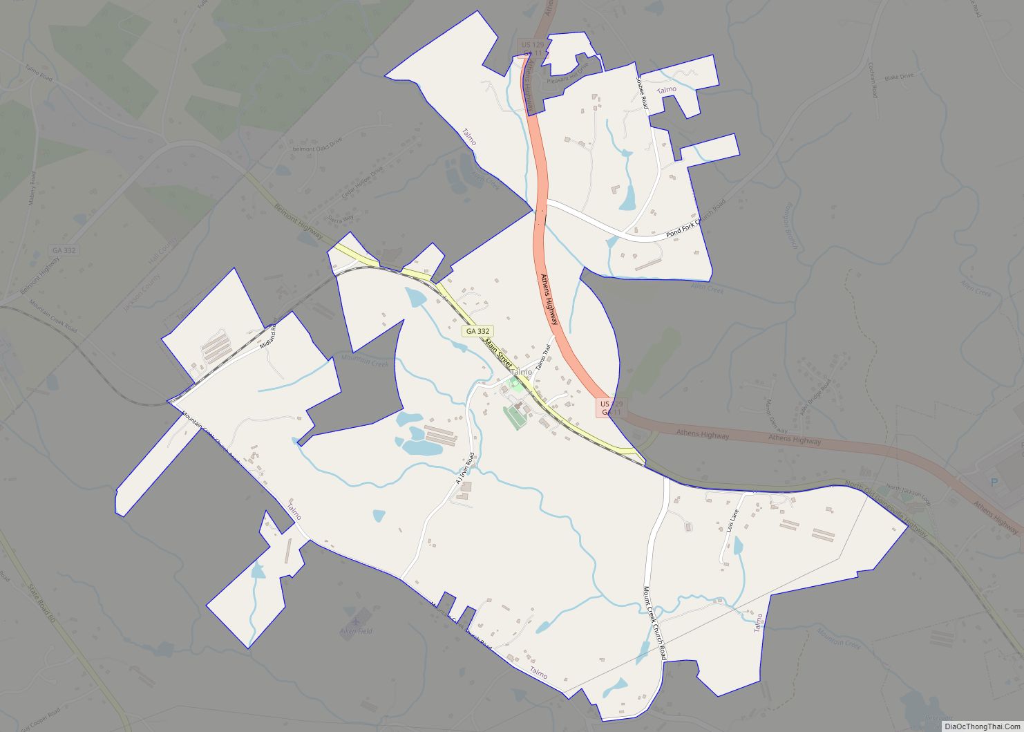
Online Interactive Map
Click on ![]() to view map in "full screen" mode.
to view map in "full screen" mode.
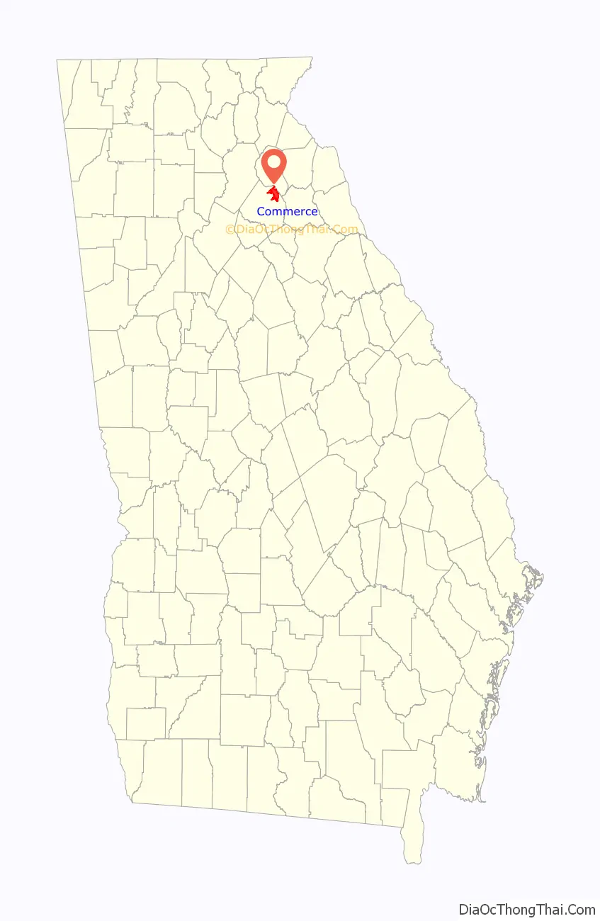
Commerce location map. Where is Commerce city?

History
Native American history
Before European settlers arrived, the area around present-day Commerce was inhabited by the Creek and the Cherokee people.
The Lacoda Trail, which extended from present-day Athens to the north Georgia mountains, was a significant trade and travel route through this area. (Georgia State Route 334, which follows a 9-mile (14 km) section of this ancient trail, was designated the “Lacoda Trail Memorial Parkway” by the Georgia General Assembly in 1998.)
Local histories that originated in the mid-1800s describe a territorial war between the Creeks and Cherokees over the land in the county during the 1770s. This war never occurred. The Cherokees were decisively defeated by the Koweta Creeks in 1754. For about a decade after their 1754 defeat, all Cherokee villages in the Georgia colony and the Hiwassee River valley in North Carolina were abandoned. William Bartram traveled through northeastern Georgia in 1773 and described the Creeks as being completely dominant over the Cherokees. The Cherokees never occupied or held title to lands within the boundaries of Jackson County.
The Creek Confederacy ceded its lands east of the Oconee River in 1785. A subsequent treaty in 1793 ceded the remainder of the land that was to become Jackson County. The last corridor of Creek land, located west of Jackson County, was ceded in 1818.
Early settlement
The first permanent white settlement in Jackson County began near present-day Commerce on January 20, 1784, when German immigrant William Dunson was awarded a land grant on Little Sandy Creek. The settlement was named “Groaning Rock”, supposedly because of a nearby hollow rock formation that produced a moaning sound when the wind passed over it. (Descendants of William Dunson are still living on the original tract of land.)
A trading post was established by Eli Shankle near Groaning Rock in 1808, named “Harmony Grove”. The common explanation is that the name is a play on his wife, Rebecca’s, maiden name: Hargrove. There is also an old Appalachian hymn tune called “Harmony Grove”, found in an 1830 book called The Virginia Harmony. This tune is popular today as the melody to “Amazing Grace”.
The Harmony Grove Female Academy, the first all-female school chartered in the state of Georgia, was chartered by the state legislature on December 20, 1824.
The Harmony Grove post office was established on October 14, 1825; Russell Jones was its first postmaster.
On September 1, 1876, the North Eastern Railroad opened its line from Athens to Lula, which passed through the heart of Harmony Grove. The railroad line had the most significant impact on the shape of the city, which began expanding both directions along the line. These tracks are now owned by the Norfolk Southern Railway.
City history
The Harmony Grove community was officially incorporated as a town on December 24, 1884, including all areas within a one-mile radius of the railroad depot, one half mile east, and 400 yards west.
Harmony Grove Mills, Inc. was organized under the laws of Jackson County on April 3, 1893, for the purpose of processing and producing cotton textiles. It served various purposes over the years, including the manufacture of denim overalls and the earliest production of electricity in the city. The mill village created to house employees makes up a significant portion of the homes on the southeast end of Commerce today. The mill had been in operation under various corporations until the spring of 2004, when it closed operations and was sold; it has been used for warehouse storage space since, and is currently for sale. The building is still a major feature of the city.
Near the end of the 19th century, many began to feel that the name “Harmony Grove” was too long to write and sounded too much like a country village. In addition, many didn’t like the fact that mail frequently went to another post office by the same name in Dawson County. Harmony Grove was reincorporated and renamed “Commerce” on August 6, 1904, in an effort to address these concerns and reflect the city’s commercial dominance in the north Georgia cotton trade.
In 1959, a series of controversial town hall meetings were held to try to convince members of the federal Interstate Highway System to re-route the proposed Interstate 85, originally planned to go through Gainesville (Hall County), through Commerce and Lavonia (Franklin County). The proposal was changed, and the interstate was routed through Jackson County. Even more so than the railroad nearly a century before, this major transportation artery brought tremendous commercial advantage to Commerce, at a time it desperately needed it.
Commerce Road Map

Commerce city Satellite Map

Geography
Commerce is located in northeastern Jackson County at 34°12′23″N 83°27′40″W / 34.20639°N 83.46111°W / 34.20639; -83.46111 (34.206520, -83.461203). Interstate 85 runs through the northern part of the city, with access from Exits 147 and 149. I-85 leads southwest 70 miles (110 km) to Atlanta and northeast 78 miles (126 km) to Greenville, South Carolina. U.S. Route 441 runs along the eastern border of Commerce, leading north 27 miles (43 km) to Demorest and south 19 miles (31 km) to Athens.
According to the U.S. Census Bureau, Commerce has a total area of 11.8 square miles (30.6 km), of which 11.7 square miles (30.3 km) are land and 0.1 square miles (0.2 km), or 0.77%, are water. Commerce sits on a drainage divide between tributaries of the Oconee River to the southwest and tributaries of the Savannah River to the northeast.
See also
Map of Georgia State and its subdivision:- Appling
- Atkinson
- Bacon
- Baker
- Baldwin
- Banks
- Barrow
- Bartow
- Ben Hill
- Berrien
- Bibb
- Bleckley
- Brantley
- Brooks
- Bryan
- Bulloch
- Burke
- Butts
- Calhoun
- Camden
- Candler
- Carroll
- Catoosa
- Charlton
- Chatham
- Chattahoochee
- Chattooga
- Cherokee
- Clarke
- Clay
- Clayton
- Clinch
- Cobb
- Coffee
- Colquitt
- Columbia
- Cook
- Coweta
- Crawford
- Crisp
- Dade
- Dawson
- Decatur
- DeKalb
- Dodge
- Dooly
- Dougherty
- Douglas
- Early
- Echols
- Effingham
- Elbert
- Emanuel
- Evans
- Fannin
- Fayette
- Floyd
- Forsyth
- Franklin
- Fulton
- Gilmer
- Glascock
- Glynn
- Gordon
- Grady
- Greene
- Gwinnett
- Habersham
- Hall
- Hancock
- Haralson
- Harris
- Hart
- Heard
- Henry
- Houston
- Irwin
- Jackson
- Jasper
- Jeff Davis
- Jefferson
- Jenkins
- Johnson
- Jones
- Lamar
- Lanier
- Laurens
- Lee
- Liberty
- Lincoln
- Long
- Lowndes
- Lumpkin
- Macon
- Madison
- Marion
- McDuffie
- McIntosh
- Meriwether
- Miller
- Mitchell
- Monroe
- Montgomery
- Morgan
- Murray
- Muscogee
- Newton
- Oconee
- Oglethorpe
- Paulding
- Peach
- Pickens
- Pierce
- Pike
- Polk
- Pulaski
- Putnam
- Quitman
- Rabun
- Randolph
- Richmond
- Rockdale
- Schley
- Screven
- Seminole
- Spalding
- Stephens
- Stewart
- Sumter
- Talbot
- Taliaferro
- Tattnall
- Taylor
- Telfair
- Terrell
- Thomas
- Tift
- Toombs
- Towns
- Treutlen
- Troup
- Turner
- Twiggs
- Union
- Upson
- Walker
- Walton
- Ware
- Warren
- Washington
- Wayne
- Webster
- Wheeler
- White
- Whitfield
- Wilcox
- Wilkes
- Wilkinson
- Worth
- Alabama
- Alaska
- Arizona
- Arkansas
- California
- Colorado
- Connecticut
- Delaware
- District of Columbia
- Florida
- Georgia
- Hawaii
- Idaho
- Illinois
- Indiana
- Iowa
- Kansas
- Kentucky
- Louisiana
- Maine
- Maryland
- Massachusetts
- Michigan
- Minnesota
- Mississippi
- Missouri
- Montana
- Nebraska
- Nevada
- New Hampshire
- New Jersey
- New Mexico
- New York
- North Carolina
- North Dakota
- Ohio
- Oklahoma
- Oregon
- Pennsylvania
- Rhode Island
- South Carolina
- South Dakota
- Tennessee
- Texas
- Utah
- Vermont
- Virginia
- Washington
- West Virginia
- Wisconsin
- Wyoming