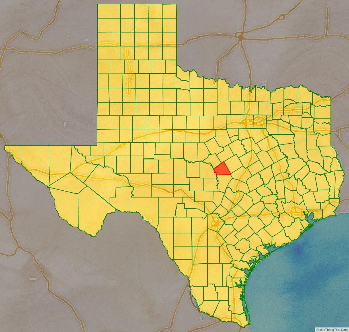
Lampasas County (/læmˈpæsəs/ lam-PASS-əs) is a county located on the Edwards Plateau in the U.S. state of Texas. As of the 2020 census, its population was 21,627. Its county seat is Lampasas. The county is named for the Lampasas River.
Lampasas County is part of the Killeen–Temple metropolitan statistical area.
| Name: | Lampasas County |
|---|---|
| FIPS code: | 48-281 |
| State: | Texas |
| Founded: | 1856 |
| Named for: | Lampasas River |
| Seat: | Lampasas |
| Largest city: | Lampasas |
| Total Area: | 714 sq mi (1,850 km²) |
| Land Area: | 713 sq mi (1,850 km²) |
| Total Population: | 21,627 |
| Population Density: | 30/sq mi (12/km²) |
| Time zone: | UTC−6 (Central) |
| Summer Time Zone (DST): | UTC−5 (CDT) |
| Website: | www.co.lampasas.tx.us |
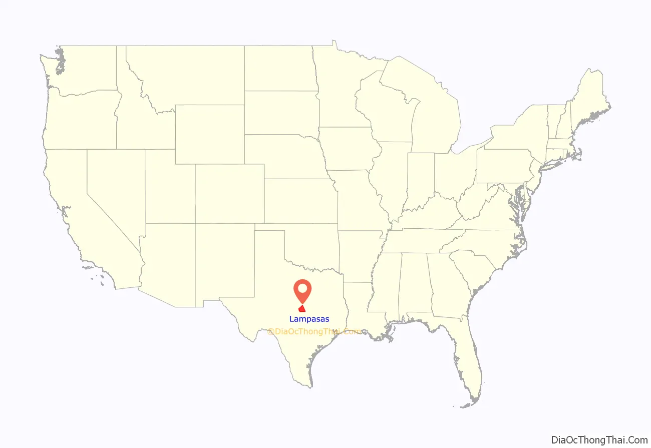
Lampasas County location map. Where is Lampasas County?
History
- Indigenous peoples were the first inhabitants of the area. Later known tribes in the area included Tonkawa, Lipan Apache and Comanche.
- 1721 The Aguayo expedition is said to have passed through the county.
- 1756 A presidio is established by Don Pedro de Terreros with the assistance of elements of the Spanish Army, at the confluence of Lucy Creek and Arroya Cavalto. The effort was abandoned not long after, but the site remained as a base of operations by Thomas Isaac Cox, a member of Terreros’ original expedition, for the purpose of obtaining hundreds of Texas mustangs for use by the Continental Army during the American Revolutionary War.
- 1853 Moses Hughes and his invalid wife, Hannah (Berry), became the first permanent settlers, seeking to take advantage of the medicinal springs.
- 1854 John Patterson was the first man to cultivate land in the county.
- 1855 Elizabeth and George W. Scott laid out the town of Burleson, named for her father. The town was later renamed Lampasas, when it becomes the county seat.
- 1856 The Sixth Texas Legislature formed Lampasas County, named after the Lampasas River, from parts of Travis, Bell, and Coryell Counties. Burleson, renamed Lampasas, is made the county seat.
- 1858 The northeastern corner of Lampasas County became part of Hamilton County.
- 1859 The Lampasas Guards were organized to ward off Indian attacks.
- 1860 Lampasas County’s population was 1,028. About 15 percent were slaves.
- 1861 Indian raids increased in Lampasas, as able-bodied men were off fighting in the war.
- 1872 Townsen’s Mill was built by Perry and Jasper Townsen. This steam mill cut “rawhide” lumber and ground wheat and corn.
- 1874 Henry A. Chadwick and son Milam built a sawmill, flour mill and cotton gin.
- 1875 The Farmers’ Alliance was born in Lampasas in reaction against the cattle rustling and illegal land dealings prevalent in the county.
- 1877 Gunfight at the Lampasas Saloon
- 1882 The Gulf, Colorado and Santa Fe Railway extended its line west from Belton to Lampasas.
- 1885 The Texas Bankers Association, the oldest and largest in the United States, had its beginnings in Lampasas.
- 1887 Mills County received northern and northwestern sections of Lampasas County.
- 1892, April 20 – First state meeting of the Daughters of the Republic of Texas was held in Lampasas.
- 1902 Pierian Club of Lampasas, a civic women’s organization, was chartered.
- 1920s Texas Power and Light Company arrived in Lampasas County.
- 1934 The Lower Colorado River Authority brought electricity to the county.
- 1935 Rollins-Brook Hospital opened near Lampasas.
- 1942 Fort Hood opened as a military training base. Hancock Park in Lampasas was temporarily turned over to the troops as a recreational area.
- 1949 Lone Star Gas established services in the county.
- Lampasas Mother’s Day Flood
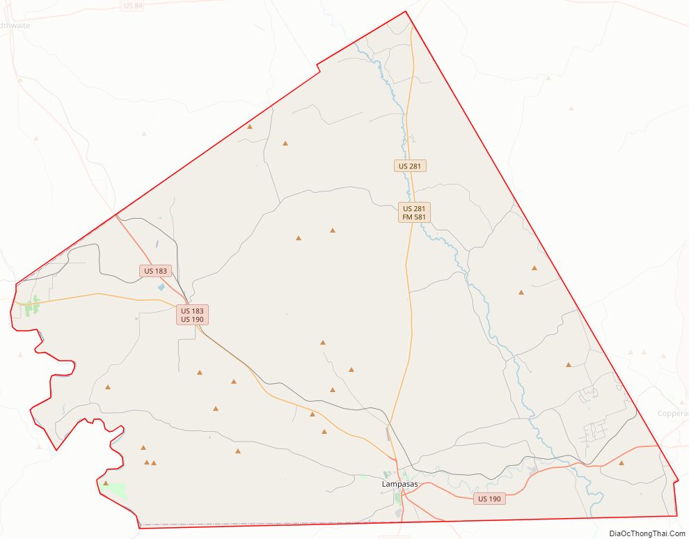
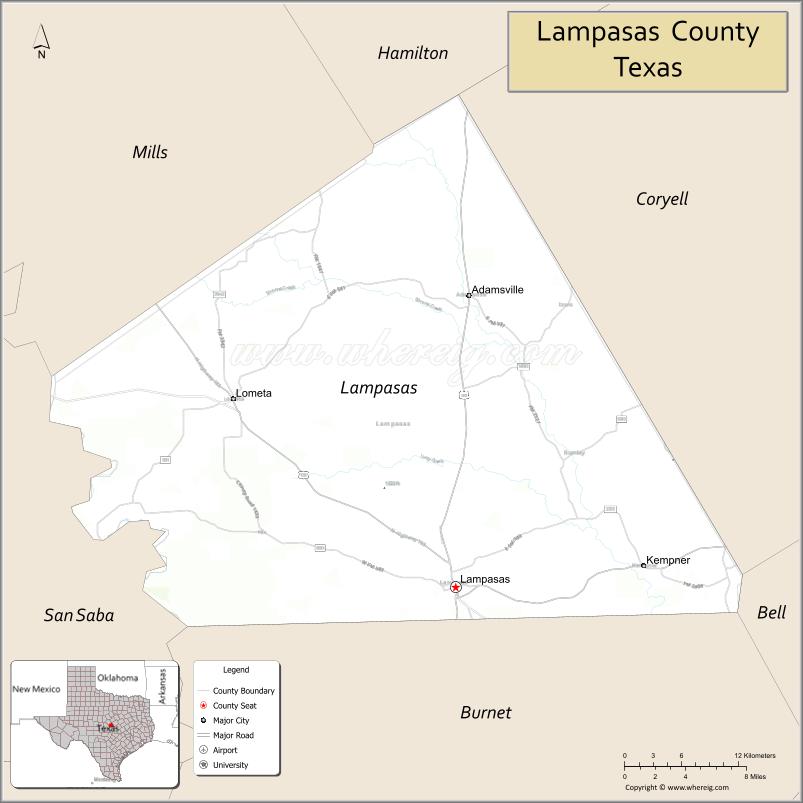
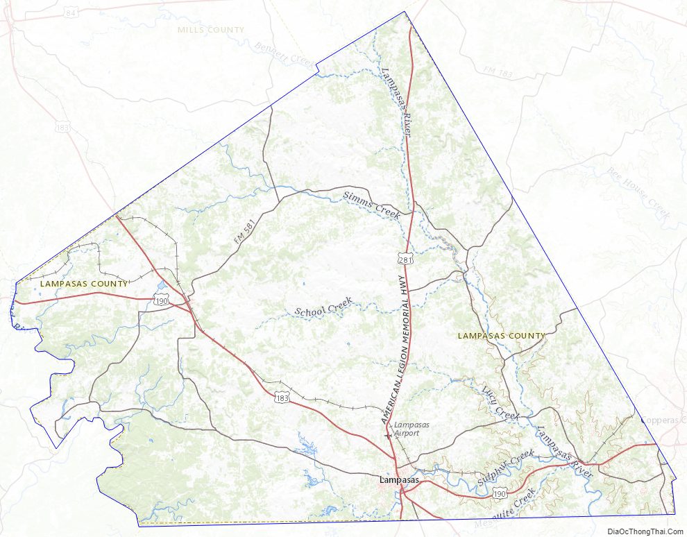
Lampasas County Road Map
Geography
According to the U.S. Census Bureau, the county has a total area of 714 sq mi (1,850 km), of which 1.1 sq mi (2.8 km) (0.2%) is covered by water.
Major highways
- U.S. Highway 183
- U.S. Highway 190
- U.S. Highway 281
Adjacent counties
- Hamilton County (north)
- Coryell County (northeast)
- Bell County (southeast)
- Burnet County (south)
- San Saba County (west)
- Mills County (northwest)
Lampasas County Topographic Map
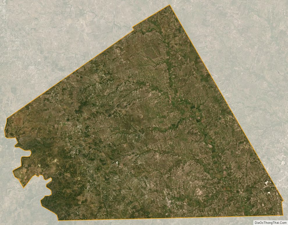
Lampasas County Satellite Map
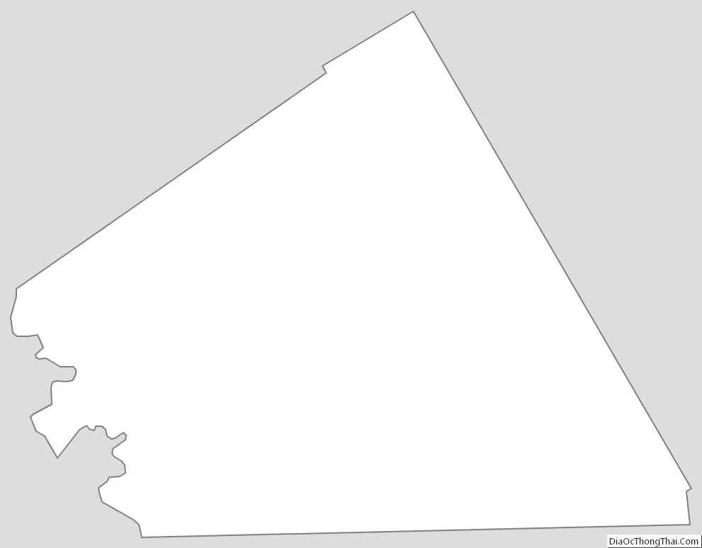
Lampasas County Outline Map