Hamilton County is a county located on the Edwards Plateau in the U.S. state of Texas. As of the 2020 census, its population was 8,222. The county seat is Hamilton. The county was created in 1858. It is named for James Hamilton Jr., a former governor of South Carolina who gave financial aid to the Republic of Texas.
| Name: | Hamilton County |
|---|---|
| FIPS code: | 48-193 |
| State: | Texas |
| Founded: | 1858 |
| Named for: | James Hamilton Jr. |
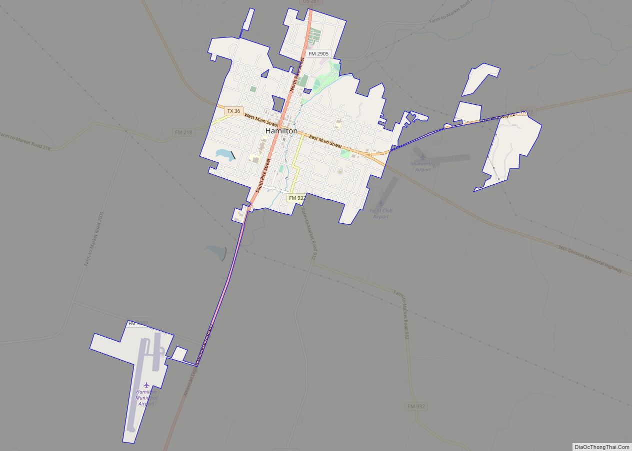
| Seat: | Hamilton |
| Largest city: | Hamilton |
| Total Area: | 836 sq mi (2,170 km²) |
| Land Area: | 836 sq mi (2,170 km²) |
| Total Population: | 8,222 |
| Population Density: | 9.8/sq mi (3.8/km²) |
| Time zone: | UTC−6 (Central) |
| Summer Time Zone (DST): | UTC−5 (CDT) |
| Website: | www.hamiltoncountytx.org |
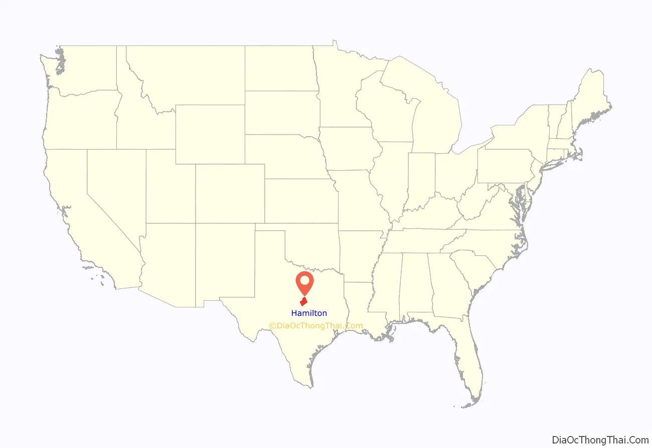
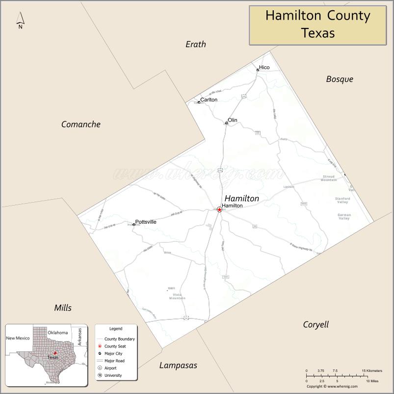
Hamilton County location map. Where is Hamilton County?
History
Indigenous peoples were the first inhabitants of the area. Later Native American tribes settled in the area, including Tawakoni, Tonkawa, Waco and Comanche.
In 1821, shortly after Mexico claimed its independence from Spain, Anglo settlers from the North came to Texas, claiming Mexican citizenship.
Following Texas’s independence from Mexico (1836) and its annexation by the United States (1845), Robert Carter and family became the first permanent white settlers in the county in 1854. The next year, settlers James Rice, Henry Standefer, Frederic Bookerman, William Beauchamp, and Asa Langford formed a community that later becomes the town of Hamilton. Asa Langford began Langford’s Cove, which later grows into present-day Evant. In 1858 the Sixth Texas Legislature formed Hamilton County, named after James Hamilton Jr., from parts of Comanche, Bosque, and Lampasas counties. In 1858, Hamilton was named the county seat.
Despite growing white settlements in Texas, Indian tribal presences remained. In 1867, Comanche raiders attacked a school where Ann Whitney was the teacher. She helped students escape before finally succumbing to 18 Comanche arrows.
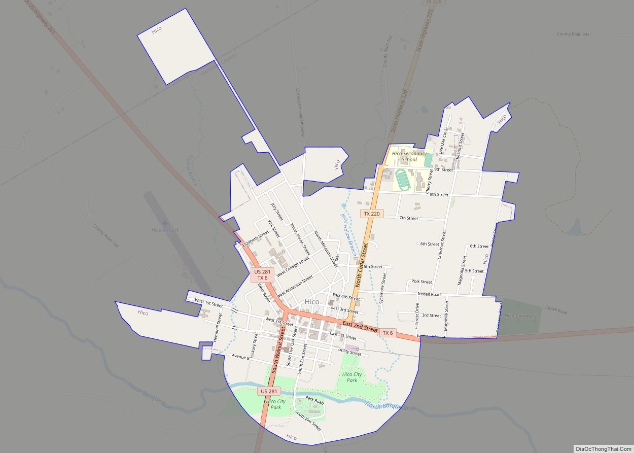
In 1882, the Hico community initiated the annual Hico Old Settlers’ Reunion.
By 1900, cotton cultivation had spread to almost 47,500 acres (192 km) of county land. By 1907, the Stephenville North and South Texas Railway had connected Hamilton with Stephenville. The St. Louis Southwestern Railway of Texas connected Hamilton with Gatesville and Comanche in 1911.
In 1934, the Civil Works Administration’s payroll included 747 Hamilton County men, who together earned about $2,000 per day.
In 1950, Ollie P. Roberts (also known as Ollie L. Roberts, “Brushy Bill” Roberts, or William Henry Roberts), a resident of Hico during the late 1940s, claimed to have been the outlaw Billy The Kid. The assertion is based on a legend that Patrick F. Garrett helped Billy fake his own death. Hico Chamber of Commerce responded by opening a Billy The Kid Museum.
In 2009, Hamilton was invaded by the West Texas Rattlesnake.
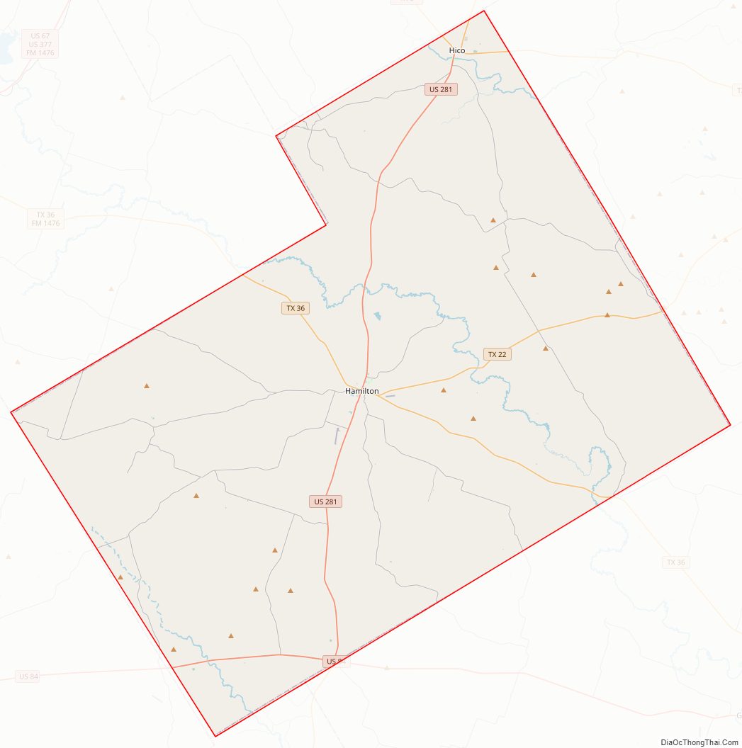
Hamilton County Road Map
Geography
According to the U.S. Census Bureau, the county has a total area of 836 square miles (2,170 km), of which 836 square miles (2,170 km) is land and 0.5 square miles (1.3 km) (0.06%) is water.
Major highways
- U.S. Highway 84
- U.S. Highway 281
- State Highway 6
- State Highway 22
- State Highway 36
- State Highway 220
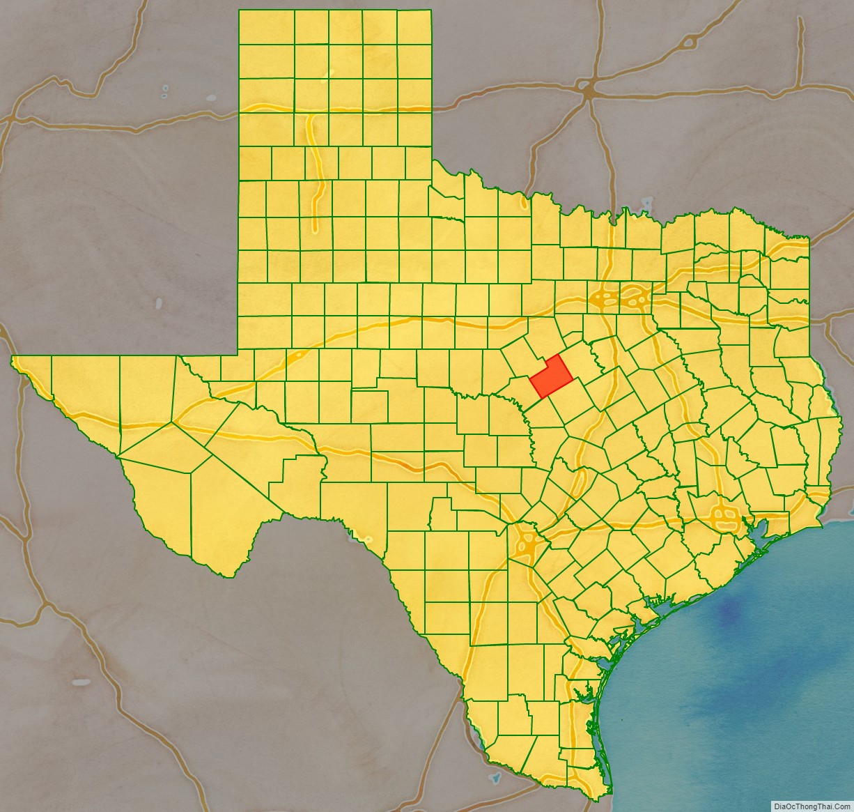
Adjacent counties
- Erath County (north)
- Bosque County (northeast)
- Coryell County (southeast)
- Lampasas County (south)
- Mills County (southwest)
- Comanche County (northwest)
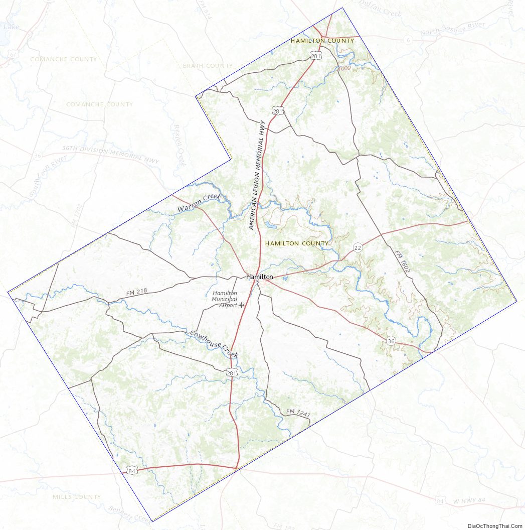
Hamilton County Topographic Map
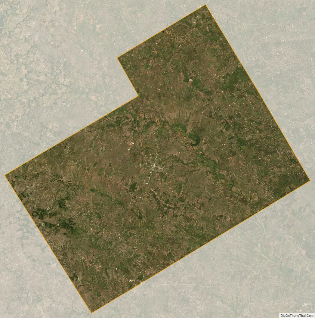
Hamilton County Satellite Map
Hamilton County Outline Map