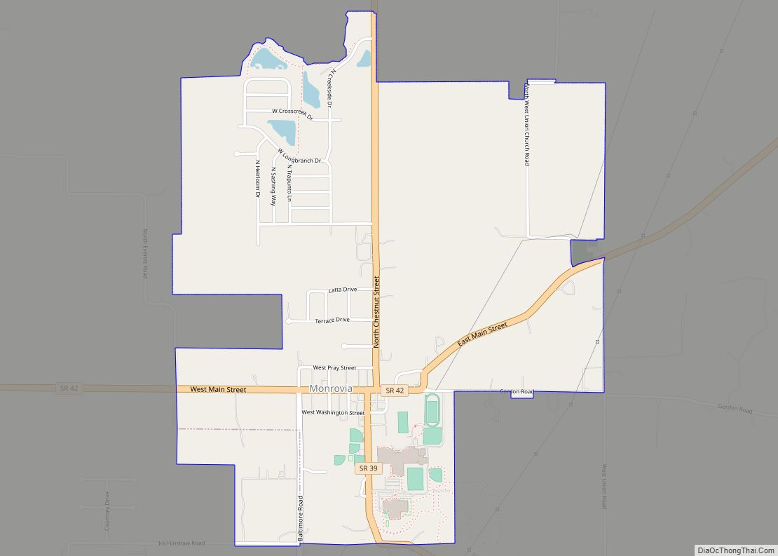
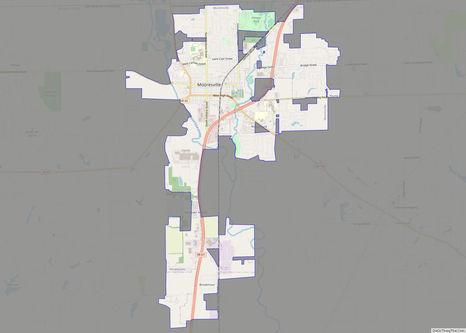
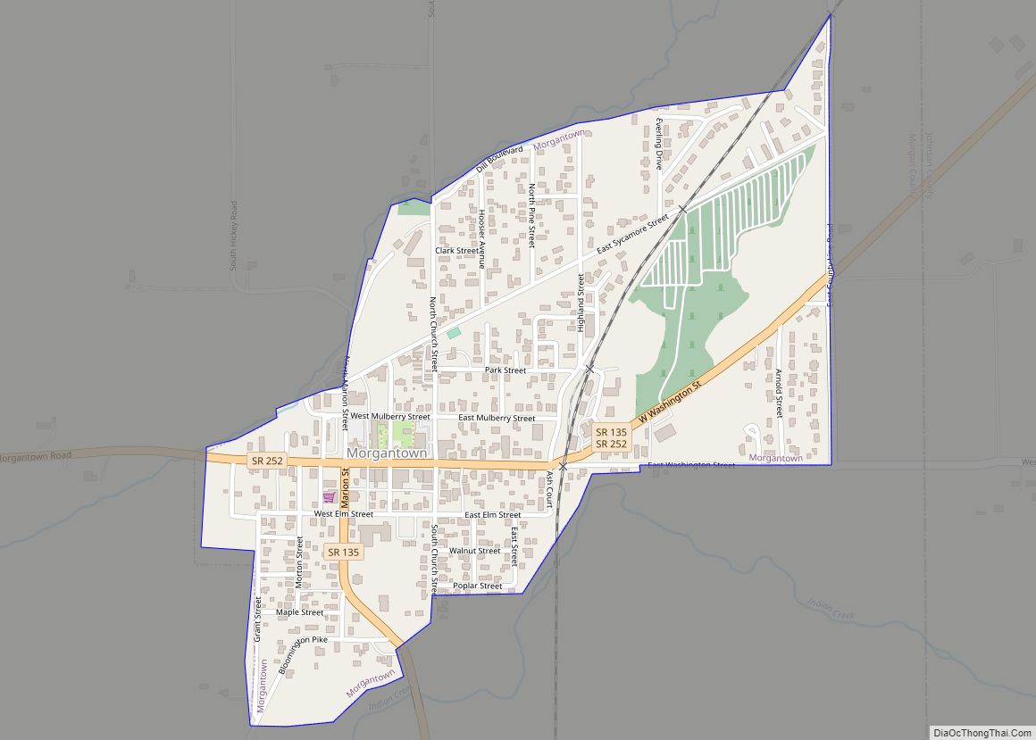
Morgan County is a county located in the U.S. state of Indiana. As of the 2010 United States Census, the population was 68,894. The county seat (and only incorporated city) is Martinsville.
Morgan County is between Indianapolis, in Marion County, and Bloomington in Monroe County. It is included in the Indianapolis-Carmel–Anderson, IN Metropolitan Statistical Area. Two major highways, Interstate 69 and Indiana State Road 67, carry large numbers of daily commuters between the two larger communities. The county has 14 townships which provide local services.
| Name: | Morgan County |
|---|---|
| FIPS code: | 18-109 |
| State: | Indiana |
| Founded: | 15 February 1822 (authorized) December 1822 (organized) |
| Named for: | Gen. Daniel Morgan |
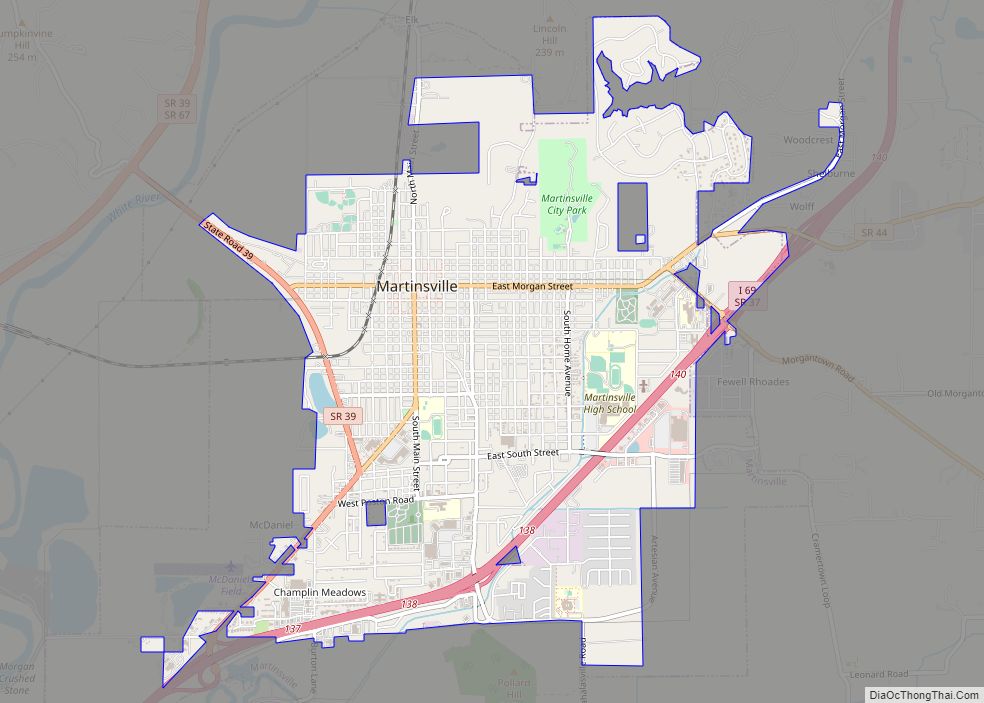
| Seat: | Martinsville |
| Largest city: | Martinsville |
| Total Area: | 409.43 sq mi (1,060.4 km²) |
| Land Area: | 403.97 sq mi (1,046.3 km²) |
| Population Density: | 173.6/sq mi (67.0/km²) |
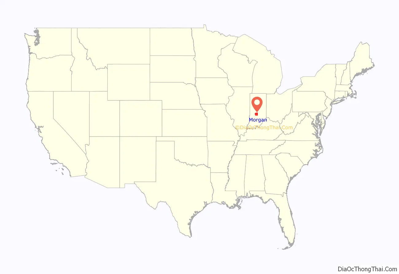
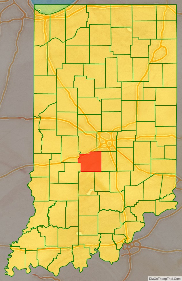
Morgan County location map. Where is Morgan County?
History
The future state of Indiana was first regulated by passage of the Northwest Ordinance in 1787. The governing structure created by this act was superposed over an area that was still largely contested with the country’s natives, although they were being gradually pushed out of the area. In 1818, a series of treaties was concluded, resulting in the confinement of the Miami tribe to the reserve area and the removal of the Delaware tribe, who had dominated central and east central Indiana, to west of the Mississippi River by 1820, clearing the way for colonization. The area was called the Delaware New Purchase until it was divided into Wabash County in the northwest and Delaware County in the southeast on 2 January 1820. Those counties were soon after dissolved, and the areas came to be called the “Wabash New Purchase” and “Delaware New Purchase” (renamed the “Adams New Purchase” in 1827). Subsequently, 35 new counties (including Morgan, authorized on 15 February 1822) were carved out of the original area. It was named for Gen. Daniel Morgan, who defeated the British at the Battle of Cowpens in the Revolutionary War.
The first settlers arrived in Morgan County in 1822. They came mostly from southern states. The Mooresville area and surrounding communities received large numbers of southern Quakers, driven to migrate because of their opposition to slavery. Paul Hadley, a Mooresville resident, was the designer of the current Indiana flag, as well as a locally prominent water color artist in the early twentieth century.
In the late nineteenth and early twentieth centuries, mineral springs in Martinsville gave rise to several spas, and the nickname of the Martinsville High School athletic teams has subsequently been the Artesians.
County government took several steps forward in the 2000s, creating a new Plan Commission, re-instituting a county economic development organization, and establishing the county’s first Park and Recreation Board between 2000 and 2004. Morgan County also was the first county in the metropolitan Indianapolis region to establish a smoking ban ordinance for restaurants, taking that step in 2004. Other communities in the region soon followed Morgan County’s lead.
Courthouse
The first building used for Morgan County courts was the log house of a pioneer. Work began in 1823 to build the first courthouse, a two-story log house. A brick courthouse replaced it in 1833.
The Morgan County courthouse was designed by Isaac Hodgson in the Italianate style. It was built from 1857 to 1859 by Perry M. Blankenship of Martinsville at a cost of $32,000. It was almost identical to Hodgson’s Jennings County courthouse in Vernon, which was also begun in 1857, but the Martinsville building received an addition in the 1970s; the original section was also remodeled and renovated at that time. The building is of red brick with white stone quoins and has tall windows with round arches, arranged in pairs. It is one of the few remaining pre-Civil War courthouses.
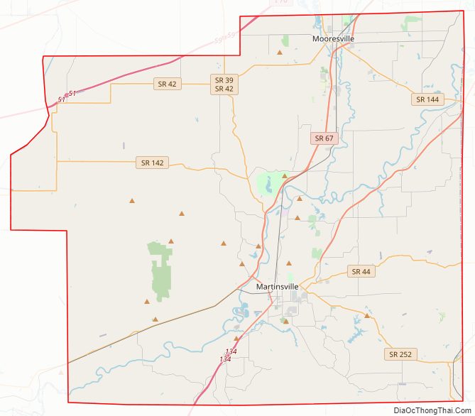
Morgan County Road Map
Geography
Morgan County is where the glaciers stopped their southward advance during the last ice age. As a result, the area has both flat areas and rolling hills, with the most diverse soil of any county in the United States. The extensive woodlands of the eighteenth century have been cleared on the county’s flat areas, with agricultural or urban uses dominating. The county is significantly carved with wooded drainages, leading to the southwest-flowing White River. According to radar telemetry gathered by the US Shuttle Radar Topographic Mission, Morgan County terrain ranges from 604 feet (184 meters) to 1,010 feet (310 meters) ASL.
According to the 2010 census, the county has a total area of 409.43 square miles (1,060.4 km), of which 403.97 square miles (1,046.3 km) (or 98.67%) is land and 5.46 square miles (14.1 km) (or 1.33%) is water. Morgan County is bisected by the White River Valley; the community has taken an interest in recent years in protecting the river as an asset, seeking to develop parks and greenways along the White River and initiating an annual river cleanup day in the spring.
The county also is home to large areas of land that were not glaciated during the last ice age. The river valley and contributing watersheds, along with the non-glaciated hills, results in a topography unlike the rest of the metropolitan Indianapolis area. County residents are proud of the scenic terrain, and in recent years have established a county park system and a bike/pedestrian trail system plan to provide protection and access to the amenities. An annual five miles (8.0 km) run is held as a fundraiser for the path system endowment.
Adjacent counties
- Hendricks County (north)
- Marion County (northeast)
- Johnson County (east)
- Brown County (southeast)
- Monroe County (south)
- Owen County (southwest)
- Putnam County (northwest)
Major highways
- Interstate 69
- Interstate 70
- State Road 37
- State Road 39
- State Road 42
- State Road 44
- State Road 67
- State Road 135
- State Road 142
- State Road 144
- State Road 252
- State Road 267
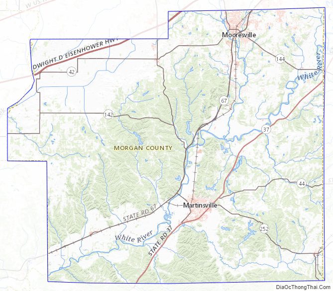
Morgan County Topographic Map
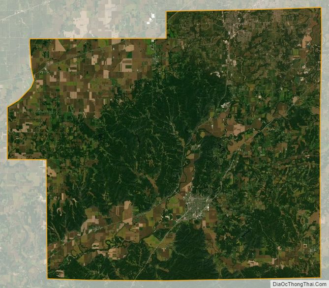
Morgan County Satellite Map
Morgan County Outline Map