Ruth is a census-designated place (CDP) in White Pine County, Nevada, United States. Founded in 1903, it had a population of 440 at the 2010 census.
Ruth was built as a company town for the adjacent Robinson Mine, a large open-pit copper mine, which is still in operation as of 2022.
| Name: | Ruth CDP |
|---|---|
| LSAD Code: | 57 |
| LSAD Description: | CDP (suffix) |
| State: | Nevada |
| County: | White Pine County |
| Elevation: | 6,880 ft (2,100 m) |
| Total Area: | 0.35 sq mi (0.90 km²) |
| Land Area: | 0.35 sq mi (0.90 km²) |
| Water Area: | 0.00 sq mi (0.00 km²) |
| Total Population: | 371 |
| Population Density: | 1,072.25/sq mi (414.24/km²) |
| ZIP code: | 89319 |
| FIPS code: | 3263800 |
| GNISfeature ID: | 0845643 |
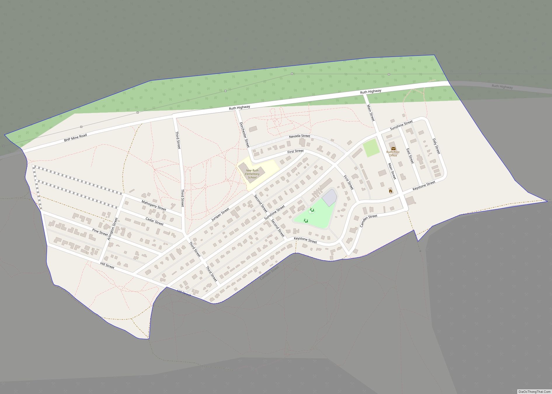
Online Interactive Map
Click on ![]() to view map in "full screen" mode.
to view map in "full screen" mode.
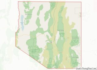
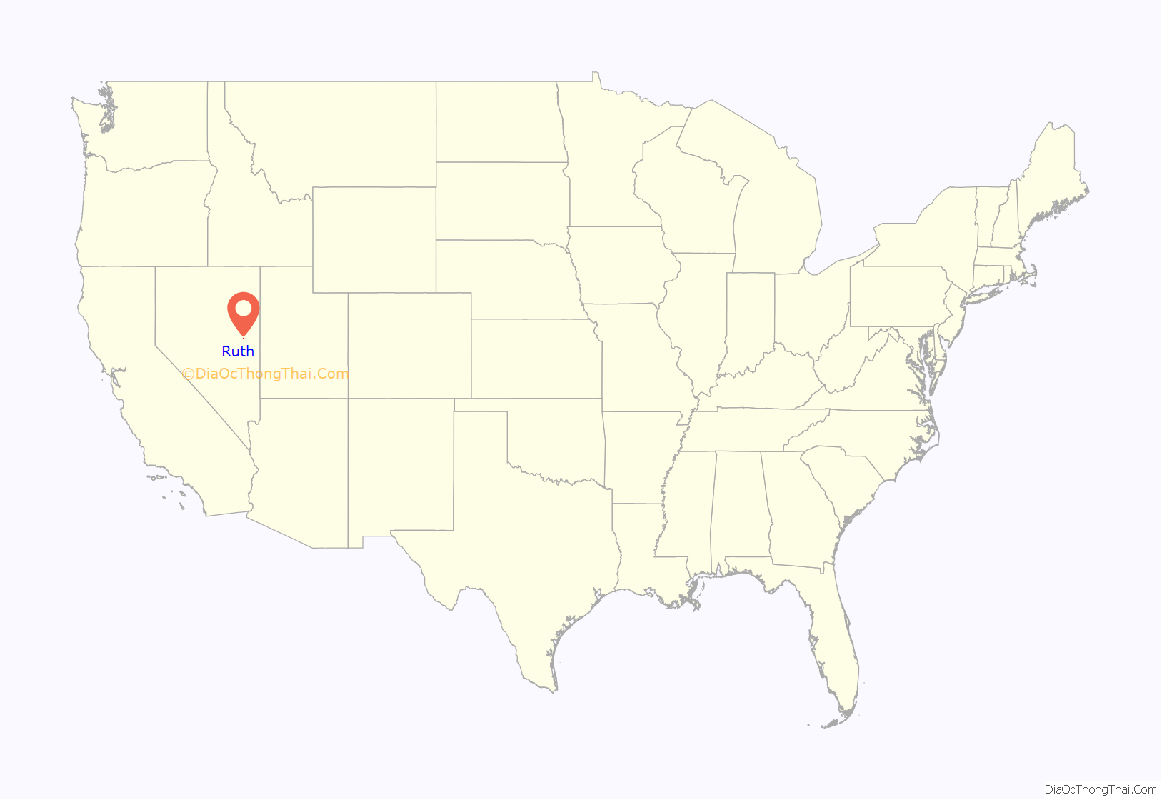
Ruth location map. Where is Ruth CDP?

History
Ruth began as a settlement for workers of the White Pine Copper Company in 1903. It derived its name from the Ruth mining claim which was named for Ruth McDonald, daughter of the original owner of the mining claim.
With the opening Nevada Northern Railway in the year 1906 copper production began to boom.
In 1905, Daniel C. Jackling “evaluated a low-grade copper prospect”, which he turned into “an impressive open-pit and satellite cave (the Veteran Mine).” Jackling went on to become president of the Nevada Consolidated Copper Company.
By 1910 the settlement was already established a small distance from the first site. Ruth was a company town for the Nevada Consolidated Copper Company: the houses belonged to the mine and the city and were administered by them. Saloons and bordellos were not permitted in the company town but were plentiful in the neighboring community of Riepetown.
A mine explosion in Ruth on July 12, 1912, killed ten people. In 1929 there was another explosion set off by dynamite blasts. 2 men were killed with a third injured. One of the killed men was Giovanni Simonetta from Cortale Italy.
In 1919 Ruth was the site of a labor dispute when 150 copper miners walked out demanding higher wages. Although some claimed the strike was instigated by the Industrial Workers of the World the leaders were actually from the Western Federation of Miners.
At the beginning of the Great Depression, Ruth had almost 2,300 inhabitants.
Nevada Consolidated Copper Co. was taken over by Kennecott Copper Corporation in 1933.
Ruth ceased being a company town in 1955 when the houses were sold to the John W. Galbreath Company. Occupants were given the opportunity to purchase the homes they had been renting. Around this time the community was moved two miles north to make way for expansion of the Deep Ruth mine.
In 1978 Kennecott closed the mines in Ruth, which went into decline. The elementary school closed in 1986.
BHP reopened the mine in 1996. From 1996 to 1999, the BHP Nevada Railroad was based here. The mine closed again in 1999.
Quadra FNX Mining reopened the Robinson Mine in 2004, and it is still in full production as of 2022.
The Nevada Northern Railway Museum maintains some track in the area.
Ruth was featured in the fourth season of the Netflix original series Stranger Things as the location of the NINA project, which is housed in a converted missile silo.
Ruth is the inspiration for the Stephen King novel Desperation.
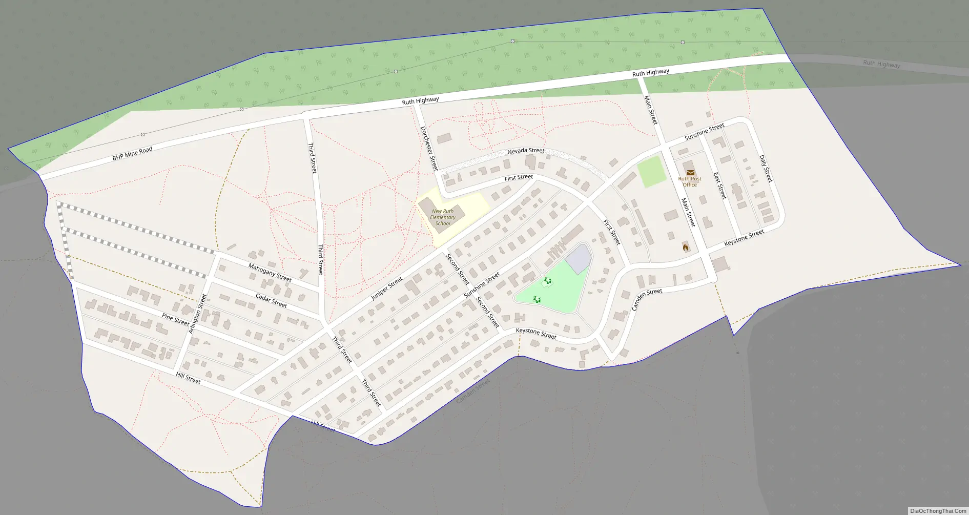
Ruth Road Map
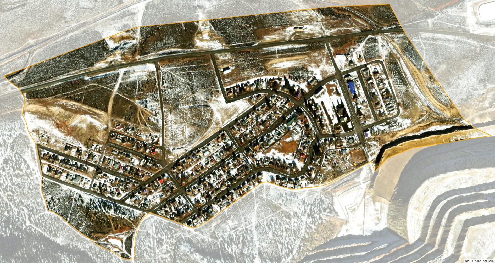
Ruth city Satellite Map
See also
Map of Nevada State and its subdivision: Map of other states:- Alabama
- Alaska
- Arizona
- Arkansas
- California
- Colorado
- Connecticut
- Delaware
- District of Columbia
- Florida
- Georgia
- Hawaii
- Idaho
- Illinois
- Indiana
- Iowa
- Kansas
- Kentucky
- Louisiana
- Maine
- Maryland
- Massachusetts
- Michigan
- Minnesota
- Mississippi
- Missouri
- Montana
- Nebraska
- Nevada
- New Hampshire
- New Jersey
- New Mexico
- New York
- North Carolina
- North Dakota
- Ohio
- Oklahoma
- Oregon
- Pennsylvania
- Rhode Island
- South Carolina
- South Dakota
- Tennessee
- Texas
- Utah
- Vermont
- Virginia
- Washington
- West Virginia
- Wisconsin
- Wyoming