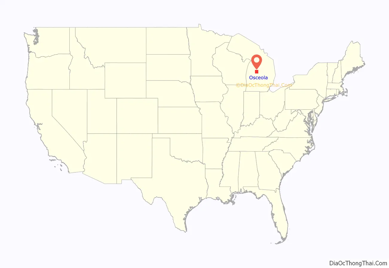
Osceola County (/ˌɒsiˈoʊlə/ AH-see-OH-lə) is a county in the U.S. state of Michigan. As of the 2020 United States Census, the population was 22,891. The county seat is Reed City.
| Name: | Osceola County |
|---|---|
| FIPS code: | 26-133 |
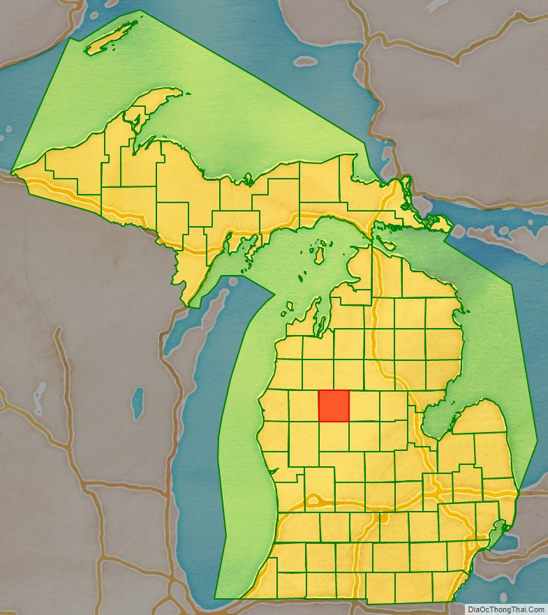
| State: | Michigan |
| Founded: | 1840 |
| Named for: | Osceola |
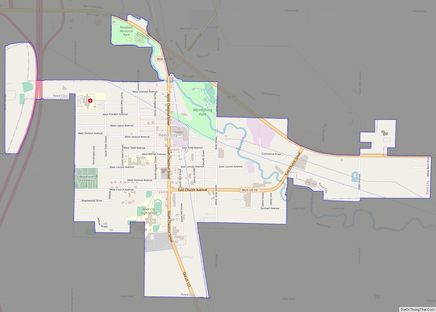
| Seat: | Reed City |
| Largest city: | Reed City |
| Total Area: | 573 sq mi (1,480 km²) |
| Land Area: | 566.39 sq mi (1,466.9 km²) |
| Total Population: | 22,891 |
| Population Density: | 41.4/sq mi (16.0/km²) |
| Time zone: | UTC−5 (Eastern) |
| Summer Time Zone (DST): | UTC−4 (EDT) |
| Website: | www.osceola-county.org |
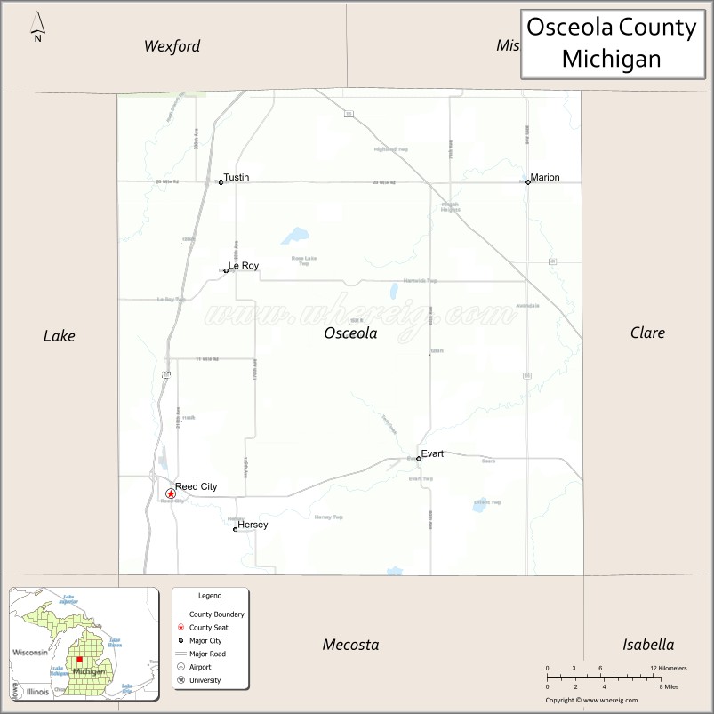
Osceola County location map. Where is Osceola County?
History
When established by the Michigan Legislature on April 1, 1840, it was named Unwattin County, after Chief Unwattin of the local Ottawa people. As a representative of the Ottawa nation, he participated in negotiations for the Treaty of Washington (1836) that granted a vast expanse of Michigan to the US Federal Government. The name was changed March 8, 1843, to Osceola, after the Seminole chief who achieved renown in Florida.
The county was initially attached for administrative purposes to Ottawa County. In 1855, it was attached to Mason County; in 1857, to Newaygo County; and in 1859, to Mecosta County.
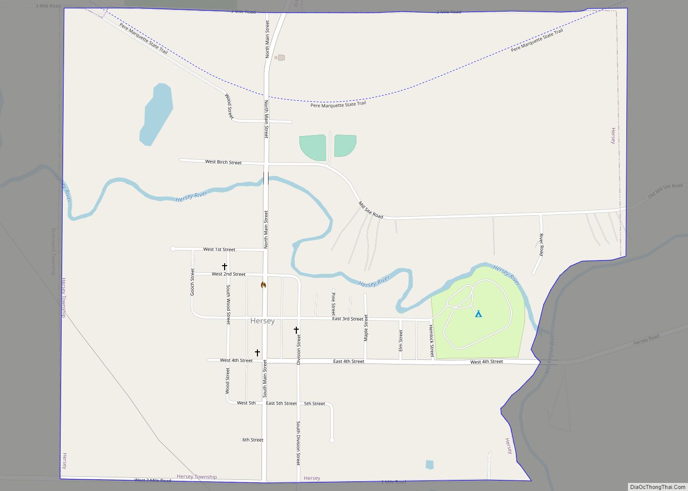
As the population increased, separate county government was organized in 1869, with Hersey designated as the county seat. Reed City became the official county seat in 1927. The county was developed initially for harvesting and processing lumber, and many European Americans came to work in lumbering and the mills.
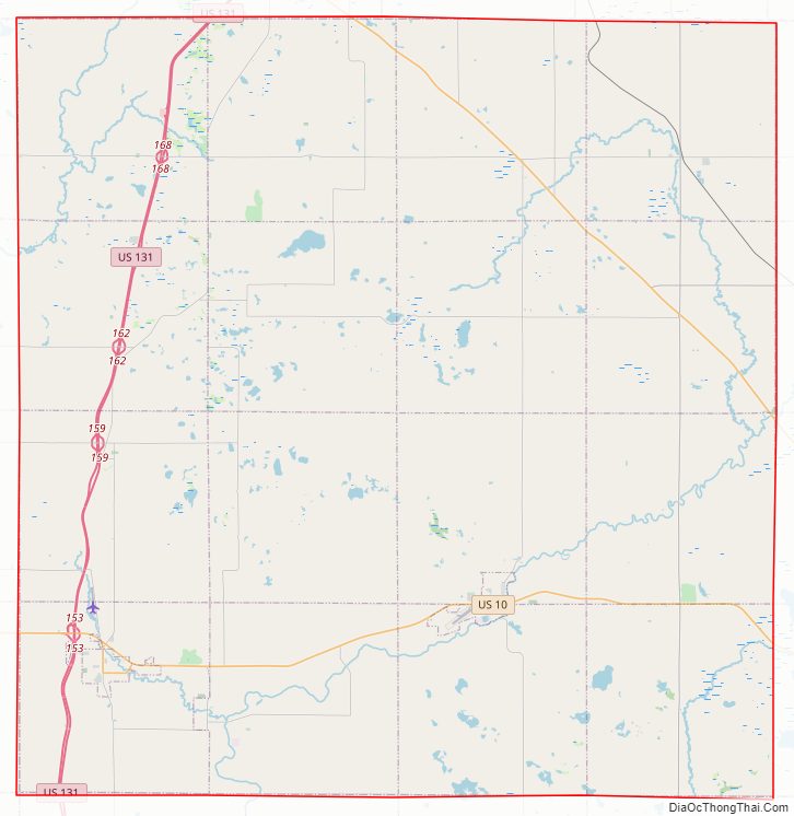
Osceola County Road Map
Geography
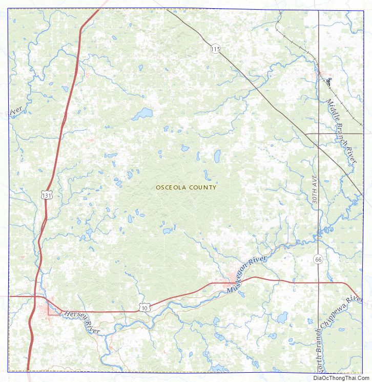
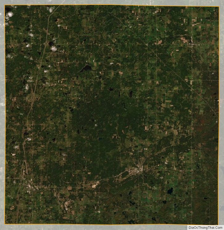
The low rolling hills of Osceola County were completely wooded prior to settlement; at present about half of the area has been cleared and converted to agricultural or urban use. There are numerous small lakes and ponds scattered across the county; the largest is Rose Lake, northeast of LeRoy. The highest point on the terrain (1,722 feet (525 meters) ASL) is Grove Hill, in Sherman Township. According to the United States Census Bureau, the county has a total area of 573 square miles (1,480 km), of which 566 square miles (1,470 km) is land and 6.7 square miles (17 km) (6.7%) is water. The county is drained by the Muskegon River and branches of the Manistee River. Osceola County is part of Northern Michigan.
Adjacent counties
- Wexford County − northwest
- Missaukee County − northeast
- Clare County − east
- Isabella County − southeast
- Mecosta County − south
- Newaygo County − southwest
- Lake County − west
Major highways
- US 10
- US 131
- Bus. US 10 in Reed City
- M-61
- M-66
- M-115
Osceola County Topographic Map
Osceola County Satellite Map
Osceola County Outline Map