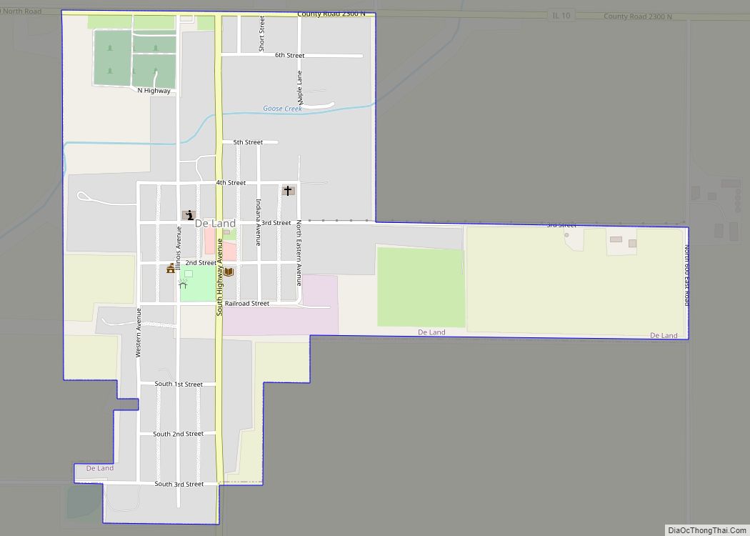
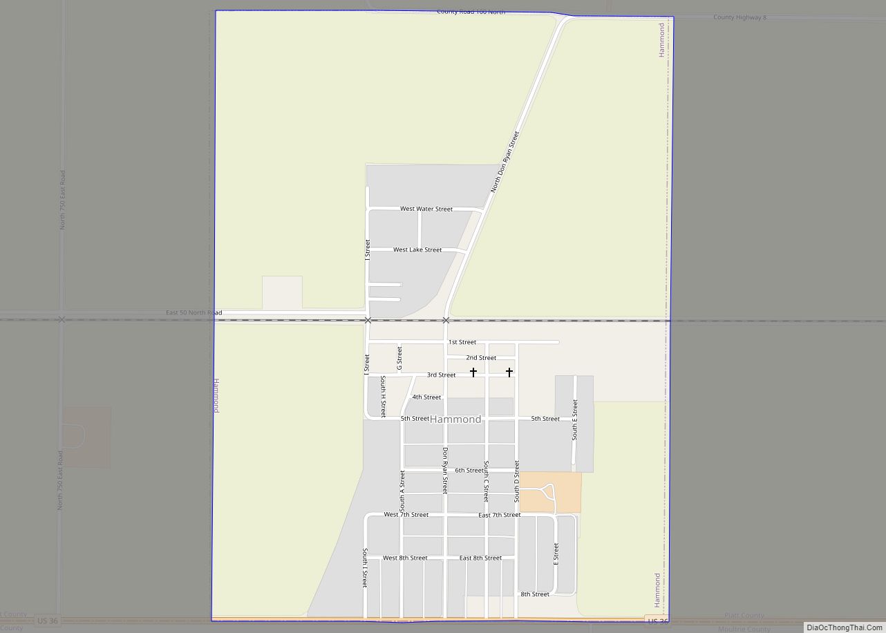
Piatt County is a county in Illinois. According to the 2020 United States Census, it had a population of 16,673. Its county seat is Monticello.
Piatt County is part of the Champaign–Urbana, IL Metropolitan Statistical Area.
| Name: | Piatt County |
|---|---|
| FIPS code: | 17-147 |
| State: | Illinois |
| Founded: | 1841 |
| Named for: | James A. Piatt |
| Seat: | Monticello |
| Largest city: | Monticello |
| Total Area: | 439 sq mi (1,140 km²) |
| Land Area: | 439 sq mi (1,140 km²) |
| Total Population: | 16,673 |
| Population Density: | 38/sq mi (15/km²) |
| Time zone: | UTC−6 (Central) |
| Summer Time Zone (DST): | UTC−5 (CDT) |
| Website: | www.piattcounty.org |
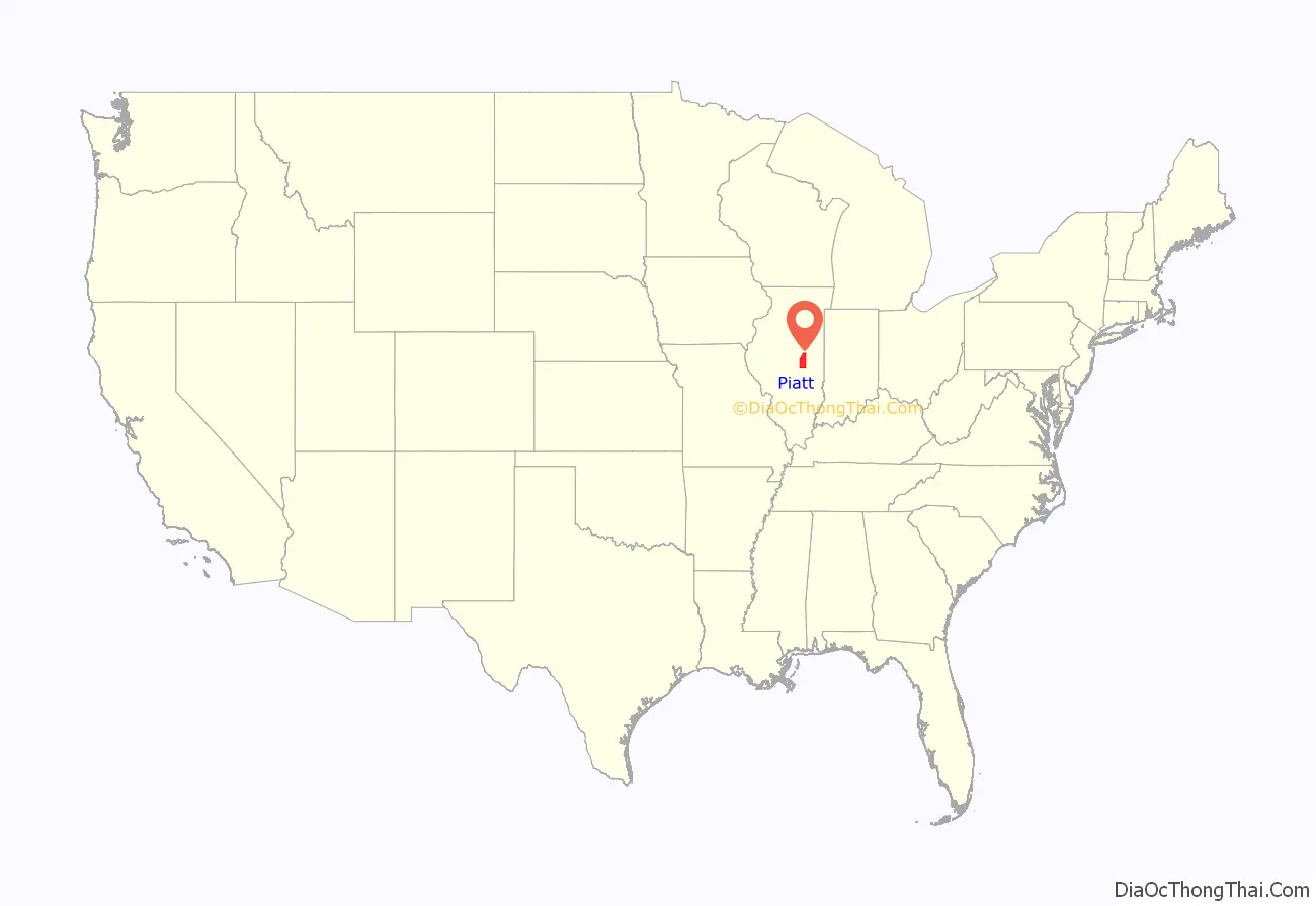
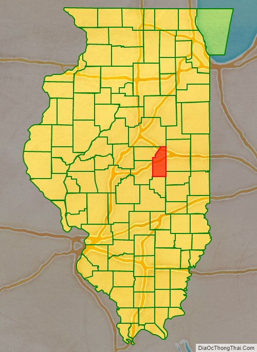
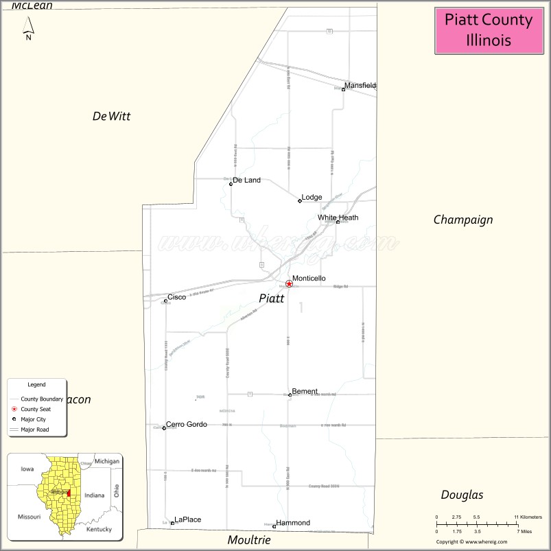
Piatt County location map. Where is Piatt County?
History
The first settler was George Haworth, a Quaker, followed by James Martin, Abraham Hanline, Solomon Carter and William Cordell.
Piatt County was formed in 1841 from Macon and Dewitt counties. Two local residents, James A. Piatt and Jesse Warner, were instrumental in forming the county. It was named after James A. Piatt after winning a coin flip against Jesse Warner.
Piatt County at the time of its creation in 1841
Abraham Lincoln practiced law in Piatt County as a circuit lawyer. Lincoln and Stephen A. Douglas planned their presidential debates in Piatt County in 1858, one of which is ornamented by a marker just south of Monticello.
The first courthouse was built in 1843. It was replaced by the current courthouse in 1904.
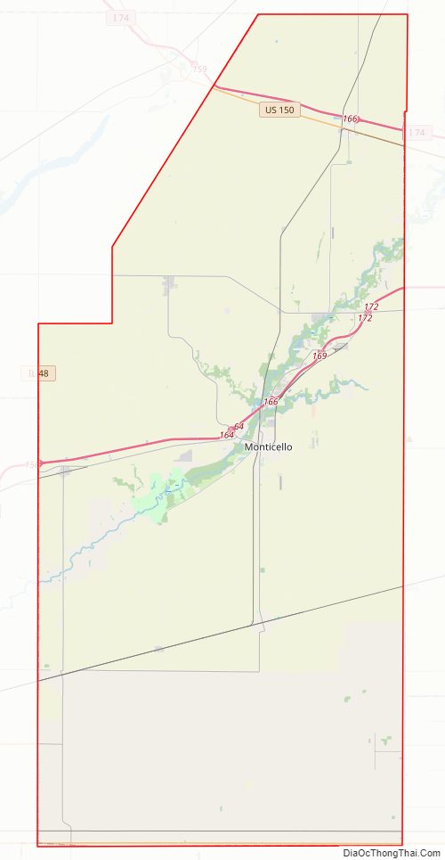
Piatt County Road Map
Geography
According to the US Census Bureau, the county has a total area of 439 square miles (1,140 km), of which 439 square miles (1,140 km) is land and 0.3 square miles (0.78 km) (0.06%) is water.
Climate and weather
In recent years, average temperatures in the county seat of Monticello have ranged from a low of 14 °F (−10 °C) in January to a high of 85 °F (29 °C) in July, although a record low of −25 °F (−32 °C) was recorded in January 1999 and a record high of 105 °F (41 °C) was recorded in July 1966. Average monthly precipitation ranged from 1.61 inches (41 mm) in January to 3.99 inches (101 mm) in August.
Major highways
- Interstate 72
- Interstate 74
- U.S. Route 36
- U.S. Route 150
- Illinois Route 10
- Illinois Route 32
- Illinois Route 48
- Illinois Route 105
Adjacent counties
- McLean County – north
- Champaign County – east
- Douglas County – southeast
- Moultrie County – south
- Macon County – southwest
- De Witt County – west
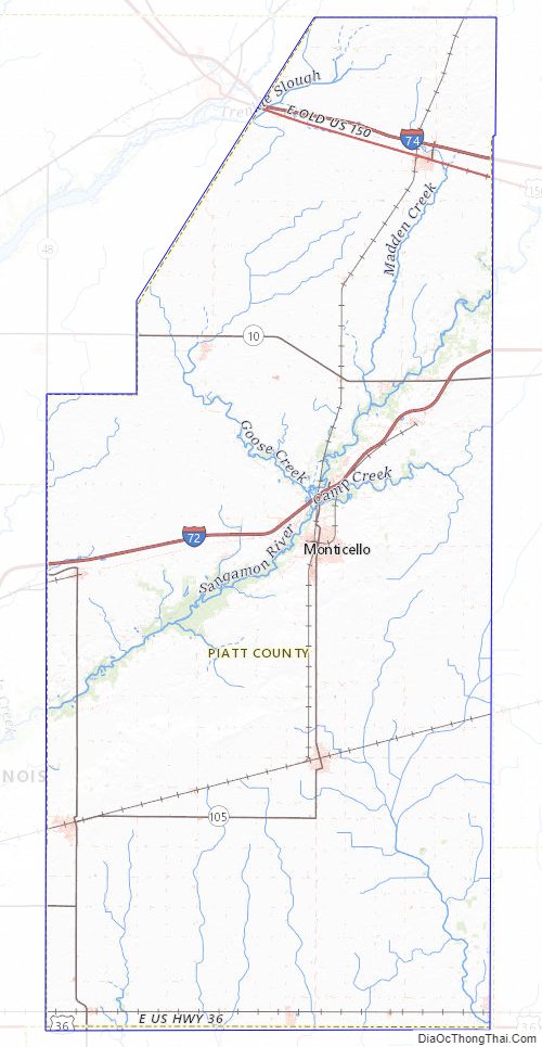
Piatt County Topographic Map
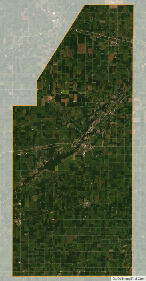
Piatt County Satellite Map
Piatt County Outline Map