Champaign County is a county in the U.S. state of Illinois. As of the 2020 census, its population was 205,865, making it the 10th-most populous county in Illinois. Its county seat is Urbana.
Champaign County is part of the Champaign–Urbana, IL Metropolitan Statistical Area. The twin cities of Urbana and Champaign are the only cities in the county, and they nearly surround the campus of the University of Illinois Urbana–Champaign.
| Name: | Champaign County |
|---|---|
| FIPS code: | 17-019 |
| State: | Illinois |
| Founded: | 1833 |
| Seat: | Urbana |
| Largest city: | Champaign |
| Total Area: | 998 sq mi (2,580 km²) |
| Land Area: | 996 sq mi (2,580 km²) |
| Total Population: | 205,865 |
| Population Density: | 210/sq mi (80/km²) |
| Time zone: | UTC−6 (Central) |
| Summer Time Zone (DST): | UTC−5 (Central) |
| Website: | www.co.champaign.il.us |
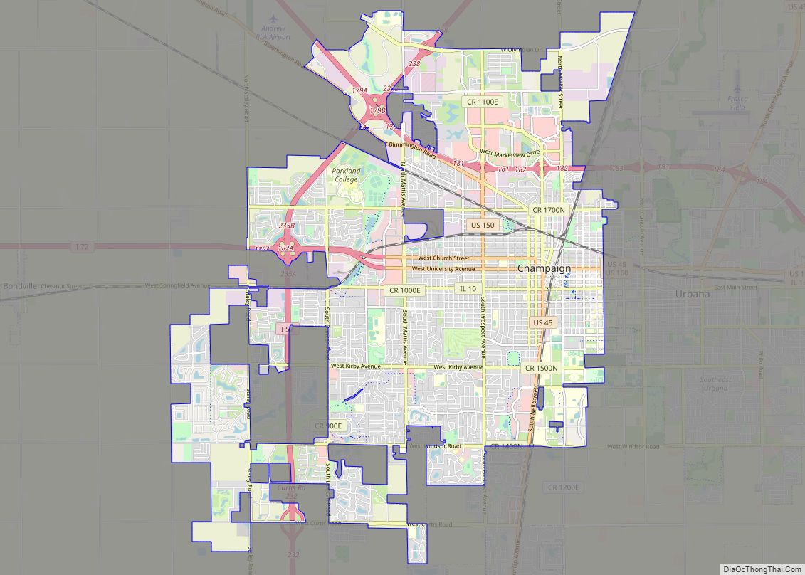
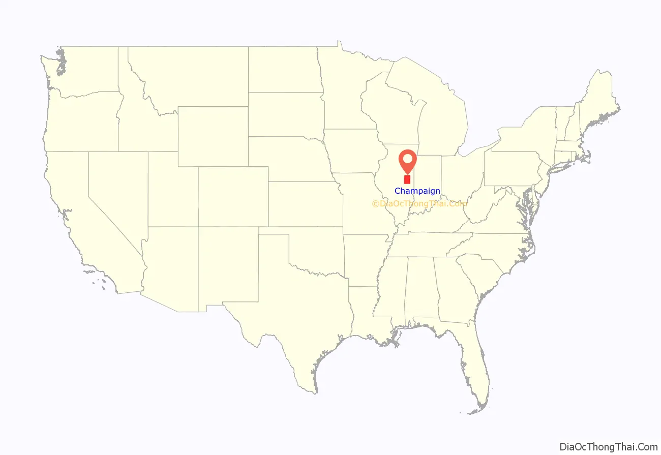
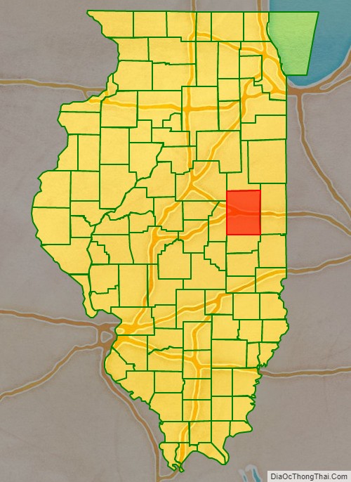
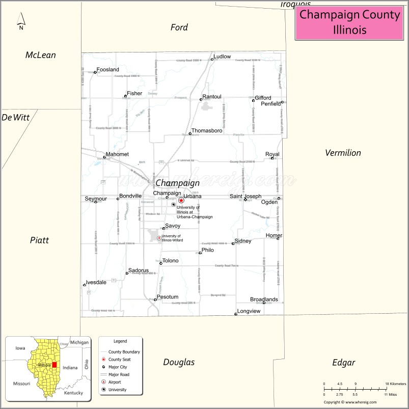
Champaign County location map. Where is Champaign County?
History
Champaign County was organized in 1833, having been previously a part of Vermilion County. The development of the county was greatly furthered by the arrival of the Chicago Branch of the Illinois Central Railroad, and even more by the establishment of the land-grant university. Later, the county also got an airport and a mass transit district. The northern part of the county experienced an economic and demographic setback with the closing of Chanute Air Training Center in the 1990s. In the 2004 Presidential election, it was one of only 15 of the 102 Illinois counties where John Kerry received a majority of the vote (50.37%).
Champaign County at the time of its creation in 1833
Country grain elevator in Champaign County
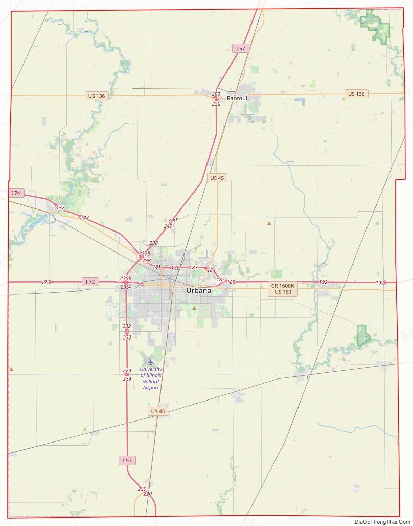
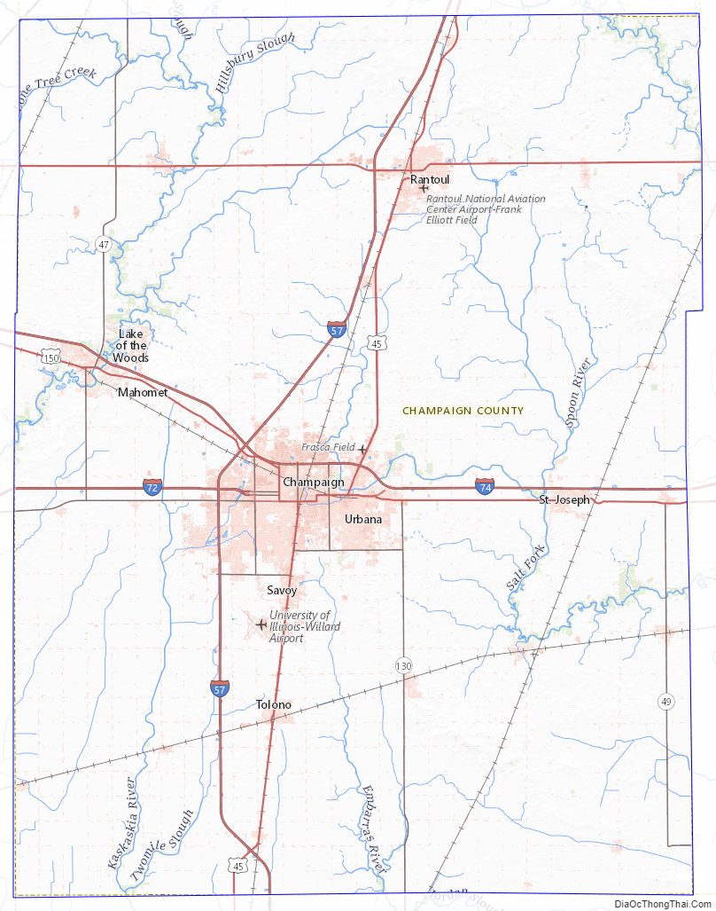
Champaign County Road Map
Geography
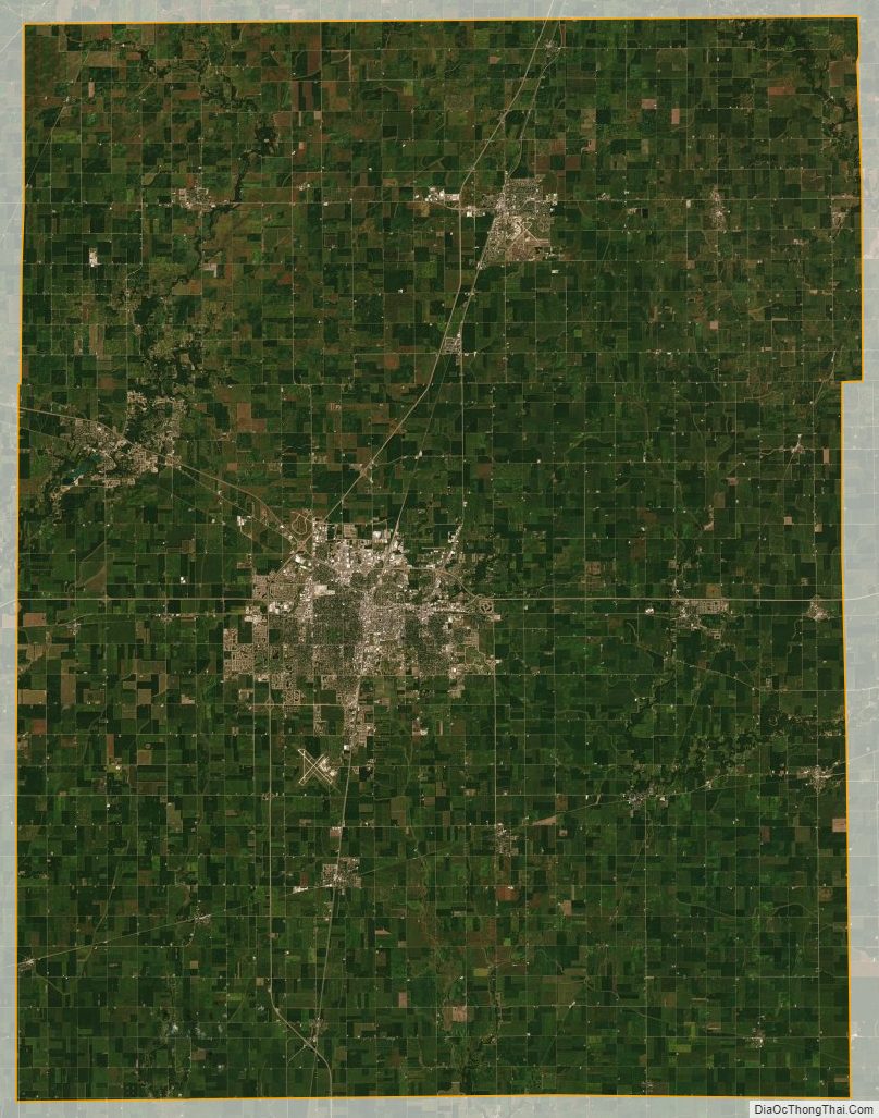
According to the U.S. Census Bureau, the county has a total area of 998 square miles (2,580 km), of which 996 square miles (2,580 km) is land and 2.1 square miles (5.4 km) (0.2%) is water. It is the fifth-largest county in Illinois by land area.
Because Champaign County is situated on a large and very flat plateau, it had virtually no natural drainage, so that much of the County consisted of wetlands until drainage ditches were built, beginning in the 1870s. This was an example of an upland marsh, which resulted in a high incidence of malaria before the late nineteenth century.
The topography of Champaign County was formed by the Wisconsin Glacier about 20,000 years before the present. Lobes of ice from what is now Lake Michigan crossed the county, creating a deep pile of glacial soil, up to 300 feet thick, topped by numerous moraines forming small, flat watersheds with no outlets.
Champaign County is situated on the divide between the Ohio and Mississippi Rivers. Rivers flow out of Champaign County to the east, west, and south. The Kaskaskia River has its origin to the northwest of Champaign, draining the western side of that City. The Kaskaskia flows toward the southwest, joining the Mississippi south of St. Louis, Missouri.
The Embarras River, on the other hand, drains the south-central portion of the Champaign–Urbana metropolitan area, originating in southeastern Champaign and flowing through the experimental fields on the southern part of the campus of the University of Illinois. The Embarras is a tributary to the Wabash River and Ohio River systems. The northeast corner of Champaign, the central portion of the University campus, and the northern part of Urbana are drained by the Boneyard Creek, which flows into the Saline Ditch, a tributary of the Vermilion and Wabash rivers.
Adjacent counties
- McLean County – northwest
- Ford County – north
- Vermilion County – east
- Edgar County – southeast
- Douglas County – south
- Piatt County – west
Champaign County Topographic Map
Champaign County Satellite Map
Champaign County Outline Map