Champaign (/ˌʃæmˈpeɪn/ sham-PAYN) is a city in Champaign County, Illinois, United States. The population was 88,302 at the 2020 census. It is the tenth-most populous municipality in Illinois and the fourth most populous city in Illinois outside the Chicago metropolitan area. It is included in the Champaign–Urbana metropolitan area.
Champaign shares the main campus of the University of Illinois with its twin city of Urbana. Champaign is also home to Parkland College, which serves about 18,000 students during the academic year. Due to the university and a number of well-known technology startup companies, it is often referred to as the hub, or a significant landmark, of the Silicon Prairie. Champaign houses offices for the Fortune 500 companies Abbott, Archer Daniels Midland (ADM), Caterpillar, John Deere, Dow Chemical Company, IBM, and State Farm. Champaign also serves as the headquarters for several companies, including Jimmy John’s.
| Name: | Champaign city |
|---|---|
| LSAD Code: | 25 |
| LSAD Description: | city (suffix) |
| State: | Illinois |
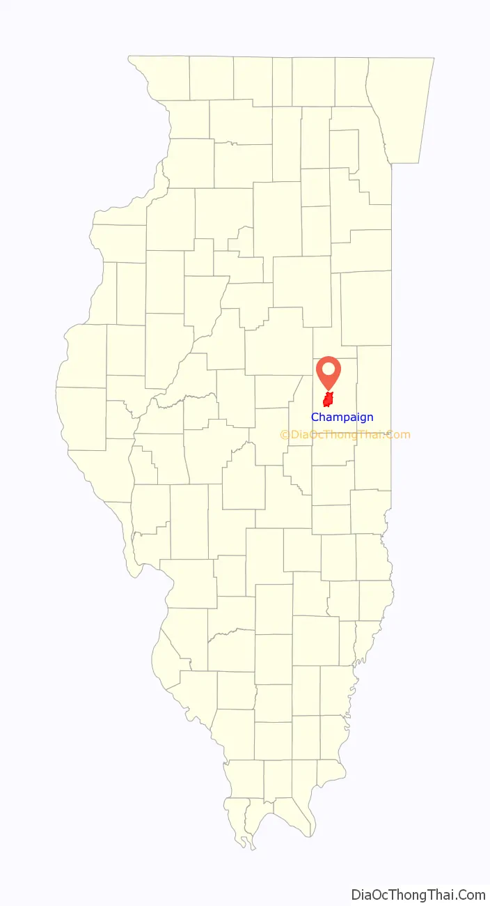
| County: | Champaign County |
| Founded: | 1855 (West Urbana) |
| Elevation: | 764 ft (233 m) |
| Land Area: | 22.99 sq mi (59.5 km²) |
| Water Area: | 0.15 sq mi (0.4 km²) |
| Population Density: | 3,800/sq mi (1,500/km²) |
| FIPS code: | 1712385 |
| GNISfeature ID: | 2393796 |
| Website: | champaignil.gov |
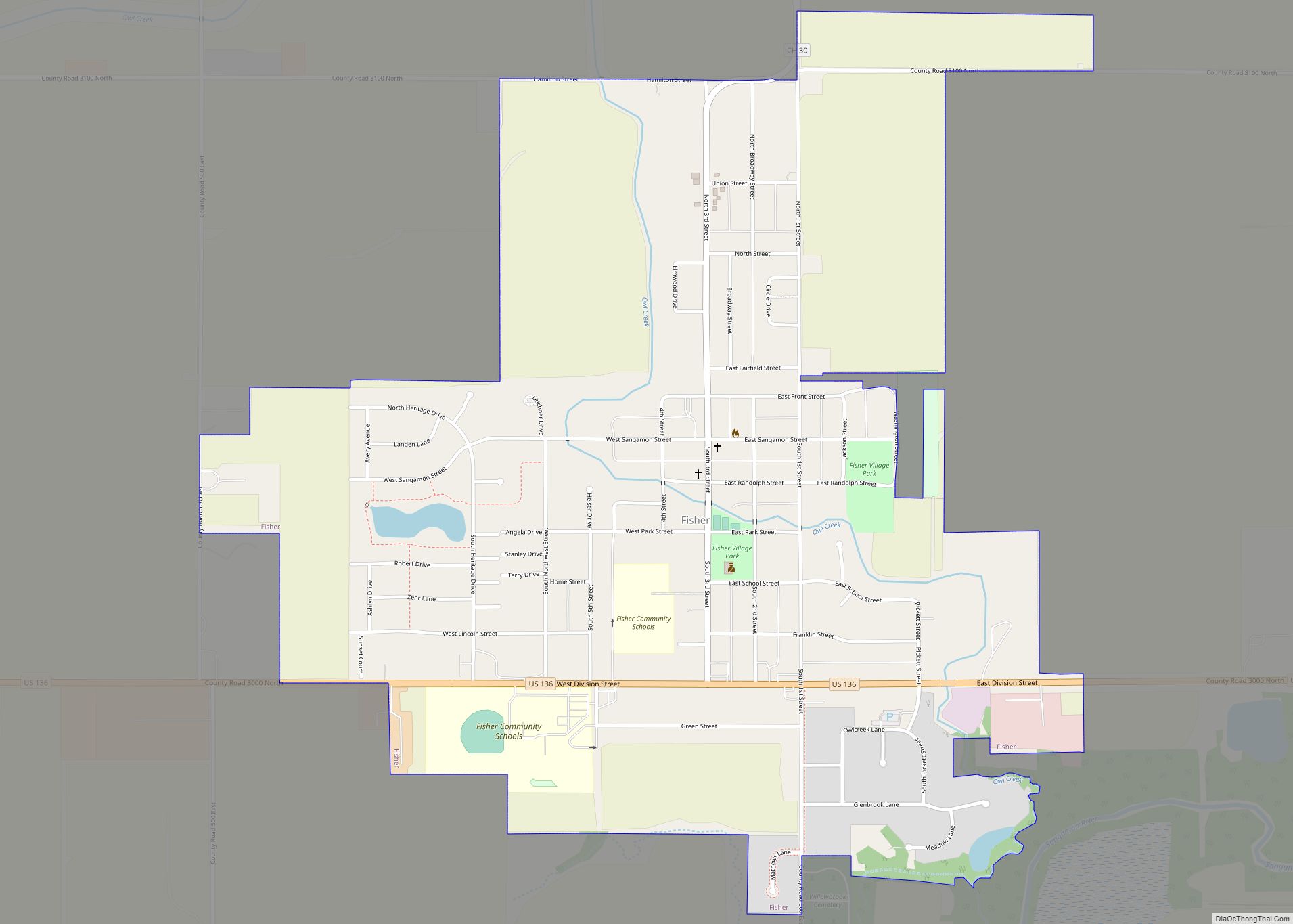
Online Interactive Map
Click on ![]() to view map in "full screen" mode.
to view map in "full screen" mode.
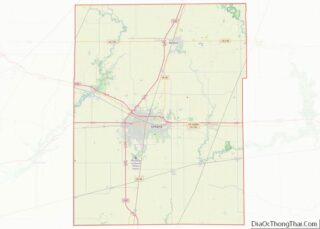
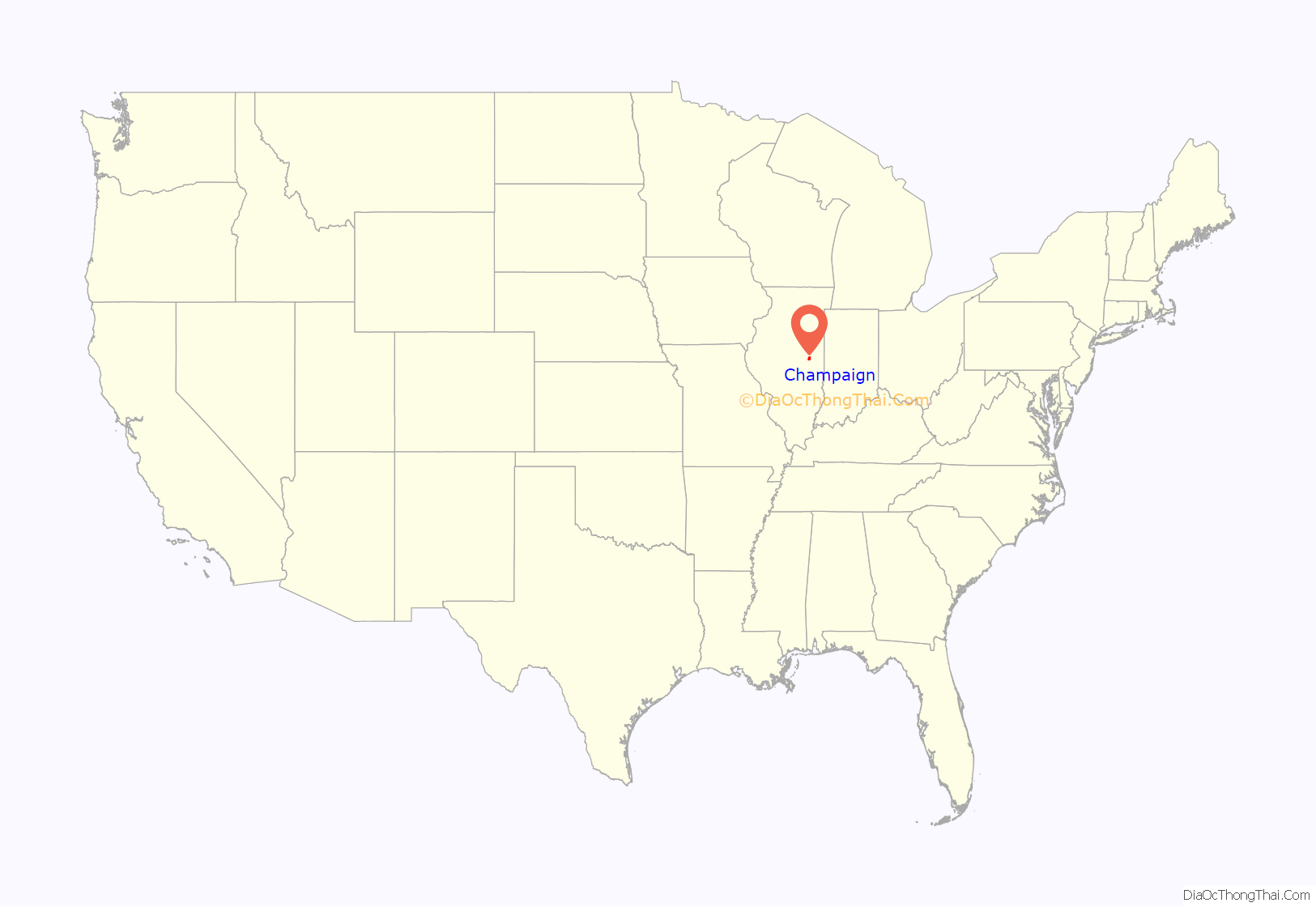
Champaign location map. Where is Champaign city?
History
Champaign was founded in 1855, when the Illinois Central Railroad laid its rail track two miles (3 km) west of downtown Urbana. Originally called “West Urbana”, it was renamed Champaign when it acquired a city charter in 1860. Both the city and county name were derived from Champaign County, Ohio.
During February 1969, Carl Perkins joined with Bob Dylan to write the song “Champaign, Illinois”, which Perkins released on his album On Top. The band Old 97’s took another Bob Dylan song, “Desolation Row”, and combined its melody with new lyrics to make a new song “Champaign, Illinois”, which they released with Dylan’s blessing on their 2010 album The Grand Theatre Volume One. It achieved considerable popularity. The two “Champaign, Illinois” songs are not similar to each other, except that Bob Dylan was involved in both of them.
On September 22, 1985, Champaign hosted the first Farm Aid concert at the University of Illinois’ Memorial Stadium. The concert drew a crowd of 80,000 people and raised over $7 million for American family farmers.
In 2005, Champaign-Urbana (specifically the University of Illinois) was the location of the National Science Olympiad Tournament, attracting young scientists from all 50 states. The city also hosts the state Science Olympiad competition every year. The University of Illinois Urbana-Champaign once again hosted the National competition on May 20–22, 2010.
Joan Severns was the city’s first female Mayor, serving between 1979 and 1983. Deb Frank Feinen, who has served as Mayor since 2015, is the city’s second female Mayor. In May 2017, the city’s first female-majority city council was sworn in.
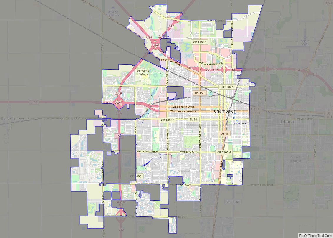
Champaign Road Map
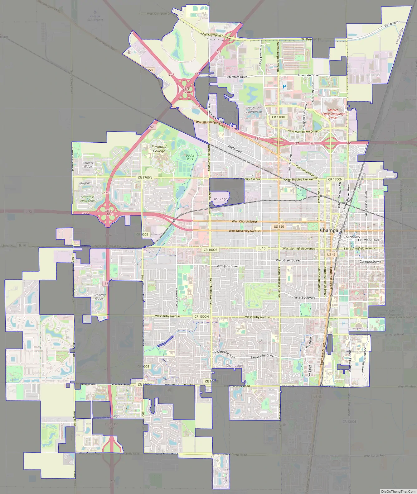
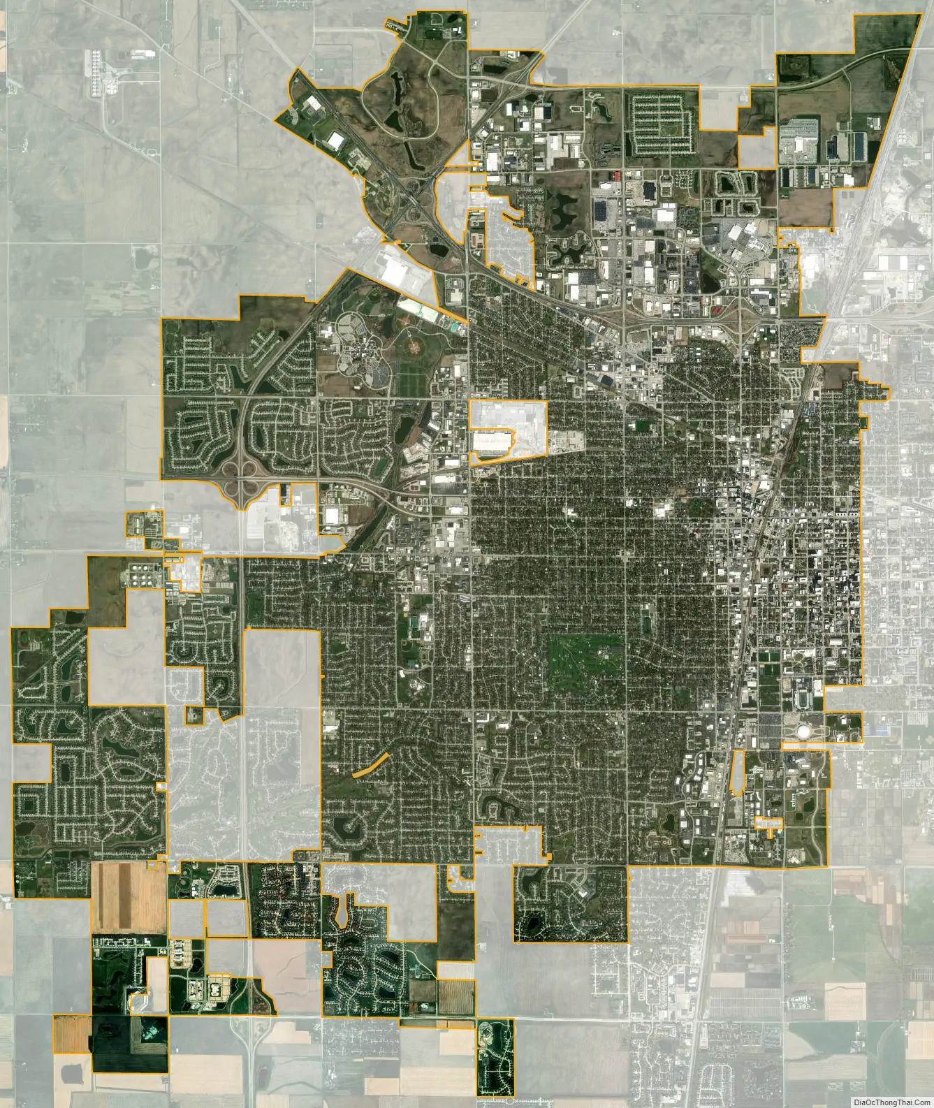
Champaign city Satellite Map
Geography
Location
According to the 2021 census gazetteer files, Champaign has a total area of 23.14 square miles (59.93 km), of which 22.99 square miles (59.54 km) (or 99.37%) is land and 0.15 square miles (0.39 km) (or 0.63%) is water.
Champaign is a city in central Illinois and is located on relatively high ground, providing sources to the Kaskaskia River to the west, and the Embarras River to the south. Downtown Champaign drains into Boneyard Creek, which feeds the Saline Branch of the Salt Fork Vermilion River.
Champaign shares a border with the neighboring city of Urbana; together they are home to the University of Illinois. Champaign, Urbana, and the bordering village of Savoy form the Champaign-Urbana Metropolitan Area also known as Champaign-Urbana. It may also be colloquially known as the “Twin Cities” or Chambana.
Climate
The city has a humid continental climate, typical of the Midwestern United States, with hot summers and cold, moderately snowy winters. Temperatures exceed 90 °F (32.2 °C) on an average of 24 days per year, and typically fall below 0 °F (−17.8 °C) on six nights annually. The record high temperature in Champaign was 109 °F (42.8 °C) in 1954, and the record low was −25 °F (−31.7 °C), recorded on four separate occasions − in 1899, 1905, 1994 and 1999.
See also
Map of Illinois State and its subdivision:- Adams
- Alexander
- Bond
- Boone
- Brown
- Bureau
- Calhoun
- Carroll
- Cass
- Champaign
- Christian
- Clark
- Clay
- Clinton
- Coles
- Cook
- Crawford
- Cumberland
- De Kalb
- De Witt
- Douglas
- Dupage
- Edgar
- Edwards
- Effingham
- Fayette
- Ford
- Franklin
- Fulton
- Gallatin
- Greene
- Grundy
- Hamilton
- Hancock
- Hardin
- Henderson
- Henry
- Iroquois
- Jackson
- Jasper
- Jefferson
- Jersey
- Jo Daviess
- Johnson
- Kane
- Kankakee
- Kendall
- Knox
- La Salle
- Lake
- Lake Michigan
- Lawrence
- Lee
- Livingston
- Logan
- Macon
- Macoupin
- Madison
- Marion
- Marshall
- Mason
- Massac
- McDonough
- McHenry
- McLean
- Menard
- Mercer
- Monroe
- Montgomery
- Morgan
- Moultrie
- Ogle
- Peoria
- Perry
- Piatt
- Pike
- Pope
- Pulaski
- Putnam
- Randolph
- Richland
- Rock Island
- Saint Clair
- Saline
- Sangamon
- Schuyler
- Scott
- Shelby
- Stark
- Stephenson
- Tazewell
- Union
- Vermilion
- Wabash
- Warren
- Washington
- Wayne
- White
- Whiteside
- Will
- Williamson
- Winnebago
- Woodford
- Alabama
- Alaska
- Arizona
- Arkansas
- California
- Colorado
- Connecticut
- Delaware
- District of Columbia
- Florida
- Georgia
- Hawaii
- Idaho
- Illinois
- Indiana
- Iowa
- Kansas
- Kentucky
- Louisiana
- Maine
- Maryland
- Massachusetts
- Michigan
- Minnesota
- Mississippi
- Missouri
- Montana
- Nebraska
- Nevada
- New Hampshire
- New Jersey
- New Mexico
- New York
- North Carolina
- North Dakota
- Ohio
- Oklahoma
- Oregon
- Pennsylvania
- Rhode Island
- South Carolina
- South Dakota
- Tennessee
- Texas
- Utah
- Vermont
- Virginia
- Washington
- West Virginia
- Wisconsin
- Wyoming