Roanoke County (/ˈroʊ.əˌnoʊk/ ROH-ə-nohk) is a county located in the U.S. state of the Commonwealth of Virginia. As of the 2020 census, the population was 96,929. Its county seat is Salem, but the county administrative offices are located in the unincorporated Cave Spring area of the county.
Roanoke County is part of the Roanoke, Virginia Metropolitan Statistical Area and located within the Roanoke Region of Virginia.
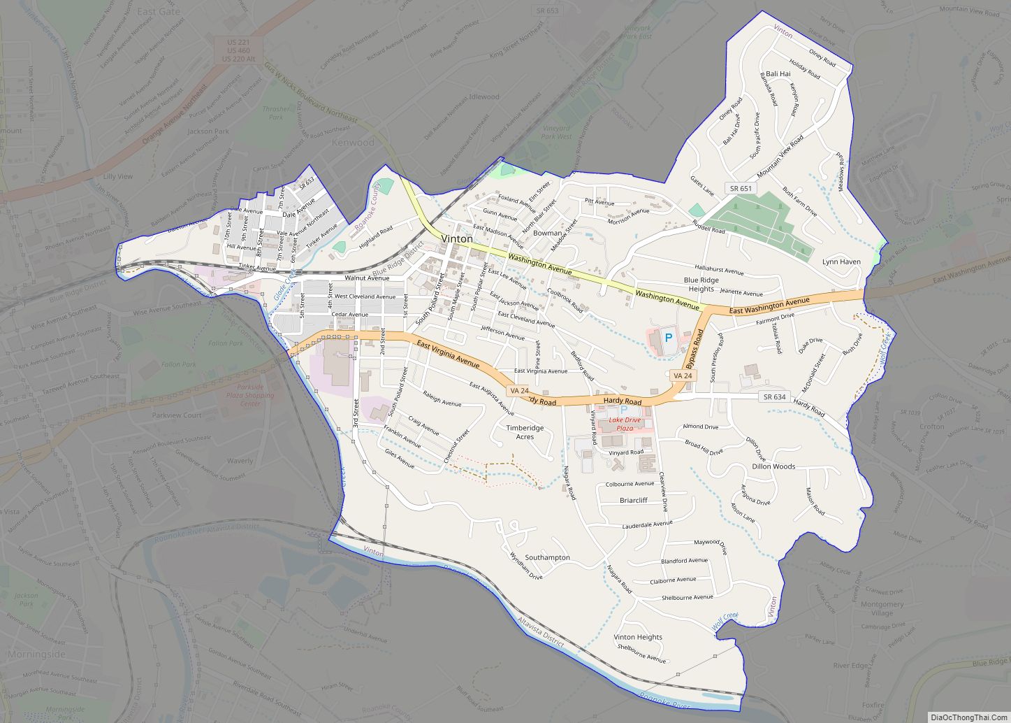
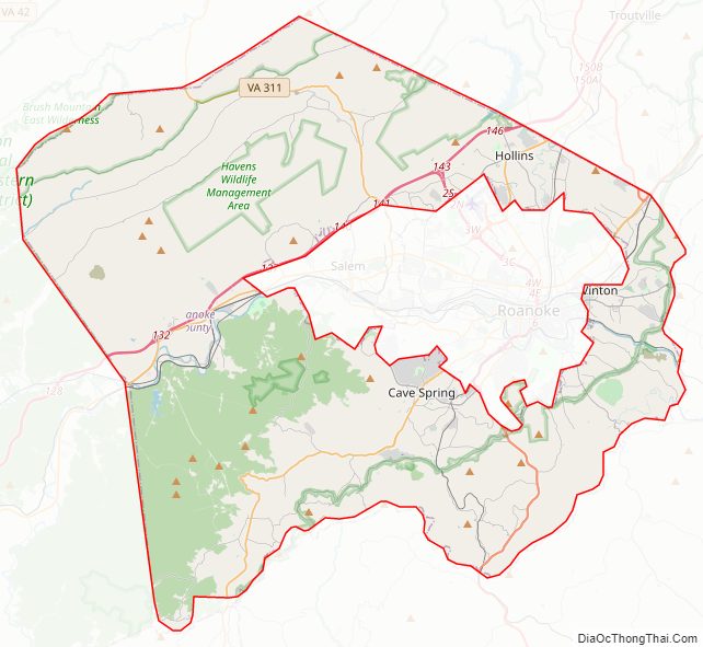
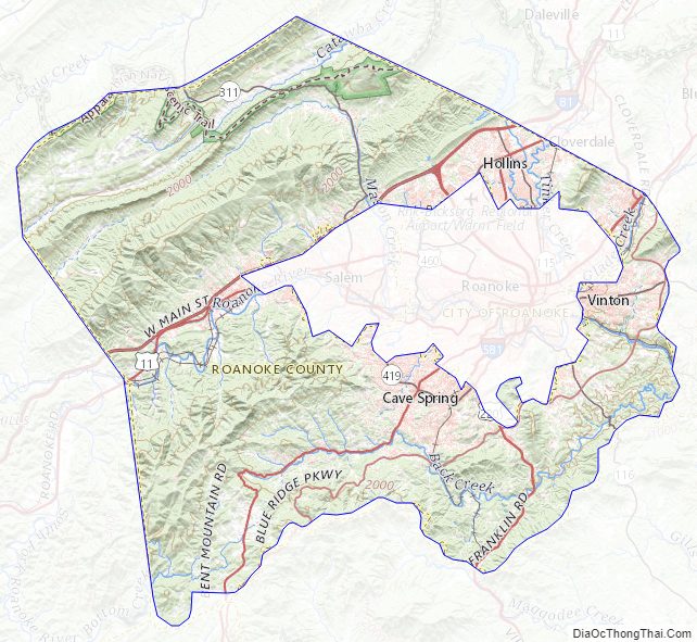
The independent cities of Roanoke and Salem (incorporated as such in 1884 and 1968 respectively) are located within the boundaries of Roanoke County, but are not a part of the county. The town of Vinton is the only municipality within the county. While significant areas of the county are rural and mountainous, most residents live in the suburbs near Roanoke and Salem in the Roanoke Valley.
| Name: | Roanoke County |
|---|---|
| FIPS code: | 51-161 |
| State: | Virginia |
| Founded: | March 30, 1838 |
| Named for: | Roanoke River |
| Seat: | Salem |
| Largest town: | Vinton |
| Total Area: | 251.3 sq mi (651 km²) |
| Land Area: | 250.6 sq mi (649 km²) |
| Total Population: | 96,929 |
| Population Density: | 390/sq mi (150/km²) |
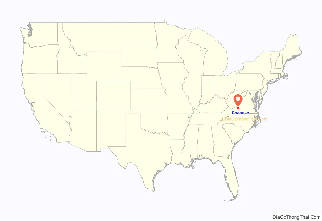
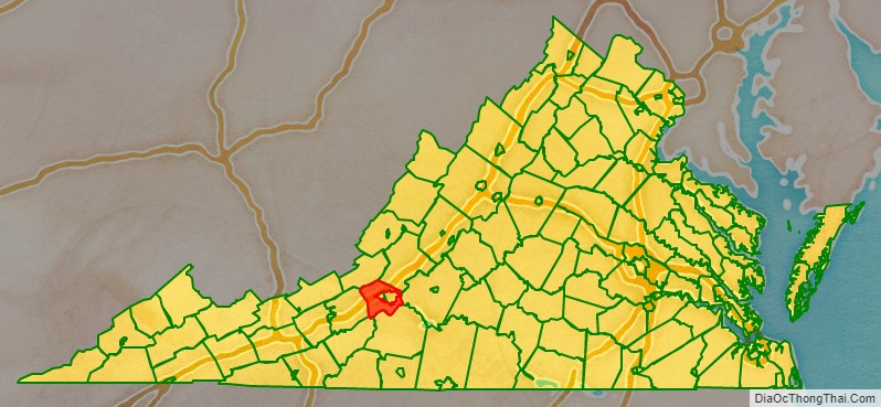
Roanoke County location map. Where is Roanoke County?
History
The county was established by an act of the Virginia Legislature on March 30, 1838, from the southern part of Botetourt County. It was named for the Roanoke River, which in turn was derived from a Native American term for money. Additional territory was transferred to Roanoke County from Montgomery County in 1845. Salem was originally the county seat. When Salem became an independent city, by agreement with the county the Roanoke County Courthouse remained in Salem and the two localities share a jail. However, the county administrative offices were moved to the Cave Spring District.
Roanoke County Road Map
Geography
According to the U.S. Census Bureau, the county has a total area of 251.3 square miles (650.9 km), of which 250.6 square miles (649.1 km) is land and 0.7 square miles (1.8 km) (0.3%) is water.
Districts
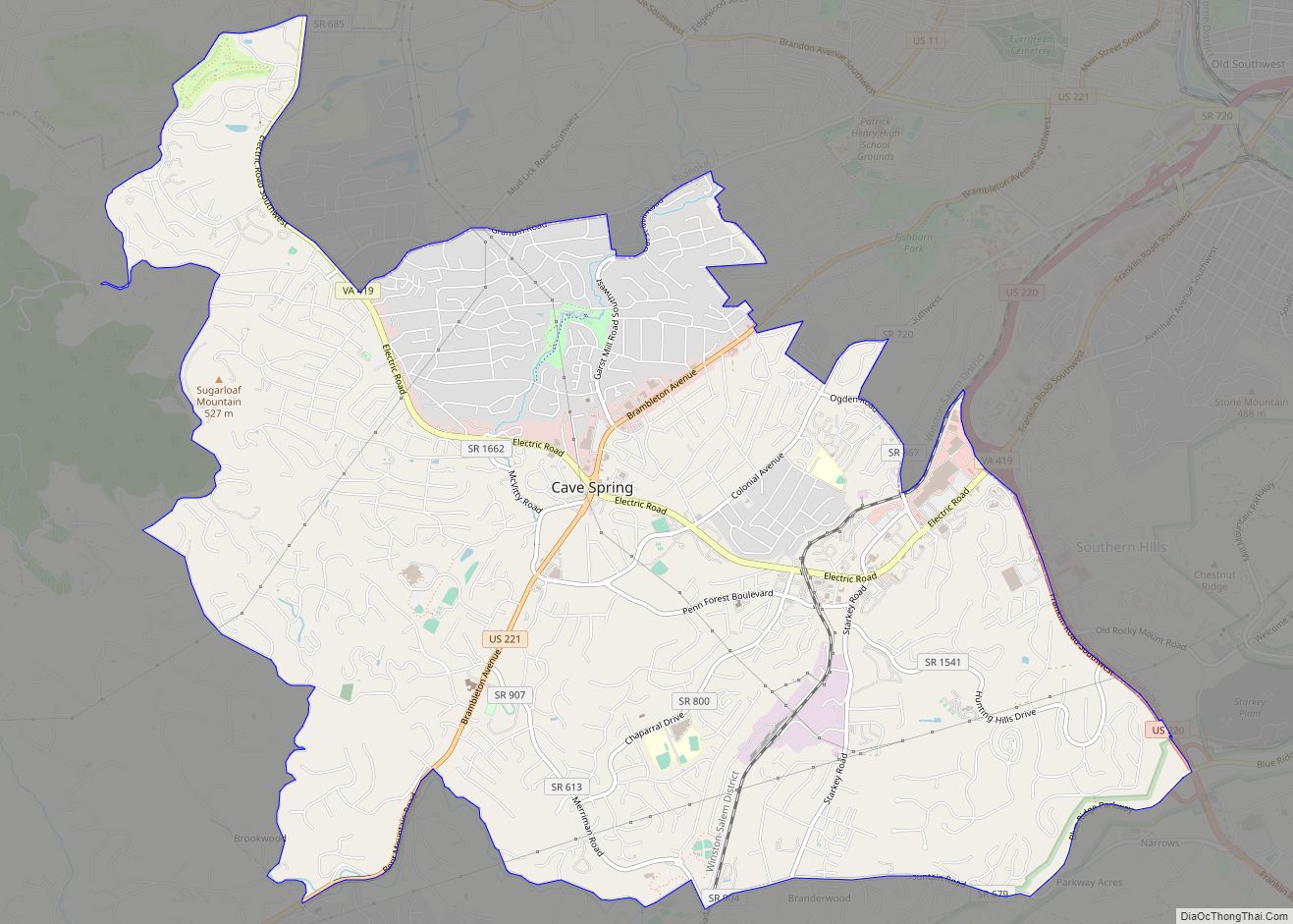
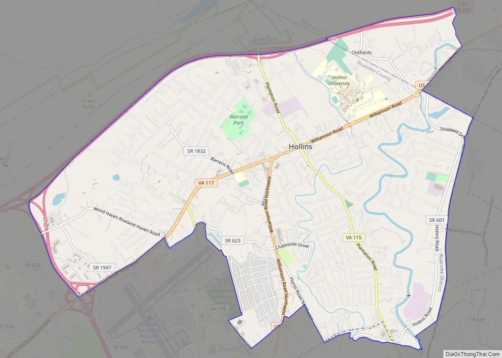
The county is governed by a Board of Supervisors with one representative elected from each of the five magisterial districts: Catawba, Cave Spring, Hollins, Vinton, and Windsor Hills. Vinton is an incorporated town with an elected town council and town manager.
Adjacent counties and cities
- Bedford County, Virginia – East
- Botetourt County, Virginia – Northeast
- Craig County, Virginia – Northwest
- Floyd County, Virginia – Southwest
- Franklin County, Virginia – Southeast
- Montgomery County, Virginia – West
- Roanoke, Virginia – Center (enclave)
- Salem, Virginia – Center (enclave)
Nationally protected areas
- Blue Ridge Parkway (part)
- Jefferson National Forest (part)
Major highways
Roanoke County Topographic Map
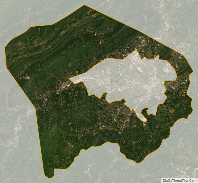
Roanoke County Satellite Map
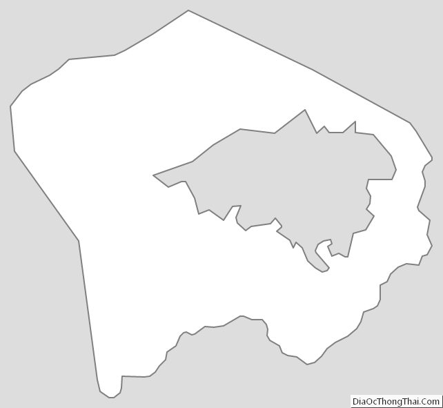
Roanoke County Outline Map