Vinton is a town in eastern Roanoke County, Virginia, United States. The population was 8,059 at the 2020 census. Vinton is part of the Roanoke Metropolitan Statistical Area and the Roanoke Region of Virginia.
| Name: | Vinton town |
|---|---|
| LSAD Code: | 43 |
| LSAD Description: | town (suffix) |
| State: | Virginia |
| County: | Roanoke County |
| Founded: | 1884 |
| Elevation: | 925 ft (282 m) |
| Total Area: | 3.15 sq mi (8.2 km²) |
| Land Area: | 3.11 sq mi (8.1 km²) |
| Water Area: | 0.04 sq mi (0.1 km²) |
| Total Population: | 8,059 |
| Population Density: | 2,600/sq mi (990/km²) |
| ZIP code: | 24179 |
| Area code: | 540 and 826 |
| FIPS code: | 5181280 |
| GNISfeature ID: | 1500260 |
| Website: | www.vintonva.gov |
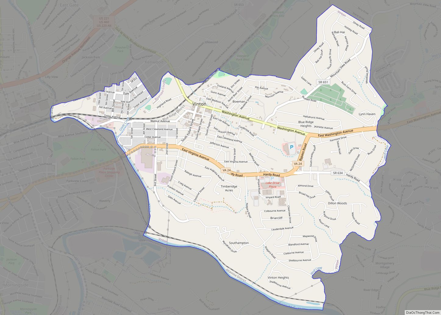
Online Interactive Map
Click on ![]() to view map in "full screen" mode.
to view map in "full screen" mode.
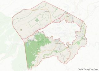
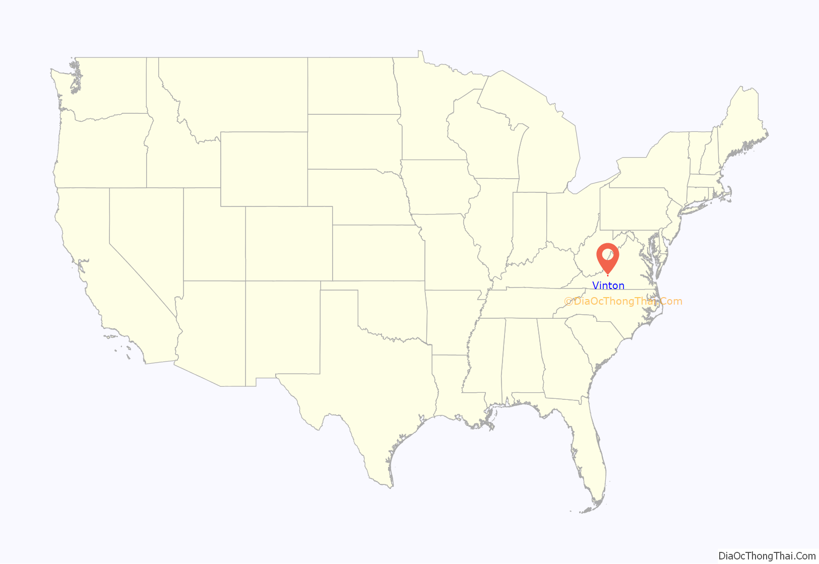
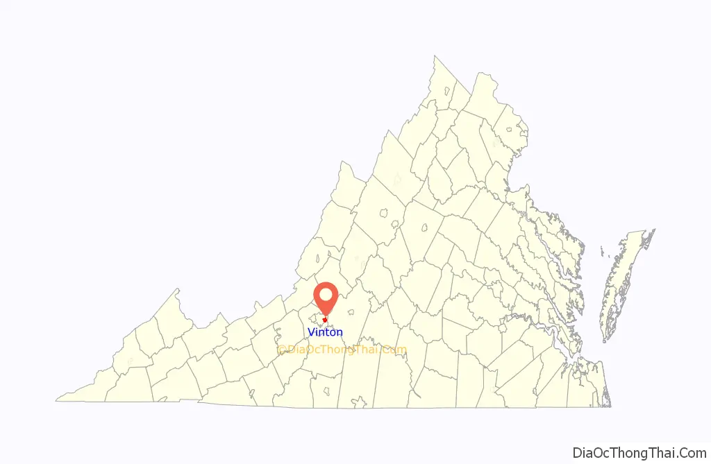
Vinton location map. Where is Vinton town?
History
By the late 18th century, settlers began moving into the area and in 1797, the Gish family established a gristmill on Glade Creek. Afterward the area would become known as Gish’s Mill. As the railroad expanded into the Roanoke Valley, Gish’s Mill became a stop for the Atlantic, Mississippi and Ohio Railroad. In the late 1870s and early 1880s, the Gish family led a movement to establish a town around the train depot site. A mass meeting to discuss incorporation was held in 1883 and in 1884 the area was incorporated as the Town of Vinton.
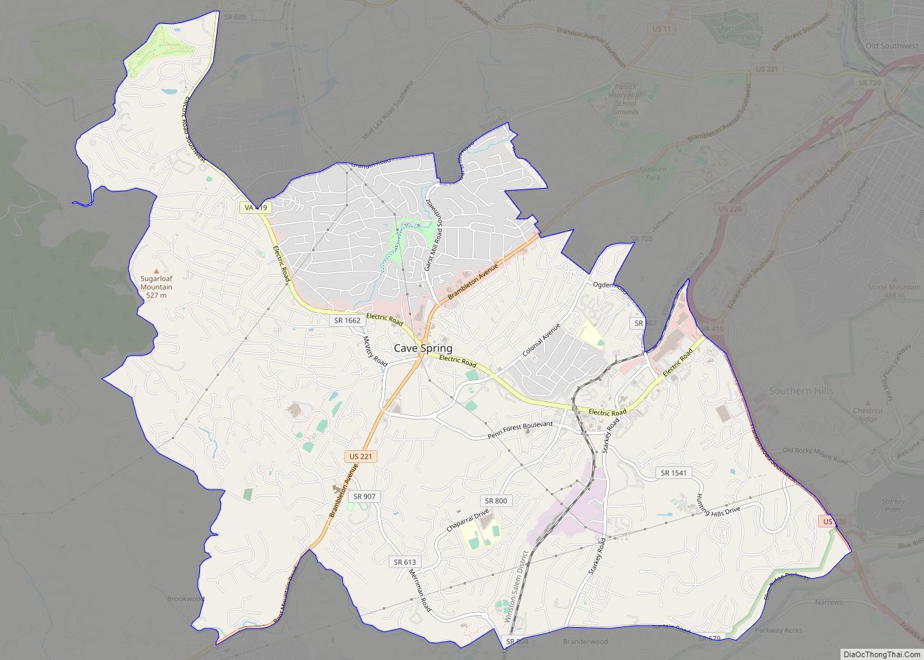
Vinton Road Map
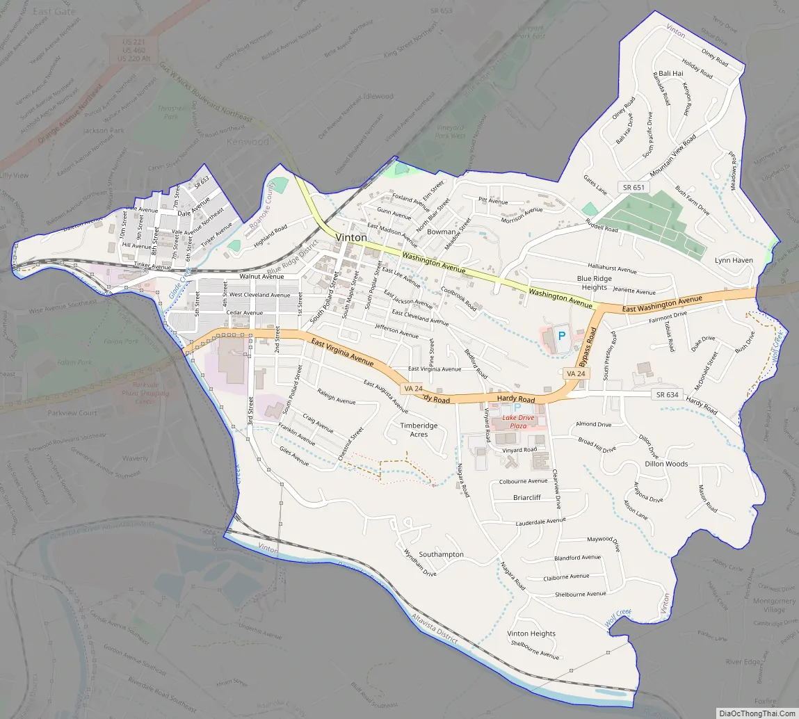
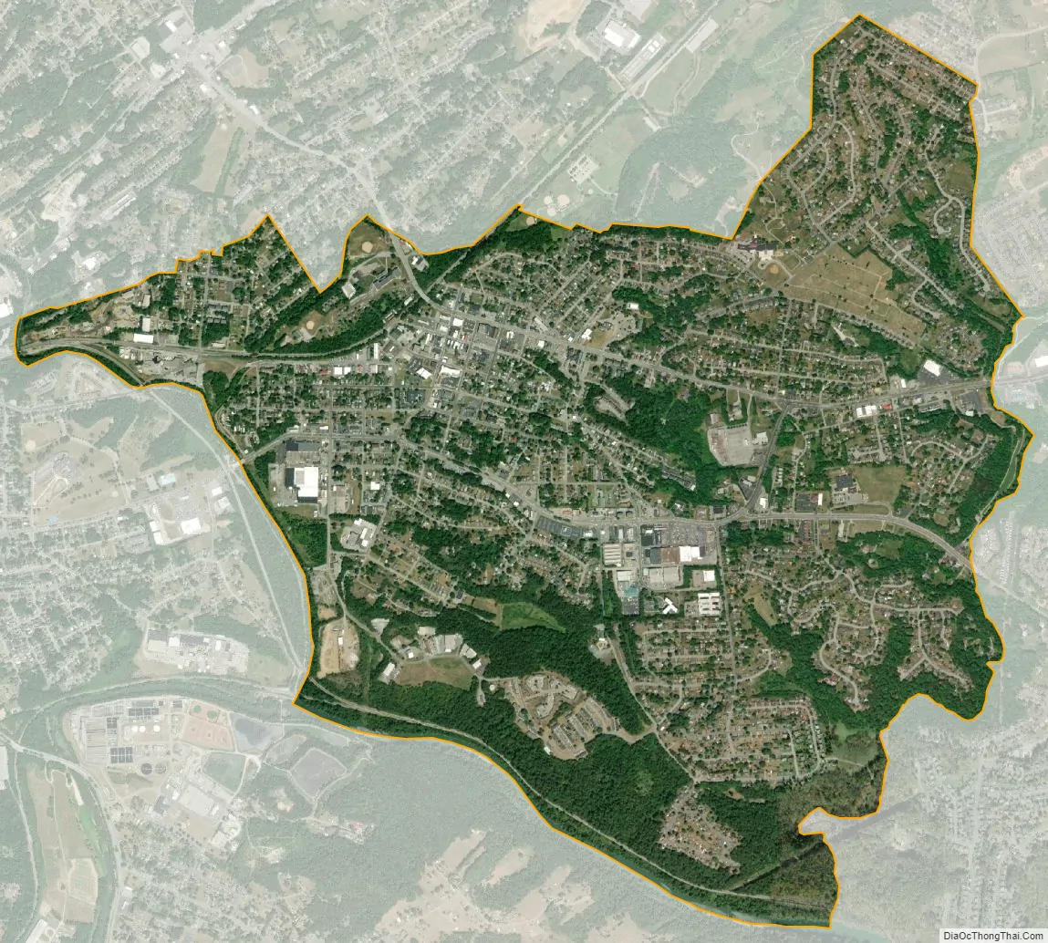
Vinton city Satellite Map
Geography
Vinton is located at 37°16′41″N 79°53′43″W / 37.27806°N 79.89528°W / 37.27806; -79.89528 (37.277987, −79.895248).
According to the United States Census Bureau, the town has a total area of 3.16 square miles (8.2 km).
The town shares a substantial portion of its western border with the neighboring city of Roanoke. Several neighborhoods in this area are bisected by the border between the two communities. Given its proximity and size, the town is considered a bedroom community for Roanoke.
The southern border of Vinton consists of 1.5 miles (2.4 km) of lakefront in the Roanoke River Gorge. This lake, however, which was created by the 1904 construction of the hydroelectric Niagara (so-called) dam, is not visible from any inhabited part of the town, is difficult to reach, and is little used.
Vinton has varied topography, considering its 3.2 square mile size. The above-mentioned lake is at an elevation of 890 feet (270 m) above sea level. The Vinton side of the lake consists of a steep, wooded cliff 150 feet (46 m) in vertical height. Vinton’s highest point is on Olney Road, at an elevation of 1,265 feet (386 m), which affords a good view of the adjacent city of Roanoke.
While the entirety of the town of Vinton is located in Roanoke County, much of its ZIP Code also covers the western portion of Bedford County.
See also
Map of Virginia State and its subdivision:- Accomack
- Albemarle
- Alexandria
- Alleghany
- Amelia
- Amherst
- Appomattox
- Arlington
- Augusta
- Bath
- Bedford
- Bedford City
- Bland
- Botetourt
- Bristol
- Brunswick
- Buchanan
- Buckingham
- Buena Vista
- Campbell
- Caroline
- Carroll
- Charles City
- Charlotte
- Charlottesville
- Chesapeake
- Chesterfield
- Clarke
- Clifton Forge City
- Colonial Heights
- Covington
- Craig
- Culpeper
- Cumberland
- Danville
- Dickenson
- Dinwiddie
- Emporia
- Essex
- Fairfax
- Fairfax City
- Falls Church
- Fauquier
- Floyd
- Fluvanna
- Franklin
- Frederick
- Fredericksburg
- Galax
- Giles
- Gloucester
- Goochland
- Grayson
- Greene
- Greensville
- Halifax
- Hampton
- Hanover
- Harrisonburg
- Henrico
- Henry
- Highland
- Hopewell
- Isle of Wight
- James City
- King and Queen
- King George
- King William
- Lancaster
- Lee
- Lexington
- Loudoun
- Louisa
- Lunenburg
- Lynchburg
- Madison
- Manassas
- Manassas Park
- Martinsville
- Mathews
- Mecklenburg
- Middlesex
- Montgomery
- Nelson
- New Kent
- Newport News
- Norfolk
- Northampton
- Northumberland
- Norton
- Nottoway
- Orange
- Page
- Patrick
- Petersburg
- Pittsylvania
- Poquoson
- Portsmouth
- Powhatan
- Prince Edward
- Prince George
- Prince William
- Pulaski
- Radford
- Rappahannock
- Richmond
- Roanoke
- Roanoke City
- Rockbridge
- Rockingham
- Russell
- Salem
- Scott
- Shenandoah
- Smyth
- Southampton
- Spotsylvania
- Stafford
- Staunton
- Suffolk
- Surry
- Sussex
- Tazewell
- Virginia Beach
- Warren
- Washington
- Waynesboro
- Westmoreland
- Williamsburg
- Winchester
- Wise
- Wythe
- York
- Alabama
- Alaska
- Arizona
- Arkansas
- California
- Colorado
- Connecticut
- Delaware
- District of Columbia
- Florida
- Georgia
- Hawaii
- Idaho
- Illinois
- Indiana
- Iowa
- Kansas
- Kentucky
- Louisiana
- Maine
- Maryland
- Massachusetts
- Michigan
- Minnesota
- Mississippi
- Missouri
- Montana
- Nebraska
- Nevada
- New Hampshire
- New Jersey
- New Mexico
- New York
- North Carolina
- North Dakota
- Ohio
- Oklahoma
- Oregon
- Pennsylvania
- Rhode Island
- South Carolina
- South Dakota
- Tennessee
- Texas
- Utah
- Vermont
- Virginia
- Washington
- West Virginia
- Wisconsin
- Wyoming