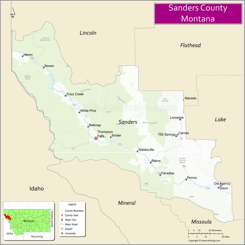
Sanders County is a county in the U.S. state of Montana. As of the 2020 census, the population was 12,400. Its county seat is Thompson Falls. The county was founded in 1905.
It has an annual county fair with rodeo at Plains.
| Name: | Sanders County |
|---|---|
| FIPS code: | 30-089 |
| State: | Montana |
| Founded: | 1905 |
| Named for: | Wilbur Fiske Sanders |
| Seat: | Thompson Falls |
| Largest city: | Thompson Falls |
| Total Area: | 2,790 sq mi (7,200 km²) |
| Land Area: | 2,761 sq mi (7,150 km²) |
| Total Population: | 12,400 |
| Population Density: | 4.4/sq mi (1.7/km²) |
| Time zone: | UTC−7 (Mountain) |
| Summer Time Zone (DST): | UTC−6 (MDT) |
| Website: | www.co.sanders.mt.us |
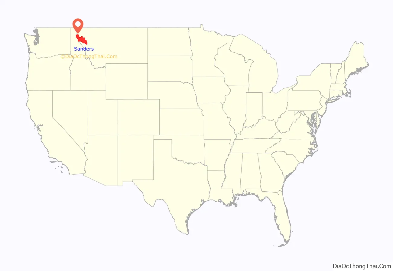
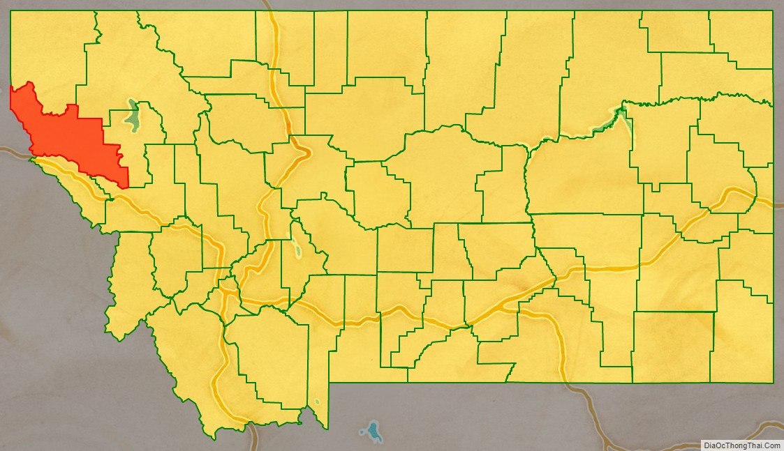
Sanders County location map. Where is Sanders County?
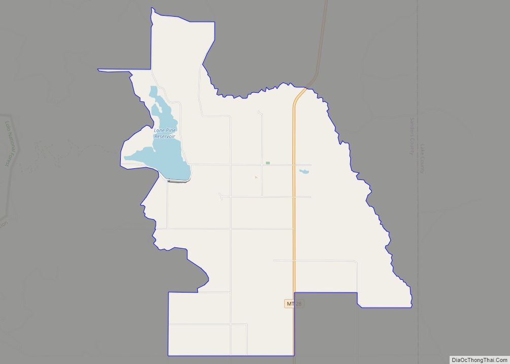
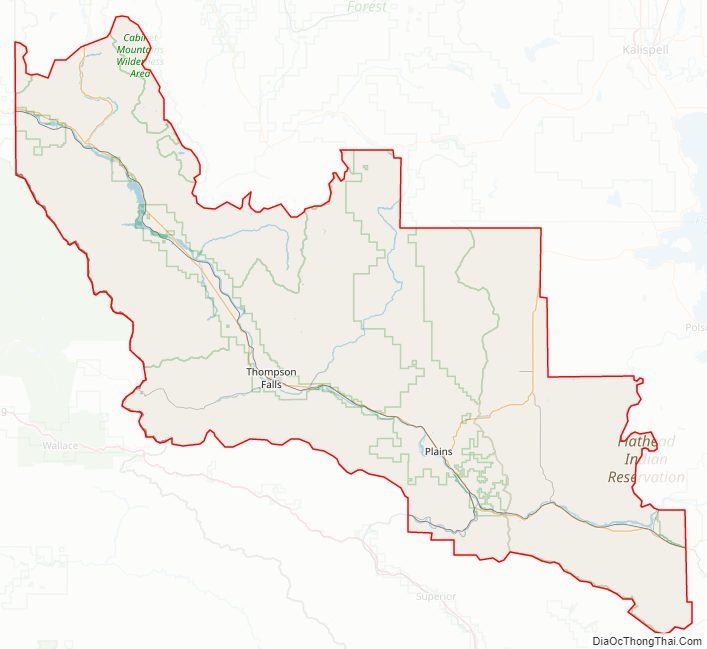
Sanders County Road Map
Geography
According to the United States Census Bureau, the county has a total area of 2,790 square miles (7,200 km), of which 2,761 square miles (7,150 km) is land and 29 square miles (75 km) (1.1%) is water.
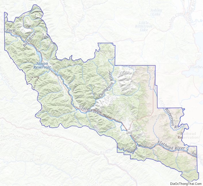
Sanders County lies on the state’s western border; thus it shares the border with Idaho to the west. It is part of the Coeur d’Alene Mountains in the Bitterroot Range. The Clark Fork River flows southeast to northwest through the middle of the county, with the Bitterroot Mountains to the south and the Cabinet Mountains to the north.
It is partially arid, with the west-facing mountain slopes capturing the most rain: ranging from nearly 40 inches a year in Heron (similar to Seattle’s annual precipitation) on the Western end of the county to less than 12 inches per year in Dixon on the East end.
During the last ice age, this was the area that dammed the glacial Lake Missoula. When the ice dam broke, the resulting floods created the Scablands in eastern Washington.
Adjacent counties
- Lincoln County – north
- Flathead County – northeast
- Lake County – east
- Missoula County – southeast
- Mineral County – south
- Shoshone County, Idaho – west/Pacific Time Border
- Bonner County, Idaho – northwest/Pacific Time Border
National protected areas
- Kaniksu National Forest (part)
- Kootenai National Forest (part)
- Lolo National Forest (part)
- Bison Range (part)
Fauna
A variety of birds and other wildlife are found in Sanders County. The Tufted duck has been observed along the Bull River. An amphibian, the Rough-skinned Newt, has a disjunctive population at Thompson Falls which is un-contiguous with the remainder of the Western United States population of this species.
Sanders County is a “destination hunting locale” with trophy specimens of White-tailed Deer (Odocoileus virginianus), Mule Deer (Odocoileus hemionus), Rocky Mountain Elk (Cervus canadensis nelsoni), Shiras Moose (Alces alces Shirasi), Mountain Goat(Oreamnos americanus), and Bighorn Sheep (Ovis canadensis Canadensis) rounding out huntable ungulate species and Black Bear, Cougar and Wolves comprising the huntable carnivores.
Rocky Mountain Bighorns are regularly hunted in the county. Grizzly bear, the Montana state animal, are also found in the county, but as an endangered species, hunting them is prohibited. Montana had the last huntable population of Grizzlies in the lower 48, allowing 10 bears a year (natural deaths, poaching and other causes of death were included in that total to decide when season closed) as late as the 1990s. Only Alaska allows hunting for Grizzlies at present.
Western Meadowlark, the state bird are found sparsely in the meadow areas of Sanders County along with Redwing Blackbird and Mountain Bluebirds.
The westslope cutthroat trout (Onchorynchus clarki lewisi) is native to the drainages of Sanders County. The threatened native bull trout relies on westslopes as a major prey species in its piscivorous diet. Catch and release fishing is required to maintain fishable populations of the two natives, which now compete with introduced rainbow trout, and warm-water species, such as largemouth bass, yellow perch, Northern Pike, and walleyes that have been introduced and thrive in the modified habitat of the Clark Fork River’s reservoirs.
Flora
Sanders County is part of the mountainous western third of Montana. It lies entirely on the western slopes of the Rocky Mountains with a mixed coniferous forest dominating the plant community. Douglas fir/Ponderosa pine (Montana state tree) climax plant community dominate much of the county, but there are numerous other conifers found there as well in pockets of micro-climates suited to their needs. These include Western red cedar, Western Hemlock, Mountain Hemlock, White Spruce, Subalpine Fir, Grand Fir, Western White Pine, Lodgepole Pine and one of the most spectacular, Western larch, one of a handful of deciduous conifers that turn gold in the autumn before dropping their needles.
Numerous broadleaf species proliferate in Sanders County: Rocky Mountain Maple, Red Alder, Paperbark Birch, Chokecherry, cottonwood, and poplar.
Arguably the most popular broad-leaf shrub in Sanders County is the Rocky Mountain huckleberry (Vaccinium membranaceum). Trout Creek, Montana 59874 is considered the “Huckleberry Capital of Montana” and holds an annual huckleberry celebration in August. Though related to the common blueberry (Vaccinium corymbosum) very few have managed to grow Rocky Mountain huckleberry in domestic cultivation. It is found in plant communities with beargrass (Xerophyllum tenax), a perennial found in burned or logged-over areas of the county’s mountains.
The bitterroot (Lewisia rediviva), the state flower, is found in limited quantities in Sanders County.
Sanders County Topographic Map
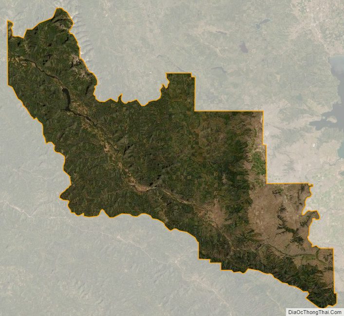
Sanders County Satellite Map
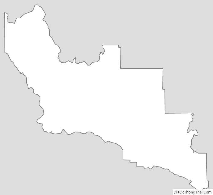
Sanders County Outline Map