Scott County is a county located in the U.S. state of Indiana. As of 2010, the population was 24,181. The county seat is Scottsburg.
| Name: | Scott County |
|---|---|
| FIPS code: | 18-143 |
| State: | Indiana |
| Founded: | 1820 |
| Named for: | Charles Scott |
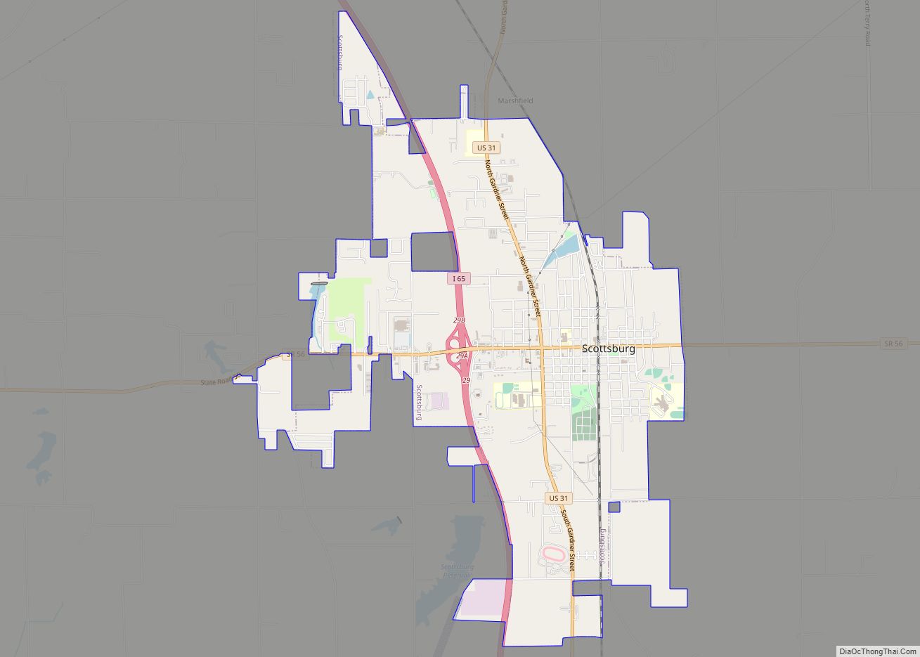
| Seat: | Scottsburg |
| Largest city: | Scottsburg |
| Total Area: | 192.75 sq mi (499.2 km²) |
| Land Area: | 190.40 sq mi (493.1 km²) |
| Population Density: | 127/sq mi (49.04/km²) |
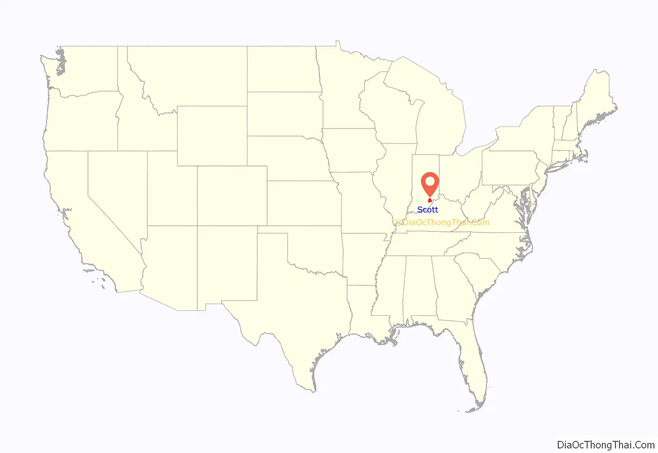
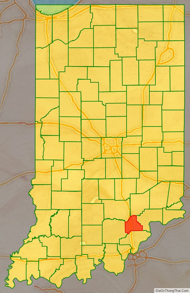
Scott County location map. Where is Scott County?
History
Scott County was formed in 1820 from portions of Clark, Jackson, Jefferson, Jennings, and Washington counties. It was named for Gen. Charles Scott, who was Governor of Kentucky from 1808 to 1812.
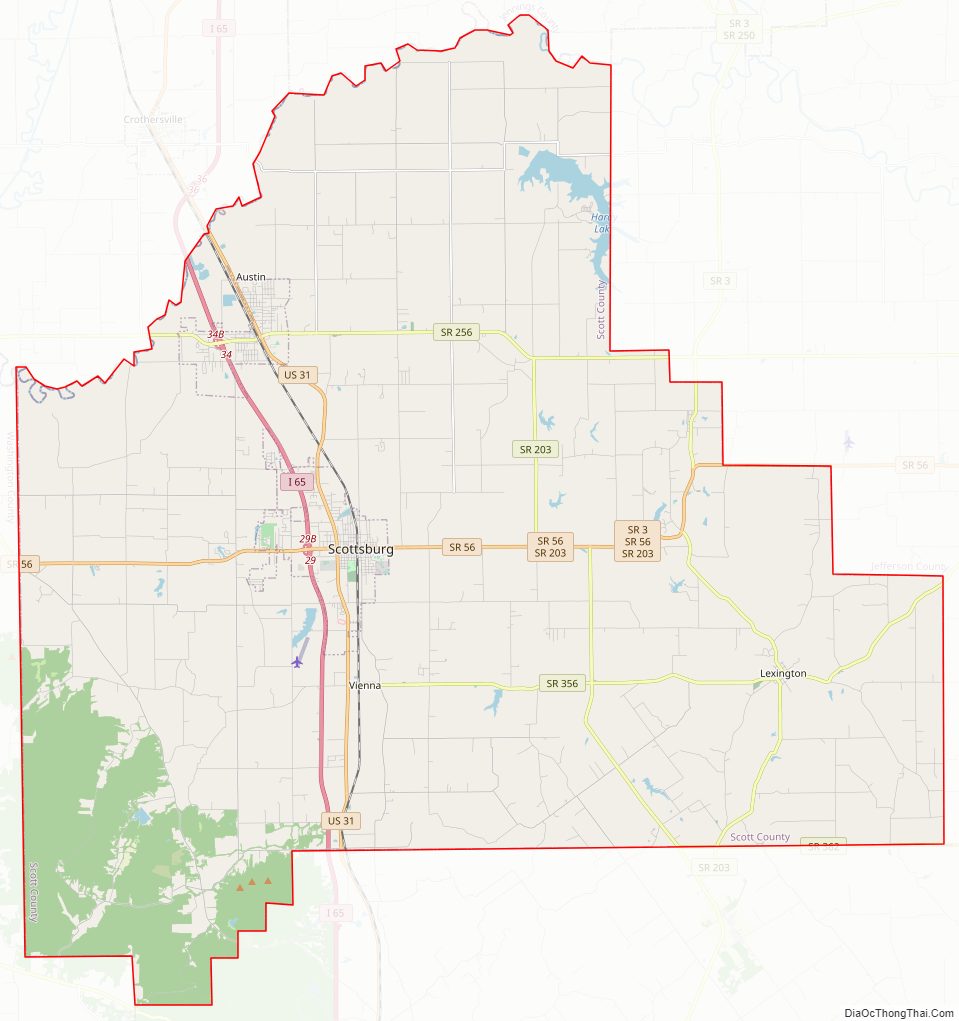
Scott County Road Map
Geography
According to the 2010 census, the county has a total area of 192.75 square miles (499.2 km), of which 190.40 square miles (493.1 km) (or 98.78%) is land and 2.35 square miles (6.1 km) (or 1.22%) is water.
Cities and towns
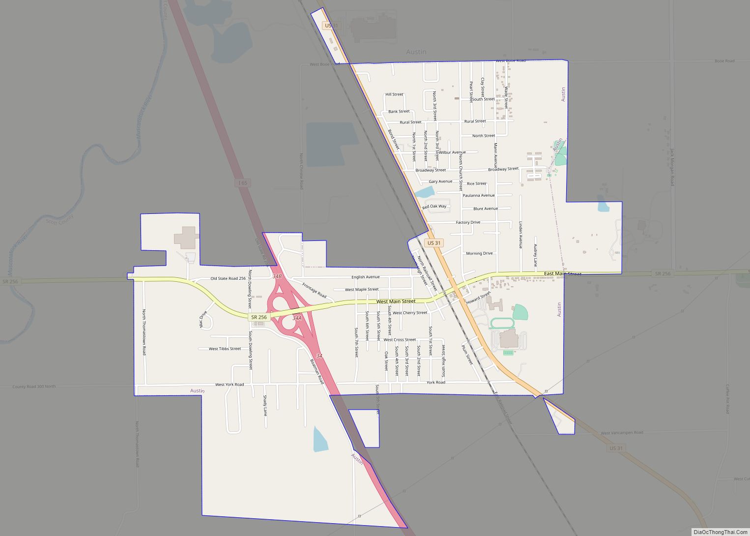
- Austin
- Scottsburg
- Lexington
Unincorporated towns
- Blocher
- Nabb
- Vienna
- Leota
Townships
- Finley
- Jennings
- Johnson
- Lexington
- Vienna
Adjacent counties
- Jennings County (northeast)
- Jefferson County (east)
- Clark County (south)
- Washington County (west)
- Jackson County (northwest)
Major highways
- Interstate 65
- U.S. Route 31
- State Road 3
- State Road 56
- State Road 160
- State Road 203
- State Road 256
- State Road 356
- State Road 362
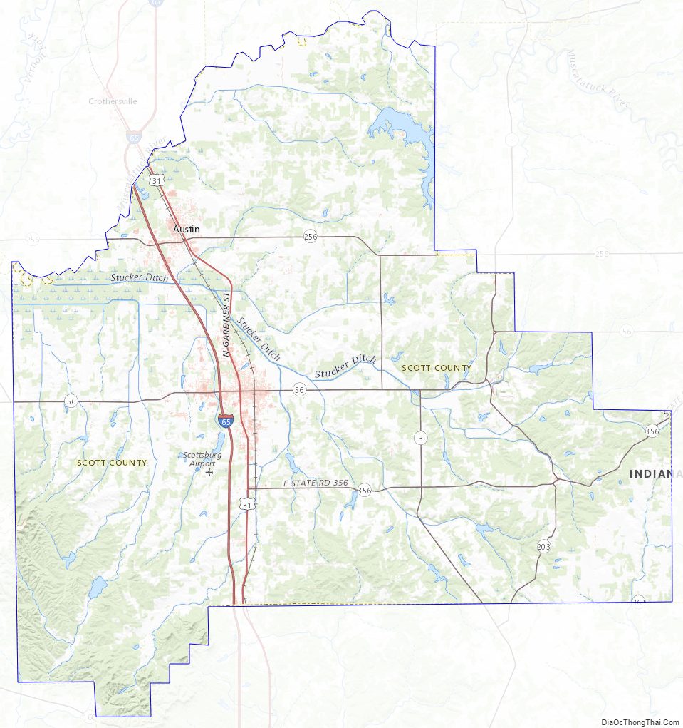
Scott County Topographic Map
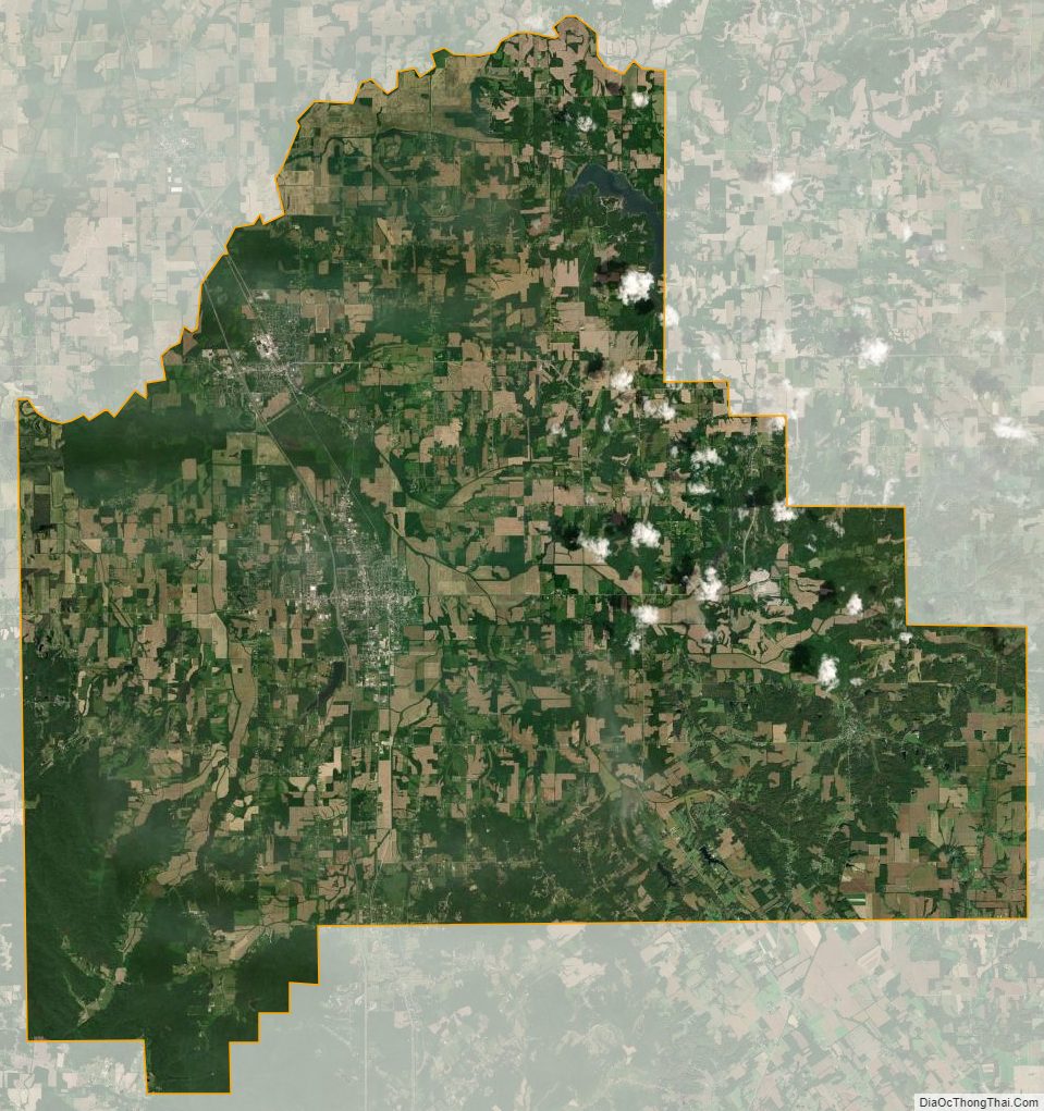
Scott County Satellite Map
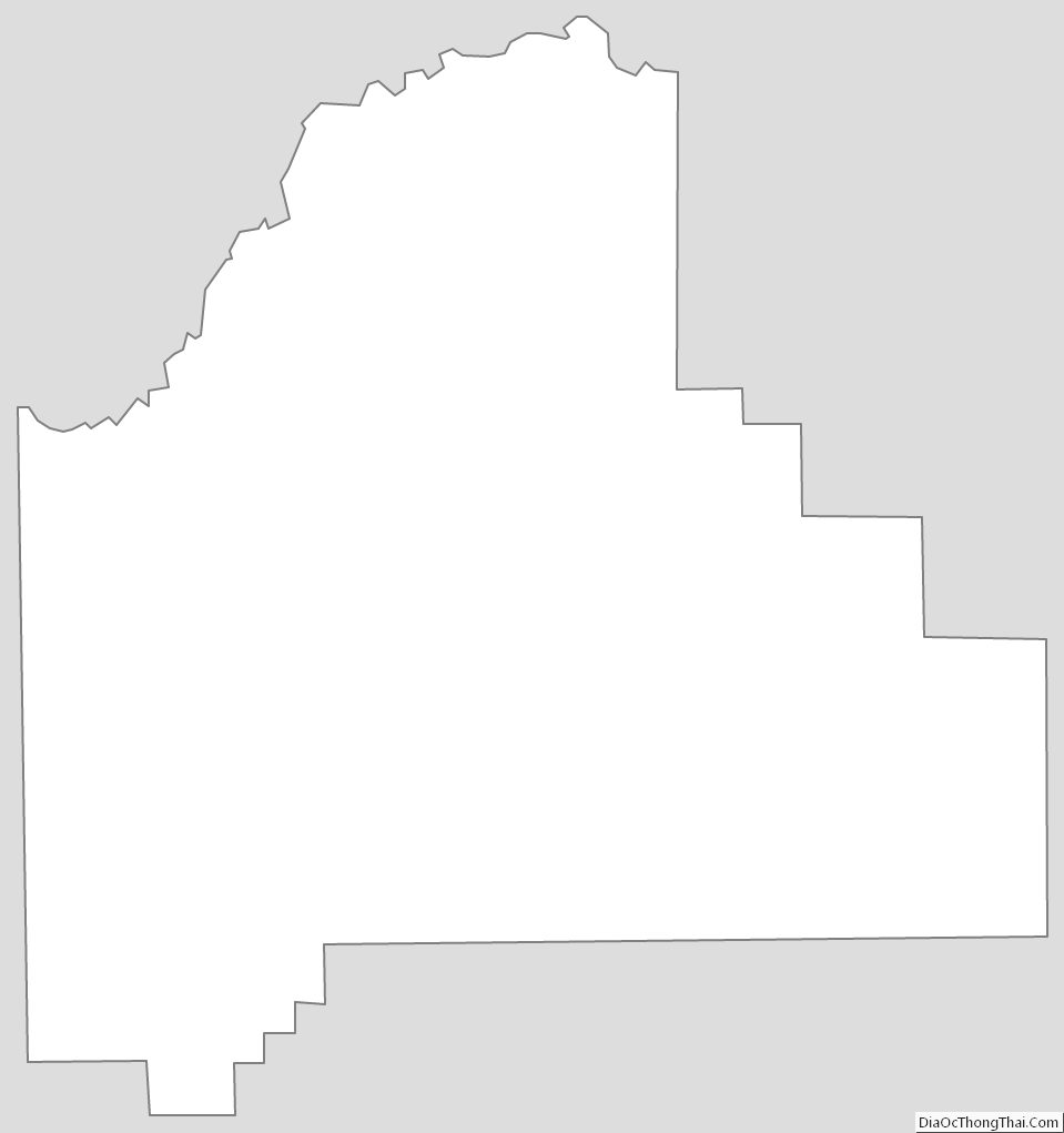
Scott County Outline Map