Oxford is a waterfront town and former colonial port in Talbot County, Maryland, United States. The population was 651 at the 2010 census.
| Name: | Oxford town |
|---|---|
| LSAD Code: | 43 |
| LSAD Description: | town (suffix) |
| State: | Maryland |
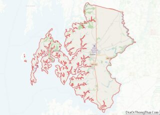
| County: | Talbot County |
| Founded: | 1683 (officially) |
| Elevation: | 7 ft (2 m) |
| Total Area: | 0.84 sq mi (2.17 km²) |
| Land Area: | 0.56 sq mi (1.45 km²) |
| Water Area: | 0.28 sq mi (0.72 km²) |
| Total Population: | 611 |
| Population Density: | 1,089.13/sq mi (420.29/km²) |
| ZIP code: | 21654 |
| Area code: | 410 |
| FIPS code: | 2459450 |
| GNISfeature ID: | 0590961 |
| Website: | www.oxfordmd.net |
Online Interactive Map
Click on ![]() to view map in "full screen" mode.
to view map in "full screen" mode.
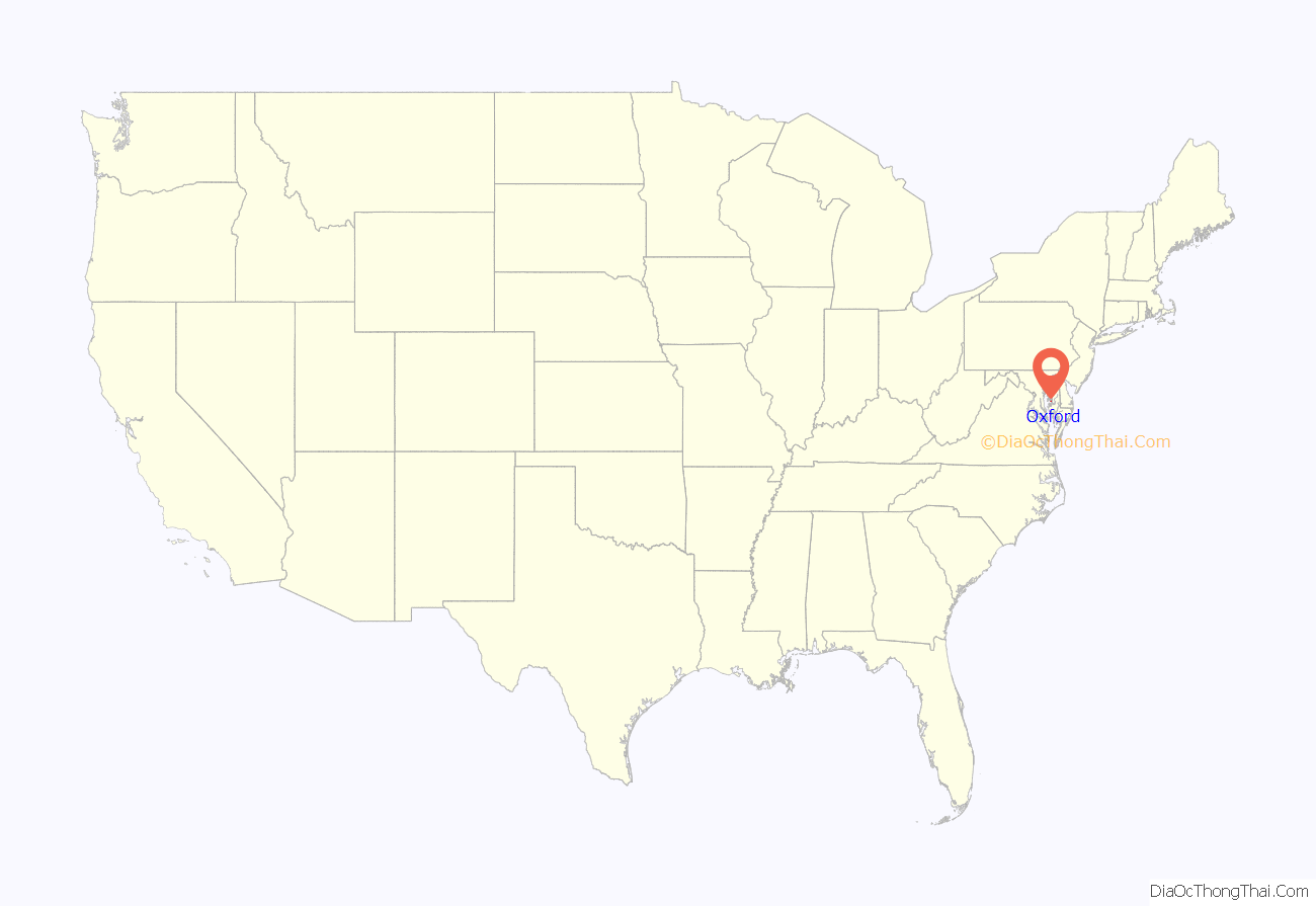
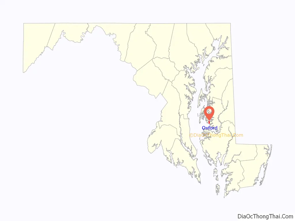
Oxford location map. Where is Oxford town?
History
Oxford is one of the oldest towns in Maryland. While Oxford officially marks the year 1683 as its founding because in that year it was first named by the Maryland General Assembly as a seaport, the town began between 1666 and 1668 when 30 acres (120,000 m) were laid out as a town called Oxford by William Stephens Jr.. By 1669 one of the first houses was built for Innkeeper Francis Armstrong (see Talbot County Land Records, A 1, f. 10/11).
Oxford first appears on a map completed in 1670 and published in 1671. In 1694, Oxford and a new town called Anne Arundel (now Annapolis) were selected as the only ports of entry for the entire Maryland province. Until the American Revolution, Oxford enjoyed prominence as an international shipping center surrounded by wealthy tobacco plantations.
Early inhabitants included Robert Morris Sr., agent for a Liverpool shipping firm who greatly influenced the town’s growth; his son, Robert Morris Jr., known as “the financier of the Revolution;” Jeremiah Banning, sea captain, war hero, and statesman; The Reverend Thomas Bacon, Anglican clergyman who wrote the first compilation of the laws of Maryland; Matthew Tilghman, known as the “patriarch of Maryland” and “father of statehood”; and Colonel Tench Tilghman, aide-de-camp to George Washington and the man who carried the message of General Cornwallis’s surrender to the Continental Congress in Philadelphia.
Tench Tilghman’s grave can be found at the Oxford cemetery. It is overshadowed by the Tench Tilghman Monument, a stone spire approximately 10 feet tall. The monument is the tallest monument found at the Oxford cemetery. The cemetery itself was used in the opening sequence of the 1988 feature film, Clara’s Heart, starring Whoopi Goldberg and Neil Patrick Harris.
The American Revolution marked the end of Oxford’s prosperity. Maritime trade declined, and tobacco was replaced by wheat as a cash crop.
After the Civil War, Oxford was revived by the completion of the railroad in 1871 and by improved methods of canning and packing which opened national markets for oysters from the Chesapeake Bay. This did not last. In the early part of the 20th century, the oyster beds played out, the packing houses closed, other businesses went bankrupt, and the railway and steamships eventually disappeared. Oxford became a sleepy little town inhabited mainly by watermen who still worked the waters of the Tred Avon River.
Oxford is host to the oldest privately operated ferry service still in continuous use in the United States. The original ferry service, known today as the Oxford–Bellevue Ferry, was established in 1683 and continues today. The ferry links Oxford with Bellevue, Maryland, crossing the 3/4 mile width of the Tred Avon River during a 7-10 minute trip (20 minute round trip).
Oxford today is still a waterman’s town, but is enjoying a new resurgence based on tourism and leisure activities. The film Failure to Launch was filmed in part here.
The town is served by the Oxford Volunteer Fire Company, composed of two engines, a truck, tanker, command unit, brush unit, two BLS units, and a boat. They often respond to all of Talbot County as part of the Mutual Aid system. On average, they respond to over 100 calls per year.
Barnaby House, Billie P. Hall, Jena, Otwell, Oxford Historic District, and S. C. Dobson are listed on the National Register of Historic Places.
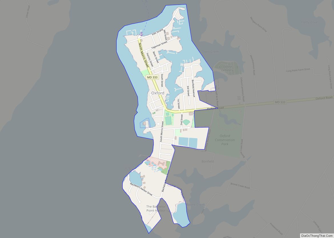
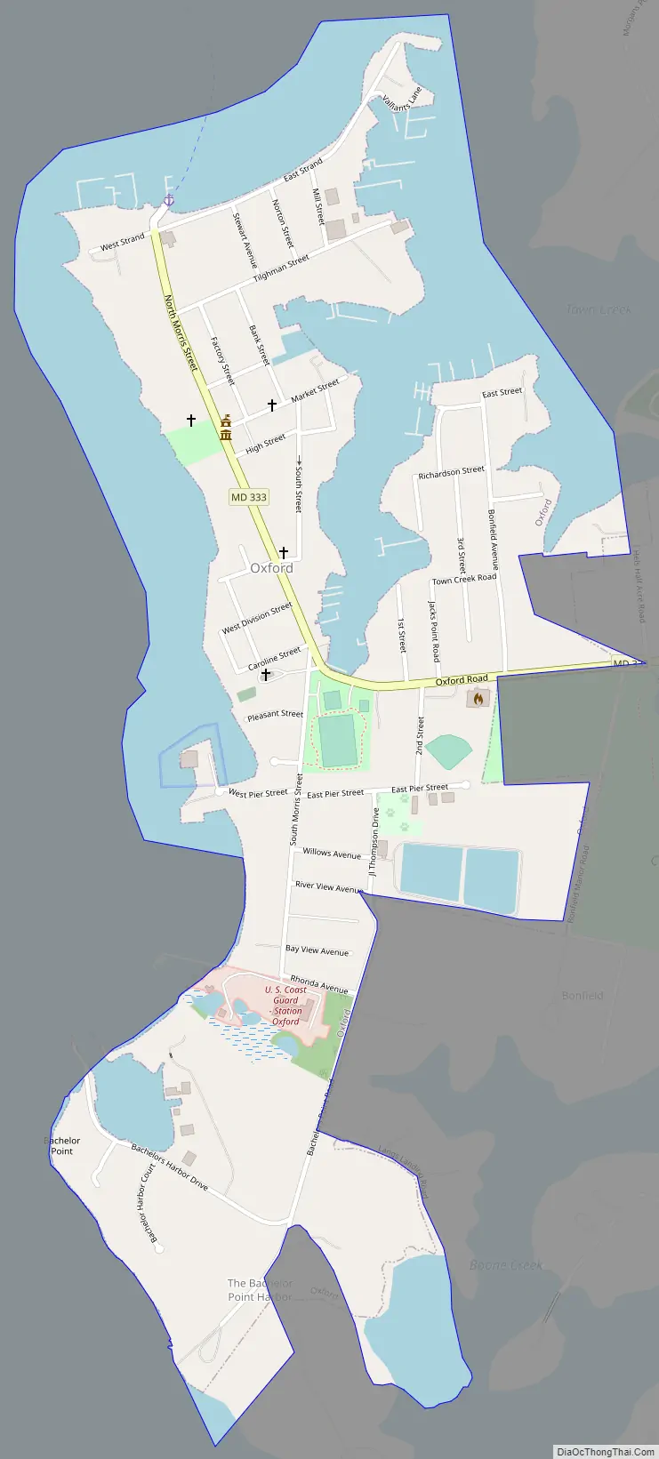
Oxford Road Map
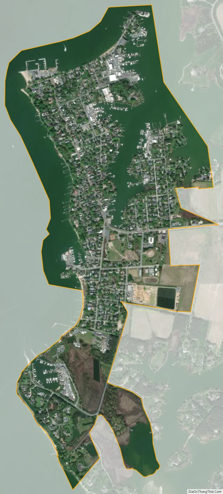
Oxford city Satellite Map
Geography
Oxford is located at 38°41’12” North, 76°10’15” West (38.686776, -76.170842) on the south bank of the Tred Avon river, near its mouth, where it empties into the Choptank.
According to the United States Census Bureau, the town has a total area of 0.83 square miles (2.15 km), of which 0.54 square miles (1.40 km) is land and 0.29 square miles (0.75 km) is water. This includes Town Creek, which nearly splits the town in two from north to south and provides a protected harbor for boaters and Oxford’s local shipbuilders.
Climate
The climate in this area is characterized by hot, humid summers and generally mild to cool winters. According to the Köppen Climate Classification system, Oxford has a humid subtropical climate, abbreviated “Cfa” on climate maps.
See also
Map of Maryland State and its subdivision: Map of other states:- Alabama
- Alaska
- Arizona
- Arkansas
- California
- Colorado
- Connecticut
- Delaware
- District of Columbia
- Florida
- Georgia
- Hawaii
- Idaho
- Illinois
- Indiana
- Iowa
- Kansas
- Kentucky
- Louisiana
- Maine
- Maryland
- Massachusetts
- Michigan
- Minnesota
- Mississippi
- Missouri
- Montana
- Nebraska
- Nevada
- New Hampshire
- New Jersey
- New Mexico
- New York
- North Carolina
- North Dakota
- Ohio
- Oklahoma
- Oregon
- Pennsylvania
- Rhode Island
- South Carolina
- South Dakota
- Tennessee
- Texas
- Utah
- Vermont
- Virginia
- Washington
- West Virginia
- Wisconsin
- Wyoming