Hungary is a medium-sized, landlocked Central European country covering an area of 93,030 km2(35,920 sq mi).
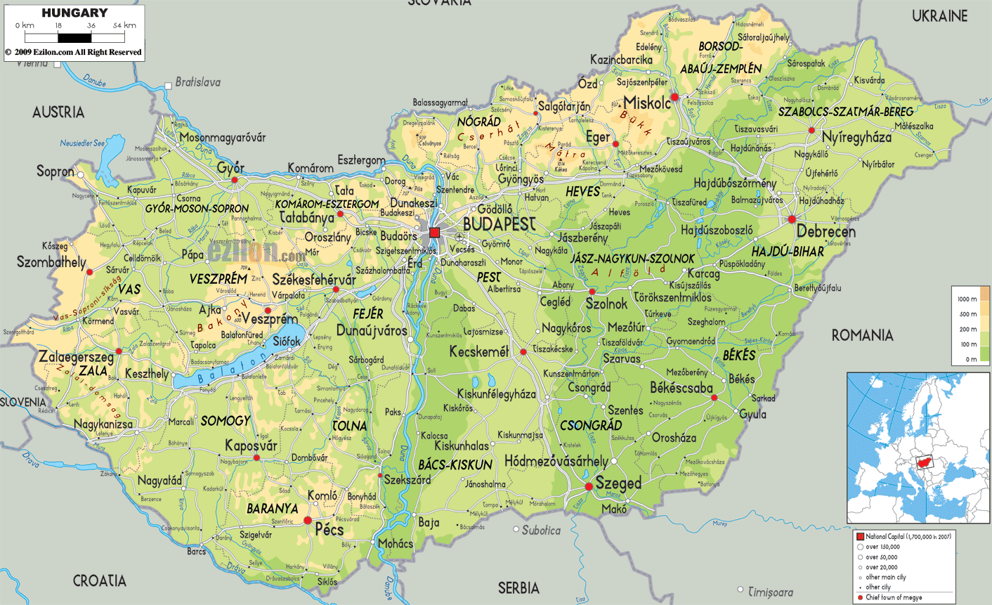
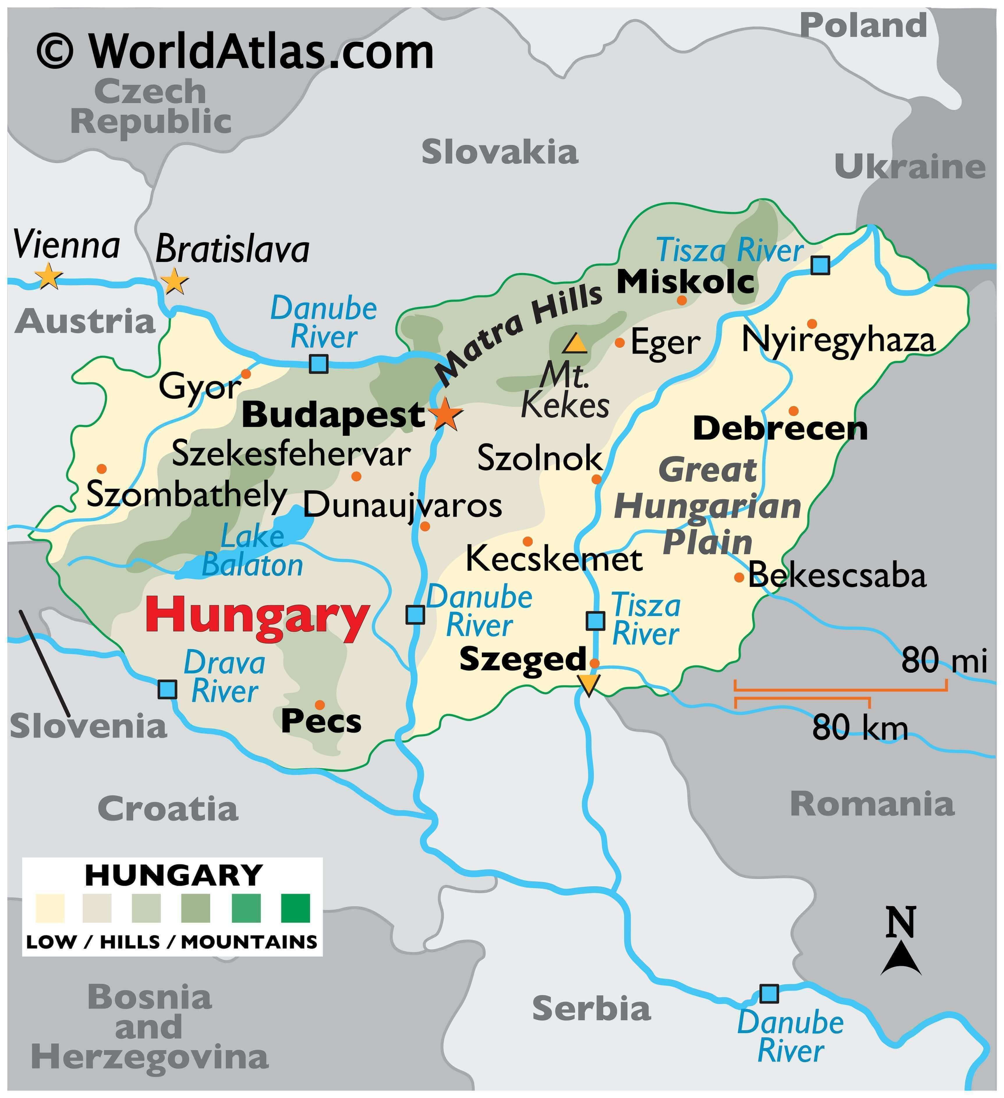
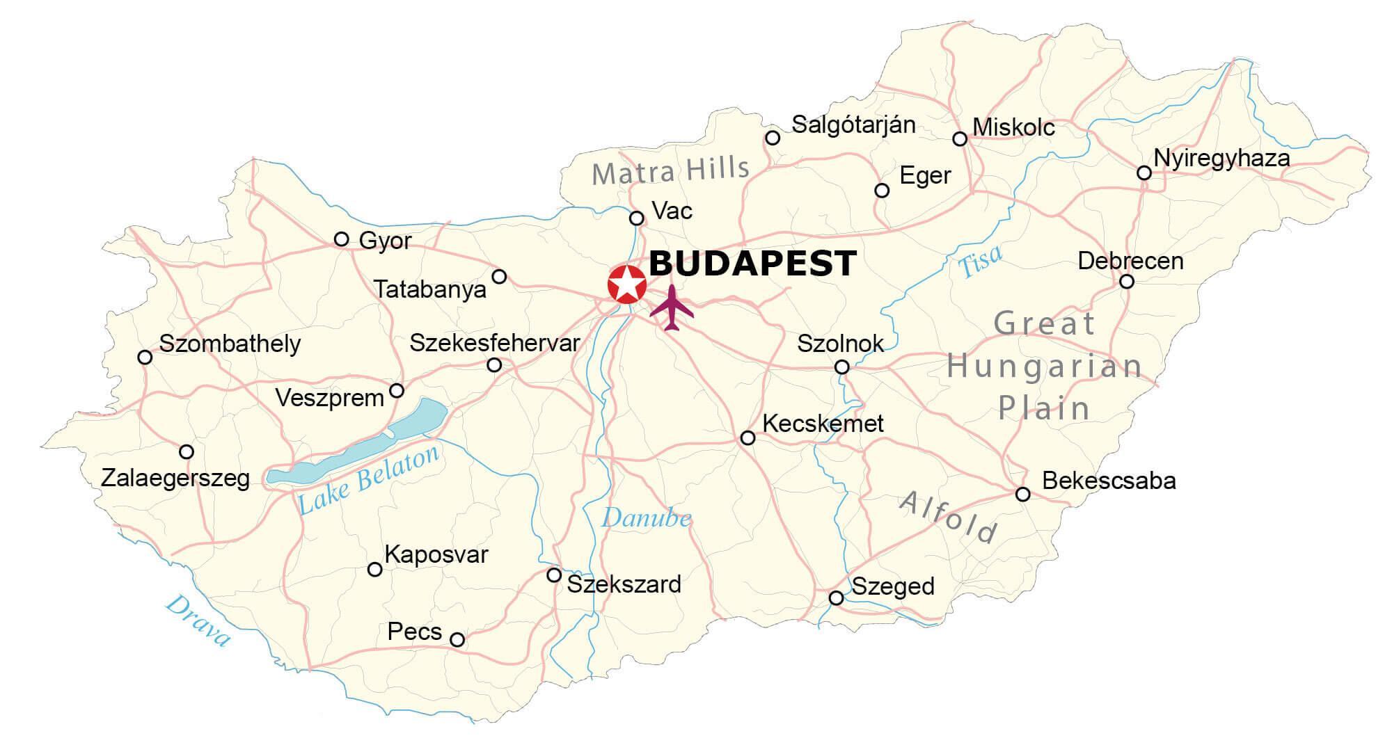
As observed on the physical map of Hungary, it is mostly a flat country, dominated by the Great Hungarian Plain east of the Danube. The plain includes approximately 56% of the country’s land. The terrain ranges from flat to rolling plains.
The land rises into hills and some low mountains in the north along the Slovakian border. The highest point, located in the Matra Hills, is Mt Kekes at 3,330 ft. (1,015m). A yellow upright triangle marks the position of this highest point on the map.
The lowest spot (marked by a yellow inverted triangle) is 77.6 m above sea level, located along the Tisza River in the south of Hungary, near Szeged.The Danube is the major river, as it divides the country almost in half, and is navigable within Hungary for 418 km. Additional rivers of note include the Drava and Tisza.Hungary has three major lakes. Lake Balaton, the largest at 78 km long and from 3 to 14 km wide, has an area of 592 sq km. As seen on the map, it is located in the west-central part of the country. It’s central Europe’s largest freshwater lake.
| Flag: |  |
|---|---|
| Legal Name: | Hungary |
| Capital Value: | Budapest |
| Largest City: |
Budapest (1,768,073) |
| Official languages: | Hungarian |
| Demonym(s): | Hungarian |
| Government: | Unitary parliamentary republic |
| Legislature: | National Assembly |
| Total Area: | 93,028 km² |
| Land Area: | 89,608 km² |
| Water Area: | 3,420 km² |
| Population: | 9,769,949 |
| Density: | 105/km (271.9/sq mi) (78th) |
| GDP: | $160.97 Billion |
| GDP Per Capita: | $16,475.74 |
| Currency Value: | Forints (HUF) |
| Driving side: | right |
| Calling code: | +36 |
| Internet TLD: | .hu |
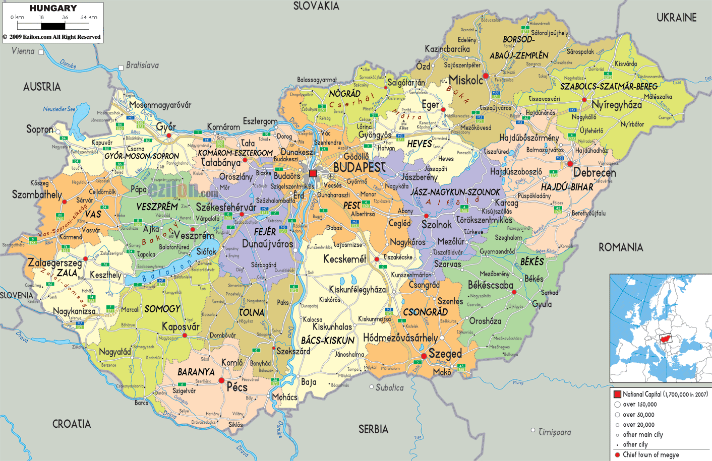
Hungary is a country of rich culture and breathtaking scenery, and this map is the perfect way to explore it. This detailed map of Hungary reveals the vast array of natural features, cities, and highways that make up the country. From the Danube River that meanders through the plains to the Matra Hills in the north, this map displays the diverse and beautiful terrain of Hungary.
The satellite and elevation map gives a bird’s eye view of Hungary’s topography. It also reveals the major cities, rivers, and highways that make up the country. With this map, you can explore Hungary’s unique landscape, from the flat Great Hungarian Plains in the southeast to the Matra Hills in the north.
Discover the beauty of Hungary with this detailed map. From the Danube River to the Matra Hills, explore the vast array of natural features, cities, and highways that make up this unique country.
Online Interactive Political Map
Click on ![]() to view map in "full screen" mode.
to view map in "full screen" mode.
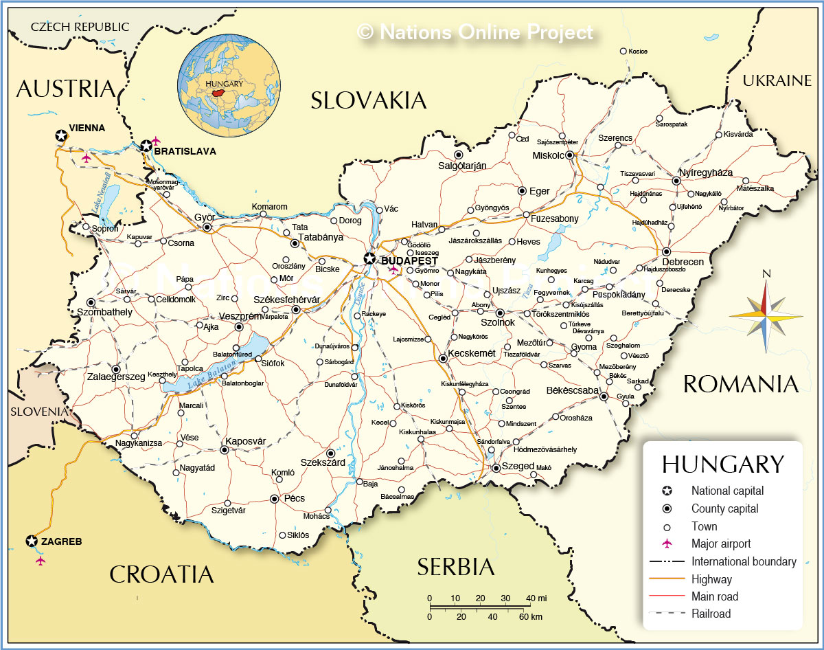
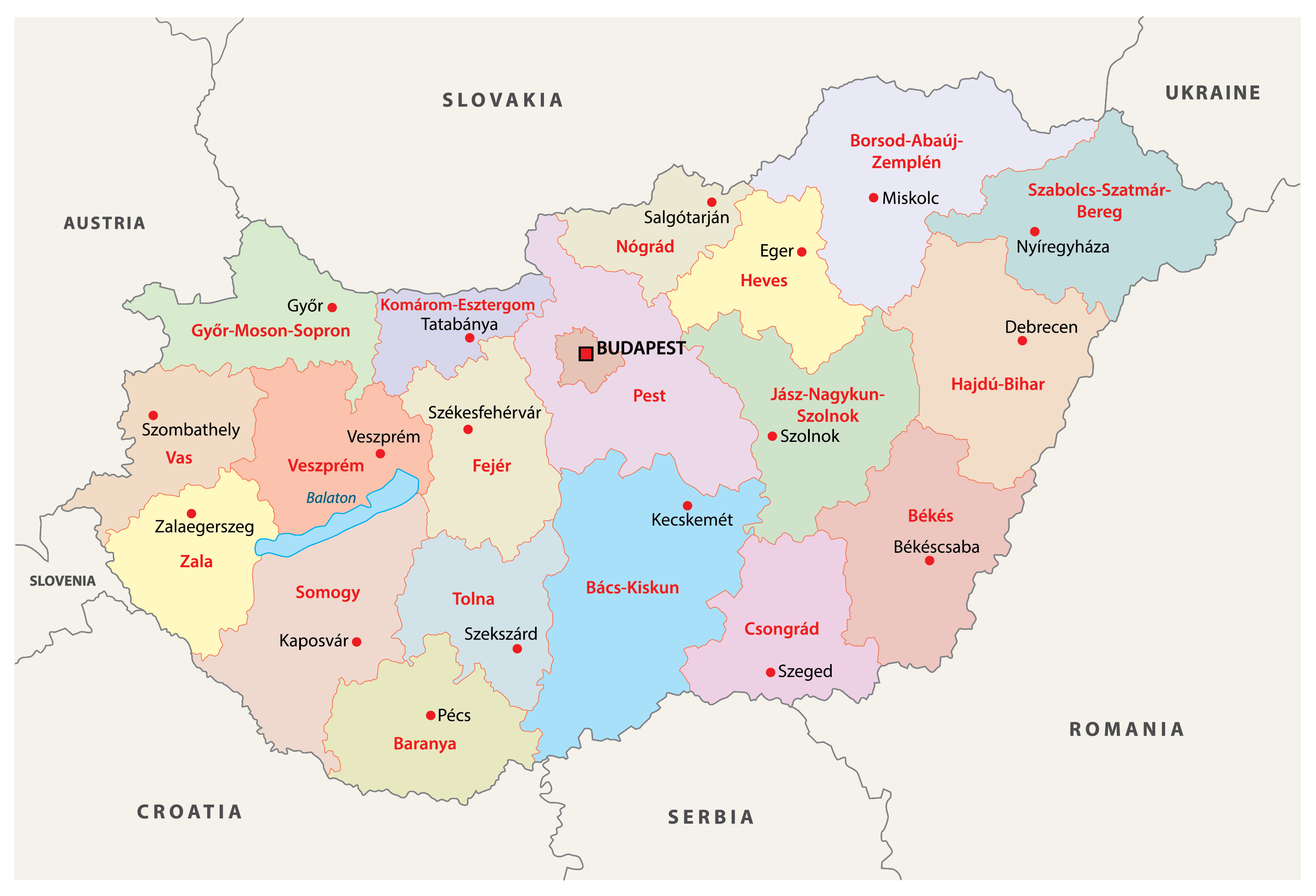
Hungary is administratively divided into 19 counties (megyek, singular – megye) and 1 capital city (fovaros). In alphabetical order, the counties are:Bacs-Kiskun, Baranya, Bekes, Borsod-Abauj-Zemplen, Csongrad, Fejer, Gyor-Moson-Sopron, Hajdu-Bihar, Heves, Jasz-Nagykun-Szolnok, Komarom-Esztergom, Nograd, Pest, Somogy, Szabolcs-Szatmar-Bereg, Tolna, Vas, Veszprem and Zala. Budapest is the capital city. There are also 23 cities with county rights, which are called ‘urban counties’(megyei jogu varosok, singular – megyei jogu varos). In alphabetical order, these are: Bekescsaba, Debrecen, Dunaujvaros, Eger, Erd, Gyor, Hodmezovasarhely, Kaposvar, Kecskemet, Miskolc, Nagykanizsa, Nyiregyhaza, Pecs, Salgotarjan, Sopron, Szeged, Szekesfehervar, Szekszard, Szolnok, Szombathely, Tatabanya, Veszprem and Zalaegerszeg.
The counties are subdivided into 174 districts while the capital city has 23 districts.
With an area of 93,030 sq. km, Hungary is a medium-sized member state of EU. Located at the center of the Carpathian Basin, on both the banks of the Danube River, Budapest is the capital, the largest and the most populous city of Hungary. It is the country’s major administrative, industrial and economic center.
Location Maps
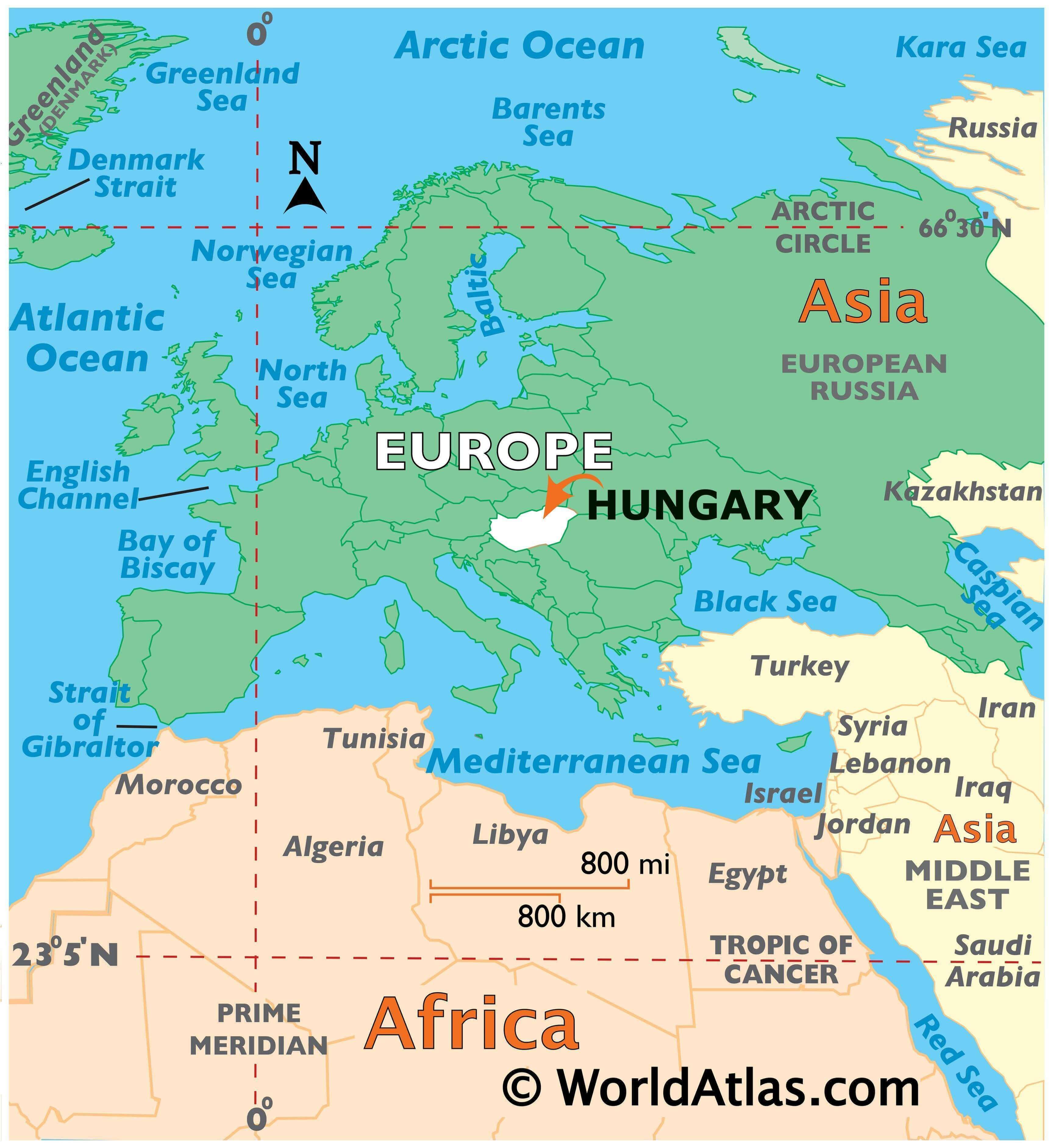
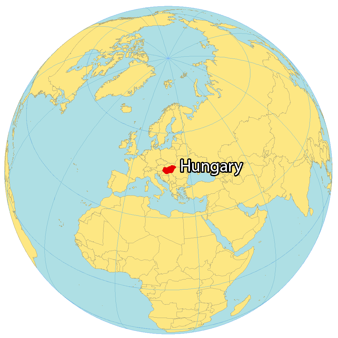
Where is Hungary?
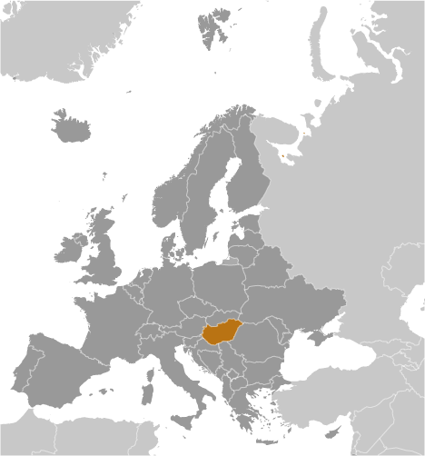
Hungary is a landlocked country located in central Europe. It borders seven other European countries including Ukraine to the northeast, Romania to the east, Serbia to the south, Croatia and Slovenia to the southwest, Austria to the west, and Slovakia to the north.
The capital and most populous city of Hungary is Budapest, which is situated along the Danube River from north to east. Hungary is known for its folk art, architecture, spas, cuisine, festivals, and the Great Hungarian Plains.
Hungary has a varied landscape, with the Great Plains in the east, the Transdanubian Mountains in the west, and the North Hungarian Mountains in the north. The Danube River runs through the country, and there are also several large lakes, including Lake Balaton, the largest lake in Central Europe.
High Definition Political Map of Hungary
Physical Map of Hungary