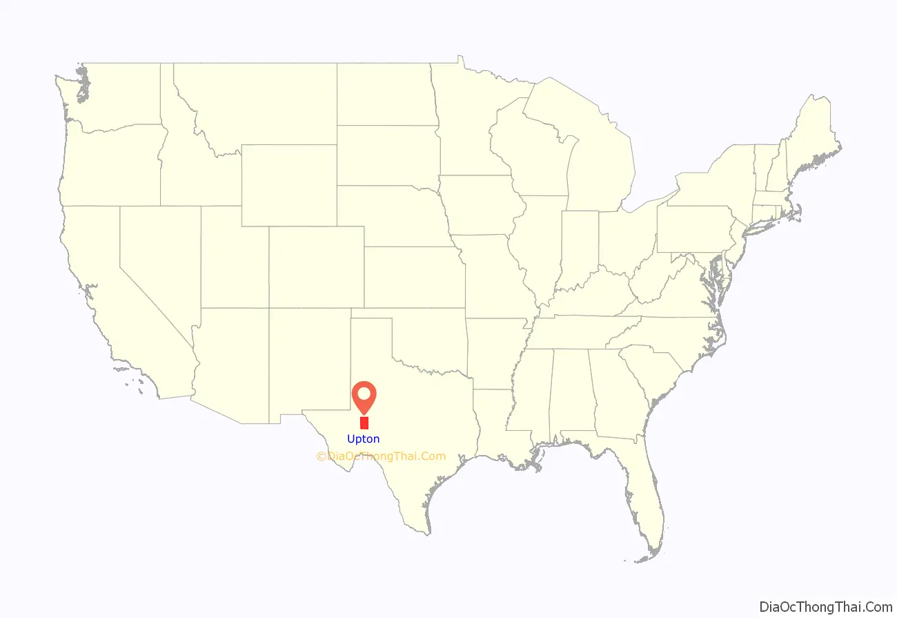
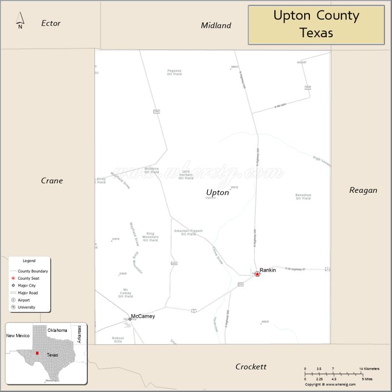
Upton County is a county located on the Edwards Plateau in the U.S. state of Texas. As of the 2020 census, its population was 3,308. Its county seat is Rankin. The county was created in 1887 and later organized in 1910. It is named for two brothers: John C. and William F. Upton, both colonels in the Confederate Army.
| Name: | Upton County |
|---|---|
| FIPS code: | 48-461 |
| State: | Texas |
| Founded: | 1910 |
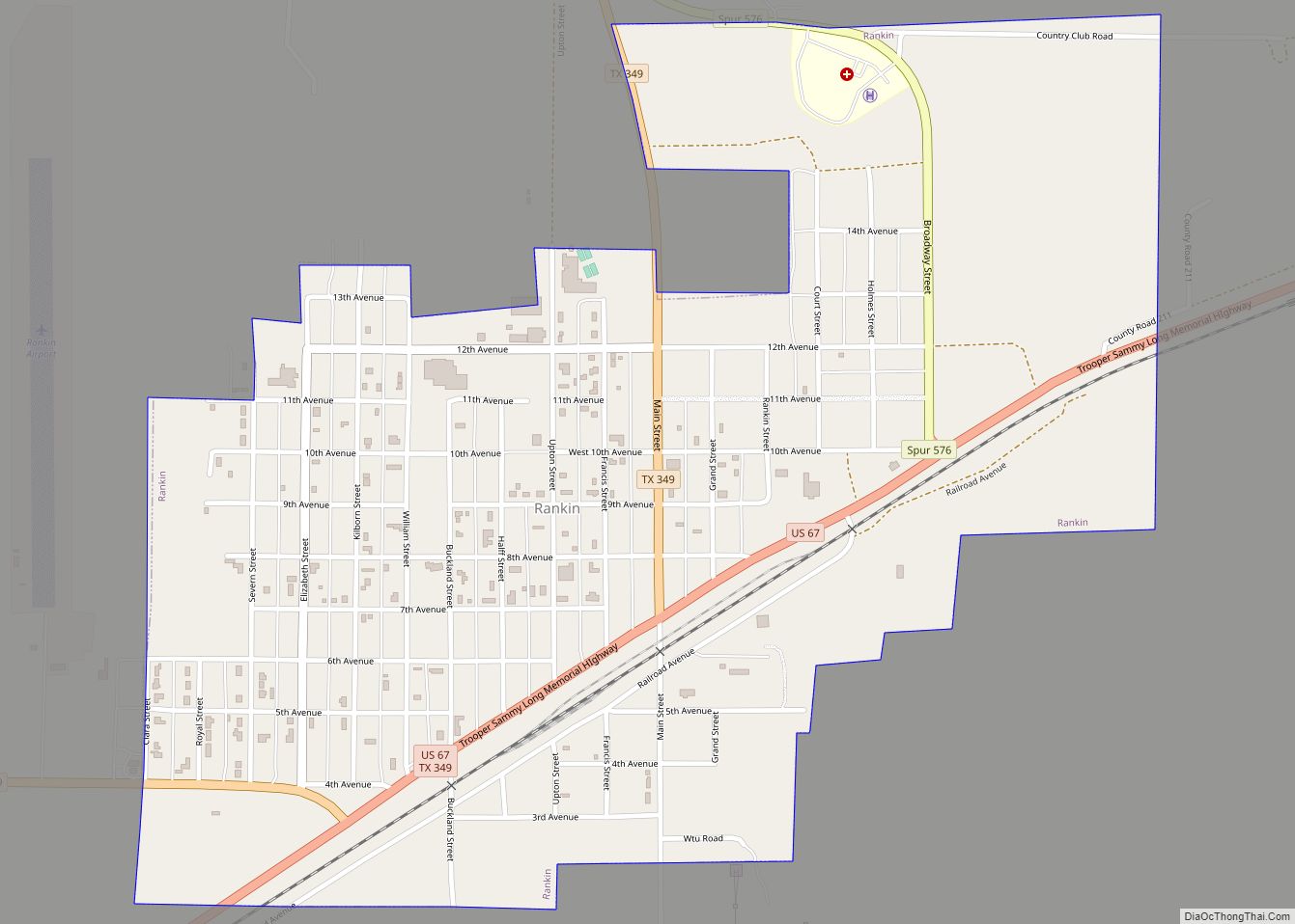
| Seat: | Rankin |
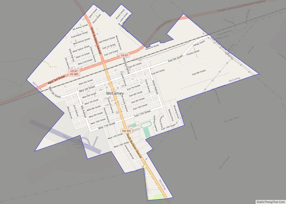
| Largest city: | McCamey |
| Total Area: | 1,242 sq mi (3,220 km²) |
| Land Area: | 1,241 sq mi (3,210 km²) |
| Total Population: | 3,308 |
| Population Density: | 2.7/sq mi (1.0/km²) |
| Time zone: | UTC−6 (Central) |
| Summer Time Zone (DST): | UTC−5 (CDT) |
| Website: | www.co.upton.tx.us |
Upton County location map. Where is Upton County?
History
Native Americans
Native Americans were the first inhabitants of the area. Tribes present at the time of conquest included the Comanches and Apache.
Trails
One of the first routes bringing people through the area was the Chihuahua Trail connecting Mexico’s state of Chihuahua with Santa Fe, New Mexico. The trail served as a trade route for nomadic tribes of Indians and Spaniards, as well as traders from both Mexico and Texas.
The Butterfield Overland Mail crossed the area from 1858 to 1861.
The Goodnight-Loving Trail served as a cattle-drive trail from 1866 to 1888. The trail began at Young County, Texas, and passed along the Pecos River to Fort Sumner, New Mexico, and into Colorado before ending in Cheyenne, Wyoming.
Establishment of the county
Upton was formed in 1887 from Tom Green County, Texas. The county was named after John C. Upton and his brother William F. Upton. of Tennessee. Cattleman George Elliott became the first to establish a homestead in Upton County in 1880. Beginning as open range, the land was shared with sheepmen by the 1890s. The United States Census counted 52 people living in the county in 1890, and only 48 in 1900; most of these were either members of three families, or were in their employ. The agricultural sector of the county has been outpaced by cattle and sheep ranching. In 1982, about 92% of the land in Upton County was in farms and ranches, but less than 1% of the county was considered prime farmland, and only 2% of the county was cultivated. In the fall of 1911, the Kansas City, Mexico and Orient Railway reached the townsite of Rankin, and by January 1912, most of the people living in Upland had moved to Rankin.
Oil
Wildcatter George McCamey’s Baker No. 1 in September 1925 opened up the McCamey Oil Field, established the town of McCamey and brought the subsequent oil boom to Upton County. The Yates Oil Field in Crockett and Pecos Counties resulted in a financial boon for the town of Rankin, which served as a supply and service center. The resulting financial windfall benefitted infrastructure in Rankin. In 1946, Mike Benedum began wildcatting in Upton County and opened up what would become known as the Benedum Oil Field. The Weir No. 1 gushed in 1961 and enabled Upton County to continue as an outstanding Texas production area.
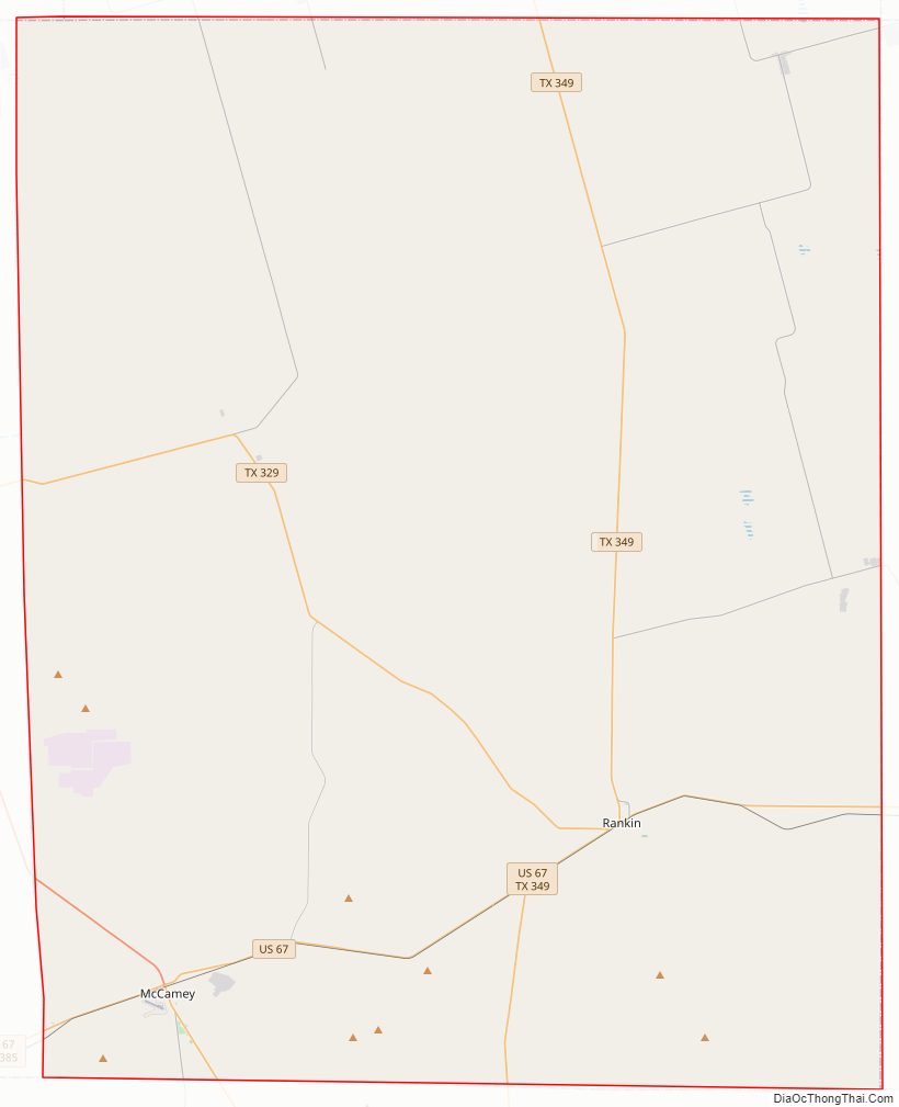
Upton County Road Map
Geography
According to the U.S. Census Bureau, the county has a total area of 1,242 square miles (3,220 km), of which 0.2 square miles (0.52 km) (0.01%) is covered by water. The Spraberry Trend, the third-largest oil field in the United States by remaining reserves, underlies much of the county. Bobcat Hills, a summit with an elevation of 2,697 ft (822 m), is found in Upton County.
Major highways
- U.S. Highway 67
- U.S. Highway 385
- State Highway 329
- State Highway 349
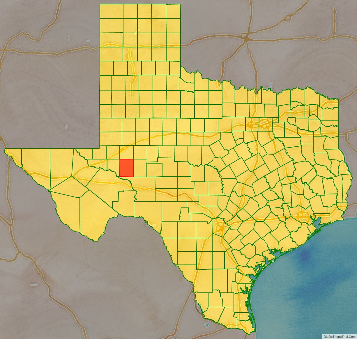
Adjacent counties
- Midland County (north)
- Reagan County (east)
- Crockett County (south)
- Crane County (west)
- Ector County (northwest)
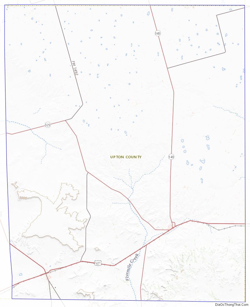
Upton County Topographic Map
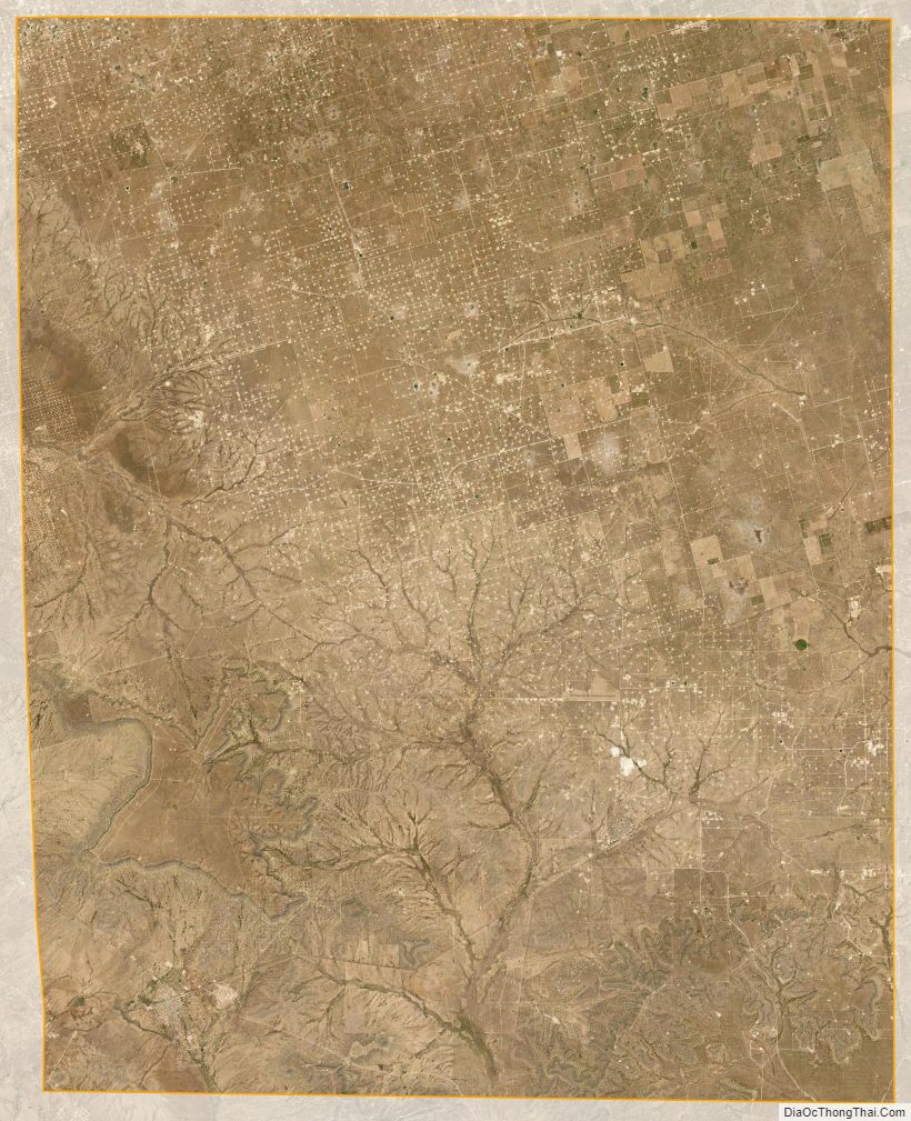
Upton County Satellite Map
Upton County Outline Map