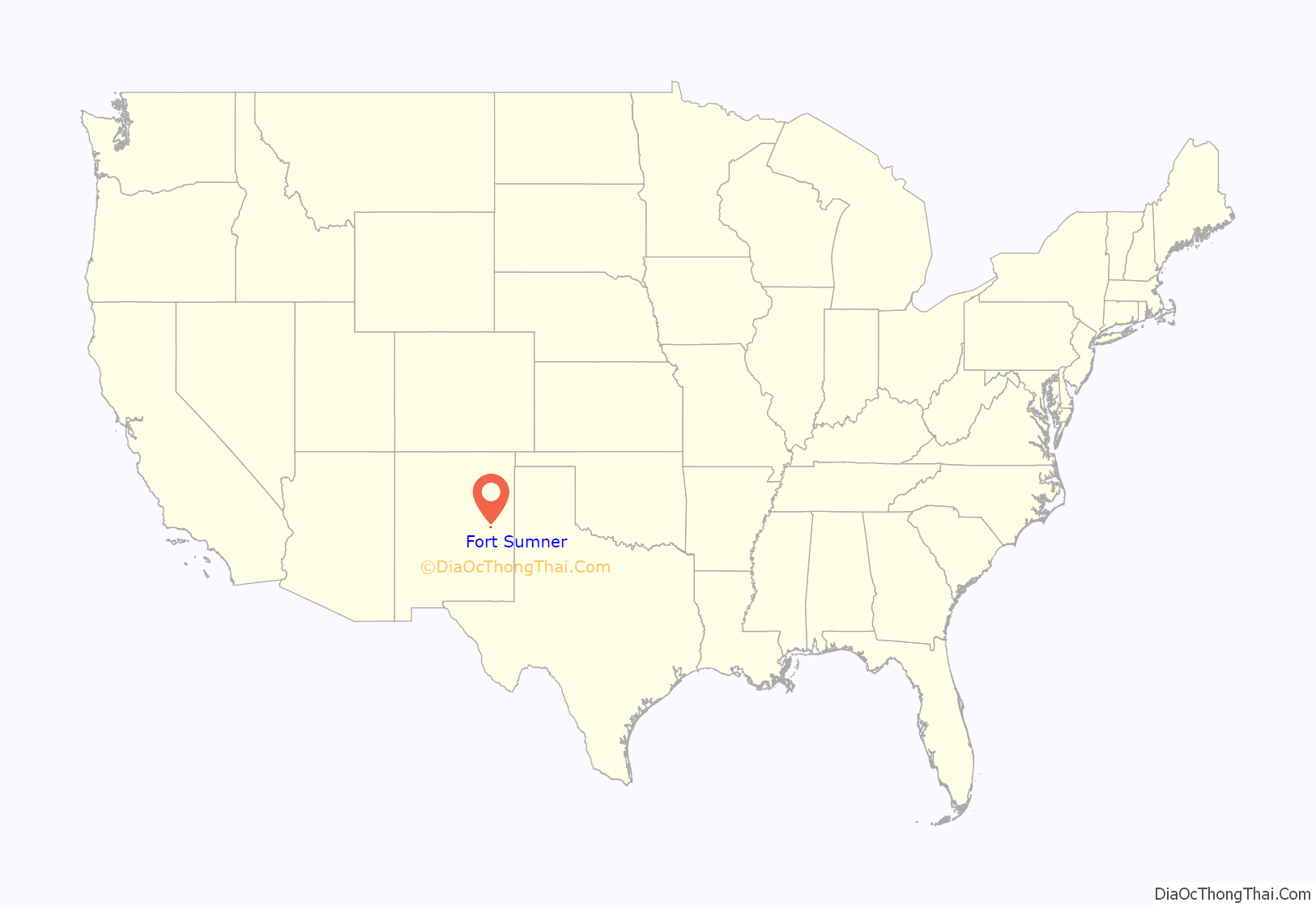
Fort Sumner is a village in and the county seat of De Baca County, New Mexico, United States. The population was 1,031 at the 2010 U.S. Census, down from the figure of 1,249 recorded in 2000. Fort Sumner is the spring and fall home of the Columbia Scientific Balloon Facility, and is home to the burial site of famed outlaw of the American West, Billy the Kid, who was shot and killed there in 1881.
| Name: | Fort Sumner village |
|---|---|
| LSAD Code: | 47 |
| LSAD Description: | village (suffix) |
| State: | New Mexico |
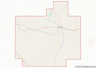
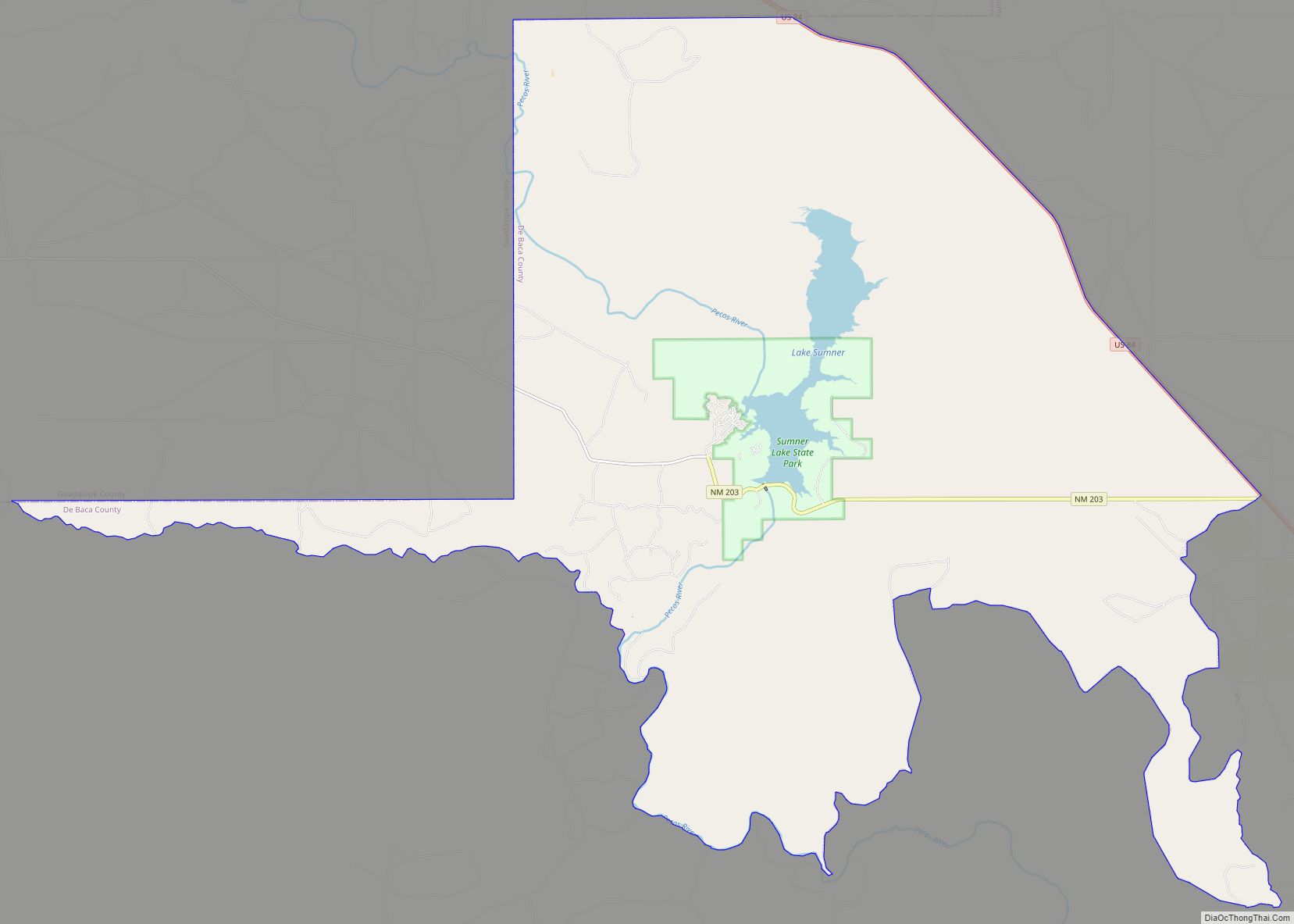
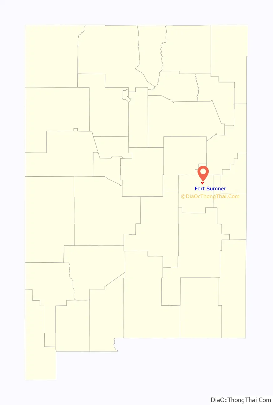
| County: | De Baca County |
| Elevation: | 4,032 ft (1,229 m) |
| Total Area: | 3.35 sq mi (8.66 km²) |
| Land Area: | 3.31 sq mi (8.58 km²) |
| Water Area: | 0.03 sq mi (0.08 km²) |
| Total Population: | 889 |
| Population Density: | 268.17/sq mi (103.56/km²) |
| ZIP code: | 88119 |
| Area code: | 575 |
| FIPS code: | 3527340 |
| GNISfeature ID: | 0923600 |
Online Interactive Map
Click on ![]() to view map in "full screen" mode.
to view map in "full screen" mode.
Fort Sumner location map. Where is Fort Sumner village?
History
Named after former New Mexico Territory military governor Edwin Vose Sumner, U.S. Fort Sumner was a military fort charged with the internment of nearby Navajo and Mescalero Apache populations from 1863 to 1868. The federal government closed the fort in 1868 and sold its buildings to Lucien Maxwell, a prominent New Mexico landowner, in 1870. In the latter 1870s Maxwell’s son Pete befriended legendary outlaw Billy the Kid, and it was in his house that Billy was killed by Pat Garrett. Billy the Kid is buried in the old military cemetery in Fort Sumner, as is Lucien Maxwell.
In 1866, the U.S. government was holding thousands of Native American Indians at Fort Sumner after they were subdued by Kit Carson. Charles Goodnight and Oliver Loving saw a business opportunity and decided to sell beef to the United States Government so that the captive, displaced, and imprisoned Native Americans could be fed. This enterprise led to the establishment of the Goodnight-Loving Trail, located far enough west to avoid any contact with mobs wanting the superior Longhorn cattle.
In the 1920s the Transcontinental Air Transport airline built an airfield in Fort Sumner as part of its coast-to-coast air passenger network, but the site was abandoned when the airline’s ambitious plans collapsed in the Great Depression. The airfield was reopened by the United States Army Air Forces as a training base during World War II. After the war, the base became the Fort Sumner Municipal Airport, and was chosen as a launch site for NASA’s high-altitude balloon program (see Columbia Scientific Balloon Facility).
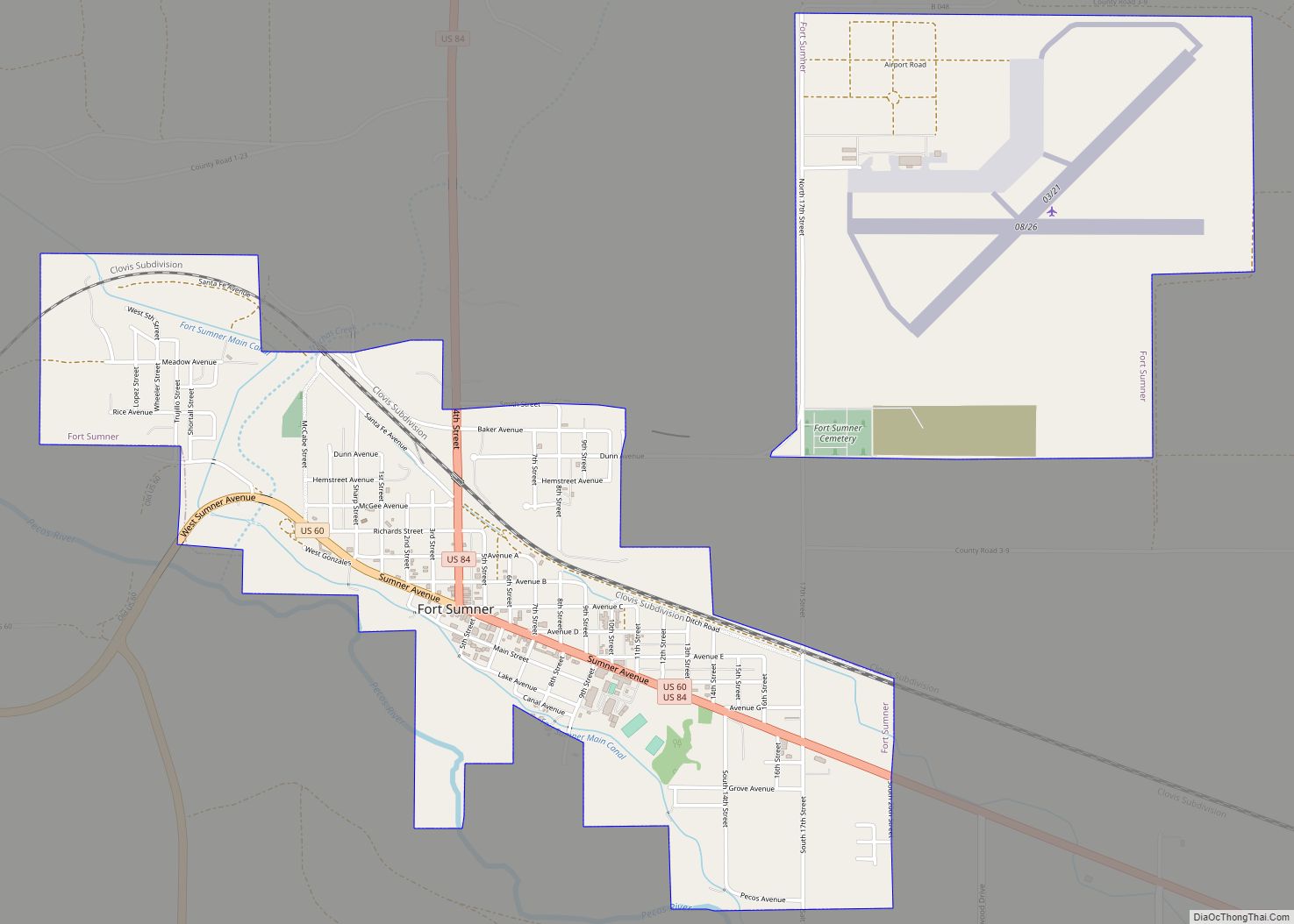
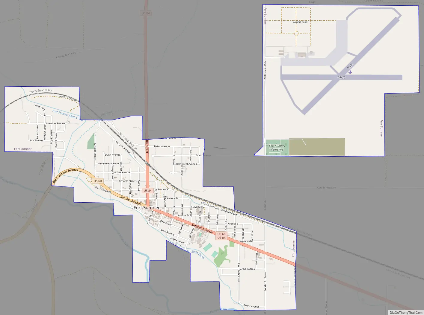
Fort Sumner Road Map
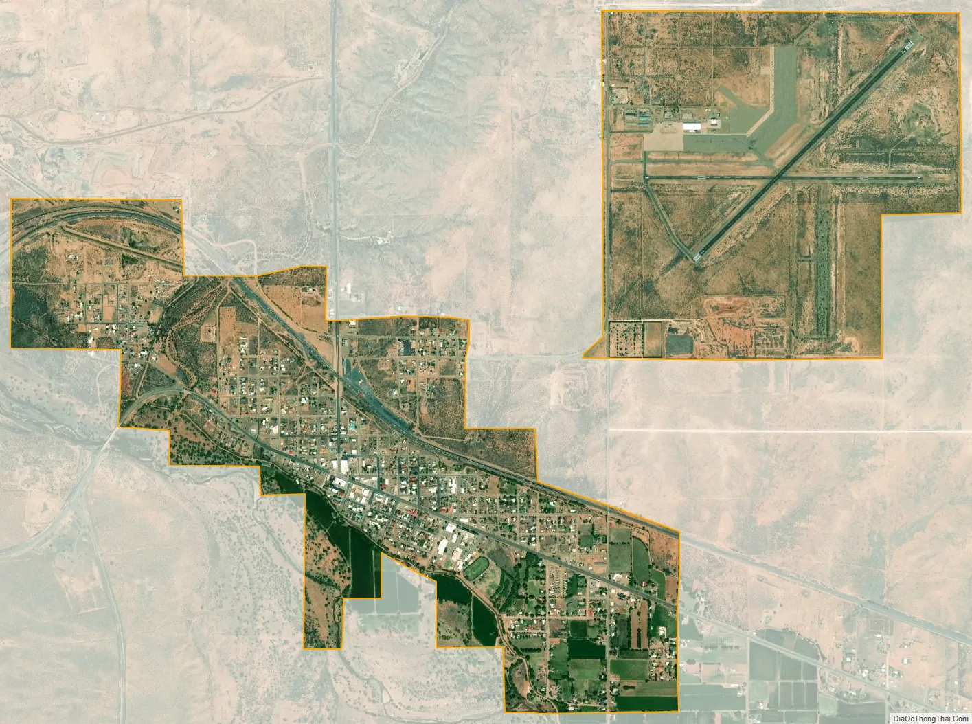
Fort Sumner city Satellite Map
Geography
Fort Sumner is located northeast of the center of De Baca County at 34°28′18″N 104°14′43″W / 34.47167°N 104.24528°W / 34.47167; -104.24528, on the north side of the Pecos River.
U.S. Route 60 passes through the village as Sumner Avenue, leading east 61 miles (98 km) to Clovis and west 58 miles (93 km) to Vaughn. U.S. Route 84 comes in from the north as 4th Street, leading northwest 44 miles (71 km) to Santa Rosa. US 84 runs east from Fort Sumner with US 60 to Clovis and the Texas border beyond it.
According to the United States Census Bureau, the village of Fort Sumner has a total area of 3.34 square miles (8.66 km), of which 3.31 square miles (8.58 km) is land and 0.03 square miles (0.08 km), or 0.93%, is water.
See also
Map of New Mexico State and its subdivision: Map of other states:- Alabama
- Alaska
- Arizona
- Arkansas
- California
- Colorado
- Connecticut
- Delaware
- District of Columbia
- Florida
- Georgia
- Hawaii
- Idaho
- Illinois
- Indiana
- Iowa
- Kansas
- Kentucky
- Louisiana
- Maine
- Maryland
- Massachusetts
- Michigan
- Minnesota
- Mississippi
- Missouri
- Montana
- Nebraska
- Nevada
- New Hampshire
- New Jersey
- New Mexico
- New York
- North Carolina
- North Dakota
- Ohio
- Oklahoma
- Oregon
- Pennsylvania
- Rhode Island
- South Carolina
- South Dakota
- Tennessee
- Texas
- Utah
- Vermont
- Virginia
- Washington
- West Virginia
- Wisconsin
- Wyoming