Akron is a town in Henry Township, Fulton County, Indiana, United States. The population was 1,167 at the 2010 census.
| Name: | Akron town |
|---|---|
| LSAD Code: | 43 |
| LSAD Description: | town (suffix) |
| State: | Indiana |
| County: | Fulton County |
| Elevation: | 850 ft (259 m) |
| Total Area: | 0.46 sq mi (1.19 km²) |
| Land Area: | 0.46 sq mi (1.19 km²) |
| Water Area: | 0.00 sq mi (0.00 km²) |
| Total Population: | 1,125 |
| Population Density: | 2,450.98/sq mi (946.69/km²) |
| ZIP code: | 46910 |
| Area code: | 574 |
| FIPS code: | 1800748 |
| Website: | www.akronindiana.com |
Online Interactive Map
Click on ![]() to view map in "full screen" mode.
to view map in "full screen" mode.
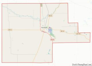
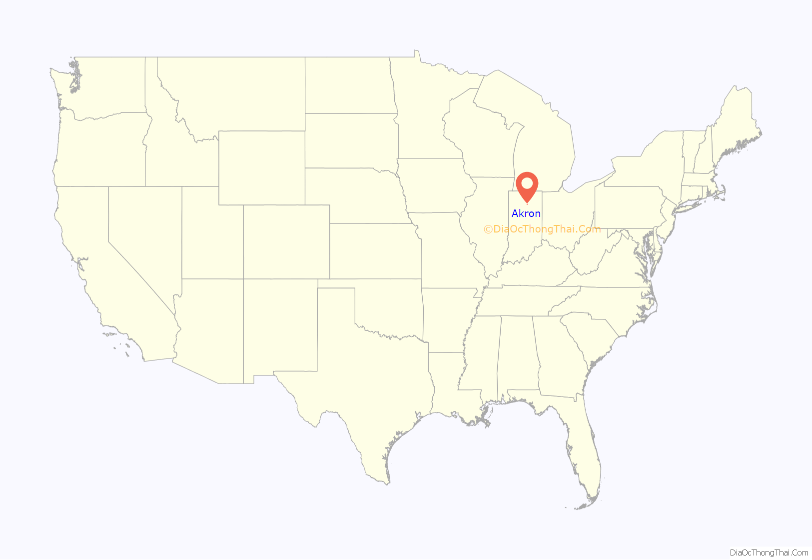
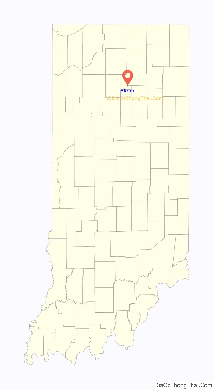
Akron location map. Where is Akron town?
History
Akron was originally named Newark by settlers from Newark, Ohio; the name was changed to Akron in 1855, for the Ohio city. It was founded by Dr. Joseph Sippy on July 4, 1836 when he brought a group of settlers to what was then the crossing of the Pottawatomie and Miami Indian trails. The first building was constructed where the Methodist church stands now. Dr. Sippy’s house, which once stood across the street from Viking Foods, was a stop on the Underground Railroad.
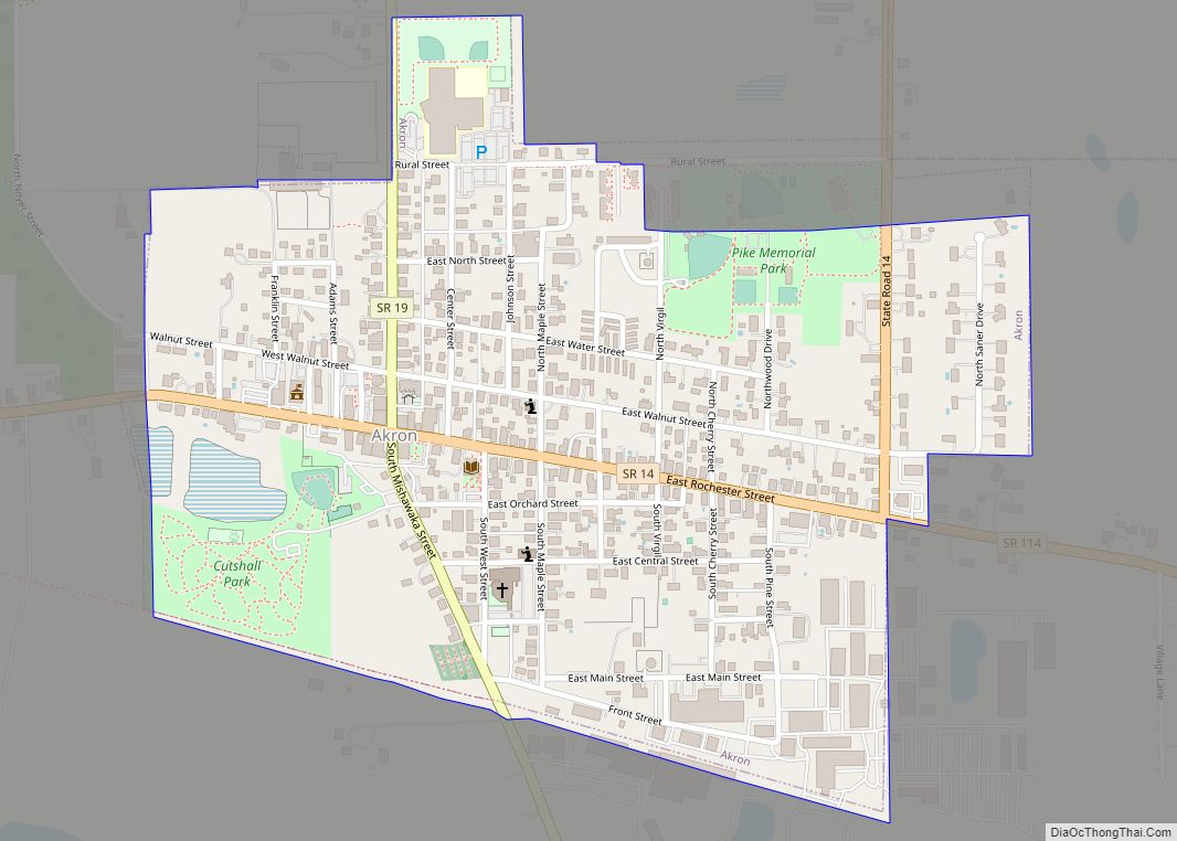
Akron Road Map
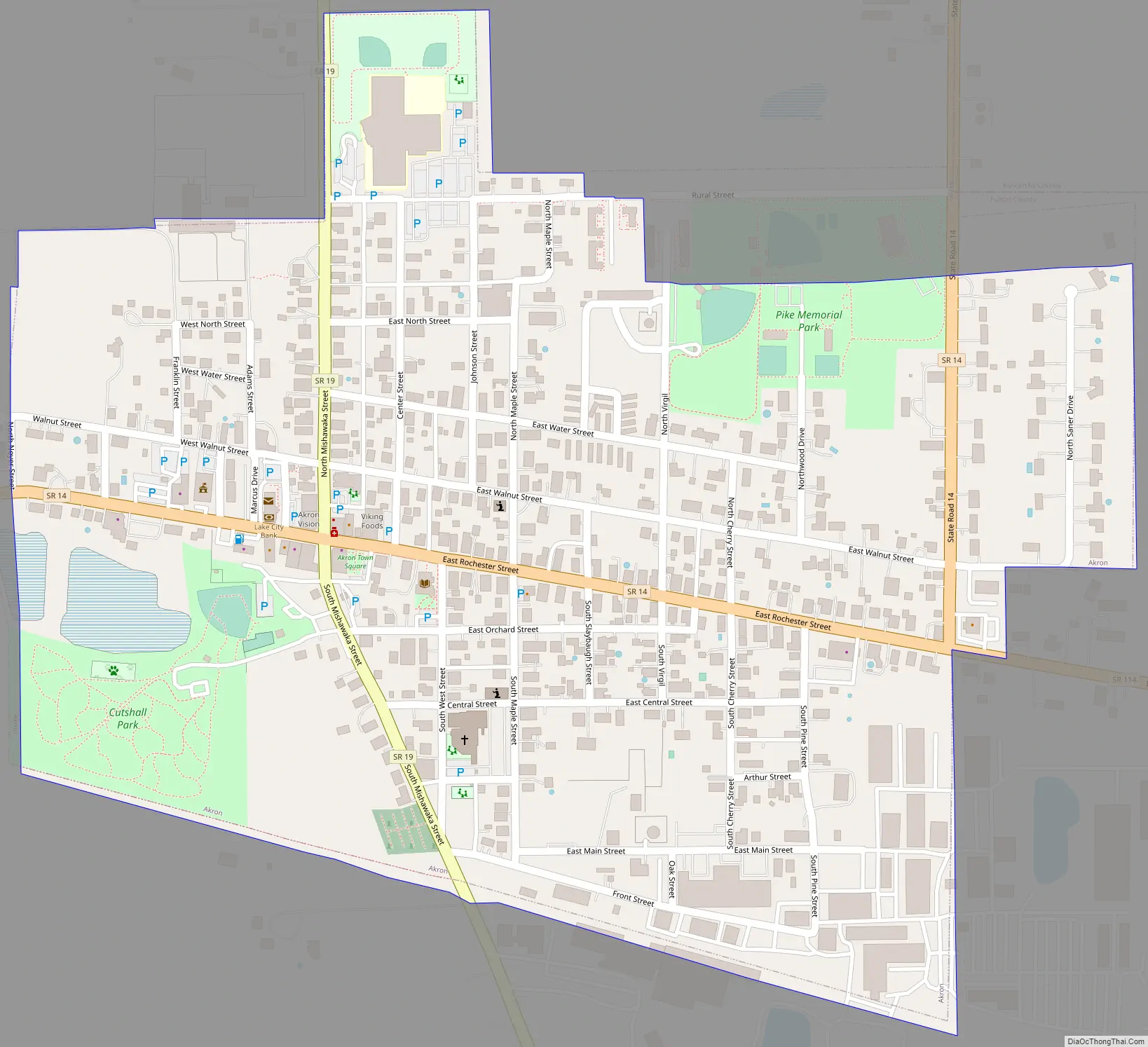
Akron city Satellite Map

Geography
Akron is located at 41°2′20″N 86°1′29″W / 41.03889°N 86.02472°W / 41.03889; -86.02472 (41.038850, -86.024784). Akron is at the crossroad of SR 14 and SR 19.
According to the 2010 census, Akron has a total area of 0.46 square miles (1.19 km), all land.
See also
Map of Indiana State and its subdivision:- Adams
- Allen
- Bartholomew
- Benton
- Blackford
- Boone
- Brown
- Carroll
- Cass
- Clark
- Clay
- Clinton
- Crawford
- Daviess
- De Kalb
- Dearborn
- Decatur
- Delaware
- Dubois
- Elkhart
- Fayette
- Floyd
- Fountain
- Franklin
- Fulton
- Gibson
- Grant
- Greene
- Hamilton
- Hancock
- Harrison
- Hendricks
- Henry
- Howard
- Huntington
- Jackson
- Jasper
- Jay
- Jefferson
- Jennings
- Johnson
- Knox
- Kosciusko
- LaGrange
- Lake
- Lake Michigan
- LaPorte
- Lawrence
- Madison
- Marion
- Marshall
- Martin
- Miami
- Monroe
- Montgomery
- Morgan
- Newton
- Noble
- Ohio
- Orange
- Owen
- Parke
- Perry
- Pike
- Porter
- Posey
- Pulaski
- Putnam
- Randolph
- Ripley
- Rush
- Saint Joseph
- Scott
- Shelby
- Spencer
- Starke
- Steuben
- Sullivan
- Switzerland
- Tippecanoe
- Tipton
- Union
- Vanderburgh
- Vermillion
- Vigo
- Wabash
- Warren
- Warrick
- Washington
- Wayne
- Wells
- White
- Whitley
- Alabama
- Alaska
- Arizona
- Arkansas
- California
- Colorado
- Connecticut
- Delaware
- District of Columbia
- Florida
- Georgia
- Hawaii
- Idaho
- Illinois
- Indiana
- Iowa
- Kansas
- Kentucky
- Louisiana
- Maine
- Maryland
- Massachusetts
- Michigan
- Minnesota
- Mississippi
- Missouri
- Montana
- Nebraska
- Nevada
- New Hampshire
- New Jersey
- New Mexico
- New York
- North Carolina
- North Dakota
- Ohio
- Oklahoma
- Oregon
- Pennsylvania
- Rhode Island
- South Carolina
- South Dakota
- Tennessee
- Texas
- Utah
- Vermont
- Virginia
- Washington
- West Virginia
- Wisconsin
- Wyoming