Map of Ferdinand town, Indiana
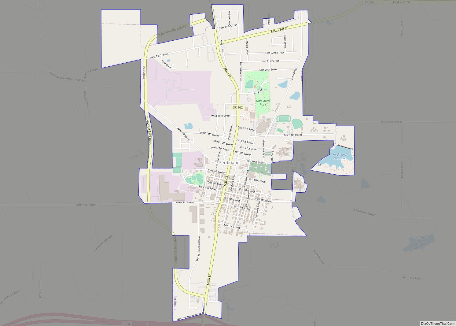
Ferdinand is a town in Ferdinand Township, Dubois County, in the U.S. state of Indiana. The population was 2,157 at the 2010 census. Ferdinand is part of the Jasper Micropolitan Statistical Area. Ferdinand town overview: Name: Ferdinand town LSAD Code: 43 LSAD Description: town (suffix) State: Indiana County: Dubois County Elevation: 535 ft (163 m) Total Area: ... Read more
Map of Ferdinand town, Indiana
Map of Farmland town
Farmland is a town in Monroe Township, Randolph County, in the U.S. state of Indiana. The population was 1,333 at the 2010 census. Farmland town overview: Name: Farmland town LSAD Code: 43 LSAD Description: town (suffix) State: Indiana County: Randolph County Elevation: 1,040 ft (317 m) Total Area: 0.53 sq mi (1.38 km²) Land Area: 0.53 sq mi (1.38 km²) Water Area: 0.00 sq mi ... Read more
Map of Farmland town
Map of Flora town, Indiana
Flora is a town in Monroe Township, Carroll County, Indiana, United States. The population was 2,036 at the 2010 census. It is part of the Lafayette, Indiana Metropolitan Statistical Area. Flora town overview: Name: Flora town LSAD Code: 43 LSAD Description: town (suffix) State: Indiana County: Carroll County Elevation: 702 ft (214 m) Total Area: 1.15 sq mi (2.97 km²) ... Read more
Map of Flora town, Indiana
Map of Fishers city
Fishers is a city in Fall Creek and Delaware townships, Hamilton County, Indiana, United States. As of the 2010 census the population was 76,794, and by 2019 the estimated population was 95,310. A suburb of Indianapolis, Fishers has grown rapidly in recent decades: about 350 people lived there in 1963, 2,000 in 1980, and only ... Read more
Map of Fishers city
Map of Fish Lake CDP, Indiana
Fish Lake is an unincorporated community and census-designated place in Lincoln Township, LaPorte County, Indiana, United States. It is located where Indiana State Road 4 passes between Upper Fish Lake and Lower Fish Lake. These lakes feed the Kankakee River. As of the 2010 census, the population of the community was 1,016. Fish Lake CDP ... Read more
Map of Fish Lake CDP, Indiana
Map of Fort Branch town
Fort Branch is the 3rd largest town and 3rd largest community in Gibson County, Indiana after Princeton and after Oakland City. The population was 2,771 at the 2010 census. It is part of the Evansville, Indiana, Metropolitan Area. Fort Branch town overview: Name: Fort Branch town LSAD Code: 43 LSAD Description: town (suffix) State: Indiana ... Read more
Map of Fort Branch town
Map of Fontanet CDP
Fontanet (also Fountain, Fountain Station, or Hunter) is an unincorporated census-designated place in central Nevins Township, Vigo County, in the U.S. state of Indiana. It lies along Baldwin St., northeast of the city of Terre Haute, the county seat of Vigo County. Its elevation is 614 feet (187 m), and it is located at 39°34′34″N 87°14′37″W / ... Read more
Map of Fontanet CDP
Map of Florence CDP, Indiana
Florence is an unincorporated census-designated place in York Township, Switzerland County, in the U.S. state of Indiana. The Belterra Casino Resort & Spa is located just outside town. Florence CDP overview: Name: Florence CDP LSAD Code: 57 LSAD Description: CDP (suffix) State: Indiana County: Switzerland County Elevation: 476 ft (145 m) Total Area: 0.15 sq mi (0.39 km²) Land Area: ... Read more
Map of Florence CDP, Indiana
Map of Fowler town, Indiana
Fowler is a town in Center Township, Benton County, Indiana, United States. The population was 2,337 at the 2020 census. It is part of the Lafayette, Indiana Metropolitan Statistical Area. Fowler town overview: Name: Fowler town LSAD Code: 43 LSAD Description: town (suffix) State: Indiana County: Benton County Elevation: 820 ft (250 m) Total Area: 1.42 sq mi (3.67 km²) ... Read more
Map of Fowler town, Indiana
Map of Fountain City town, Indiana
Fountain City, formerly Newport, is a town in New Garden Township, Wayne County, in the U.S. state of Indiana. The population was 796 at the 2010 census. Fountain City town overview: Name: Fountain City town LSAD Code: 43 LSAD Description: town (suffix) State: Indiana County: Wayne County Elevation: 1,106 ft (337 m) Total Area: 0.26 sq mi (0.68 km²) Land ... Read more
Map of Fountain City town, Indiana
Map of Fortville town
Fortville is a town in Vernon Township, Hancock County, Indiana, United States. The population was 4,784 at the 2020 census. Fortville town overview: Name: Fortville town LSAD Code: 43 LSAD Description: town (suffix) State: Indiana County: Hamilton County, Hancock County Elevation: 856 ft (261 m) Total Area: 3.46 sq mi (8.96 km²) Land Area: 3.45 sq mi (8.94 km²) Water Area: 0.01 sq mi (0.02 km²) ... Read more
Map of Fortville town
Map of Francisco town
Francisco is the fifth largest town and seventh largest community in Gibson County, Indiana, United States. A town in Center Township, the population was 469 at the 2010 census and was founded in 1851. Local tradition says the town was named for its first settler, a Spanish laborer working on the Wabash and Erie Canal ... Read more
Map of Francisco town