Fortville is a town in Vernon Township, Hancock County, Indiana, United States. The population was 4,784 at the 2020 census.
| Name: | Fortville town |
|---|---|
| LSAD Code: | 43 |
| LSAD Description: | town (suffix) |
| State: | Indiana |
| County: | Hamilton County, Hancock County |
| Elevation: | 856 ft (261 m) |
| Total Area: | 3.46 sq mi (8.96 km²) |
| Land Area: | 3.45 sq mi (8.94 km²) |
| Water Area: | 0.01 sq mi (0.02 km²) |
| Total Population: | 4,784 |
| Population Density: | 1,386.67/sq mi (535.39/km²) |
| ZIP code: | 46040 |
| Area code: | 317 |
| FIPS code: | 1824286 |
| GNISfeature ID: | 0434692 |
| Website: | fortvilleindiana.org |
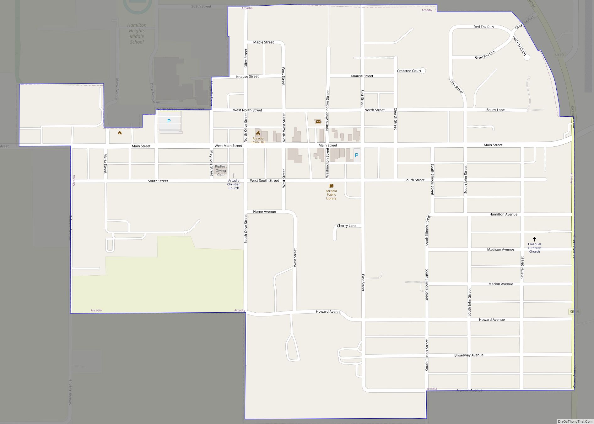
Online Interactive Map
Click on ![]() to view map in "full screen" mode.
to view map in "full screen" mode.
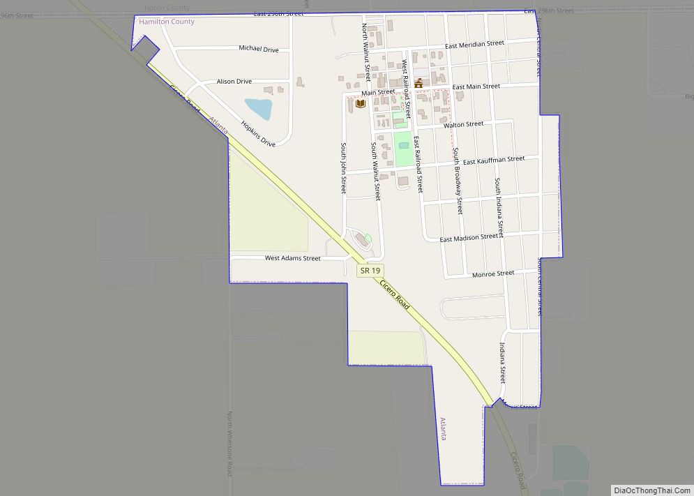
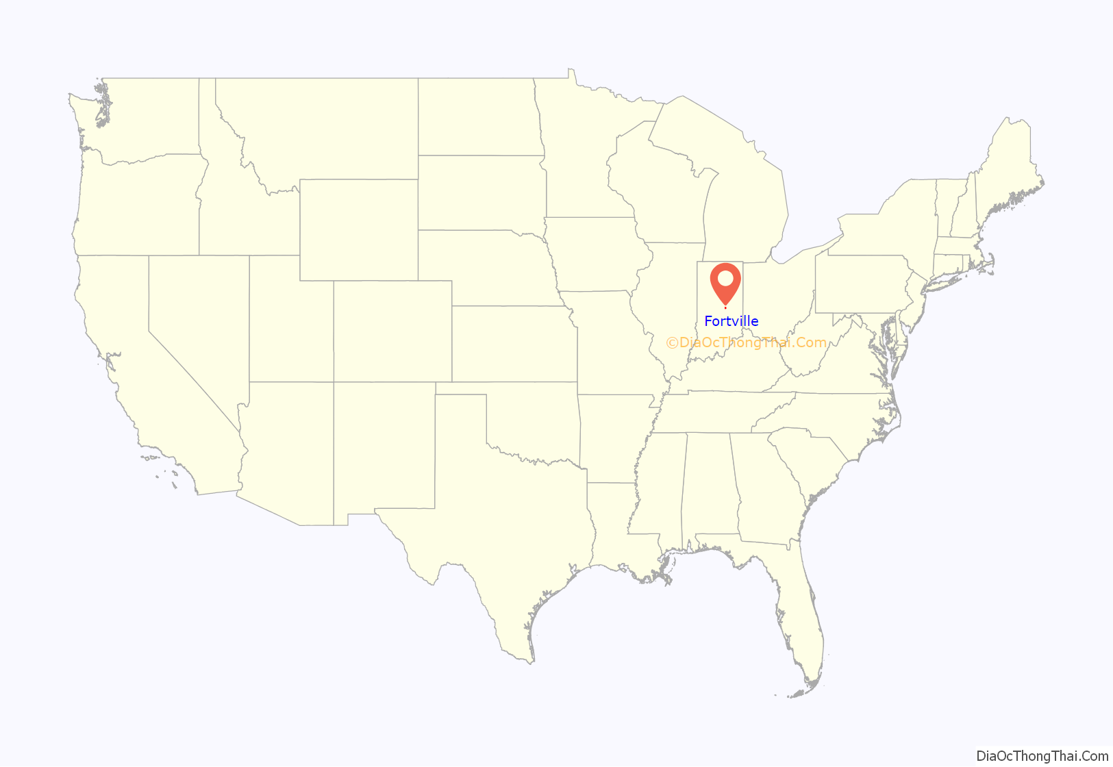
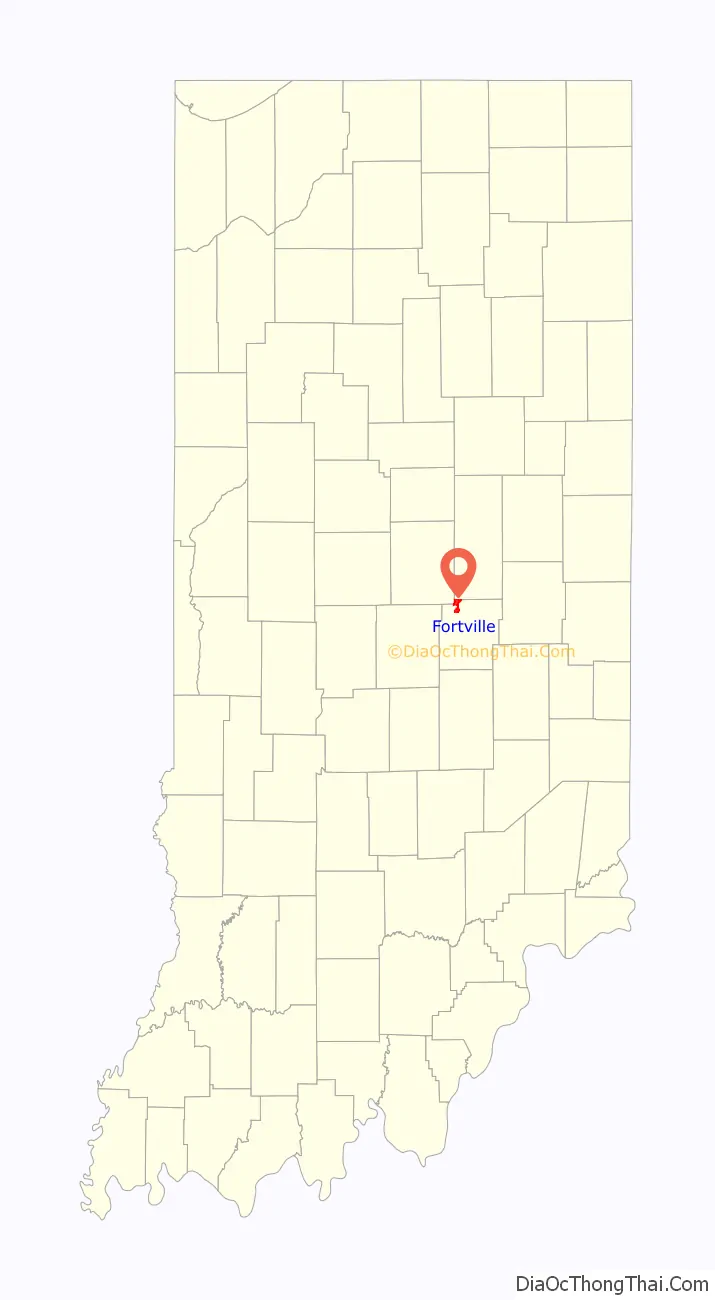
Fortville location map. Where is Fortville town?
History
Fortville was originally called Walpole, and under the latter name was laid out and platted in 1849. It was named for Cephas Fort, the original owner of the town site. Fortville was incorporated as a town in 1865.
The historic Browne-Rafert House on Merrill Street was listed on the National Register of Historic Places in 2015.
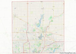
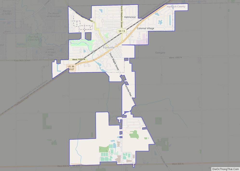
Fortville Road Map

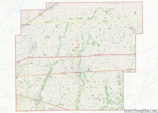
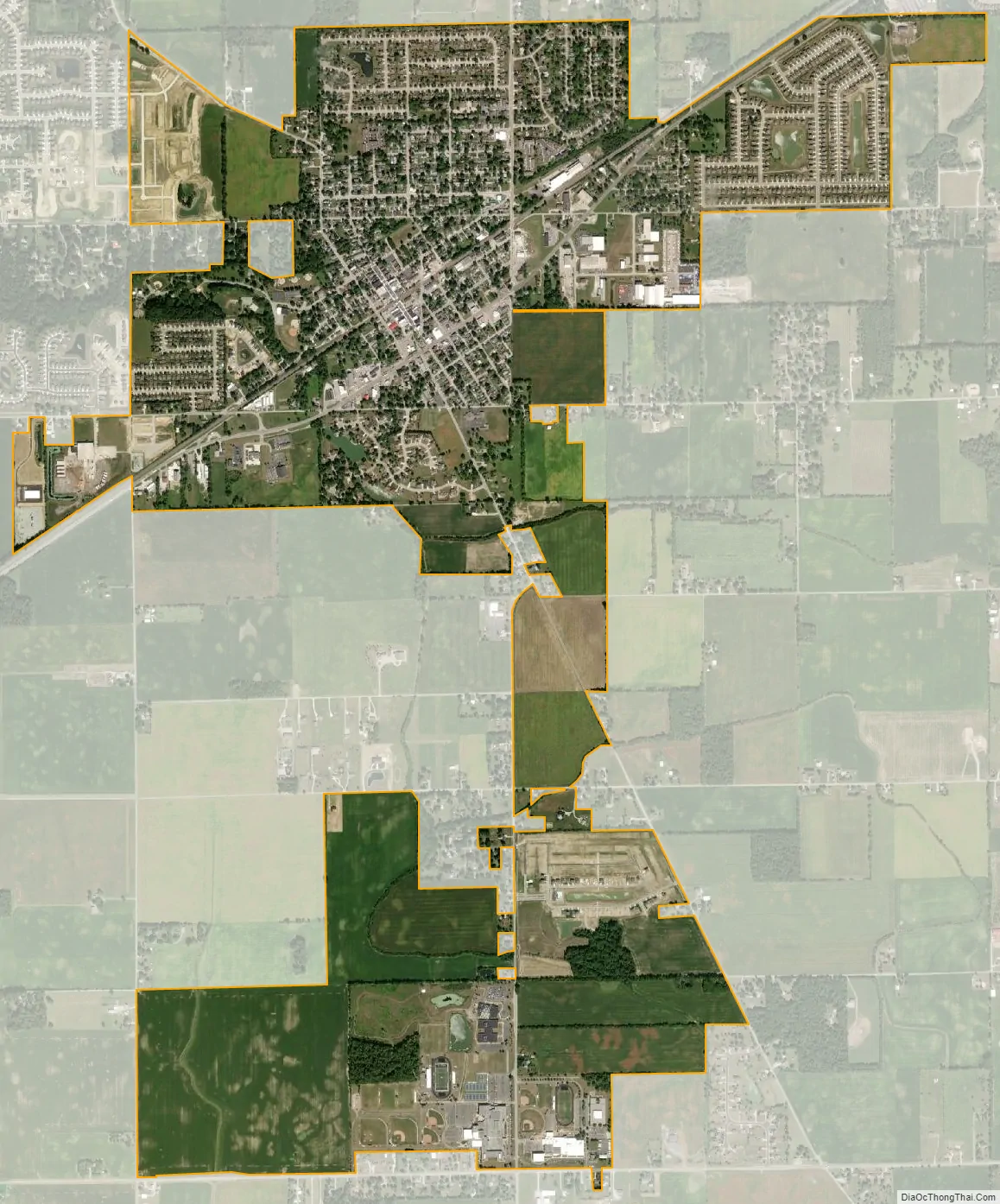
Fortville city Satellite Map
Geography
Fortville is located in the northwest corner of Hancock County, Indiana at 39°56′5″N 85°50′50″W / 39.93472°N 85.84722°W / 39.93472; -85.84722 (39.934740, -85.847237), immediately adjacent to neighboring Hamilton County, which forms the town’s northwest boundary and Madison County, which borders to the north. It is approximately 25 miles (40.23 km) northeast of Downtown Indianapolis, Indiana and is a part of the Indianapolis metropolitan area.
According to the 2010 census, Fortville has a total area of 2.91 square miles (7.54 km), of which 2.90 square miles (7.51 km) (or 99.67%) is land and 0.01 square miles (0.03 km) (or 0.33%) is water.
Despite occasional droughts throughout central Indiana, Fortville has a steady and reliable supply of water because it is situated over a natural aquifer.
See also
Map of Indiana State and its subdivision:- Adams
- Allen
- Bartholomew
- Benton
- Blackford
- Boone
- Brown
- Carroll
- Cass
- Clark
- Clay
- Clinton
- Crawford
- Daviess
- De Kalb
- Dearborn
- Decatur
- Delaware
- Dubois
- Elkhart
- Fayette
- Floyd
- Fountain
- Franklin
- Fulton
- Gibson
- Grant
- Greene
- Hamilton
- Hancock
- Harrison
- Hendricks
- Henry
- Howard
- Huntington
- Jackson
- Jasper
- Jay
- Jefferson
- Jennings
- Johnson
- Knox
- Kosciusko
- LaGrange
- Lake
- Lake Michigan
- LaPorte
- Lawrence
- Madison
- Marion
- Marshall
- Martin
- Miami
- Monroe
- Montgomery
- Morgan
- Newton
- Noble
- Ohio
- Orange
- Owen
- Parke
- Perry
- Pike
- Porter
- Posey
- Pulaski
- Putnam
- Randolph
- Ripley
- Rush
- Saint Joseph
- Scott
- Shelby
- Spencer
- Starke
- Steuben
- Sullivan
- Switzerland
- Tippecanoe
- Tipton
- Union
- Vanderburgh
- Vermillion
- Vigo
- Wabash
- Warren
- Warrick
- Washington
- Wayne
- Wells
- White
- Whitley
- Alabama
- Alaska
- Arizona
- Arkansas
- California
- Colorado
- Connecticut
- Delaware
- District of Columbia
- Florida
- Georgia
- Hawaii
- Idaho
- Illinois
- Indiana
- Iowa
- Kansas
- Kentucky
- Louisiana
- Maine
- Maryland
- Massachusetts
- Michigan
- Minnesota
- Mississippi
- Missouri
- Montana
- Nebraska
- Nevada
- New Hampshire
- New Jersey
- New Mexico
- New York
- North Carolina
- North Dakota
- Ohio
- Oklahoma
- Oregon
- Pennsylvania
- Rhode Island
- South Carolina
- South Dakota
- Tennessee
- Texas
- Utah
- Vermont
- Virginia
- Washington
- West Virginia
- Wisconsin
- Wyoming