Fountain City, formerly Newport, is a town in New Garden Township, Wayne County, in the U.S. state of Indiana. The population was 796 at the 2010 census.
| Name: | Fountain City town |
|---|---|
| LSAD Code: | 43 |
| LSAD Description: | town (suffix) |
| State: | Indiana |
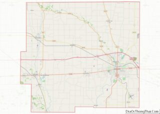
| County: | Wayne County |
| Elevation: | 1,106 ft (337 m) |
| Total Area: | 0.26 sq mi (0.68 km²) |
| Land Area: | 0.26 sq mi (0.68 km²) |
| Water Area: | 0.00 sq mi (0.00 km²) |
| Total Population: | 714 |
| Population Density: | 2,704.55/sq mi (1,045.00/km²) |
| ZIP code: | 47341 |
| Area code: | 765 |
| FIPS code: | 1825090 |
| GNISfeature ID: | 434712 |
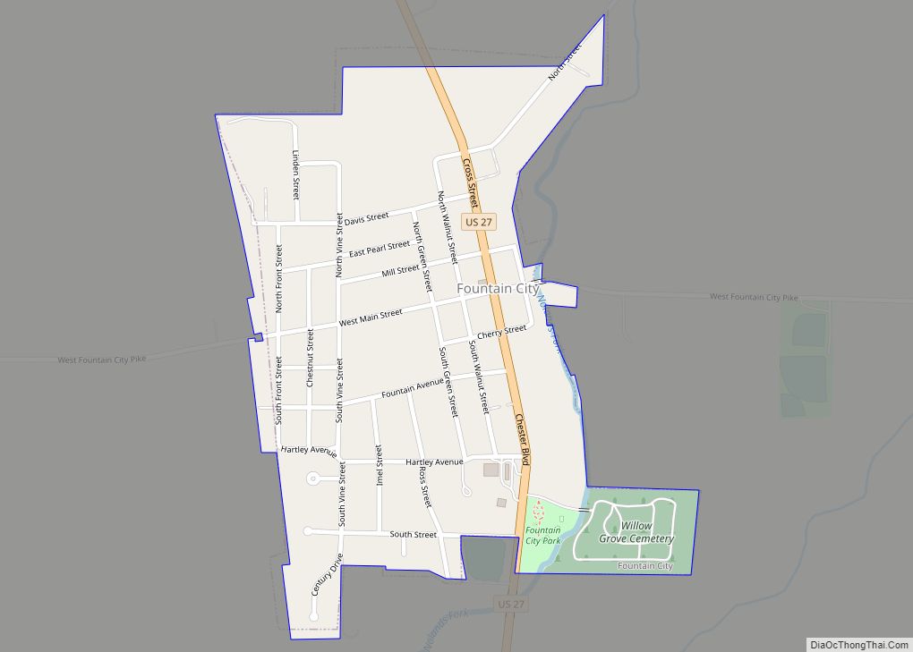
Online Interactive Map
Click on ![]() to view map in "full screen" mode.
to view map in "full screen" mode.
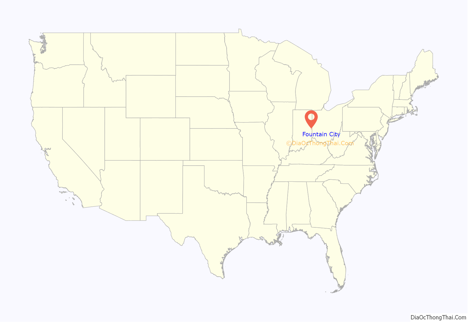
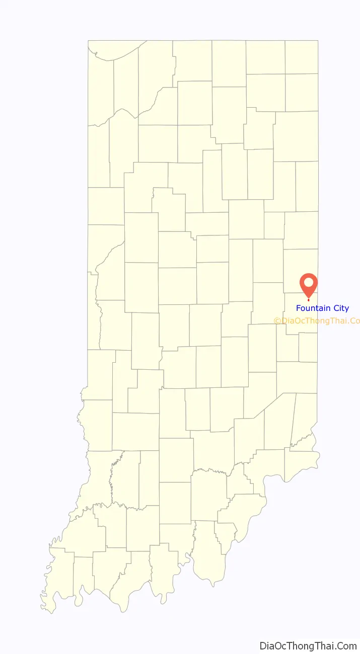
Fountain City location map. Where is Fountain City town?
History
Fountain City was originally called New Garden, and under the latter name was laid out in 1818. New Garden became Newport in 1834, which was renamed Fountain City in 1878, named for its natural springs. It was incorporated as a town in 1844.
The Fountain City post office has been in operation since 1878.
Historic site
The Levi Coffin House, home of Quaker abolitionist Levi Coffin and his wife Catherine, was an important stop on the Underground Railroad. Coffin was sometimes known as the “president” of the Underground Railroad. It is now operated as an Indiana State Historic Site.
Fountain City Road Map
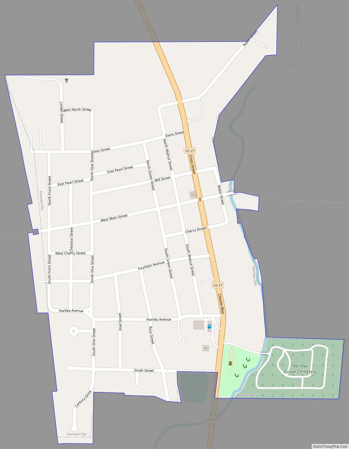
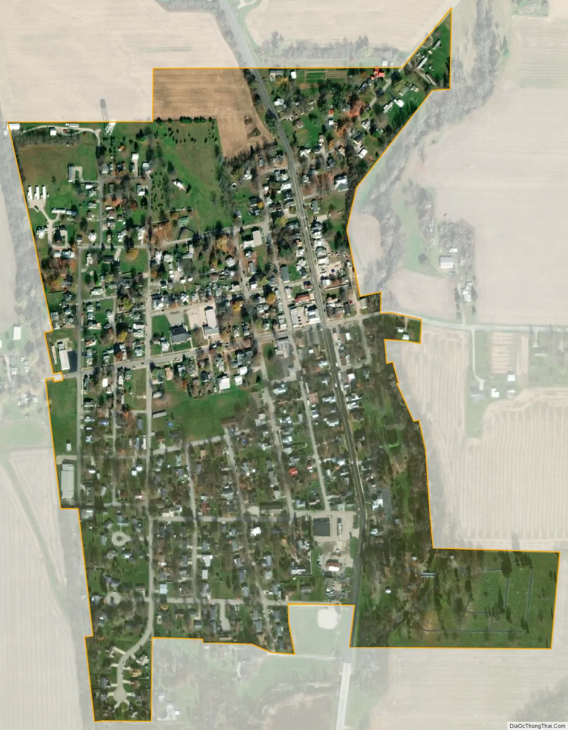
Fountain City city Satellite Map
Geography
Fountain City is located at 39°57′16″N 84°55′12″W / 39.95444°N 84.92000°W / 39.95444; -84.92000 (39.954525, -84.919890).
According to the 2010 census, Fountain City has a total area of 0.26 square miles (0.67 km), all land.
See also
Map of Indiana State and its subdivision:- Adams
- Allen
- Bartholomew
- Benton
- Blackford
- Boone
- Brown
- Carroll
- Cass
- Clark
- Clay
- Clinton
- Crawford
- Daviess
- De Kalb
- Dearborn
- Decatur
- Delaware
- Dubois
- Elkhart
- Fayette
- Floyd
- Fountain
- Franklin
- Fulton
- Gibson
- Grant
- Greene
- Hamilton
- Hancock
- Harrison
- Hendricks
- Henry
- Howard
- Huntington
- Jackson
- Jasper
- Jay
- Jefferson
- Jennings
- Johnson
- Knox
- Kosciusko
- LaGrange
- Lake
- Lake Michigan
- LaPorte
- Lawrence
- Madison
- Marion
- Marshall
- Martin
- Miami
- Monroe
- Montgomery
- Morgan
- Newton
- Noble
- Ohio
- Orange
- Owen
- Parke
- Perry
- Pike
- Porter
- Posey
- Pulaski
- Putnam
- Randolph
- Ripley
- Rush
- Saint Joseph
- Scott
- Shelby
- Spencer
- Starke
- Steuben
- Sullivan
- Switzerland
- Tippecanoe
- Tipton
- Union
- Vanderburgh
- Vermillion
- Vigo
- Wabash
- Warren
- Warrick
- Washington
- Wayne
- Wells
- White
- Whitley
- Alabama
- Alaska
- Arizona
- Arkansas
- California
- Colorado
- Connecticut
- Delaware
- District of Columbia
- Florida
- Georgia
- Hawaii
- Idaho
- Illinois
- Indiana
- Iowa
- Kansas
- Kentucky
- Louisiana
- Maine
- Maryland
- Massachusetts
- Michigan
- Minnesota
- Mississippi
- Missouri
- Montana
- Nebraska
- Nevada
- New Hampshire
- New Jersey
- New Mexico
- New York
- North Carolina
- North Dakota
- Ohio
- Oklahoma
- Oregon
- Pennsylvania
- Rhode Island
- South Carolina
- South Dakota
- Tennessee
- Texas
- Utah
- Vermont
- Virginia
- Washington
- West Virginia
- Wisconsin
- Wyoming