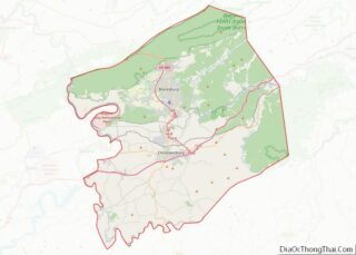
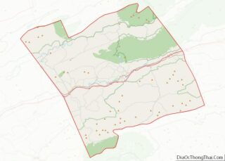
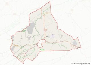
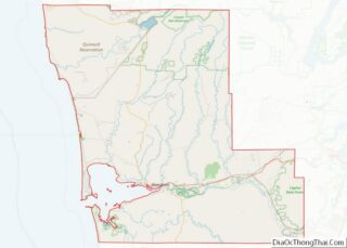
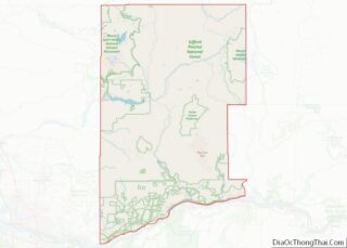
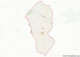
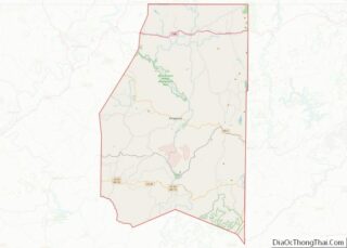
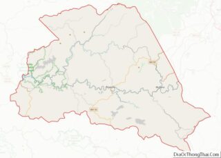
Map of Louisa County, Virginia
Louisa County is a county located in the Commonwealth of Virginia. As of the 2020 census, the population was 37,596. The county seat is Louisa. Louisa County overview: Name: Louisa County FIPS code: 51-109 State: Virginia Founded: 1742 Named for: Louise of Great Britain Seat: Louisa Largest town: Louisa Total Area: 511 sq mi (1,320 km²) Land Area: ... Read more
Map of Louisa County, Virginia
Map of Northumberland County, Virginia
Northumberland County is a county located in the Commonwealth of Virginia. At the 2020 census, the population was 11,839. Its county seat is Heathsville. The county is located on the Northern Neck and is part of the Northern Neck George Washington Birthplace AVA winemaking appellation. Northumberland County overview: Name: Northumberland County FIPS code: 51-133 State: ... Read more
Map of Northumberland County, Virginia
Map of Rappahannock County, Virginia
Rappahannock County is a county located in the northern Piedmont region of the Commonwealth of Virginia, US, adjacent to Shenandoah National Park. As of the 2020 Census, the population was 7,348. Its county seat is Washington. The name “Rappahannock” comes from the Algonquian word lappihanne (also noted as toppehannock), meaning “river of quick, rising water” ... Read more
Map of Rappahannock County, Virginia
Map of Surry County, Virginia
Surry County is a county in the Commonwealth of Virginia. As of the 2020 census, the population was 6,561. In 1652, Surry County was formed from the portion of James City County south of the James River. For more than 350 years it has depended on an agricultural economy. The county has 19 sites listed ... Read more
Map of Surry County, Virginia
Map of Chelan County, Washington
Chelan County (/ʃəˈlæn/, shə-LAN) is a county in the U.S. state of Washington. As of the 2020 census, its population was 79,074. The county seat and largest city is Wenatchee. The county was created out of Okanogan and Kittitas Counties on March 13, 1899. It derives its name from a Chelan Indian word meaning “deep ... Read more
Map of Chelan County, Washington
Map of Klickitat County, Washington
Klickitat County is a county located in the U.S. state of Washington. As of the 2020 census, the population was 22,735. The county seat and largest city is Goldendale. The county is named after the Klickitat tribe. Klickitat County overview: Name: Klickitat County FIPS code: 53-039 State: Washington Founded: December 20, 1859 Named for: Klickitat ... Read more
Map of Klickitat County, Washington
Map of Walla Walla County, Washington
Walla Walla County is a county located in the U.S. state of Washington. As of the 2020 census, its population was 62,584. The county seat and largest city is Walla Walla. The county was formed on April 25, 1854 and is named after the Walla Walla tribe of Native Americans. Walla Walla County is included ... Read more
Map of Walla Walla County, Washington
Map of Greenbrier County, West Virginia
Greenbrier County (/ˈɡriːnbraɪ.ər/) is a county in the U.S. state of West Virginia. As of the 2020 census, the population was 32,977. Its county seat is Lewisburg. The county was formed in 1778 from Botetourt and Montgomery counties in Virginia. Greenbrier County overview: Name: Greenbrier County FIPS code: 54-025 State: West Virginia Founded: October 20, ... Read more
Map of Greenbrier County, West Virginia
Map of Mineral County, West Virginia
Mineral County is a county in the U.S. state of West Virginia. It is part of the Cumberland, MD-WV Metropolitan Statistical Area. As of the 2020 census, the population was 26,938. Its county seat is Keyser. The county was founded in 1866. Mineral County overview: Name: Mineral County FIPS code: 54-057 State: West Virginia Founded: ... Read more
Map of Mineral County, West Virginia
Map of Summers County, West Virginia
Summers County is a county located in the U.S. state of West Virginia. As of the 2020 census, the population was 11,959. Its county seat is Hinton. The county was created by an act of the West Virginia Legislature on February 27, 1871, from parts of Fayette, Greenbrier, Mercer and Monroe counties and named in ... Read more
Map of Summers County, West Virginia
Map of Buffalo County, Wisconsin
Buffalo County is a county located in the U.S. state of Wisconsin. As of the 2020 census, the population was 13,317. Its county seat is Alma. The county was created in 1853 and organized the following year. Buffalo County overview: Name: Buffalo County FIPS code: 55-011 State: Wisconsin Founded: 1854 Named for: Buffalo River Seat: ... Read more
Map of Buffalo County, Wisconsin
Map of Grant County, Wisconsin
Grant County is a county located in the U.S. state of Wisconsin. As of the 2020 census, the population was 51,938. Its county seat is Lancaster. The county is named after the Grant River, in turn named after a fur trader who lived in the area when Wisconsin was a territory. Grant County comprises the ... Read more
Map of Grant County, Wisconsin