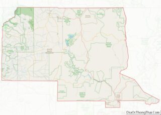
Map of East Baton Rouge Parish

Map of East Baton Rouge Parish, Louisiana

East Baton Rouge Parish (French: Paroisse de Bâton Rouge Est) is the most populous parish in the U.S. state of Louisiana. Its population was 456,781 at the 2020 census. The parish seat is Baton Rouge, Louisiana’s state capital. East Baton Rouge Parish is located within the Greater Baton Rouge area. East Baton Rouge Parish overview: … Read more

Map of Madison Parish

Map of Madison Parish, Louisiana

Madison Parish overview: Name: Madison Parish FIPS code: 22-065 State: Louisiana Founded: 1838 Named for: James Madison Seat: Tallulah Largest city: Tallulah Total Area: 651 sq mi (1,690 km²) Land Area: 624 sq mi (1,620 km²) Total Population: 10,017 Population Density: 15/sq mi (5.9/km²) Time zone: UTC−6 (Central) Summer Time Zone (DST): UTC−5 (CDT) Website: madisonparish.org Madison Parish location map. Where is … Read more

Map of Saint Landry Parish

Map of St. Landry Parish, Louisiana

St. Landry Parish (French: Paroisse de Saint-Landry) is a parish located in the U.S. state of Louisiana. As of the 2020 Census, the population was 82,540. The parish seat is Opelousas. The parish was established in 1807. St. Landry Parish comprises the Opelousas, LA Micropolitan Statistical Area (μSA), which is also included in the Lafayette-Opelousas-Morgan … Read more

Map of Androscoggin County

Map of Androscoggin County, Maine

Androscoggin County (French: Comté d’Androscoggin) is a county in the U.S. state of Maine. As of the 2020 census, the county’s population was 111,139. Its county seat is Auburn and its largest city is Lewiston. Androscoggin County comprises the Lewiston-Auburn, Maine Metropolitan Statistical Area and is partially included in the Lewiston-Auburn, Maine, Metropolitan New England … Read more

Map of Allegany County

Map of Allegany County, Maryland

Allegany County is located in the northwestern part of the U.S. state of Maryland. As of the 2020 census, the population was 68,106. Its county seat is Cumberland. The name Allegany may come from a local Lenape word, welhik hane or oolikhanna, which means ‘best flowing river of the hills’ or ‘beautiful stream’. A number … Read more

Map of Queen Anne's County

Map of Queen Anne’s County, Maryland

Queen Anne’s County is located on the Eastern Shore of the U.S. state of Maryland. As of the 2020 census, the population was 49,874. Its county seat and most populous municipality is Centreville. The census-designated place of Stevensville is the county’s most populous place. The county is named for Queen Anne of Great Britain, who … Read more

Map of Nantucket County

Map of Nantucket County, Massachusetts

Nantucket (/ˌnænˈtʌkɪt/) is an island about 30 miles (50 km) south from Cape Cod. Together with the small islands of Tuckernuck and Muskeget, it constitutes the Town and County of Nantucket, a combined county/town government that is part of the U.S. state of Massachusetts. It is the only such consolidated town-county in Massachusetts. As of the … Read more

Map of Branch County

Map of Branch County, Michigan

Branch County is a county in the U.S. state of Michigan. As of the 2020 Census, the population was 44,862. The county seat is Coldwater. As one of the “cabinet counties” it was named for the U.S. Secretary of the Navy John Branch under President Andrew Jackson. The county was founded in 1829, and was … Read more

Map of Grand Traverse County

Map of Grand Traverse County, Michigan

Grand Traverse County (/ˈtrævərz/ TRAV-ərz) is a county located in the U.S. state of Michigan. As of the 2020 census, the population was 95,238, making it the largest county in Northern Michigan. Its county seat is Traverse City. The county is part of the Traverse City micropolitan area, which also includes neighboring Benzie, Kalkaska, and … Read more

Map of Lake Hurron Water body

Map of Lake Hurron Water body, Michigan

Lake Hurron Water body overview: Name: Lake Hurron Water body State: Michigan Lake Hurron Water body location map. Where is Lake Hurron Water body? Lake Hurron Water body Road Map Lake Hurron Water body Topographic Map Lake Hurron Water body Satellite Map Lake Hurron Water body Outline Map See also

Map of Midland County

Map of Midland County, Michigan

Midland County is a county located in the U.S. state of Michigan. As of the 2020 Census, the population was 83,494. The county seat is Midland. The county’s name is due to its closeness to the geographical Lower Peninsula’s geographical center. It was founded in 1831. However, it was not until 1855 that the county … Read more

Map of Roscommon County

Map of Roscommon County, Michigan

Roscommon County (/rɒsˈkɒmən/ RAHS-comm-ən) is a county located in the U.S. state of Michigan. As of the 2020 Census, the population was 23,459. The county seat is Roscommon. The county was founded in 1840 and organized in 1875. Roscommon County overview: Name: Roscommon County FIPS code: 26-143 State: Michigan Founded: 1840 Named for: County Roscommon, … Read more