Martinsburg is a city in and the county seat of Berkeley County, West Virginia, United States. The population was 18,773 at the 2020 census, making Martinsburg the largest city in the Eastern Panhandle of West Virginia and the seventh-largest city in the state. It is a principal city of the Hagerstown–Martinsburg metropolitan area extending into Maryland, which had 293,844 residents in 2020.
| Name: | Martinsburg city |
|---|---|
| LSAD Code: | 25 |
| LSAD Description: | city (suffix) |
| State: | West Virginia |
| County: | Berkeley County |
| Elevation: | 453 ft (138 m) |
| Land Area: | 6.63 sq mi (17.17 km²) |
| Water Area: | 0.02 sq mi (0.04 km²) |
| Population Density: | 2,632.18/sq mi (1,016.31/km²) |
| ZIP code: | 25401–25405 |
| Area code: | 304 681 |
| FIPS code: | 5452060 |
| GNISfeature ID: | 1542824 |
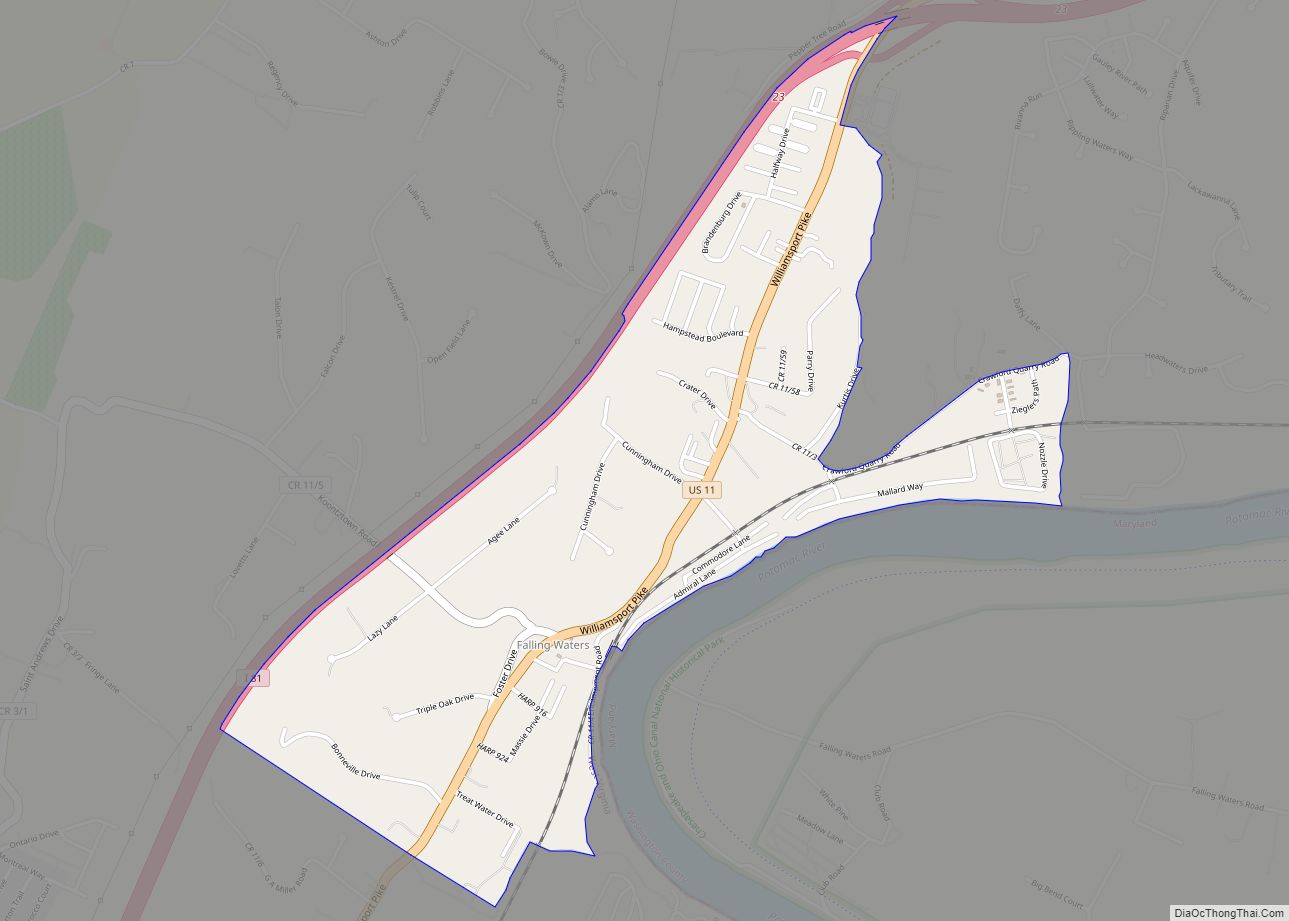
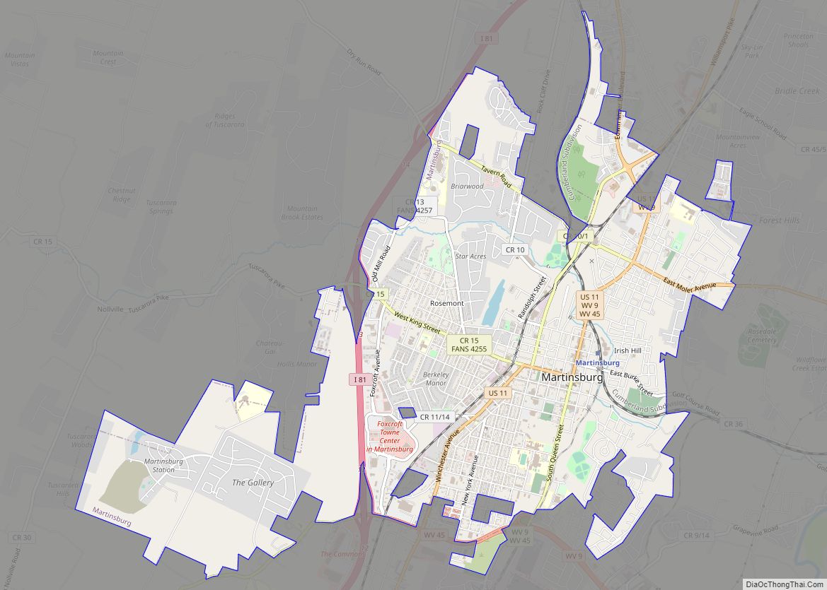
Online Interactive Map
Click on ![]() to view map in "full screen" mode.
to view map in "full screen" mode.
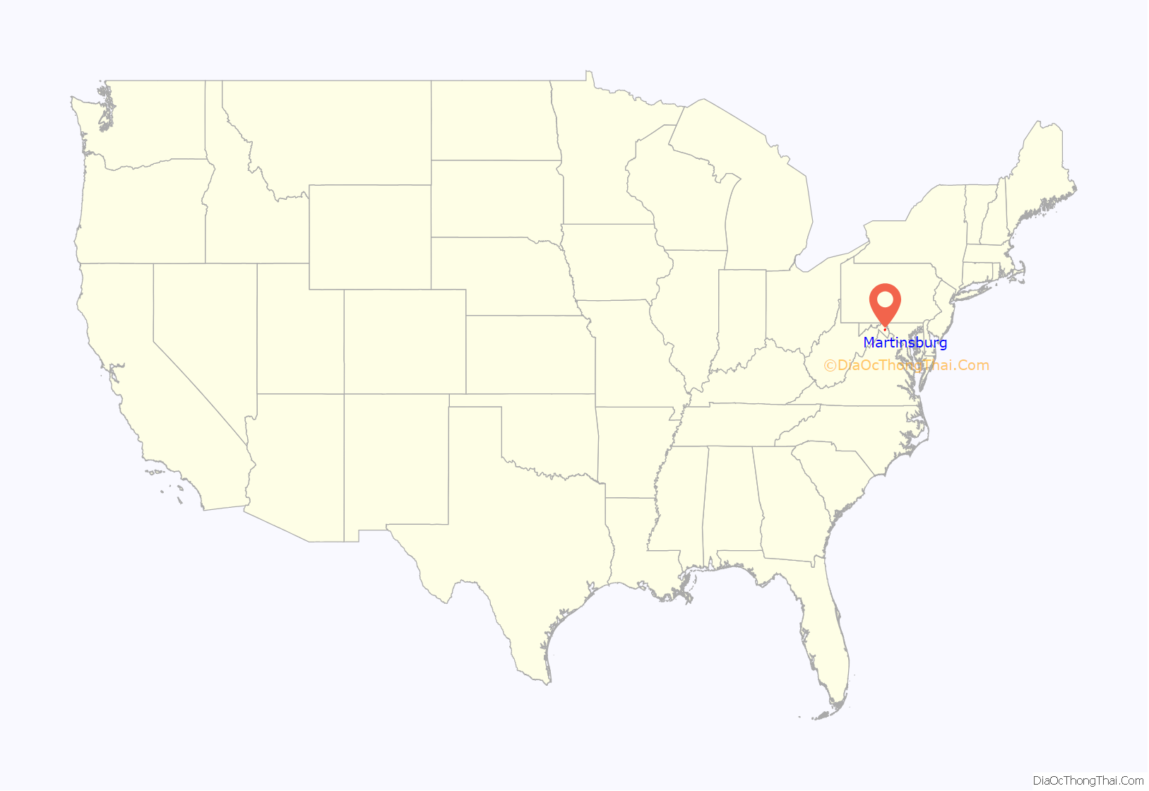
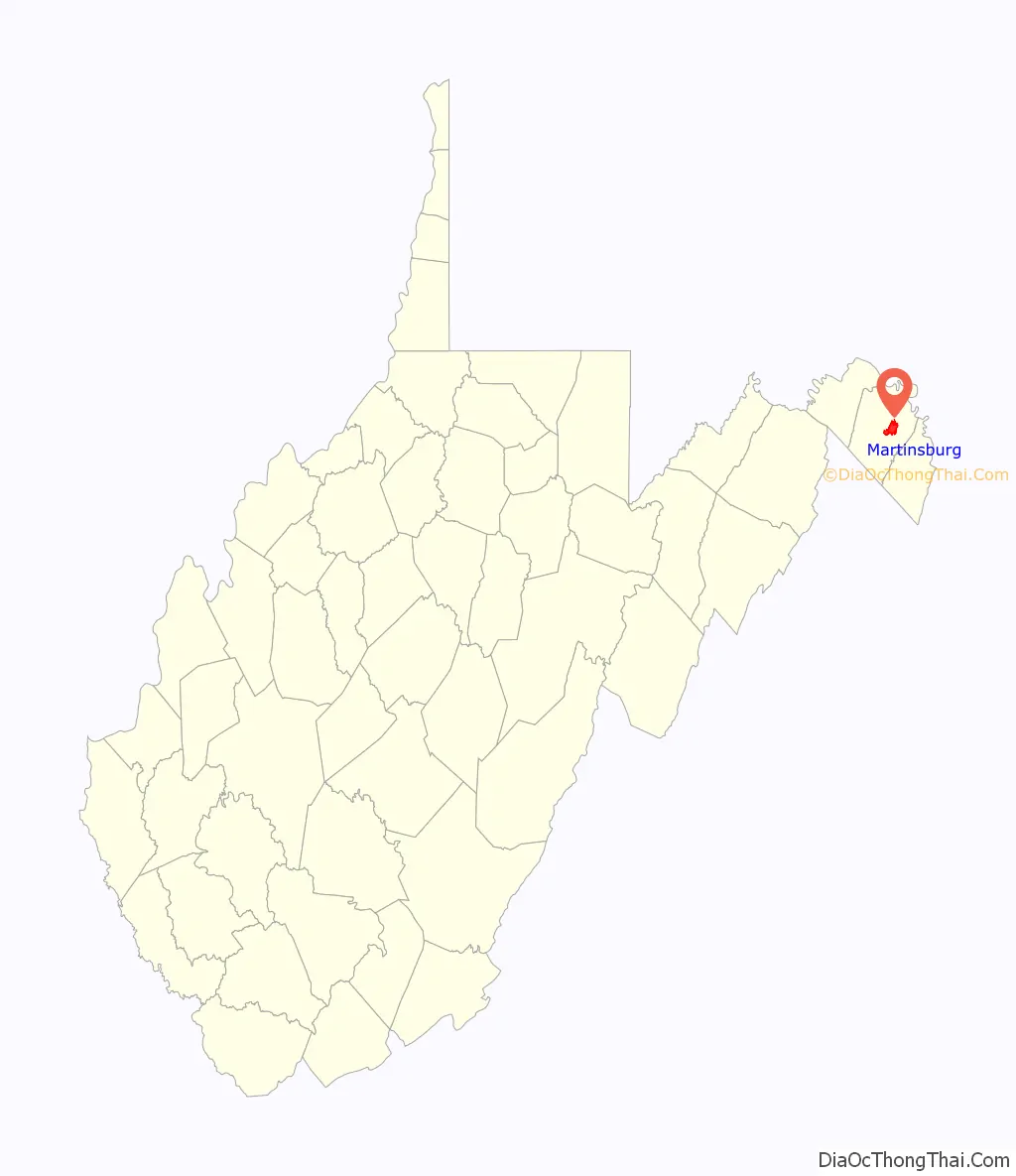
Martinsburg location map. Where is Martinsburg city?
History
Martinsburg was established by an act of the Virginia General Assembly that was adopted in December 1778 during the American Revolutionary War. Founder Major General Adam Stephen named the gateway town to the Shenandoah Valley along Tuscarora Creek in honor of Colonel Thomas Bryan Martin, a nephew of Thomas Fairfax, 6th Lord Fairfax of Cameron.
Aspen Hall, a Georgian mansion, is the oldest house in the city. Part was built in 1745 by Edward Beeson, Sr. Aspen Hall, and its wealthy residents had key roles in the agricultural, religious, transportation, and political history of the region. Significant events related to the French and Indian War, the Revolution, and the Civil War took place on the property. Three original buildings are still standing, including the rare blockhouse of Mendenhall’s Fort.
The first United States post office in what is now West Virginia was established at Martinsburg in 1792. At that time, Martinsburg and the larger territory were still part of Virginia.
The Baltimore and Ohio Railroad (B&O) reached Martinsburg in 1842. The Baltimore and Ohio Railroad Martinsburg Shops were constructed in 1849 and rebuilt after the American Civil War.
According to William Still, “The Father of the Underground Railroad” and its historian: Mr Robert Brown, alias Thomas Jones, escaped from slavery in Martinsburg on Christmas night in 1856. He rode a horse and had it swim across the freezing Potomac River. After riding forty miles, he walked in cold wet clothes for two days, to Harrisburg, Pennsylvania. He received assistance there from the Underground Railroad and traveled by train to Philadelphia, and the office of William Still with the Pennsylvania Anti-Slavery Society. Brown’s wife and four children had been sold; he sought help to find them. He had a likeness of his wife, and locks of hair from each of them.
Civil war
In 1854, ten-year-old Isabelle Boyd, known as “Belle” and later a noted spy for the Confederacy, moved to Martinsburg with her family, where her father Benjamin operated a general merchandise store. After the Civil War began, Benjamin joined the Second Virginia Infantry, which was part of the Stonewall Brigade. His wife Mary was thus in charge of the Boyd home when Union forces under General Robert Patterson took Martinsburg. When a group of Patterson’s men tried to raise a Union flag over the Boyd home, Mary refused. One of the soldiers, Frederick Martin, threatened Mary, and Belle shot him. She was acquitted.
She soon became involved in espionage, sending information to Confederate generals Thomas “Stonewall” Jackson and J.E.B. “Jeb” Stuart. Often she was helped by Eliza Corsey, a Boyd family slave whom Belle had taught to read and write. In 1863, Belle was arrested in Martinsburg by the Union Army and imprisoned. Boyd’s Greek Revival home, which he had built in 1853 and sold in 1855, had numerous owners over the decades. In 1992 it was purchased by the Berkeley County Historical Society. The historical society renovated the building and now operates it as the Berkeley County Museum. It is also known as the Belle Boyd House.
Reconstruction
Residents of West Virginia were split in their allegiance during the war, with half of its soldiers serving in the Confederate army. The vote to create a new state in western Virginia was very low, but statehood was approved by Congress and President Lincoln, and the new state was admitted to the Union on June 20, 1863.
The city of Martinsburg was incorporated by an act of the new West Virginia Legislature on March 30, 1868.
Martinsburg became a center of the railroad industry and its workers. The Great Railroad Strike of 1877 began July 14, 1877, in this city at the Baltimore and Ohio Railroad Martinsburg Shops. After several unsuccessful attempts to quell the protests, Governor Henry M. Mathews called for federal troops. By the time these troops had restored order, the protest of the rail company had spread across the country.
Telephone service was established in Martinsburg in 1883. In 1889, electricity began to be furnished to Martinsburg as part of a franchise granted to the United Edison Manufacturing Company of New York.
The Interwoven Mills began operations in Martinsburg in 1891.
Construction of the Apollo Civic Theatre was completed in 1913.
World War I and beyond
Over one thousand (1,039) men from Berkeley County participated in World War I. Of these, forty-one were killed, and twenty-one were wounded in battle. A monument to those who fell in battle was erected in Martinsburg in 1925.
During World War II, the Newton D. Baker Hospital in Martinsburg treated thousands of soldiers wounded in the war. In 1946 this military hospital became a part of the Veterans Administration (VA). The VA Medical Center in Martinsburg still provides care to United States veterans.
Due to restructuring beginning in the late 1940s and continuing through the 1970s, many of the mills and factories operating in Martinsburg shut down and went out of business, dealing a major blow to the local economy. Jobs were moved to the Deep South and later offshore.
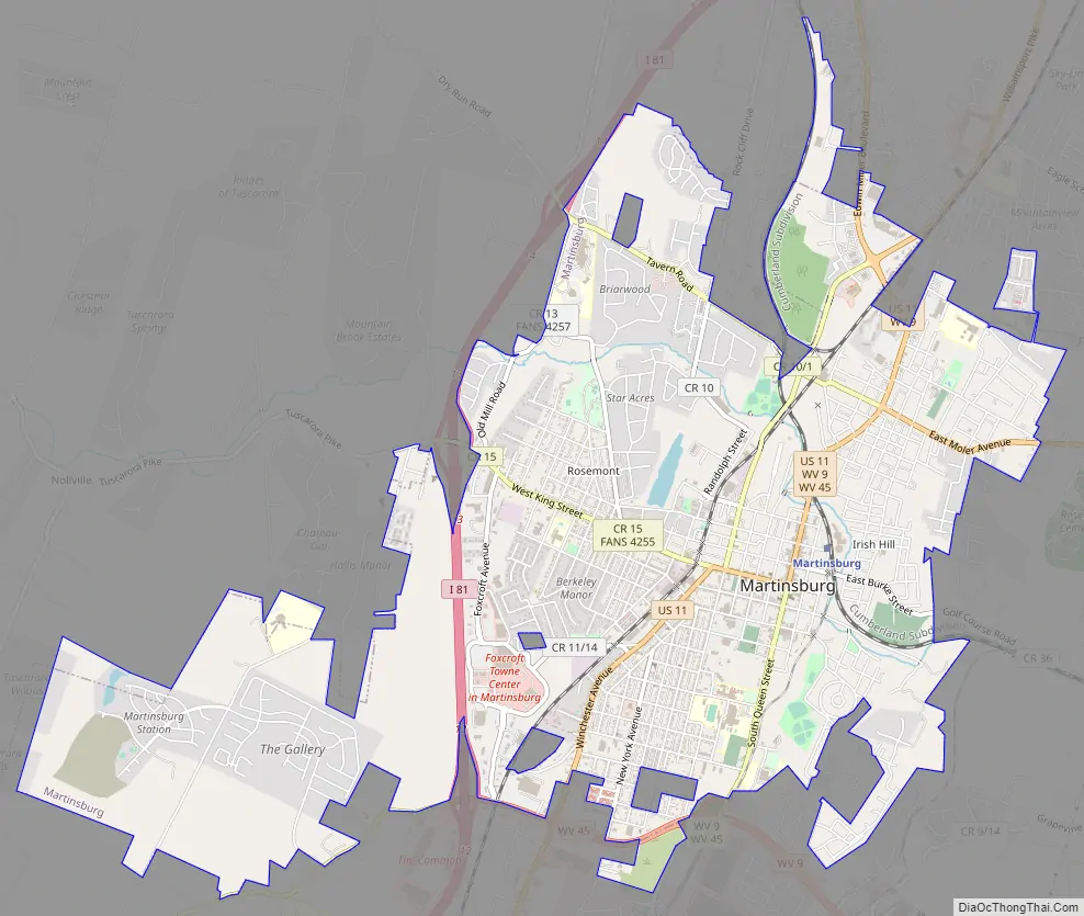
Martinsburg Road Map
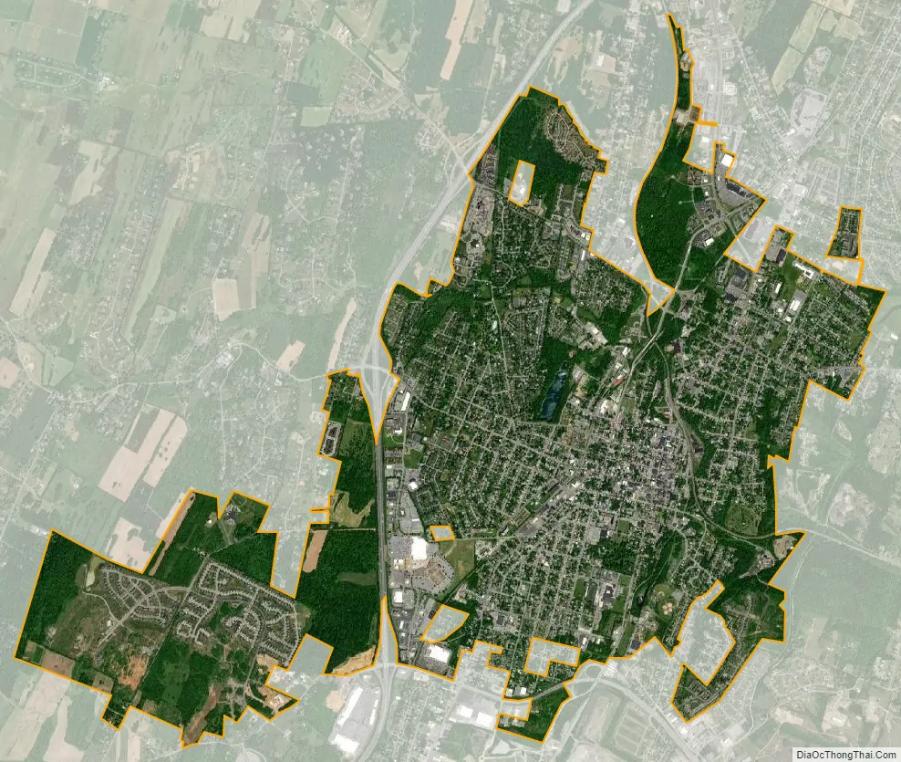
Martinsburg city Satellite Map
Geography
Location and topography
Martinsburg is located at 39°27′33″N 77°58′4″W / 39.45917°N 77.96778°W / 39.45917; -77.96778 (39.459207, −77.967814). Martinsburg is approximately 18 miles (29 km) southwest of Hagerstown, 73 miles (117 km) west of Baltimore, 63 miles (101 km) northwest of Washington, D.C., and 134 miles (216 km) east of Morgantown. U.S. Route 11 runs through the center of town, and Interstate 81 passes along the northern side of the town.
Martinsburg is 212 miles (341 km) distant from the state capital of Charleston. However, it is closer to no less than five other state capitals: Harrisburg PA – 80 miles (130 km), Annapolis MD – 85 miles (137 km), Dover DE – 132 miles (212 km), Richmond VA – 135 miles (217 km), and Trenton NJ – 179 miles (288 km).
According to the United States Census Bureau, the city has a total area of 6.67 square miles (17.28 km), of which 6.65 square miles (17.22 km) is land and 0.02 square miles (0.05 km) is water.
Climate
Martinsburg lies in the transitional area between humid subtropical climate (Köppen Cfa) and humid continental climatic zones (Köppen Dfa), with four distinct seasons. Winters are cool to cold, with a January daily mean temperature of 32.4 °F (0.2 °C) and an average annual snowfall of 26.1 inches (66 cm), while summers are hot and humid with a July daily mean temperature of 75.7 °F (24.3 °C) and 27 days of 90 °F (32 °C)+ readings annually. Precipitation is moderate, with winter being the driest period and May thru July the wettest. Extreme temperatures at Eastern West Virginia Regional Airport range from −18 °F (−28 °C) on January 21, 1994, up to 112 °F (44 °C) on July 11, 1936; an even colder −19 °F (−28 °C) was recorded in the city on January 14, 1912.
See also
Map of West Virginia State and its subdivision:- Barbour
- Berkeley
- Boone
- Braxton
- Brooke
- Cabell
- Calhoun
- Clay
- Doddridge
- Fayette
- Gilmer
- Grant
- Greenbrier
- Hampshire
- Hancock
- Hardy
- Harrison
- Jackson
- Jefferson
- Kanawha
- Lewis
- Lincoln
- Logan
- Marion
- Marshall
- Mason
- McDowell
- Mercer
- Mineral
- Mingo
- Monongalia
- Monroe
- Morgan
- Nicholas
- Ohio
- Pendleton
- Pleasants
- Pocahontas
- Preston
- Putnam
- Raleigh
- Randolph
- Ritchie
- Roane
- Summers
- Taylor
- Tucker
- Tyler
- Upshur
- Wayne
- Webster
- Wetzel
- Wirt
- Wood
- Wyoming
- Alabama
- Alaska
- Arizona
- Arkansas
- California
- Colorado
- Connecticut
- Delaware
- District of Columbia
- Florida
- Georgia
- Hawaii
- Idaho
- Illinois
- Indiana
- Iowa
- Kansas
- Kentucky
- Louisiana
- Maine
- Maryland
- Massachusetts
- Michigan
- Minnesota
- Mississippi
- Missouri
- Montana
- Nebraska
- Nevada
- New Hampshire
- New Jersey
- New Mexico
- New York
- North Carolina
- North Dakota
- Ohio
- Oklahoma
- Oregon
- Pennsylvania
- Rhode Island
- South Carolina
- South Dakota
- Tennessee
- Texas
- Utah
- Vermont
- Virginia
- Washington
- West Virginia
- Wisconsin
- Wyoming