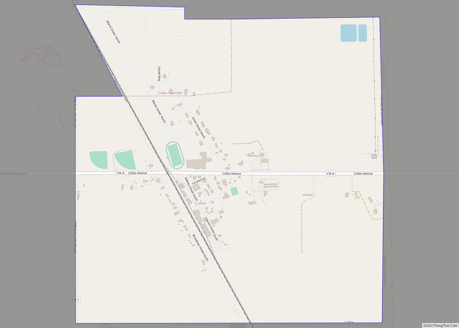
Wahpeton (/ˈwɑːpɪtən/ WAH-pit-ən) is a city in Richland County, in southeast North Dakota along the Bois de Sioux River at its confluence with the Otter Tail River, which forms the Red River of the North. Wahpeton is the county seat of Richland County. The population was 8,007 at the 2020 census.
Wahpeton was founded in 1869 and is the principal city of the Wahpeton Micropolitan Statistical Area, which includes all of Richland County, North Dakota and Wilkin County, Minnesota. Wahpeton’s twin city is Breckenridge, Minnesota, on the other side of the river. The Bois de Sioux River and the Otter Tail River join at Wahpeton and Breckenridge to form the Red River of the North.
The North Dakota State College of Science is in Wahpeton. The local newspaper is the Wahpeton Daily News.
| Name: | Wahpeton city |
|---|---|
| LSAD Code: | 25 |
| LSAD Description: | city (suffix) |
| State: | North Dakota |
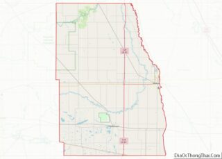
| County: | Richland County |
| Elevation: | 965 ft (294 m) |
| Total Area: | 5.27 sq mi (13.65 km²) |
| Land Area: | 5.27 sq mi (13.65 km²) |
| Water Area: | 0.00 sq mi (0.00 km²) |
| Total Population: | 8,007 |
| Population Density: | 1,519.64/sq mi (586.76/km²) |
| ZIP code: | 58074–58076 |
| Area code: | 701 |
| FIPS code: | 3882660 |
| GNISfeature ID: | 1033621 |
| Website: | wahpeton.com |
Online Interactive Map
Click on ![]() to view map in "full screen" mode.
to view map in "full screen" mode.
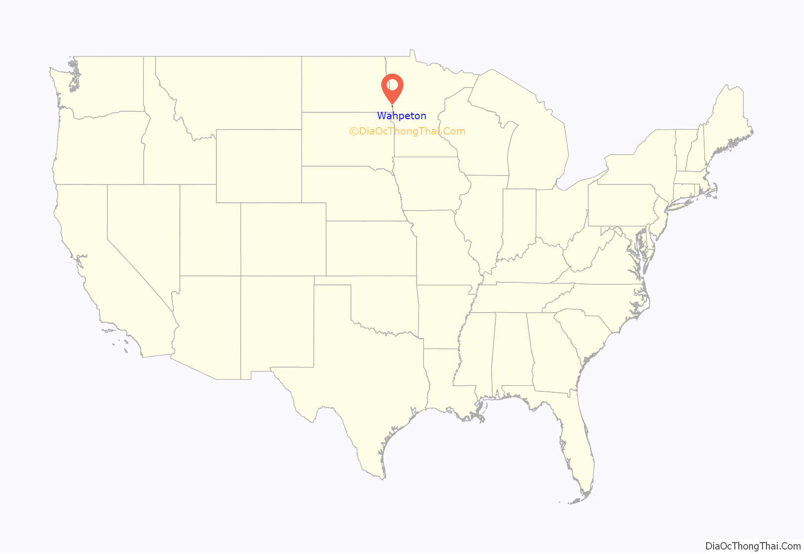
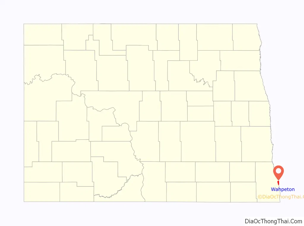
Wahpeton location map. Where is Wahpeton city?
History
The first European explorer in the area was Jonathan Carver in 1767. He explored and mapped the Northwest at the request of Major Robert Rogers, commander of Fort Michilimackinac. This British fort at Mackinaw City, Michigan, protected the passage between Lake Michigan and Lake Huron of the Great Lakes. In 1763 the British had extended their reach in Canada and territory west of the Appalachian Mountains, taking over former French colonial territories after defeating the French in the Seven Years’ War.
Carver’s mission was to find the Northwest Passage, the imagined waterway to the Orient which Rogers (and many other explorers of the time) believed existed. Carver could not find what does not exist, but his account of exploration helped attract fur traders and other explorers to this territory.
More than 100 years after Carver’s expedition, a U.S. government surveying party passed through the Wahpeton area. With the Civil War over, the government wanted to encourage development in the West. J. W. Blanding, a member of the expedition, was so impressed by the fertile river valley that he returned to his Wisconsin home determined to move his family and property to the Dakota Territory. Blanding so influenced other Wisconsin settlers that many had reached the Wahpeton area and homesteaded there before Blanding arranged his return.
The first settler was Morgan T. Rich. His plow turned the first furrow of rich black bottomland in 1869. When other settlers arrived, they formed a tiny community and named it Richville, commemorating both its founder and the fertile quality of the soil.
In 1871, a U.S. post office opened. At the same time, the town’s name was changed to Chahinkapa, a Lakota Sioux word meaning “the end of the woods”. Two years later, the county was organized and named Chahinkapa County.
Later that year the county was renamed Richland County and the town of Chahinkapa renamed Wahpeton. This was derived from the Dakota name of the local band of Dakota Indians, the Wakhpetonwan. The name in Dakota means “leaf dwellers.” They adopted this name at an earlier time when they lived in the vicinity of Lake Mille Lacs, before they were displaced by the Ojibwe and pushed to the west.
Growth of the village of Wahpeton was quite slow during the first few years, but it increased rapidly in 1872 with the completion of a railroad line into Breckenridge, Minnesota, a tiny community across the Bois de Sioux River. The St. Paul and Pacific Railway (now the Great Northern) had entered the region. The railroad generated a booming business in flatboat building in both communities. Flatboats could carry freight directly from the railroad downriver via the Red River of the North (which flowed north) to northern parts of the state and to Winnipeg, Manitoba, Canada.
The railroad line attracted many more settlers to the area—both migrants from the Eastern United States, Native Americans, and new European immigrants. Germans, Bohemians, Scandinavians, and Native Americans moved to Richland County to file for homesteads. In 1874, Jacob Morvin and Joseph Sittarich opened the county’s first retail store in Wahpeton. By 1876 the traffic between Wahpeton and Breckenridge had grown past the ferry’s capacity. A bridge was built across the Bois de Sioux River connecting the towns.
Another flurry of growth occurred in 1880 when the St. Paul, Minneapolis, and Manitoba Railroad crossed the river and pushed its tracks on toward the northwest. By 1883 the population of Wahpeton was estimated to be as high as 1,400 people.
In 1888, the Northern Light Electric Company (NLEC) was organized here. It made Wahpeton among North Dakota’s first cities to be electrified. In 1909, NLEC became the first customer of the newly founded Otter Tail Power Company. In 1913, NLEC’s owner, C. B. Kidder, sold his company to Otter Tail Power and became its first general manager. In 1927, Otter Tail Power built what was then its largest power plant at Wahpeton, naming it Kidder Station. The plant was removed in 1977; the site is now a park.
In 1889, the Red River Valley University was established in Wahpeton. It later was renamed the North Dakota State College of Science.
On June 10, 1897, a lightning bolt struck the main pole in a Ringling Brothers Circus tent as it was being erected, breaking the pole and causing three deaths. The lives lost are commemorated with a monument in a graveyard south of Wahpeton.
In 1904, the U.S. government established the Wahpeton Indian School here. The boarding school operated into the 1970s. It was intended to educate Native American children from reservations and tribes in northern Minnesota, North Dakota, and northern South Dakota. It was an Indian boarding school, designed to assimilate the children to mainstream language, culture and religion. In most such schools, children were required to use English rather than their native languages (which were many among these groups), dress in Euro-American style, and practice Christianity. The school has since been transferred to an inter-tribal group, chartered under the federally recognized Sisseton-Wahpeton Dakota Oyate and funded by the Bureau of Indian Education. The tribes renamed the school Circle of Nations School and operate it, serving children in grades 4–8.
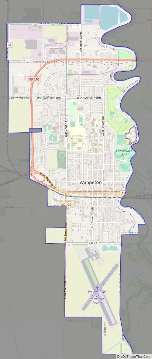
Wahpeton Road Map
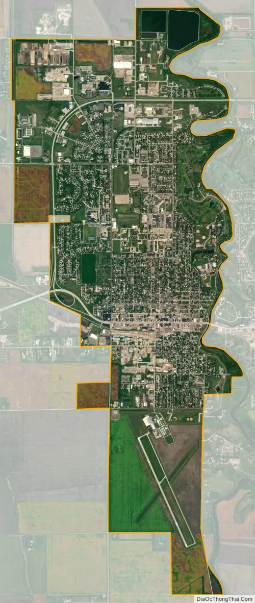
Wahpeton city Satellite Map
Geography
Wahpeton is located at 46°16′12″N 96°36′38″W / 46.27000°N 96.61056°W / 46.27000; -96.61056 (46.269931, −96.610463). According to the United States Census Bureau, it has an area of 5.29 square miles (13.70 km), all land.
The Red River forms one of the most fertile river valleys in the world. As it flows north to Canada, it forms the state boundary between North Dakota and Minnesota. Wahpeton is near the river’s headwaters at the confluence of the Bois de Sioux and Otter Tail Rivers.
Climate
This climatic region is typified by large seasonal temperature differences, with warm to hot (and often humid) summers and cold (sometimes severely cold) winters. According to the Köppen Climate Classification system, Wahpeton has a humid continental climate, abbreviated “Dfb” on climate maps.
See also
Map of North Dakota State and its subdivision:- Adams
- Barnes
- Benson
- Billings
- Bottineau
- Bowman
- Burke
- Burleigh
- Cass
- Cavalier
- Dickey
- Divide
- Dunn
- Eddy
- Emmons
- Foster
- Golden Valley
- Grand Forks
- Grant
- Griggs
- Hettinger
- Kidder
- Lamoure
- Logan
- McHenry
- McIntosh
- McKenzie
- McLean
- Mercer
- Morton
- Mountrail
- Nelson
- Oliver
- Pembina
- Pierce
- Ramsey
- Ransom
- Renville
- Richland
- Rolette
- Sargent
- Sheridan
- Sioux
- Slope
- Stark
- Steele
- Stutsman
- Towner
- Traill
- Walsh
- Ward
- Wells
- Williams
- Alabama
- Alaska
- Arizona
- Arkansas
- California
- Colorado
- Connecticut
- Delaware
- District of Columbia
- Florida
- Georgia
- Hawaii
- Idaho
- Illinois
- Indiana
- Iowa
- Kansas
- Kentucky
- Louisiana
- Maine
- Maryland
- Massachusetts
- Michigan
- Minnesota
- Mississippi
- Missouri
- Montana
- Nebraska
- Nevada
- New Hampshire
- New Jersey
- New Mexico
- New York
- North Carolina
- North Dakota
- Ohio
- Oklahoma
- Oregon
- Pennsylvania
- Rhode Island
- South Carolina
- South Dakota
- Tennessee
- Texas
- Utah
- Vermont
- Virginia
- Washington
- West Virginia
- Wisconsin
- Wyoming