Niagara Falls is a city in Niagara County, New York, United States. As of the 2020 census, the city had a total population of 48,671. It is adjacent to the Niagara River, across from the city of Niagara Falls, Ontario, and named after the famed Niagara Falls which they share. The city is within the Buffalo–Niagara Falls metropolitan area and the Western New York region.
While the city was formerly occupied by Native Americans, Europeans who migrated to the Niagara Falls in the mid-17th century began to open businesses and develop infrastructure. Later in the 18th and 19th centuries, scientists and businessmen began harnessing the power of the Niagara River for electricity and the city began to attract manufacturers and other businesses drawn by the promise of inexpensive hydroelectric power. After the 1960s, however, the city and region witnessed an economic decline, following an attempt at urban renewal under then Mayor Lackey. Consistent with the rest of the Rust Belt as industries left the city, old line affluent families relocated to nearby suburbs and out of town.
Despite the decline in heavy industry, Niagara Falls State Park and the downtown area closest to the falls continue to thrive as a result of tourism. The population, however, has continued to decline from a peak of 102,394 in the 1960s due to the loss of manufacturing jobs in the area.
| Name: | Niagara Falls city |
|---|---|
| LSAD Code: | 25 |
| LSAD Description: | city (suffix) |
| State: | New York |
| County: | Niagara County |
| Elevation: | 614 ft (187 m) |
| Land Area: | 14.09 sq mi (36.48 km²) |
| Water Area: | 2.74 sq mi (7.10 km²) 16.37% |
| Population Density: | 3,455.27/sq mi (1,334.09/km²) |
| ZIP code: | 14301-14305 |
| Area code: | 716 |
| FIPS code: | 3651055 |
| GNISfeature ID: | 0970406 |
| Website: | niagarafallsusa.org |
Online Interactive Map
Click on ![]() to view map in "full screen" mode.
to view map in "full screen" mode.
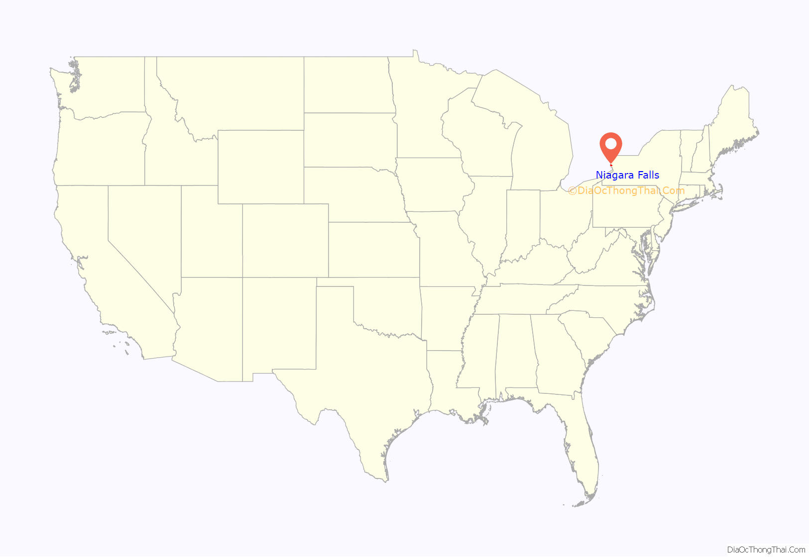
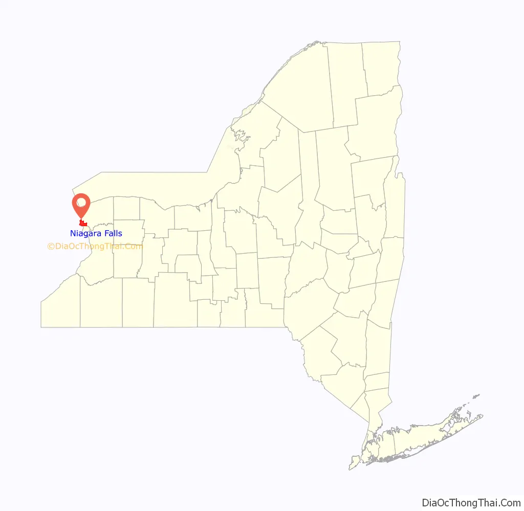
Niagara Falls location map. Where is Niagara Falls city?
History
Before Europeans entered the area, it was dominated by the Neutral Nation of Native Americans. European migration into the area began in the 17th century. The first recorded European to visit the area was Frenchman Robert de la Salle, who built Fort Conti at the mouth of the Niagara River early in 1679, with permission from the Iroquois, as a base for boatbuilding; his ship Le Griffon was built on the upper Niagara River at or near Cayuga Creek in the same year. He was accompanied by Belgian priest Louis Hennepin, who was the first known European to see the falls. The influx of newcomers may have been a catalyst for already hostile native tribes to turn to open warfare in competition for the fur trade.
The City of Niagara Falls was incorporated on March 17, 1892, from the villages of Manchester and Suspension Bridge, which were parts of the Town of Niagara. Thomas Vincent Welch, a member of the charter committee and a New York state assemblyman and a second-generation Irish American, persuaded Governor Roswell P. Flower to sign the bill on St. Patrick’s Day. George W. Wright was elected the first mayor of Niagara Falls.
By the end of the 19th century, the city was heavily industrialized, due in part to the power potential offered by the Niagara River. Tourism was considered a secondary niche, while manufacturing of petrochemicals, abrasives, metallurgical products and other materials was the main producer of jobs and attracted a large number of workers, many of whom were immigrants.
In 1927, the city annexed the village of La Salle, named for Robert de la Salle, from the Town of Niagara.
Industry and tourism grew steadily throughout the first half of the 20th century due to a high demand for industrial products and the increased mobility of people to travel. Paper, rubber, plastics, petrochemicals, carbon insulators and abrasives were among the city’s major industries. This prosperity would end by the late 1960s as aging industrial plants moved to less expensive locations. In addition, the falls were incompatible with modern shipping technology.
In 1956, the Schoellkopf Power Plant on the lower river just downstream of the American Falls was critically damaged by the collapse of the Niagara Gorge wall above it. This prompted the planning and construction of one of the largest hydroelectric plants to be built in North America to that time, generating a large influx of workers and families to the area. New York City urban planner Robert Moses built the new power plant in nearby Lewiston, New York. Much of the power generated there fueled growing demands for power in downstate New York and New York City.
The neighborhood of Love Canal gained national media attention in 1978 when toxic waste contamination from a chemical landfill beneath it forced United States President Jimmy Carter to declare a state of emergency, the first such presidential declaration made for a non-natural disaster. Hundreds of residents were evacuated from the area, many of whom were ill because of exposure to chemical waste.
After the Love Canal disaster, the city—which had already been declining in population for nearly two decades—experienced accelerated economic and political difficulties. The costs of manufacturing elsewhere had become less expensive, which led to the closure of several factories. The city’s population eventually dropped by more than half of its peak, as workers fled the city in search of jobs elsewhere. Then, much like the nearby city of Buffalo, the city’s economy plummeted when a failed urban renewal project destroyed Falls Street and the tourist district.
In 2001, the leadership of Laborers Local 91 was found guilty of extortion, racketeering and other crimes following an exposé by Mike Hudson of the Niagara Falls Reporter. Union boss Michael “Butch” Quarcini died before trial, while the rest of the union leadership was sentenced to prison.
In early 2010, former Niagara Falls Mayor Vincenzo Anello was indicted on federal charges of corruption, alleging the mayor accepted $40,000 in loans from a businessman who was later awarded a no-bid lease on city property. The charges were dropped as part of a plea deal after Anello pleaded guilty to unrelated charges of pension fraud, regarding a pension from the International Brotherhood of Electrical Workers, of which he is a member. He was sentenced to 10 to 16 months in prison.
The city’s decline received national exposure from Bloomberg Businessweek in 2010.
On November 30, 2010, the New York State Attorney General entered into an agreement with the city and its police department to create new policies to govern police practices in response to claims of excessive force and police misconduct. The city committed to create policies and procedures to prevent and respond to allegations of excessive force, and to ensure police are properly trained and complaints are properly investigated. Prior claims filed by residents will be evaluated by an independent panel.
The city has multiple properties on the National Register of Historic Places. It also has three national historic districts, including Chilton Avenue-Orchard Parkway Historic District, Deveaux School Historic District and the Park Place Historic District.
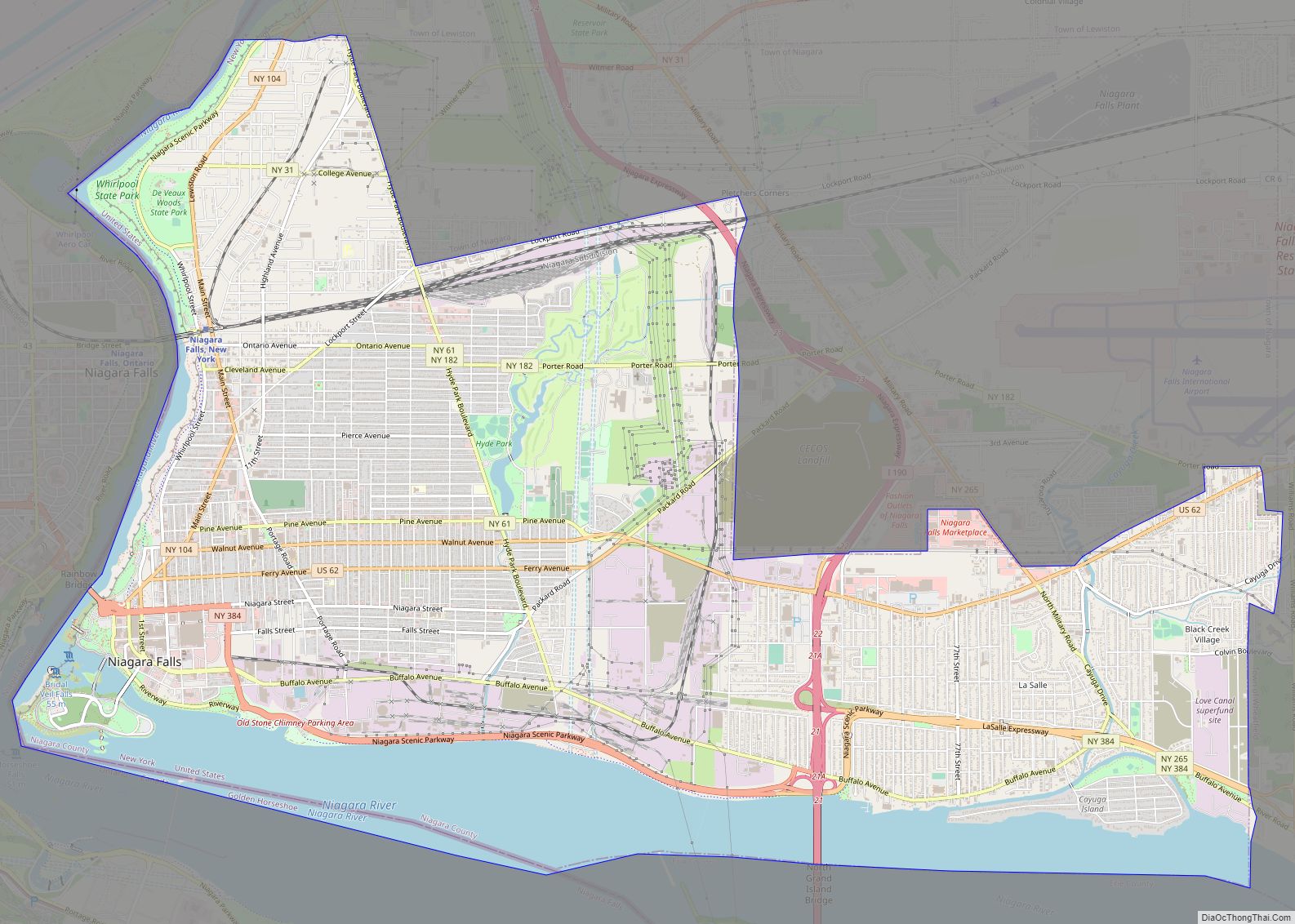
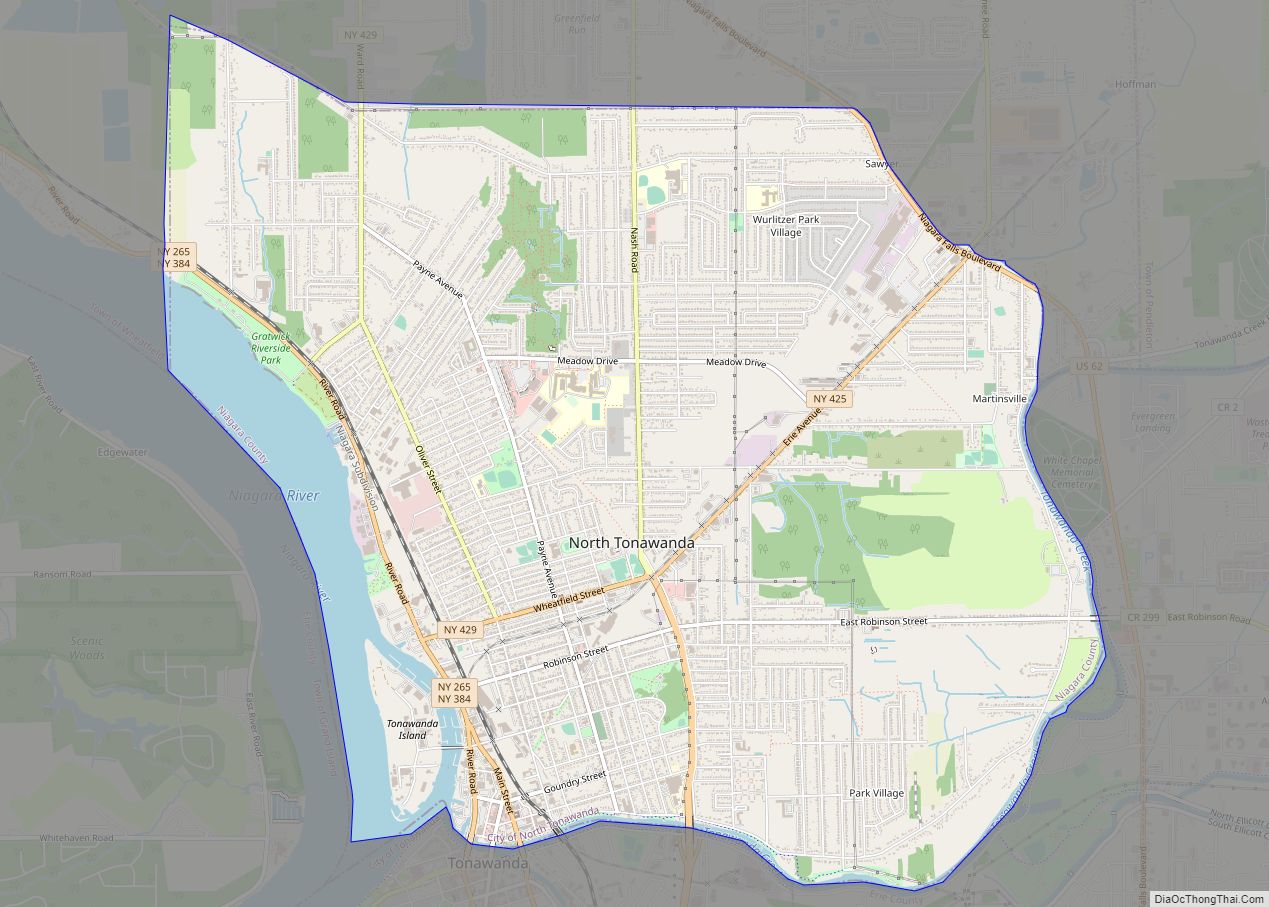
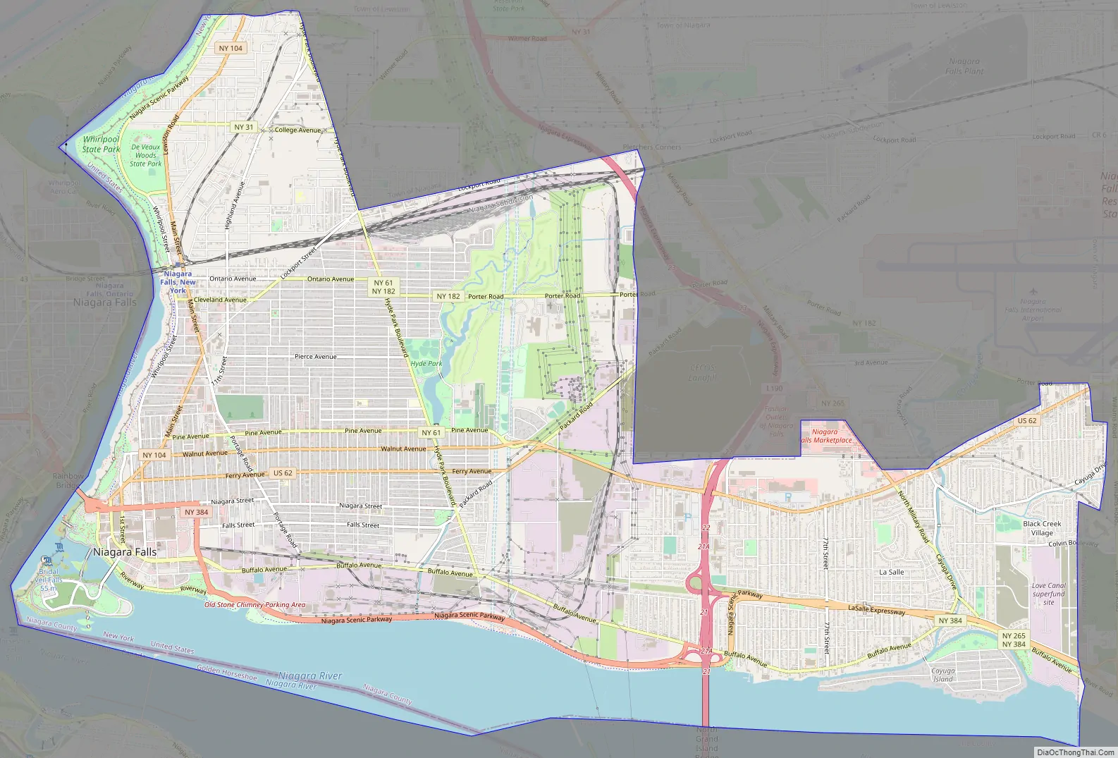
Niagara Falls Road Map
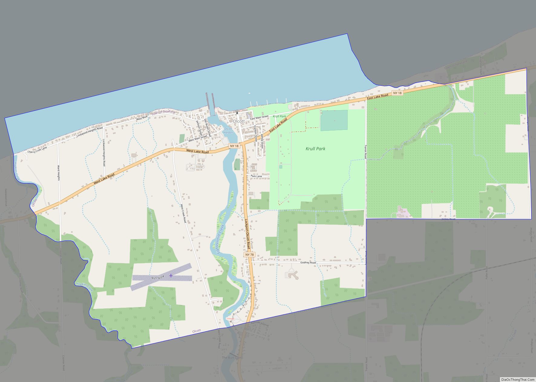
Niagara Falls city Satellite Map
Geography
Niagara Falls is at the international boundary between the United States and Canada. The city is within the Buffalo–Niagara Falls metropolitan area and is approximately 16 miles (26 km) from Buffalo, New York.
According to the United States Census Bureau, the city has an area of 16.8 square miles (44 km), of which 14.1 square miles (37 km) is land and 2.8 square miles (7.3 km) (16.37%) is water. The city is built along the Niagara Falls and the Niagara Gorge, which is next to the Niagara River.
Climate
Niagara Falls has a humid continental climate (Dfa). The city experiences cold, snowy winters and hot, humid summers. Precipitation is moderate and consistent in all seasons, falling equally or more as snow during the winter. The city has snowier than average winters compared to most cities in the US, however less than many other cities in Upstate New York including nearby Buffalo and Rochester. Thaw cycles with temperatures above 32 °F (0 °C) are a common occurrence. The hottest and coldest temperatures recorded in the decade through 2015 were 97 °F (36 °C) in 2005 and −13 °F (−25 °C) in 2003, respectively. 38% of warm season precipitation falls in the form of a thunderstorm.
Neighborhoods
- Buffalo Avenue – runs along the south end along the Niagara River once home to a vast number of old families with architecturally significant mansions; further east surrounded by a number of industrial sites.
- Central District
- Deveaux – Located in the northwestern corner (west of the North End) along the Niagara River is residential area built in the 1920s to 1940s. Named for Judge Samuel DeVeaux who left his estate to be established as the Deveaux College for Orphans and Destitute Children in 1853 (closed 1971), now the site of DeVeaux Woods State Park and DeVeaux School Historical District.
- Downtown – Area around the Falls and home to hotels including Seneca Niagara Resort Casino, Niagara Falls State Park, Niagara Falls Culinary Institute (formerly Rainbow Outlet Mall)
- East Side – the area bounded by the gorge on the west, Niagara Street on the south, Ontario Avenue on the North and Main Street (NY Rt 104) on the east.
- Hyde Park – Located near the namesake Hyde Park next to Little Italy as well as home to Hyde Park Municipal Golf Course.
- LaSalle – Bounded by 80th Street, Niagara Falls Boulevard, Cayuga Drive and LaSalle Expressway was built up in the 1940s to 1960s. Cayuga Island is linked to neighborhood. The actual neighborhood where the Love Canal was to be built.
- Little Italy – home to a once predominately Italian community that runs along Pine Avenue from Main Street to Hyde Park Boulevard
- Love Canal – Established in the 1950s on land acquired from Hooker Chemical Company. Most of the neighborhood was evacuated in the 1980s after toxic waste was discovered underground. Resettlement began in 1990.
- Niagara Street – residential area east of Downtown along Niagara Street (distinct from Niagara Ave.) once home to a predominately German and Polish community.
- North End – runs along Highland Avenue in the north end of the city
See also
Map of New York State and its subdivision:- Albany
- Allegany
- Bronx
- Broome
- Cattaraugus
- Cayuga
- Chautauqua
- Chemung
- Chenango
- Clinton
- Columbia
- Cortland
- Delaware
- Dutchess
- Erie
- Essex
- Franklin
- Fulton
- Genesee
- Greene
- Hamilton
- Herkimer
- Jefferson
- Kings
- Lake Ontario
- Lewis
- Livingston
- Madison
- Monroe
- Montgomery
- Nassau
- New York
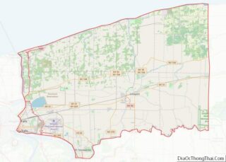
- Niagara
- Oneida
- Onondaga
- Ontario
- Orange
- Orleans
- Oswego
- Otsego
- Putnam
- Queens
- Rensselaer
- Richmond
- Rockland
- Saint Lawrence
- Saratoga
- Schenectady
- Schoharie
- Schuyler
- Seneca
- Steuben
- Suffolk
- Sullivan
- Tioga
- Tompkins
- Ulster
- Warren
- Washington
- Wayne
- Westchester
- Wyoming
- Yates
- Alabama
- Alaska
- Arizona
- Arkansas
- California
- Colorado
- Connecticut
- Delaware
- District of Columbia
- Florida
- Georgia
- Hawaii
- Idaho
- Illinois
- Indiana
- Iowa
- Kansas
- Kentucky
- Louisiana
- Maine
- Maryland
- Massachusetts
- Michigan
- Minnesota
- Mississippi
- Missouri
- Montana
- Nebraska
- Nevada
- New Hampshire
- New Jersey
- New Mexico
- New York
- North Carolina
- North Dakota
- Ohio
- Oklahoma
- Oregon
- Pennsylvania
- Rhode Island
- South Carolina
- South Dakota
- Tennessee
- Texas
- Utah
- Vermont
- Virginia
- Washington
- West Virginia
- Wisconsin
- Wyoming