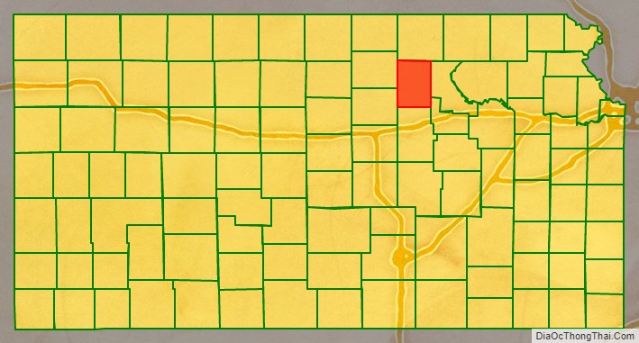
Clay County (county code CY) is a county located in the U.S. state of Kansas. As of the 2020 census, the county population was 8,117. Its county seat and most populous city is Clay Center.
| Name: | Clay County |
|---|---|
| FIPS code: | 20-027 |
| State: | Kansas |
| Founded: | February 20, 1857 |
| Named for: | Henry Clay |
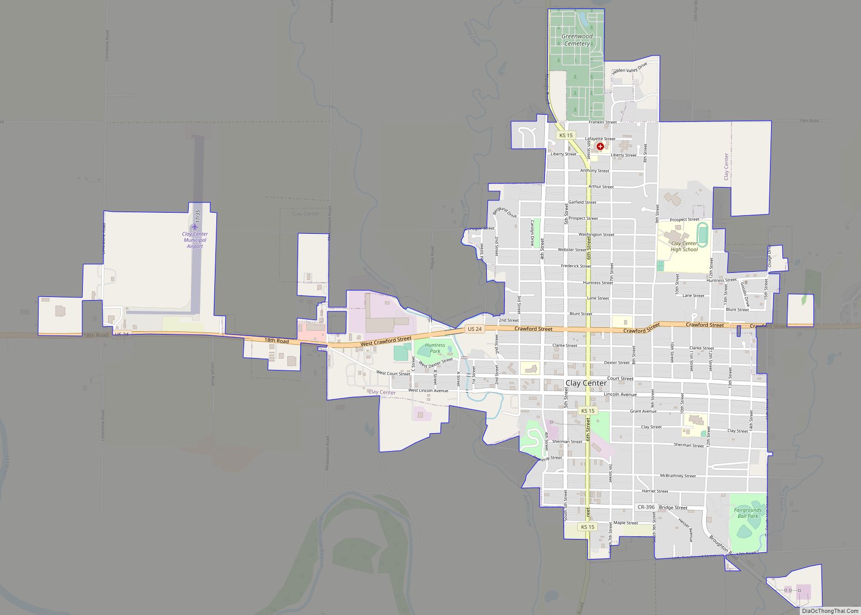
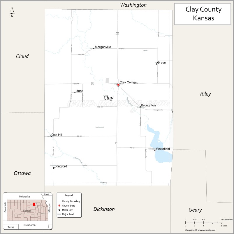
| Seat: | Clay Center |
| Largest city: | Clay Center |
| Total Area: | 656 sq mi (1,700 km²) |
| Land Area: | 645 sq mi (1,670 km²) |
| Total Population: | 8,117 |
| Population Density: | 12.6/sq mi (4.9/km²) |
| Time zone: | UTC−6 (Central) |
| Summer Time Zone (DST): | UTC−5 (CDT) |
| Website: | ClayCountyKansas.org |
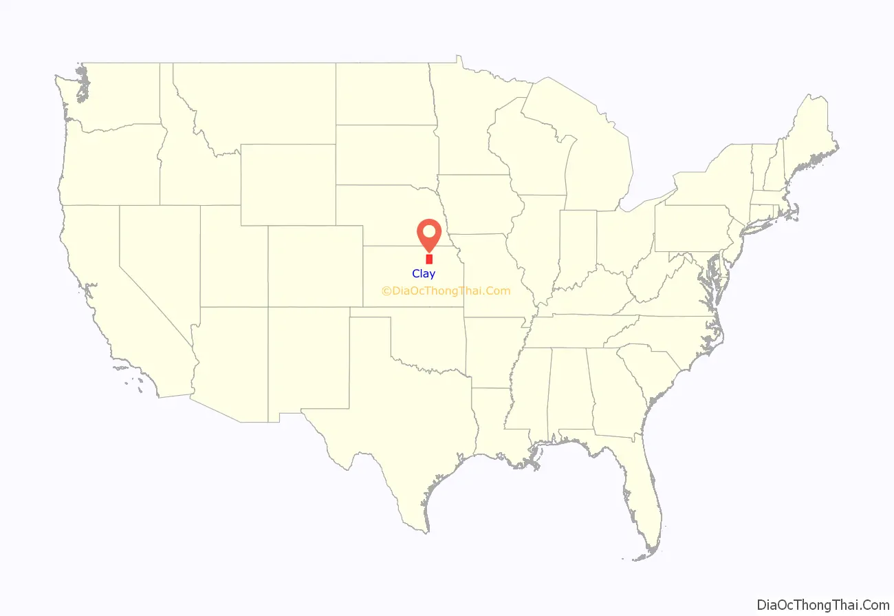
Clay County location map. Where is Clay County?
History
Early history
For many millennia, the Great Plains of North America was inhabited by nomadic Native Americans. From the 16th century to 18th century, the Kingdom of France claimed ownership of large parts of North America. In 1762, after the French and Indian War, France secretly ceded New France to Spain, per the Treaty of Fontainebleau.
19th century
In 1802, Spain returned most of the land to France, but keeping title to about 7,500 square miles. In 1803, most of the land for modern day Kansas was acquired by the United States from France as part of the 828,000 square mile Louisiana Purchase for 2.83 cents per acre.
In 1854, the Kansas Territory was organized, then in 1861 Kansas became the 34th U.S. state. In 1857, Clay County was established.
When the first counties were created by the Kansas legislature in 1855, the territory within the present limits of the county was attached to Riley County for all revenue and judicial purposes. Subsequently, Clay was attached to Geary County. In 1857, Clay was created and named in honor of the famous American statesman Henry Clay, a member of the United States Senate from Kentucky and United States Secretary of State in the 19th century.
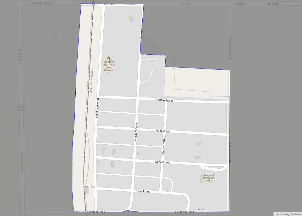
In 1887, the Atchison, Topeka and Santa Fe Railway built a branch line from Neva (3 miles west of Strong City) to Superior, Nebraska. This branch line connected Strong City, Neva, Rockland, Diamond Springs, Burdick, Lost Springs, Jacobs, Hope, Navarre, Enterprise, Abilene, Talmage, Manchester, Longford, Oak Hill, Miltonvale, Aurora, Huscher, Concordia, Kackley, Courtland, Webber, Superior. At some point, the line from Neva to Lost Springs was pulled, but the right of way has not been abandoned. This branch line was originally called “Strong City and Superior line” but later the name was shortened to the “Strong City line”. In 1996, the Atchison, Topeka and Santa Fe Railway merged with Burlington Northern Railroad and renamed to the current BNSF Railway. Most locals still refer to this railroad as the “Santa Fe”.
21st century
In 2010, the Keystone-Cushing Pipeline (Phase II) was constructed north to south through Clay County, with much controversy over tax exemption and environmental concerns (if a leak ever occurs). A pumping station named Riley was built along the pipeline.
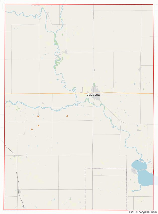
Clay County Road Map
Geography
According to the U.S. Census Bureau, the county has a total area of 656 square miles (1,700 km), of which 645 square miles (1,670 km) is land and 10 square miles (26 km) (1.6%) is water.
Adjacent counties
- Washington County (north)
- Riley County (east)
- Geary County (southeast)
- Dickinson County (south)
- Ottawa County (southwest)
- Cloud County (west)
Major highways
Sources: National Atlas, U.S. Census Bureau
- U.S. Route 24
- Kansas Highway 15
- Kansas Highway 82
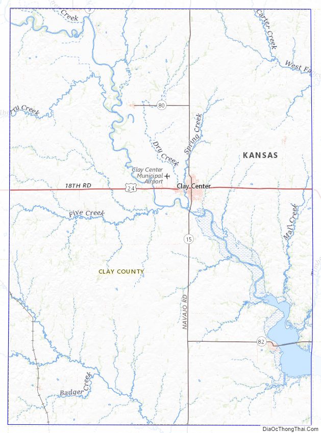
Clay County Topographic Map
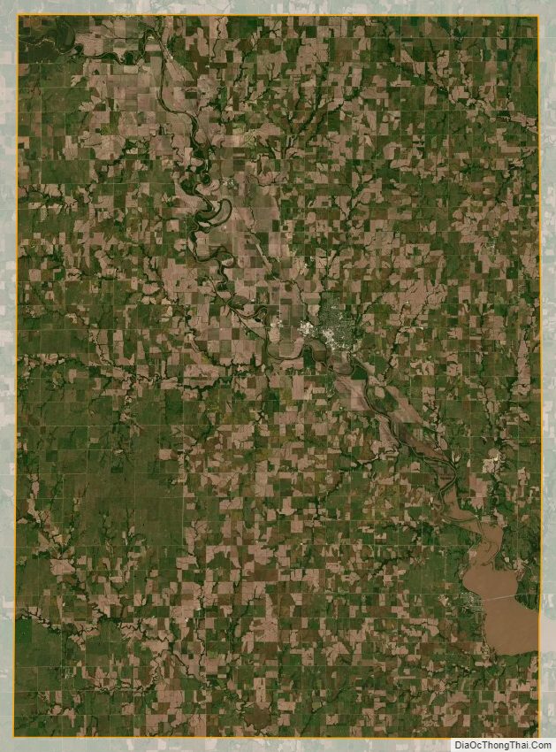
Clay County Satellite Map
Clay County Outline Map