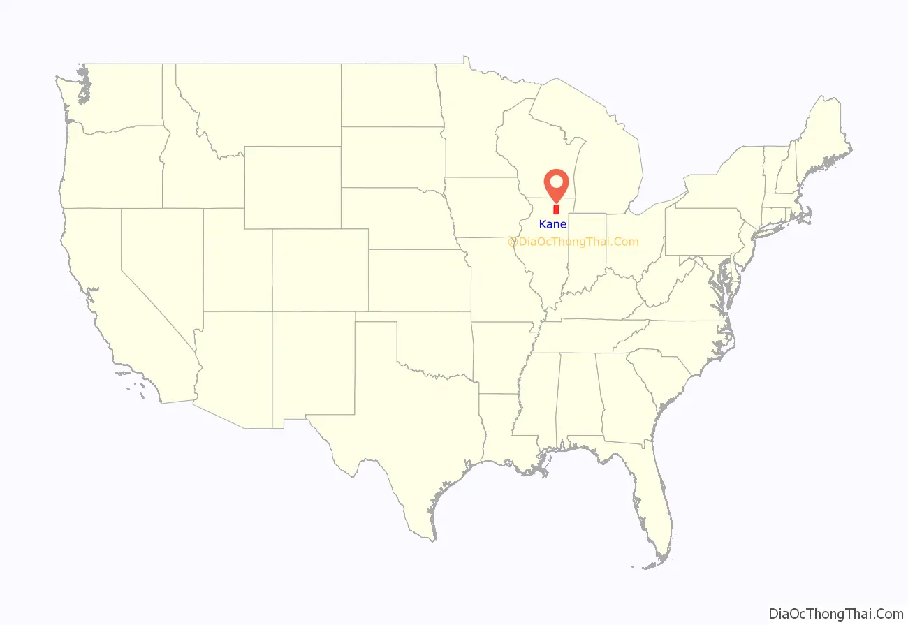
Kane County is a county in the U.S. state of Illinois. According to the 2020 census, it has a population of 516,522, making it the fifth-most populous county in Illinois. Its county seat is Geneva, and its largest city is Aurora. Kane County is one of the collar counties of the metropolitan statistical area designated “Chicago–Naperville–Elgin, IL–IN–WI” by the US Census.
| Name: | Kane County |
|---|---|
| FIPS code: | 17-089 |
| State: | Illinois |
| Founded: | January 16, 1836 |
| Named for: | Elias Kane |
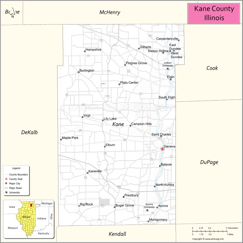
| Seat: | Geneva |
| Largest city: | Aurora |
| Total Area: | 524 sq mi (1,360 km²) |
| Land Area: | 520 sq mi (1,300 km²) |
| Total Population: | 516,522 |
| Population Density: | 990/sq mi (380/km²) |
| Time zone: | UTC−6 (Central) |
| Summer Time Zone (DST): | UTC−5 (CDT) |
| Website: | countyofkane.org |
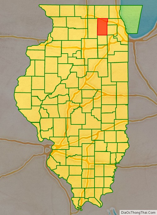
Kane County location map. Where is Kane County?
History
Kane County was formed out of LaSalle County in 1836. The county was named in honor of Elias Kane, United States Senator from Illinois, and the first Secretary of State of Illinois.
Kane County from the time of its creation to 1837, when DeKalb County was split off
Kane County between 1837 and 1841
Kane County in 1841, reduced to its present size
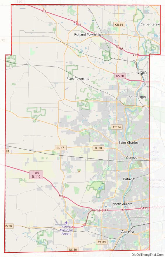
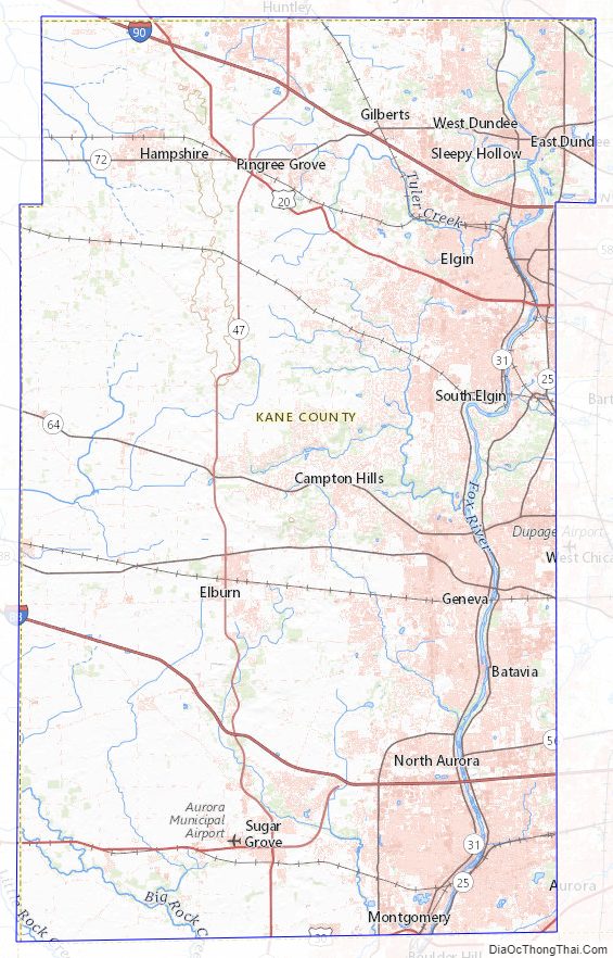
Kane County Road Map
Geography
According to the U.S. Census Bureau, the county’s area was 524 square miles (1,360 km), of which 520 square miles (1,300 km) is land and 4.1 square miles (11 km) (0.8%) is water. Its largest cities are along the Fox River.
Climate
In recent years, average temperatures in the county seat of Geneva have ranged from a low of 10 °F (−12 °C) in January to a high of 84 °F (29 °C) in July, although a record low of −26 °F (−32 °C) was recorded in January 1985 and a record high of 111 °F (44 °C) was recorded in July 1936. The average monthly precipitation ranged from 1.52 inches (39 mm) in February to 4.39 inches (112 mm) in July.
Adjacent counties
- McHenry County (north)
- Cook County (east)
- DuPage County (east)
- Will County (southeast)
- Kendall County (south)
- DeKalb County (west)
Kane County Topographic Map
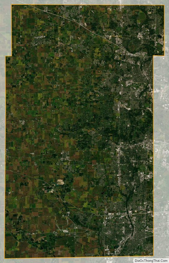
Kane County Satellite Map
Kane County Outline Map