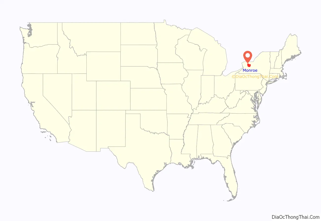
Monroe County is a county in the Finger Lakes region of the State of New York. The county is along Lake Ontario’s southern shore. At the 2020 census, Monroe County’s population was 759,443, an increase since the 2010 census. Its county seat and largest city is the city of Rochester. The county is named after James Monroe, the fifth president of the United States. Monroe County is part of the Rochester, NY Metropolitan Statistical Area.
| Name: | Monroe County |
|---|---|
| FIPS code: | 36-055 |
| State: | New York |
| Founded: | 1821 |
| Named for: | James Monroe |
| Seat: | Rochester |
| Largest city: | Rochester |
| Total Area: | 1,367 sq mi (3,540 km²) |
| Land Area: | 657 sq mi (1,700 km²) |
| Total Population: | 759,443 |
| Population Density: | 1,155.9/sq mi (446.3/km²) |
| Time zone: | UTC−5 (Eastern) |
| Summer Time Zone (DST): | UTC−4 (EDT) |
| Website: | www.monroecounty.gov |
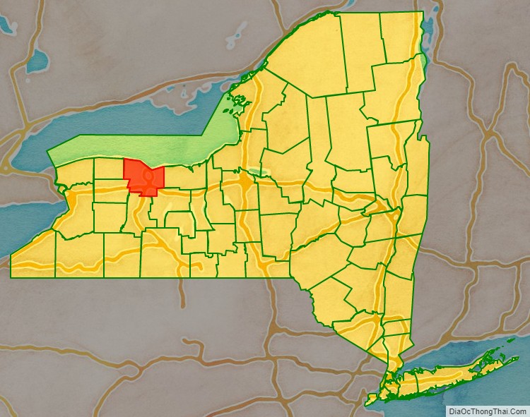
Monroe County location map. Where is Monroe County?
History
When counties were established in the Province of New York in 1683, the present Monroe County was part of Albany County. This was an enormous county, including the northern part of the State of New York as well as all of the present State of Vermont and, in theory, extending westward to the Pacific Ocean. This county was reduced in size on July 3, 1766, by the creation of Cumberland County, and further on March 16, 1770, by the creation of Gloucester County, both containing territory now in Vermont.
On March 12, 1772, what was left of Albany County was split into three parts, one remaining under the name Albany County. One of the other pieces, Tryon County, contained the western portion (and thus, since no western boundary was specified, theoretically still extended west to the Pacific). The eastern boundary of Tryon County was approximately five miles west of the present city of Schenectady, and the county included the western part of the Adirondack Mountains and the area west of the West Branch of the Delaware River. The area then designated as Tryon County now includes 37 counties of the State of New York. The county was named for William Tryon, colonial governor of New York.
In the years prior to 1776, most of the Loyalists in Tryon County fled to Canada. In 1784, following the peace treaty that ended the American Revolutionary War, the name of Tryon County was changed to Montgomery County in order to honor the general, Richard Montgomery, who had captured several places in Canada and died attempting to capture the city of Quebec, replacing the name of the hated British governor.
In 1789, Ontario County was split off from Montgomery. The actual area split off from Montgomery County was much larger than the present county, also including the present Allegany, Cattaraugus, Chautauqua, Erie, Genesee, Livingston, Monroe, Niagara, Orleans, Steuben, Wyoming, Yates, and part of Schuyler and Wayne counties.
Genesee County was created by a splitting of Ontario County in 1802. This was much larger than the present Genesee County, however. It contained the present Allegany, Cattaraugus, Chautauqua, Erie, Niagara, Orleans, Wyoming, and portions of Livingston and Monroe counties.
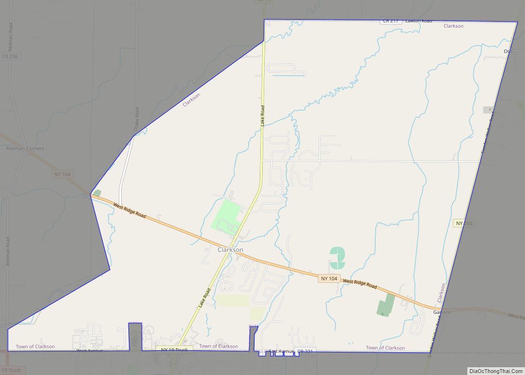
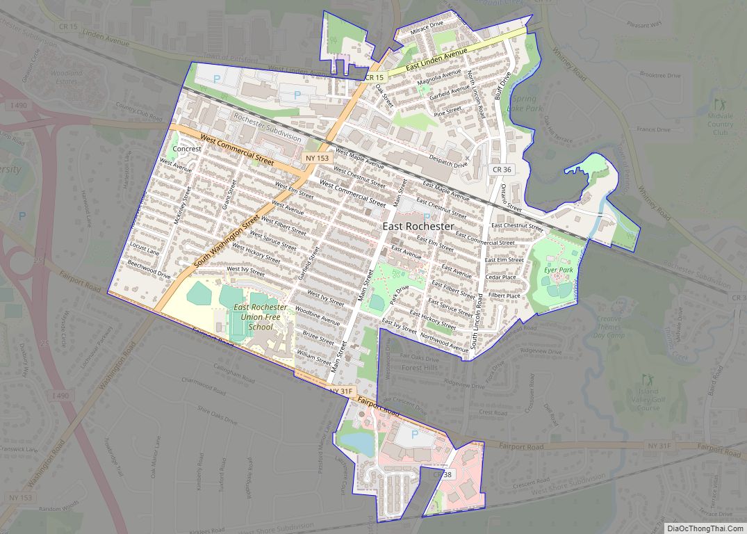
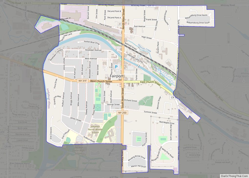
Finally, Monroe County was formed from parts of Genesee and Ontario counties in 1821.
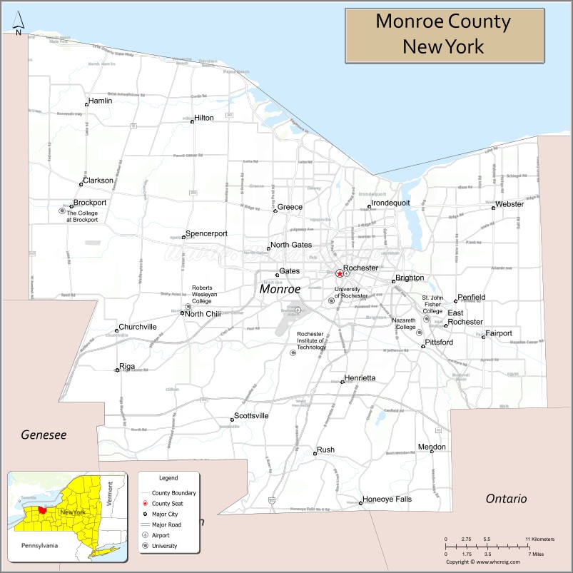
Monroe County Road Map

Geography
According to the U.S. Census Bureau, the county’s total area is 1,367 square miles (3,540 km), of which 657 square miles (1,700 km) is land and 710 square miles (1,800 km) (52%) is water.
Monroe County is in Western State of New York’s northern tier, northeast of Buffalo and northwest of Syracuse. The northern county line is also the state line and the border of the United States, marked by Lake Ontario. Monroe County is north of the Finger Lakes.
Adjacent counties
- Wayne County – east
- Ontario County – southeast
- Livingston County – south
- Orleans County – west
- Genesee County – southwest
Major highways
- I-90 Toll / New York Thruway
- I-390
- I-490
- I-590
- New York State Route 15
- New York State Route 15A
- New York State Route 18
- New York State Route 19
- New York State Route 31
- New York State Route 31F
- New York State Route 33
- New York State Route 33A
- New York State Route 36
- New York State Route 64
- New York State Route 65
- New York State Route 96
- New York State Route 104
- New York State Route 153
- New York State Route 250
- New York State Route 251
- New York State Route 252
- New York State Route 259
- New York State Route 286
- New York State Route 390
- New York State Route 404
- New York State Route 441
- New York State Route 531
- New York State Route 590
- Lake Ontario State Parkway
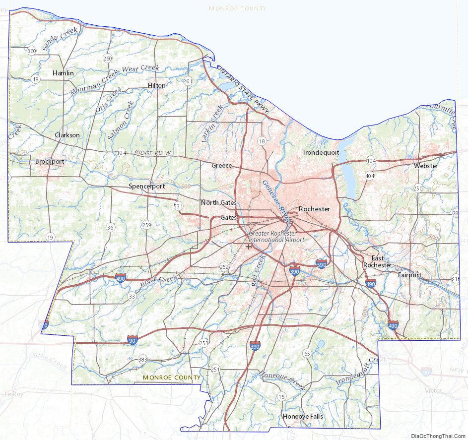
Monroe County Topographic Map
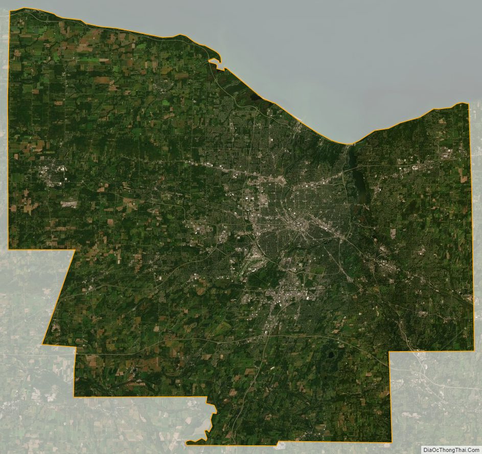
Monroe County Satellite Map
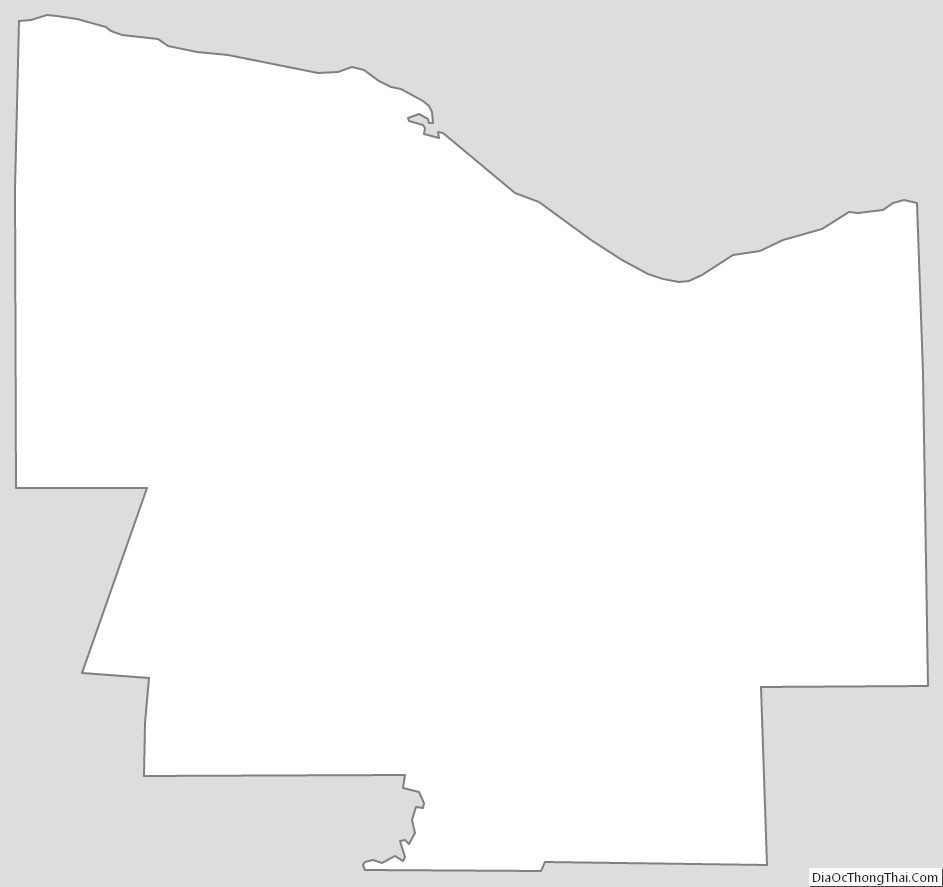
Monroe County Outline Map