Pennington County is a county in the U.S. state of South Dakota. As of the 2020 census, the population was 109,222, making it the second-most populous county in South Dakota. Its county seat is Rapid City. The county was created in 1875, and was organized in 1877. It is named for John L. Pennington, fifth Governor of Dakota Territory, who held office in 1875 when the county was formed.
Pennington County is included in the Rapid City metropolitan statistical area. It is also the location of Mount Rushmore.
| Name: | Pennington County |
|---|---|
| FIPS code: | 46-103 |
| State: | South Dakota |
| Founded: | 1875 |
| Named for: | John L. Pennington |
| Seat: | Rapid City |
| Largest city: | Rapid City |
| Total Area: | 2,784 sq mi (7,210 km²) |
| Land Area: | 2,777 sq mi (7,190 km²) |
| Total Population: | 109,222 |
| Population Density: | 40/sq mi (20/km²) |
| Time zone: | UTC−7 (Mountain) |
| Summer Time Zone (DST): | UTC−6 (MDT) |
| Website: | www.co.pennington.sd.us |
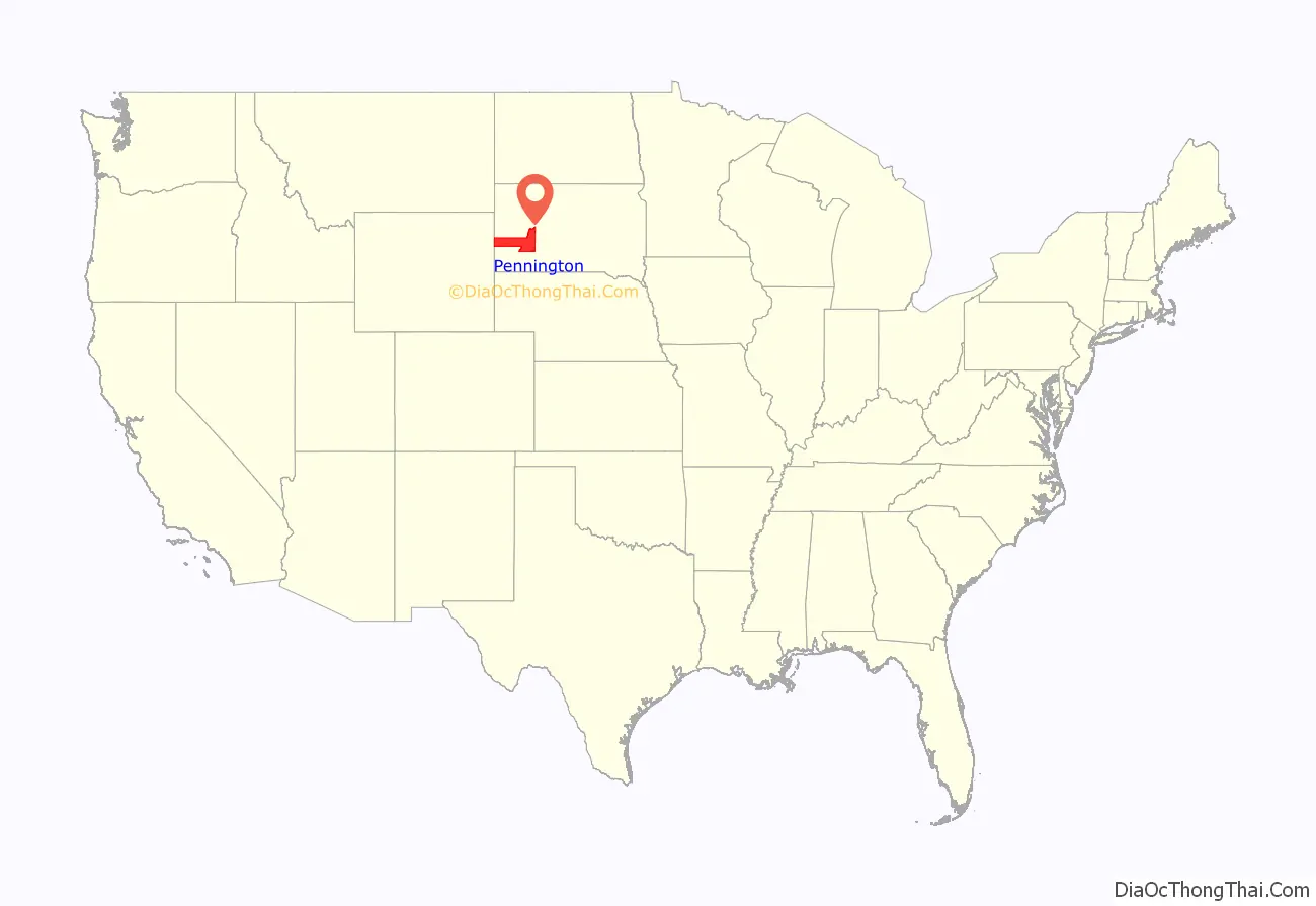
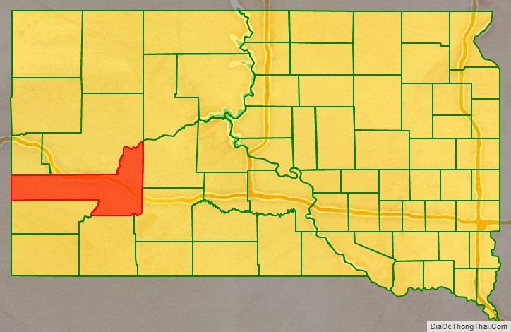
Pennington County location map. Where is Pennington County?
History
In 1874, US Army commander George A. Custer led a group into the Black Hills area. He and some of his officers climbed the crest now called Black Elk Peak, and made a toast to US General William S. Harney. They named the peak for Harney, and this name was used until 2016. This expedition reported that gold could be found in the Black Hills, which spurred a gold rush into the future county area. The mining settlements that sprang up were in violation of a treaty signed with the Sioux Nation in 1868. By 1875, settlement was sufficient to justify creation of a local governing organization, so Pennington County was created on January 11, 1875, and it was fully organized by April 19, 1877. The county’s boundaries were adjusted in 1877 and in 1898.
The county seat was initially at Sheridan, a mining camp. (Sheridan is credited with hosting the first Federal Court west of the Missouri River.) In 1878, the county seat was moved to Rapid City.
In 1923, Doane Robinson, superintendent of the SD State Historical Society, began promoting the concept of a giant sculpture carved from a Black Hills mountain. By 1927 this concept took substance, when work on Mount Rushmore began.
Shortly after the US entered World War II, an Army training airbase was established in Pennington County. It has continued until the present, now known as Ellsworth Air Force Base. Supporting this activity has provided a substantial portion of the county’s economic base since that time.
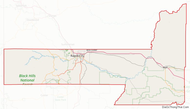
Pennington County Road Map
Geography
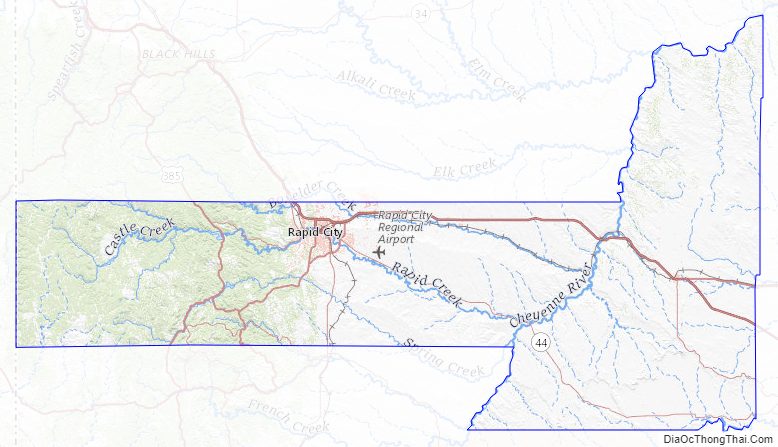
Pennington County is located on the west line of South Dakota. Its west boundary line abuts the east boundary line of the state of Wyoming. Its west end contains the nation’s highest peak east of the continental divide, Black Elk Peak. The rugged arid western end contains forest and gullies, descendending to rough rolling hill country in the east. The Cheyenne River flows north-northeastward through the center of the county and then along its northeastern border on its way to discharge in the Missouri River, while Rapid Creek flows east-southeastward through the western part, to discharge into the Cheyenne at the county’s midpoint. The county terrain varies in elevation from Black Elk Peak at 7,242′ (2207m) to its NE corner, at 1,896′ (578m) ASL.
Pennington County has a total area of 2,784 square miles (7,210 km), of which 2,777 square miles (7,190 km) is land and 7.7 square miles (20 km) (0.3%) is water. It is the third-largest county in South Dakota by area.
Major highways
- Interstate 90
- U.S. Highway 14
- U.S. Highway 16
- U.S. Highway 16A
- U.S. Highway 385
- South Dakota Highway 40
- South Dakota Highway 44
- South Dakota Highway 240
- South Dakota Highway 244
Adjacent counties
- Meade County – north
- Ziebach County – northeast
- Haakon County – northeast
- Jackson County – southeast
- Oglala Lakota County – south
- Custer County – southwest
- Weston County, Wyoming – west
- Lawrence County – northwest
National protected areas
- Badlands National Park (part)
- Badlands Wilderness
- Black Hills National Forest (part)
- Black Elk Wilderness (part)
- Buffalo Gap National Grassland (part)
- Minuteman Missile National Historic Site (part)
- Mount Rushmore National Memorial
Lakes and reservoirs
- Deerfield Lake
- Pactola Reservoir
- Shearer Lake
- Sheridan Lake
Pennington County Topographic Map
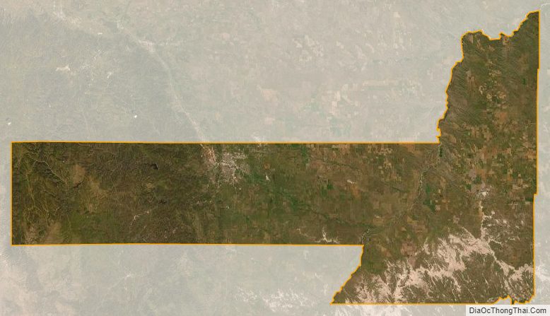
Pennington County Satellite Map
Pennington County Outline Map