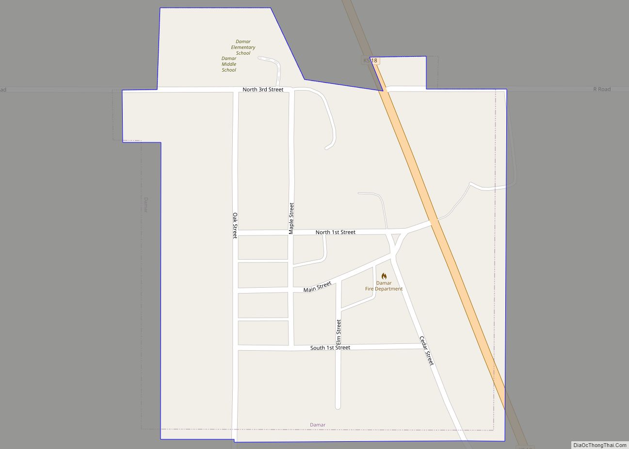
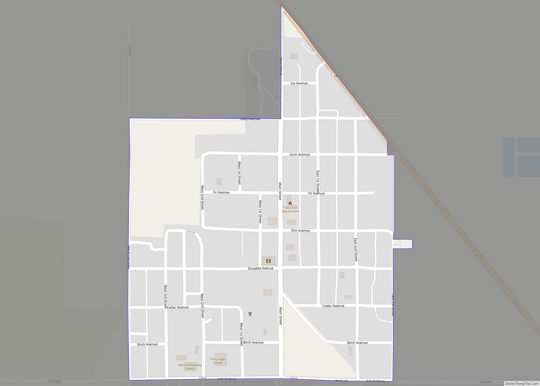
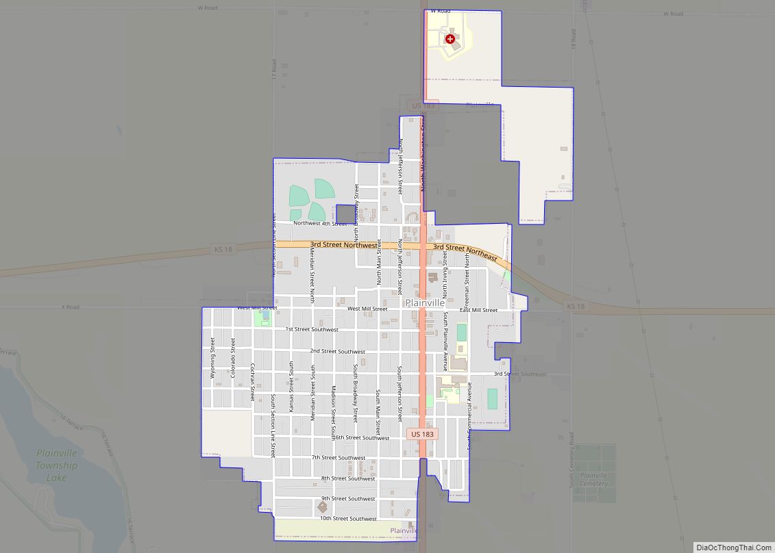
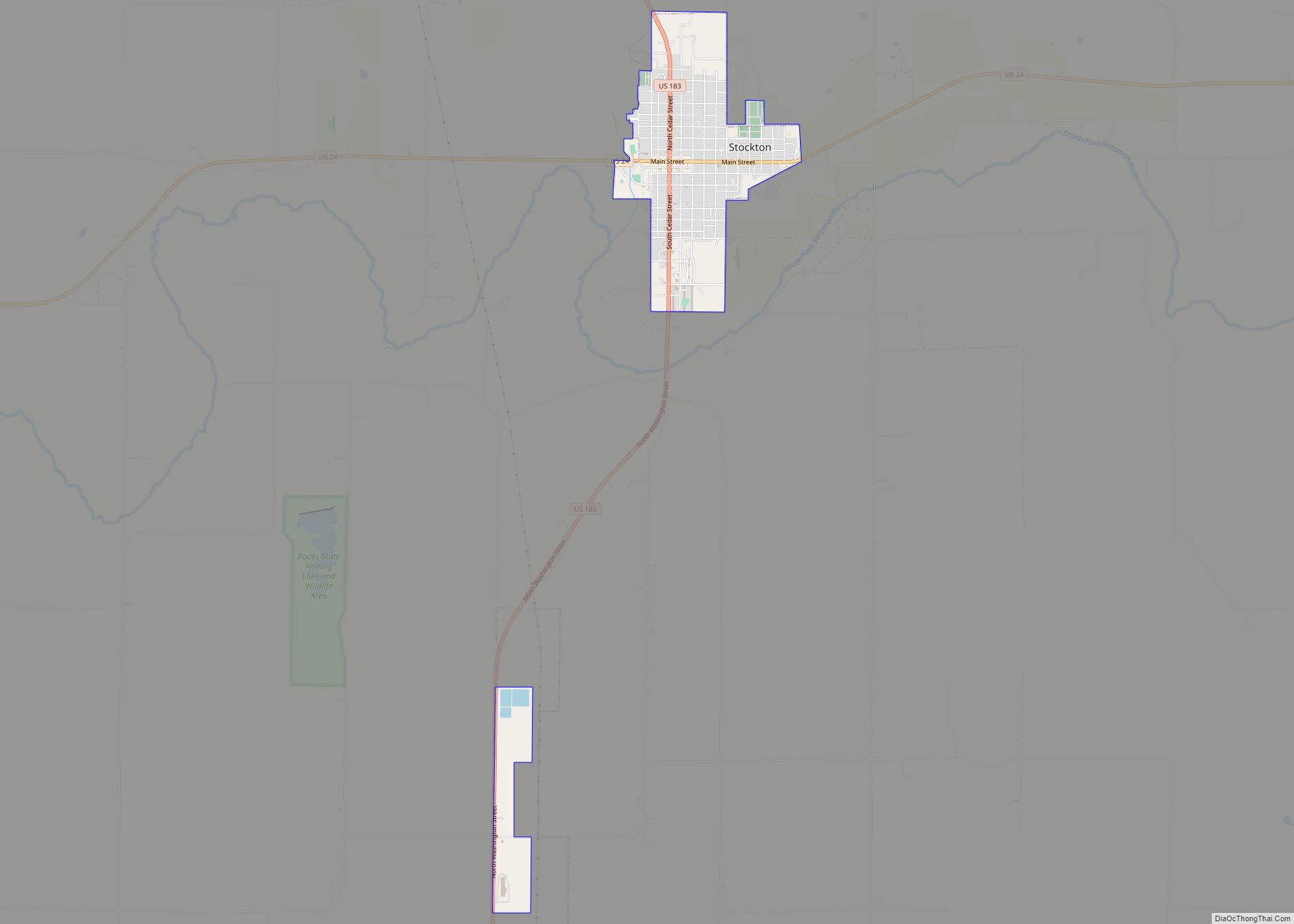
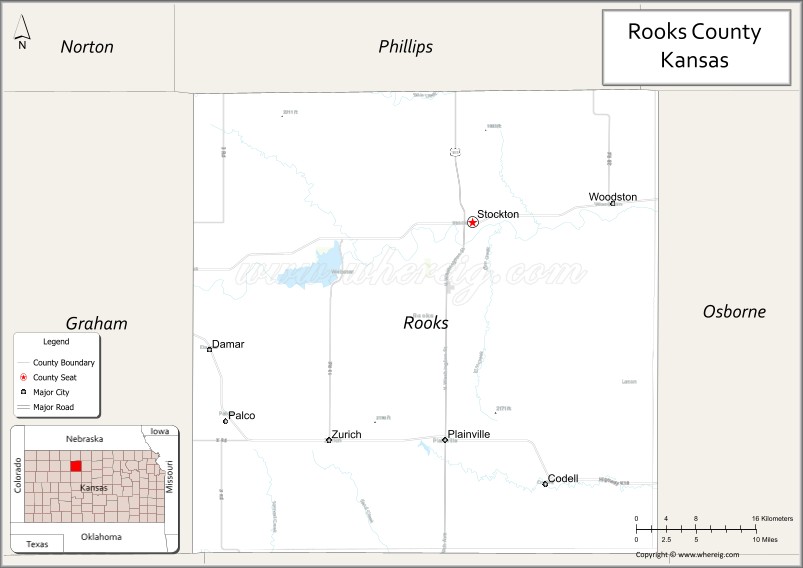
Rooks County (standard abbreviation: RO) is a county located in the U.S. state of Kansas. As of the 2020 census, the county population was 4,919. The county seat is Stockton, and the largest city is Plainville. The county was named for Private John C. Rooks of the 11th Kansas Infantry who died at the Battle of Prairie Grove near Fayetteville, Arkansas, during the Civil War.
| Name: | Rooks County |
|---|---|
| FIPS code: | 20-163 |
| State: | Kansas |
| Founded: | February 26, 1867 |
| Named for: | John C. Rooks |
| Seat: | Stockton |
| Largest city: | Plainville |
| Total Area: | 895 sq mi (2,320 km²) |
| Land Area: | 891 sq mi (2,310 km²) |
| Total Population: | 4,919 |
| Population Density: | 5.5/sq mi (2.1/km²) |
| Time zone: | UTC−6 (Central) |
| Summer Time Zone (DST): | UTC−5 (CDT) |
| Website: | rookscounty.net |
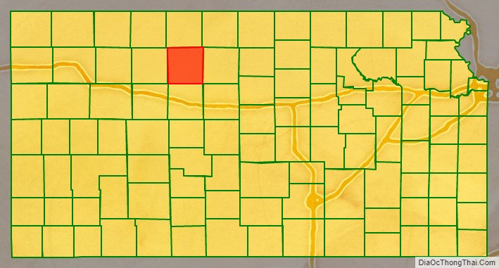
Rooks County location map. Where is Rooks County?

History
Early history
For many millennia, the Great Plains of North America was inhabited by nomadic Native Americans. From the 16th century to 18th century, the Kingdom of France claimed ownership of large parts of North America. In 1762, after the French and Indian War, France secretly ceded New France to Spain, per the Treaty of Fontainebleau.
19th century
In 1802, Spain returned most of the land to France, but keeping title to about 7,500 square miles. In 1803, most of the land for modern day Kansas was acquired by the United States from France as part of the 828,000 square mile Louisiana Purchase for 2.83 cents per acre.
In 1854, the Kansas Territory was organized, then in 1861 Kansas became the 34th U.S. state. In 1867, Rooks County was established.
In 1881, the first county courthouse was built in Stockton. The county jail was built nearby from cottonwood logs strengthened by tons of iron.
20th century
In 1923, a new courthouse opened in Stockton. The Rooks County Courthouse was added to the National Register of Historic Places in 2002.
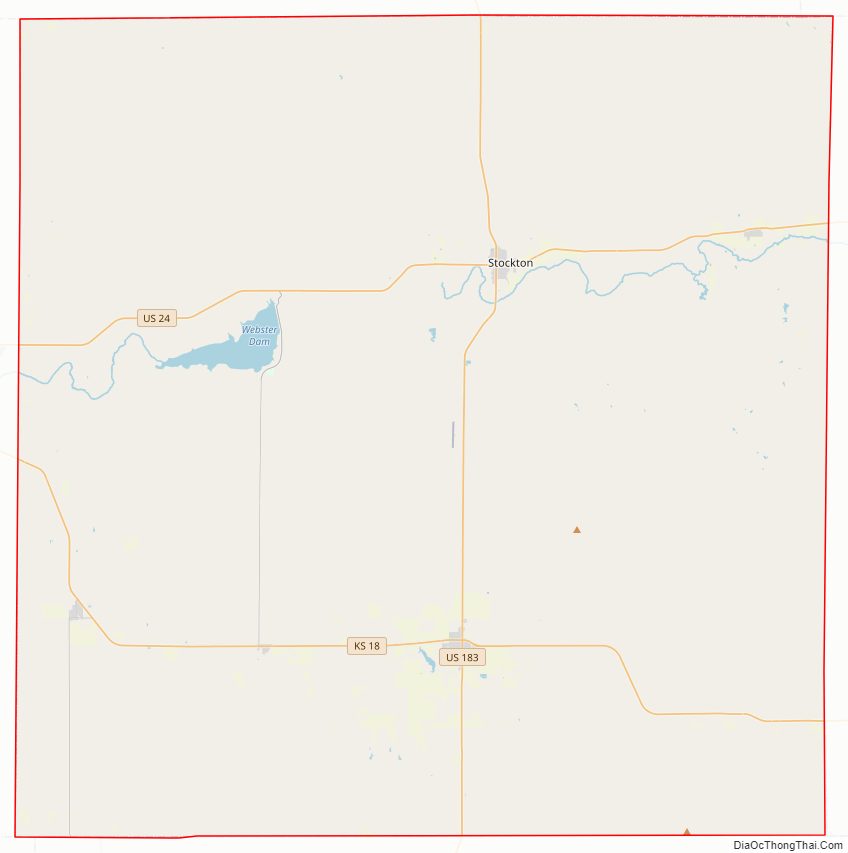
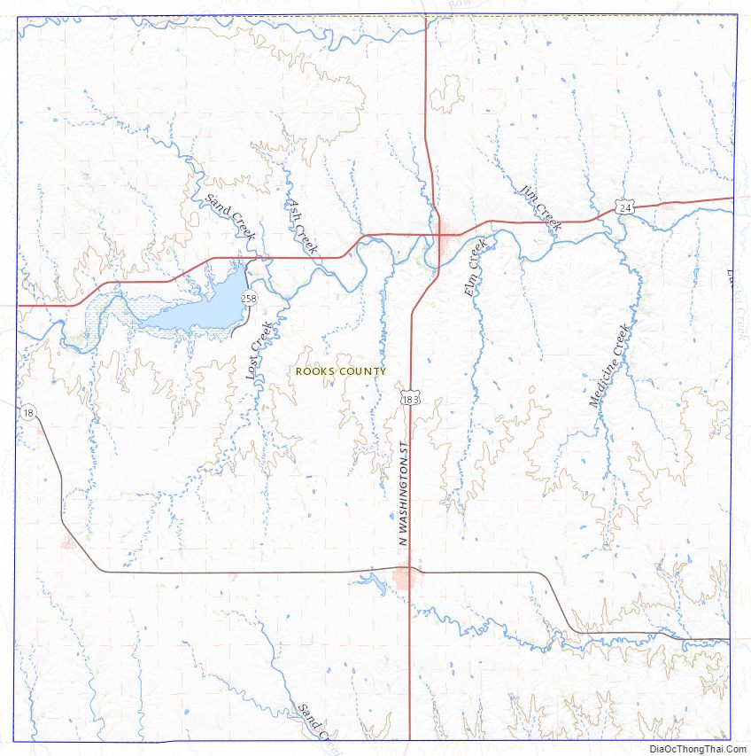
Rooks County Road Map
Geography
According to the U.S. Census Bureau, the county has a total area of 895 square miles (2,320 km), of which 891 square miles (2,310 km) is land and 4.6 square miles (12 km) (0.5%) is water.
Adjacent counties
- Phillips County (north)
- Smith County (northeast)
- Osborne County (east)
- Ellis County (south)
- Trego County (southwest)
- Graham County (west)
Rooks County Topographic Map
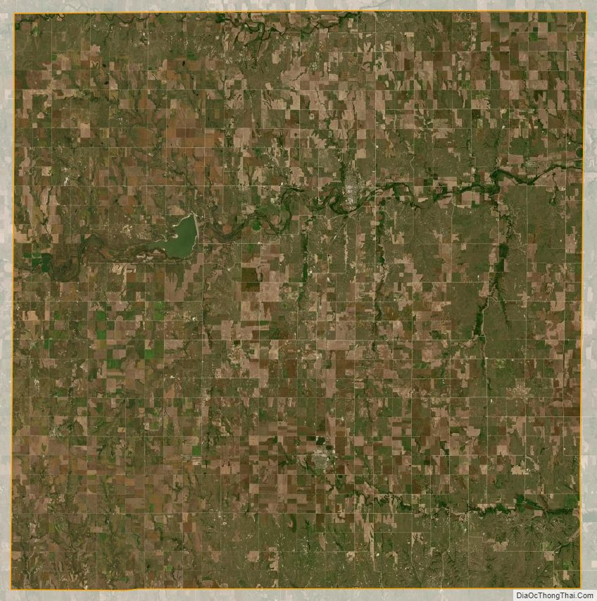
Rooks County Satellite Map
Rooks County Outline Map