Fayetteville (/ˈfeɪətvɪl/) is the second-largest city in Arkansas, the county seat of Washington County, and the biggest city in Northwest Arkansas. The city is on the outskirts of the Boston Mountains, deep within the Ozarks. Known as Washington until 1829, the city was named after Fayetteville, Tennessee, from which many of the settlers had come. It was incorporated on November 3, 1836, and was rechartered in 1867. Fayetteville is included in the three-county Northwest Arkansas Metropolitan Statistical Area, which is ranked 102nd in terms of population in the United States with 560,709 in 2021 according to the United States Census Bureau. The city had a population of 95,230 in 2021.
Fayetteville is home to the University of Arkansas, the state’s flagship university. When classes are in session, thousands of students on campus change up the pace of the city. Thousands of Arkansas Razorbacks alumni and fans travel to Fayetteville to attend football, basketball, and baseball games. The city of Fayetteville is colloquially known as the “Track Capital of the World” due to the success and prestige of the University of Arkansas cross country and track & field programs. The University’s men’s cross country and track and field programs have won a combined 41 national championships to date with the women’s teams adding 5 national championships since 2015.
The city is the first in America to be awarded the designation of “Bike City” by the Union Cycliste Internationale (UCI), the world governing body of cycling. It was given the title in 2021 due to it not only hosting major UCI cycling events, but also its work in developing cycling through programs and infrastructure.
The city hosts the Walmart Shareholders Meetings each year at the Bud Walton Arena.
| Name: | Fayetteville city |
|---|---|
| LSAD Code: | 25 |
| LSAD Description: | city (suffix) |
| State: | Arkansas |
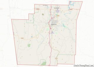
| County: | Washington County |
| Founded: | 1828 |
| Incorporated: | 1836 |
| Elevation: | 1,378 ft (420 m) |
| Land Area: | 54.42 sq mi (140.96 km²) |
| Water Area: | 1.38 sq mi (3.57 km²) |
| Population Density: | 1,726.21/sq mi (666.49/km²) |
| ZIP code: | 72701–72704 |
| Area code: | 479 |
| FIPS code: | 0523290 |
| GNISfeature ID: | 2403601 |
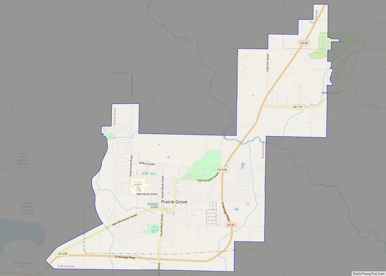
Online Interactive Map
Click on ![]() to view map in "full screen" mode.
to view map in "full screen" mode.
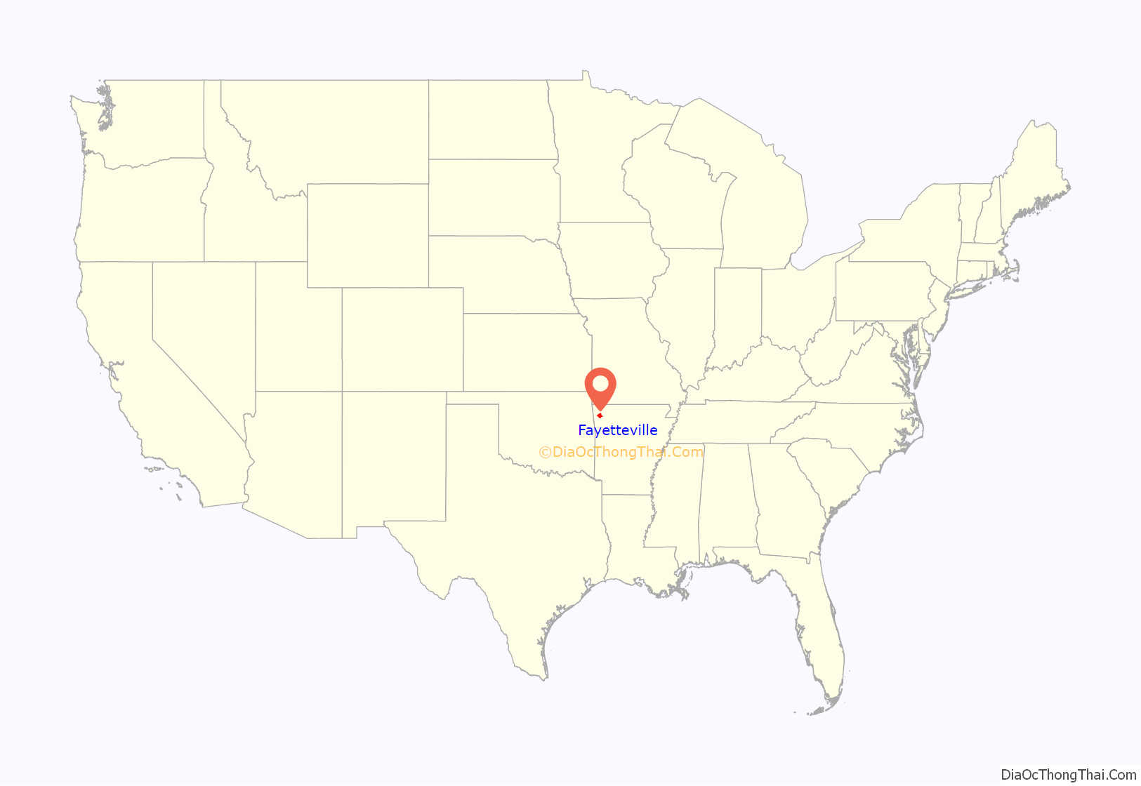
Fayetteville location map. Where is Fayetteville city?

History
Settlement through Antebellum period
In 1828, George McGarrah settled at Big Spring with his family on the modern day corner of Spring and Willow, founding the town of Washington, and starting work on the courthouse. On October 17, Washington County was established, Washington chosen as the county seat. The Washington Courthouse was finished in 1829, and also contained the post office. Later in the year Postmaster Larkin Newton changed the name to the Fayetteville Courthouse, to avoid confusing with Washington, Hempstead County. Two councilmen selected to name the city were from Fayetteville, Tennessee, which was itself named for Fayetteville, North Carolina (where some of its earliest residents had lived before moving to Tennessee). That original Fayetteville was named for General Lafayette, a French general who helped the colonies gain independence in the American Revolutionary War.
The first store in Fayetteville was opened by John Nye in a small building constructed by James Holmsley. In 1832 David Walker, Chief Justice of the Arkansas supreme court, built a double log cabin on what is now Center Street. In 1822 Archibald Yell, the second Governor of Arkansas, built a house and called it “Waxhaw” after his home in North Carolina. This was on the outskirts of town then but now is a street named after him that connects College and School streets. The first hotels were the Burnside House and the Onstott House. Fayetteville was incorporated as a town on November 3, 1836.
In 1859, a city charter was obtained from the Legislature. During the Civil War the municipal government was suspended and was not reinstated until 1867. P.V. Rhea was the president of the town trustees in 1836; J.W. Walker was the first mayor under the charter of 1859, and M.L. Harrison was the first mayor when the government was reorganized in 1867. The telegraph came to Fayetteville in 1860, strung along the Military Road from St. Louis, Missouri, to Little Rock.
Civil War and Reconstruction
During the American Civil War, the Union General Samuel Ryan Curtis occupied Fayetteville on February 18, 1862, and the following week, the Battle of Pea Ridge took place northeast of Fayetteville. The city housed wounded soldiers from the Battle of Prairie Grove in December 1862, and housed injured troops on Dickson Street. Confederate troops besieged Union soldiers in Fayetteville on April 18, 1863, at the present-day intersection of College Avenue (U.S. Route 71B) and Dickson Street, and at their headquarters. Union soldiers held the city against cannon fire and cavalry attacks, although their headquarters sustained damage. The building was restored and is operated as the Headquarters House, a museum of the Washington County Historical Society. Fayetteville was occupied from December 1862 until May 1865 (except May–September 1863) by the First Arkansas Union Cavalry, a regiment of Union men from Northwest Arkansas. Union forces repelled a Confederate attack in October 1864. After the war, the United States government established the Fayetteville National Cemetery in 1867. A cemetery for Confederate dead was founded in 1873.
Newspapers were established early; in 1859, Elias Cornelius Boudinot, a young half-Cherokee attorney, and James Pettigrew founded The Arkansan. The Fayetteville Weekly Democrat began publishing in 1868. It later developed as the Northwest Arkansas Times, and is still in print today. The Fayetteville Schools District was founded on March 20, 1871, as the first independent school district in Arkansas. The public school system was established by the Reconstruction era legislature; before the war, all education was private. Arkansas had struggled with a state banking crisis, resulting in the illegality of banking until 1868. Following the reinstatement, the Stark Bank became the first bank in the state in 1872, becoming the William McIlroy Bank four years later. This institution remains today as Arvest Bank.
School integration
In 1954, a few days after Charleston, Fayetteville was the second school district in the southern United States to implement school integration in response to Brown v. Board of Education.
Fayetteville Road Map

Fayetteville city Satellite Map

Geography
Missouri, and Eastern Oklahoma. The rocks of the Boston Mountains were formed when sandstones and shales were deposited on top of the Springfield Plateau during the Pennsylvanian Period. In the Fayetteville area, following uplift during the Ouachita orogeny, the sediments were eroded to expose the Mississippian limestone formations of the Springfield Plateau, while south of Fayetteville the remaining deeply eroded Pennsylvanian sediments form the steep Boston Mountains.
Fayetteville is also the namesake of the Fayetteville Shale, a geological formation which has recently become an epicenter for natural gas extraction by hydraulic fracturing.
Metropolitan area
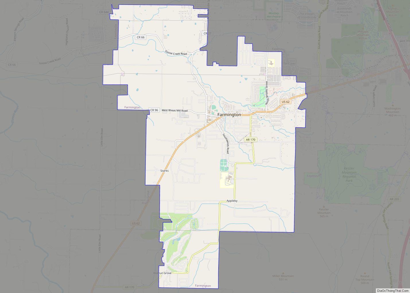
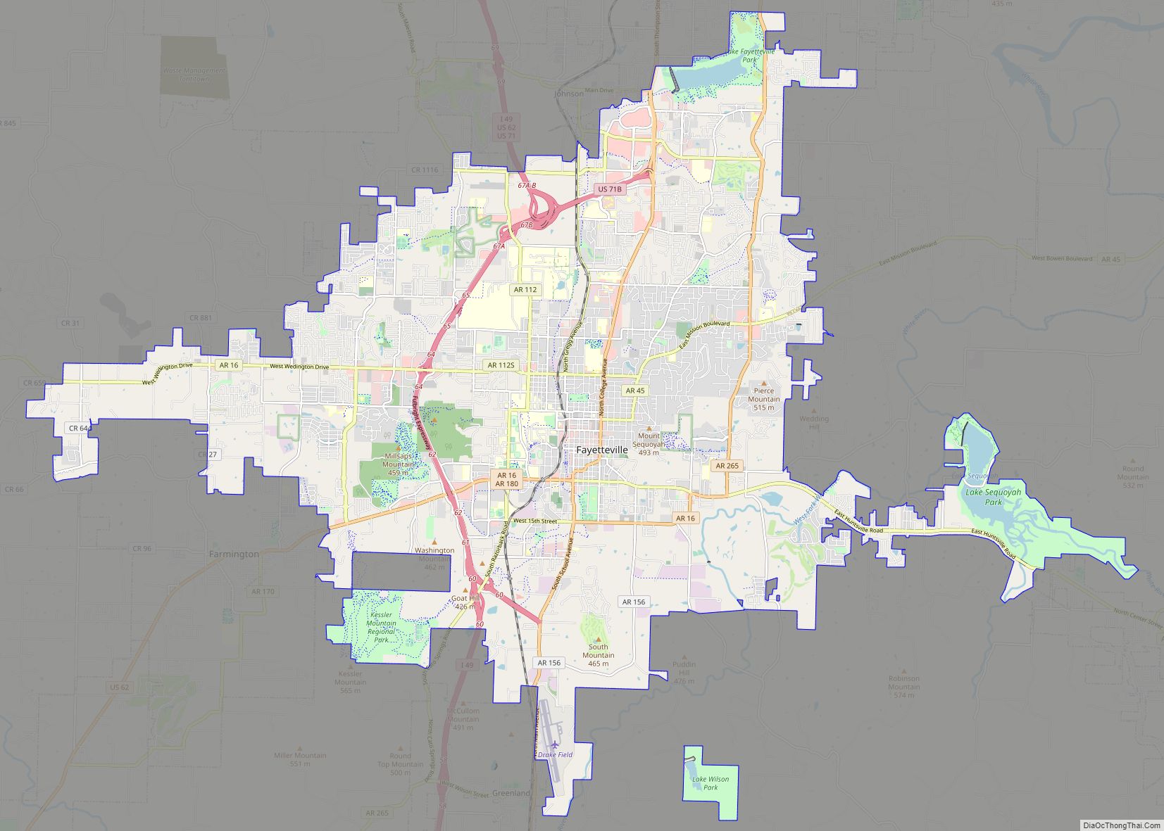
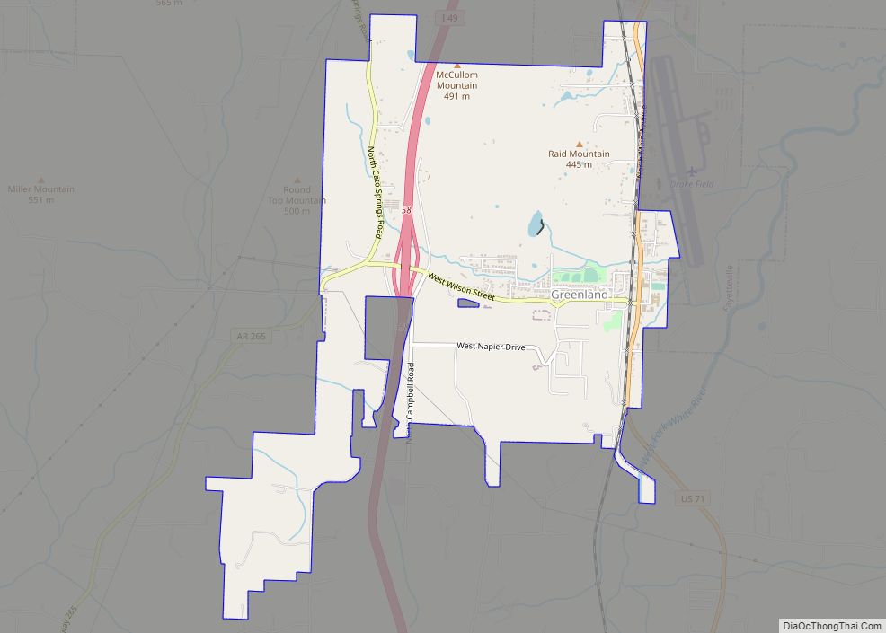
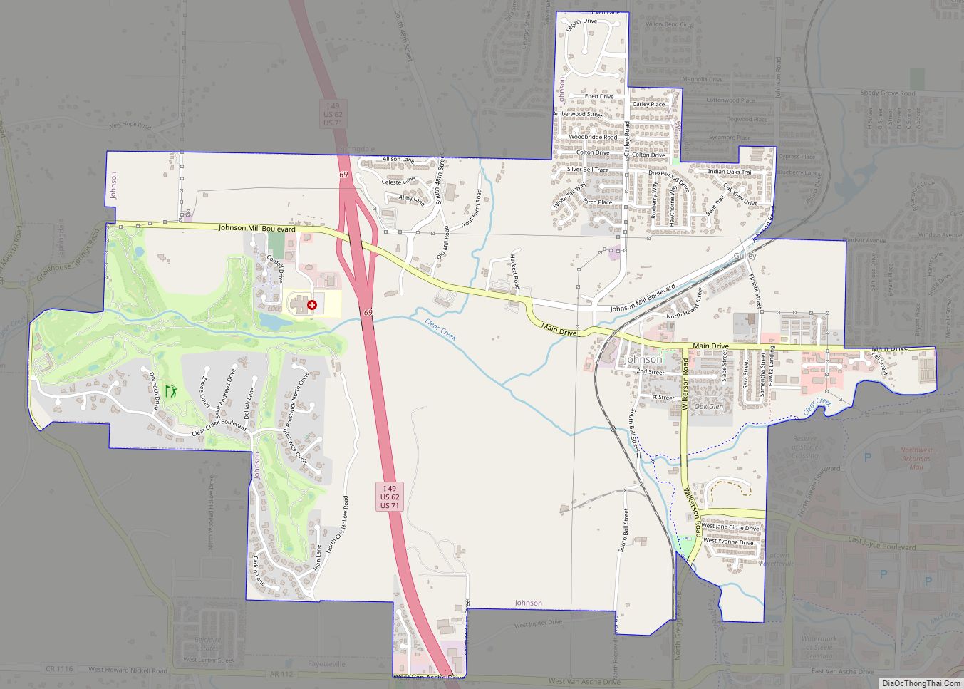
According to the United States Census Bureau, the city has a total area of 55.2 square miles (143 km), of which, 53.8 square miles (139 km) of it is land and 1.4 square miles (3.6 km) of it (2.59%) is water. The city is centrally located in Washington County, Arkansas, along Interstate 49/US Route 71. This is the only fully controlled access route through the area, which replaced the winding US 71 (now US 71B) in the 1990s. An interstate connection with Fort Smith to the south and Kansas City, Missouri, to the north has contributed to Fayetteville’s growth. Within Washington County, Fayetteville is bordered along the north by Springdale and Johnson. At times, this transition is seamlessly urban. Fayetteville is not bordered to its south, instead opening up to scenic country along the Boston Mountains Scenic Loop. Past the rural communities of Greenland and West Fork is Devil’s Den State Park. To the west is Farmington along US Route 62 and to the east is undeveloped land in rural Washington County.
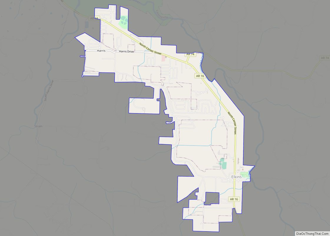
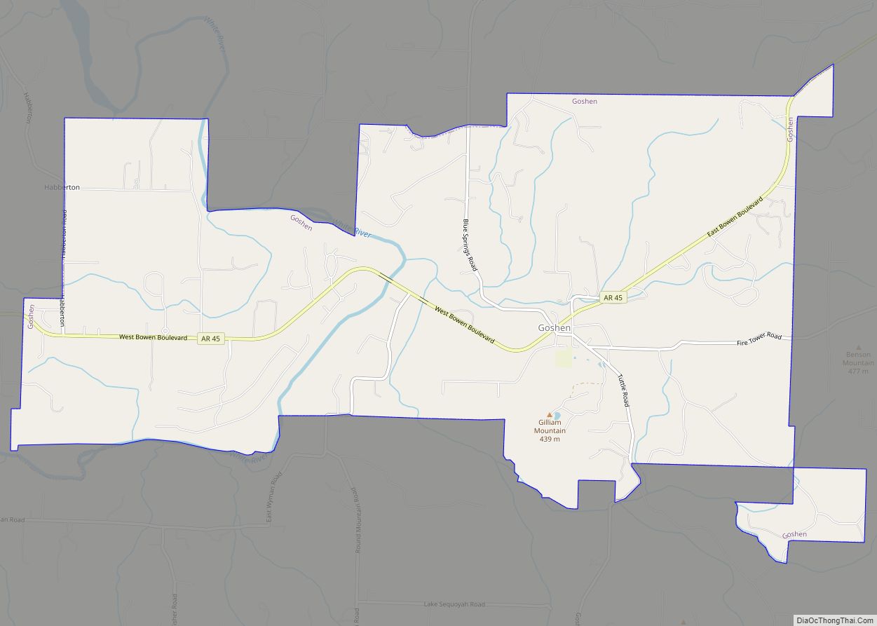
The Fayetteville–Springdale–Rogers Metropolitan Area consists of three Arkansas counties: Benton, Madison, and Washington. The area had a population of 463,205 at the 2010 census which had increased to 546,725 by the 2020 Census (an increase of 24.2 per cent). Although the Metropolitan Statistical Area does not consist of the usual principal-city-with-suburbs geography, Fayetteville’s adjacent communities include Elkins, Farmington, Greenland, Habberton, Johnson, and Wyman.
Districts
Fayetteville is entirely contained within Fayetteville Township, as the township and city have identical boundaries. Although Arkansas generally does not use its civil townships for any governmental purpose, they are used for voting boundaries in some places.
Generally the part of Fayetteville west of I-49/US 71 is called west Fayetteville. Another prominent district is Uptown Fayetteville, which encompasses the scores of business and new homes near the Northwest Arkansas Mall in north Fayetteville. The University of Arkansas defines its own part of Fayetteville, with dozens of student apartments and restaurants located near campus. The University’s impact is also apparent along College Avenue, which contains hundreds of shops and restaurants. Northeast of campus are the Wilson Park Historic District and the Mount Nord Historic District. The Fayetteville Historic Square is the original city center of Fayetteville, and Dickson Street is the best-known entertainment district in Arkansas. Homes atop Mount Sequoyah in the eastern part of the city encircle Mount Sequoyah Retreat and Conference Center. Old structures are also located along the former Butterfield Overland Mail route, a stagecoach route to San Francisco, California, now known as Old Wire Road. Fifteenth Street forms the southernmost residential district of Fayetteville, with the Fayetteville Industrial Park to its east.
Fayetteville has annexed six unincorporated communities within its current corporate limits. Four of them are still listed as “populated places” by the USGS Board on Geographic Names. The other 2 are listed as “historical populated places.” Annexations since 1870 are displayed on Fayetteville’s website in the interactive maps section. Fayetteville’s second annexations took place in 1946 when it incorporated Fayette Junction and McNair into the city. Baldwin was added the following year, with Barbara and Ruckers Grove being annexed in 1967. Fayetteville’s most recent annexation occurred in 1982 when White Rock was added to the city limits.
Climate
Fayetteville has a humid subtropical climate (Köppen Cfa). Fayetteville experiences all four seasons and does receive cold air masses from the north; however, some of the Arctic masses are blocked by the higher elevations of the Ozarks.
July is the hottest month of the year, with an average high of 88.7 °F (31.5 °C) and an average low of 69.4 °F (20.8 °C). Temperatures above 100 °F (38 °C) are rare but do occur, on average, 3 times a year. January is the coldest month with an average high of 46.5 °F (8.1 °C) and an average low of 26.9 °F (−2.8 °C). Highs below 32 °F (0 °C) occur on average 10.4 times a year, with 0.6 nights per year dropping below 0 °F (−18 °C). The city’s highest temperature was 111 °F (43.9 °C), recorded on July 14, 1954. The lowest temperature recorded was −24 °F (−31 °C), on February 12, 1899.
Precipitation is weakly seasonal, with a bimodal pattern: wet seasons in the spring and fall, and relatively drier summers and winters, but some rain in all months. The spring wet season is more pronounced than fall, with the highest rainfall in May. This differs slightly from the climate in central Arkansas, where the fall wet season is more comparable to spring.
See also
Map of Arkansas State and its subdivision:- Arkansas
- Ashley
- Baxter
- Benton
- Boone
- Bradley
- Calhoun
- Carroll
- Chicot
- Clark
- Clay
- Cleburne
- Cleveland
- Columbia
- Conway
- Craighead
- Crawford
- Crittenden
- Cross
- Dallas
- Desha
- Drew
- Faulkner
- Franklin
- Fulton
- Garland
- Grant
- Greene
- Hempstead
- Hot Spring
- Howard
- Independence
- Izard
- Jackson
- Jefferson
- Johnson
- Lafayette
- Lawrence
- Lee
- Lincoln
- Little River
- Logan
- Lonoke
- Madison
- Marion
- Miller
- Mississippi
- Monroe
- Montgomery
- Nevada
- Newton
- Ouachita
- Perry
- Phillips
- Pike
- Poinsett
- Polk
- Pope
- Prairie
- Pulaski
- Randolph
- Saint Francis
- Saline
- Scott
- Searcy
- Sebastian
- Sevier
- Sharp
- Stone
- Union
- Van Buren
- Washington
- White
- Woodruff
- Yell
- Alabama
- Alaska
- Arizona
- Arkansas
- California
- Colorado
- Connecticut
- Delaware
- District of Columbia
- Florida
- Georgia
- Hawaii
- Idaho
- Illinois
- Indiana
- Iowa
- Kansas
- Kentucky
- Louisiana
- Maine
- Maryland
- Massachusetts
- Michigan
- Minnesota
- Mississippi
- Missouri
- Montana
- Nebraska
- Nevada
- New Hampshire
- New Jersey
- New Mexico
- New York
- North Carolina
- North Dakota
- Ohio
- Oklahoma
- Oregon
- Pennsylvania
- Rhode Island
- South Carolina
- South Dakota
- Tennessee
- Texas
- Utah
- Vermont
- Virginia
- Washington
- West Virginia
- Wisconsin
- Wyoming