Van Buren County is a county located in the U.S. state of Arkansas. As of the 2020 census, the population was 15,796. The county seat is Clinton. The county was formed on November 11, 1833, and named for Martin Van Buren, President of the United States, who was Vice President at the time of the county’s formation. Van Buren County was a dry county until November 3, 2020 as the county residents voted to make it a wet county.
Van Buren County should not be confused with the city of Van Buren, which is located approximately 100 miles to the west in Crawford County just north of Fort Smith.
| Name: | Van Buren County |
|---|---|
| FIPS code: | 05-141 |
| State: | Arkansas |
| Founded: | November 11, 1833 |
| Named for: | Martin Van Buren |
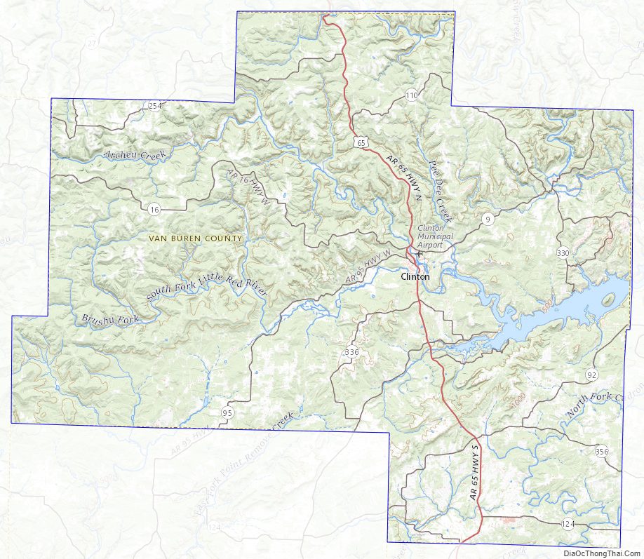
| Seat: | Clinton |
| Largest city: | Clinton |
| Total Area: | 724 sq mi (1,880 km²) |
| Land Area: | 708 sq mi (1,830 km²) |
| Total Population: | 15,796 |
| Population Density: | 22/sq mi (8.4/km²) |
| Time zone: | UTC−6 (Central) |
| Summer Time Zone (DST): | UTC−5 (CDT) |
| Website: | www.vanburencountyark.com |
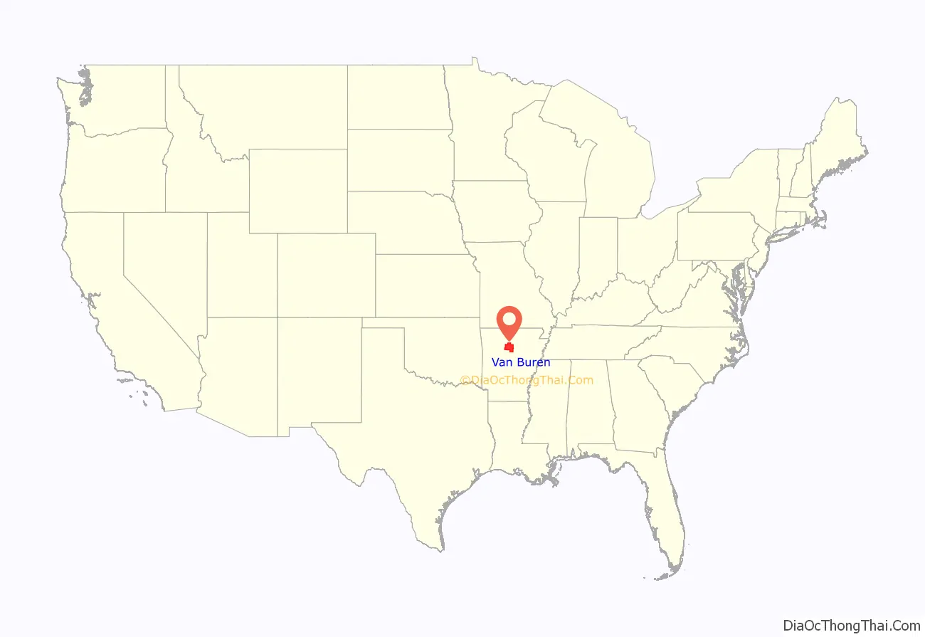
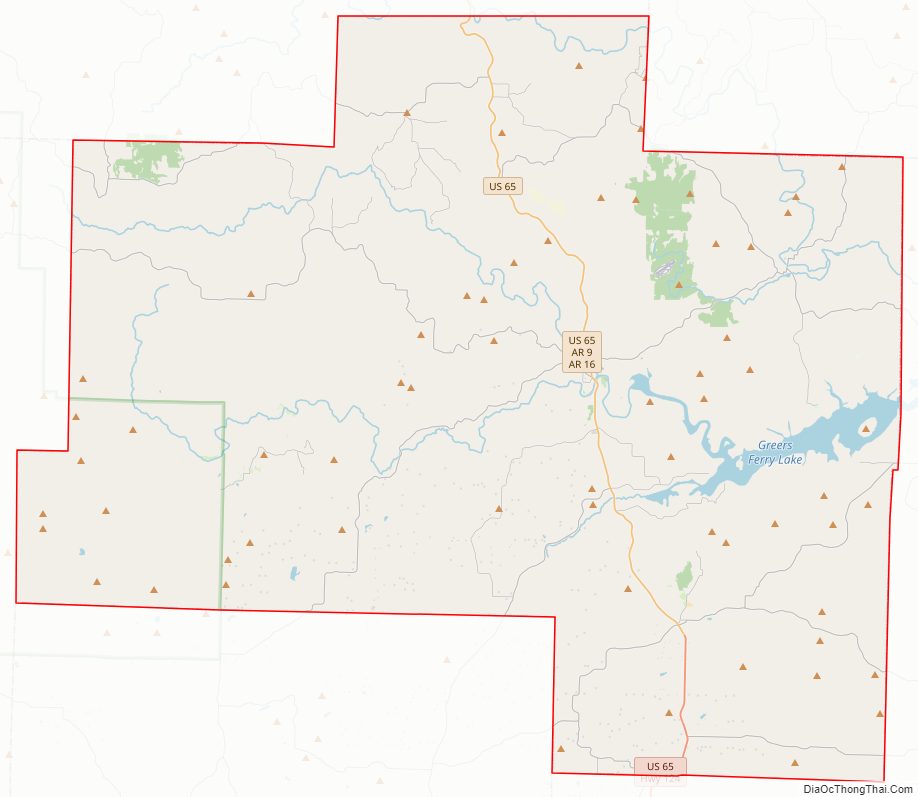
Van Buren County location map. Where is Van Buren County?
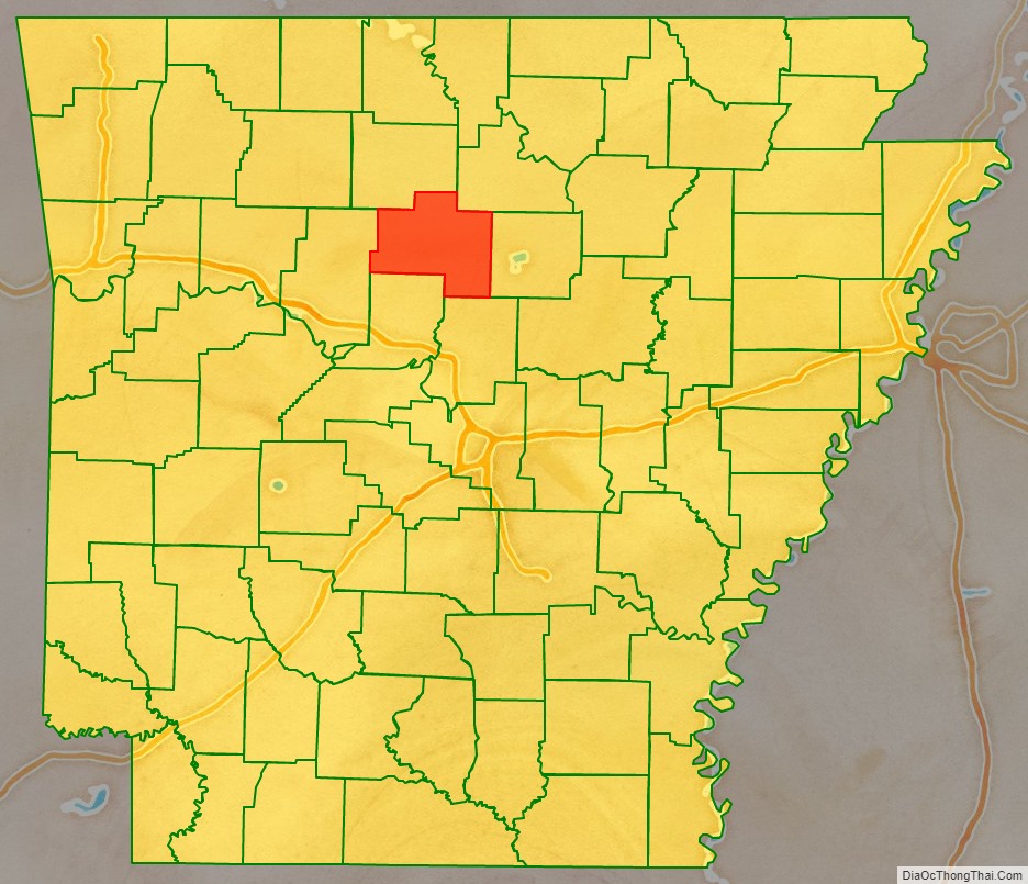
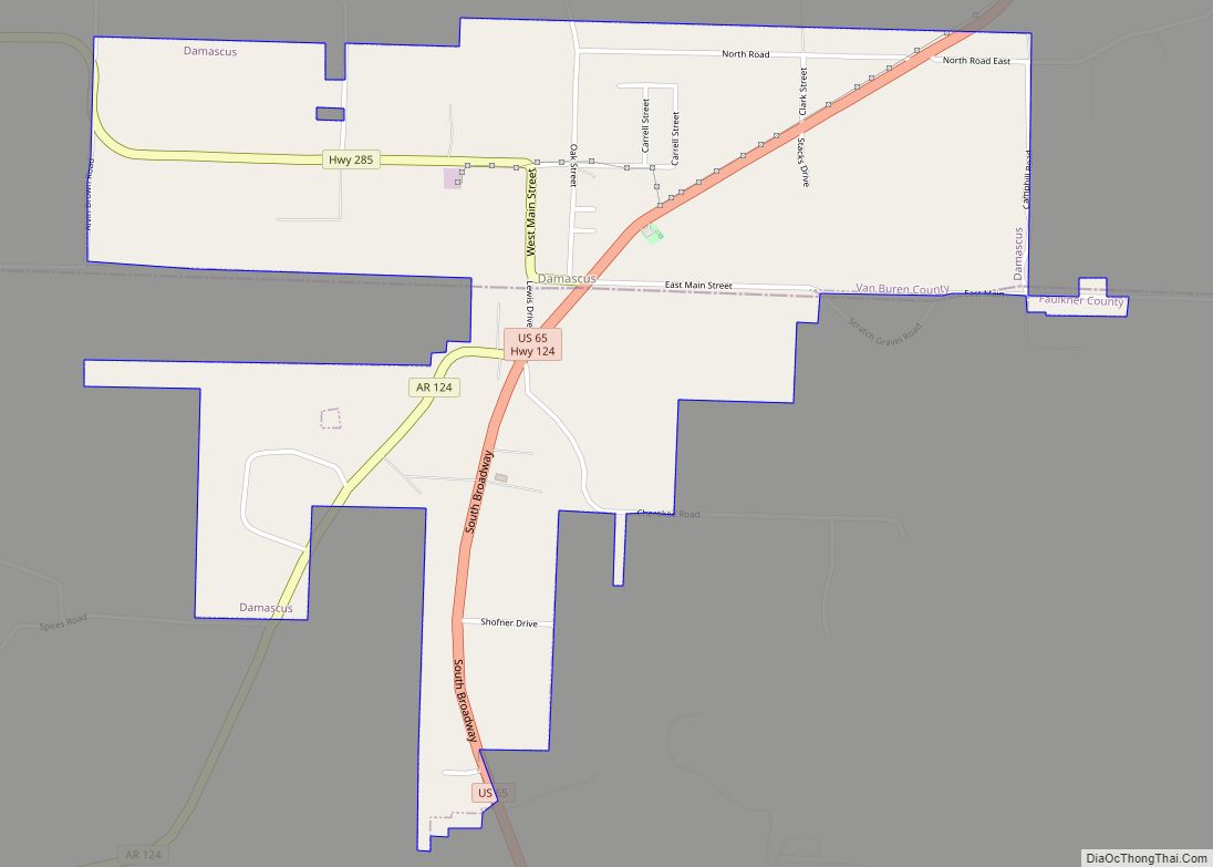
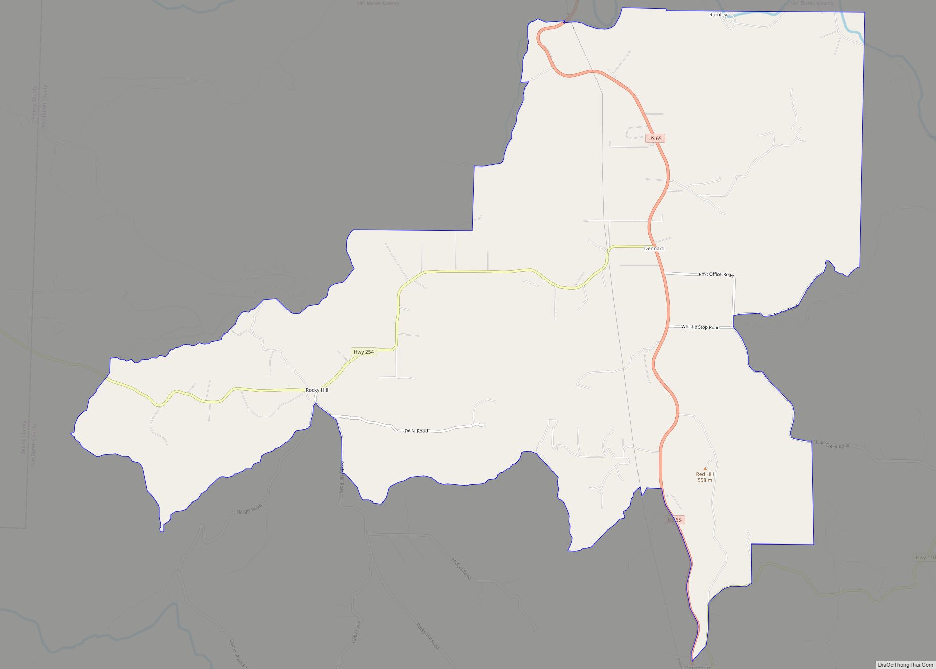
Van Buren County Road Map
Geography
According to the U.S. Census Bureau, the county has a total area of 724 square miles (1,880 km), of which 708 square miles (1,830 km) is land and 16 square miles (41 km) (2.2%) is water.
Major highways
- U.S. Highway 65
- Arkansas Highway 9
- Arkansas Highway 16
- Arkansas Highway 27
- Arkansas Highway 92
- Arkansas Highway 95
- Arkansas Highway 110
- Arkansas Highway 124
- Arkansas Highway 254
- Arkansas Highway 285
- Arkansas Highway 330
- Arkansas Highway 336
- Arkansas Highway 337
- Arkansas Highway 356
Adjacent counties
- Searcy County (north)
- Stone County (northeast)
- Cleburne County (east)
- Faulkner County (southeast)
- Conway County (southwest)
- Pope County (west)
National protected area
- Ozark National Forest (part)
Van Buren County Topographic Map
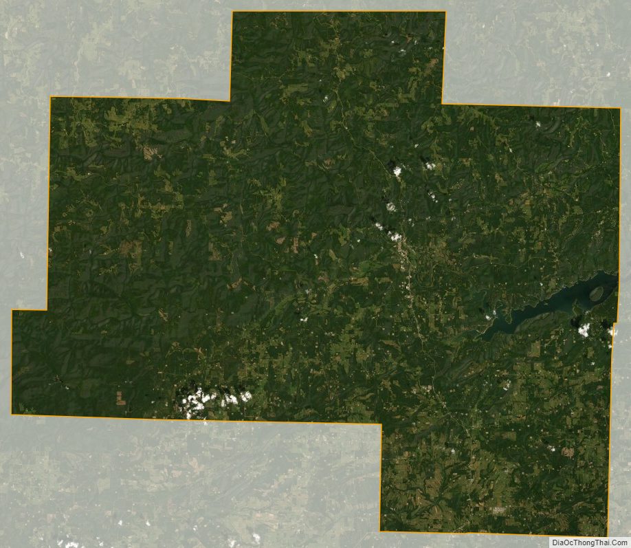
Van Buren County Satellite Map
Van Buren County Outline Map