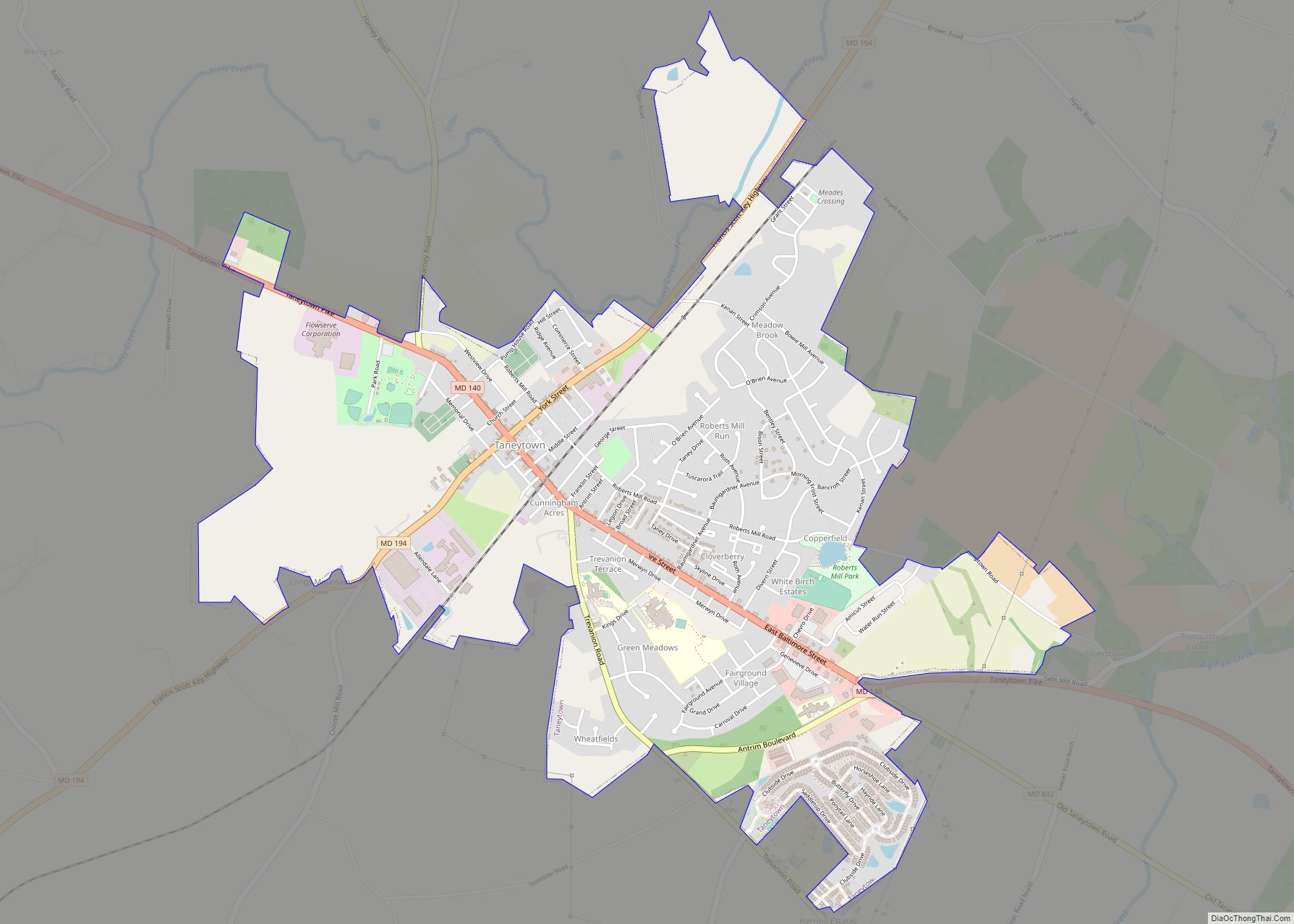
Taneytown (/ˈtɔːnitaʊn/ TAW-nee-town, locally also /ˈtænitaʊn/) is a city in Carroll County, Maryland, United States. The population was 6,728 at the 2010 census. Taneytown was founded in 1754. Of the city, George Washington once wrote, “Tan-nee town is but a small place with only the Street through wch.(sic) the road passes, built on. The buildings are principally of wood.” Taneytown has a history museum that displays the history of the city for visitors and citizens to see. The Bullfrog Road Bridge was listed on the National Register of Historic Places in 1978.
| Name: | Taneytown city |
|---|---|
| LSAD Code: | 25 |
| LSAD Description: | city (suffix) |
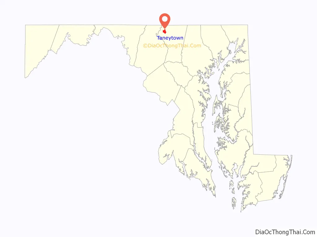
| State: | Maryland |
| County: | Carroll County |
| Incorporated: | 1836 |
| Elevation: | 505 ft (154 m) |
| Total Area: | 3.16 sq mi (8.19 km²) |
| Land Area: | 3.16 sq mi (8.18 km²) |
| Water Area: | 0.01 sq mi (0.02 km²) |
| Total Population: | 7,234 |
| Population Density: | 2,292.14/sq mi (884.88/km²) |
| ZIP code: | 21787 |
| Area code: | 410 |
| FIPS code: | 2476725 |
| GNISfeature ID: | 0587687 |
| Website: | www.taneytown.org |
Online Interactive Map
Click on ![]() to view map in "full screen" mode.
to view map in "full screen" mode.
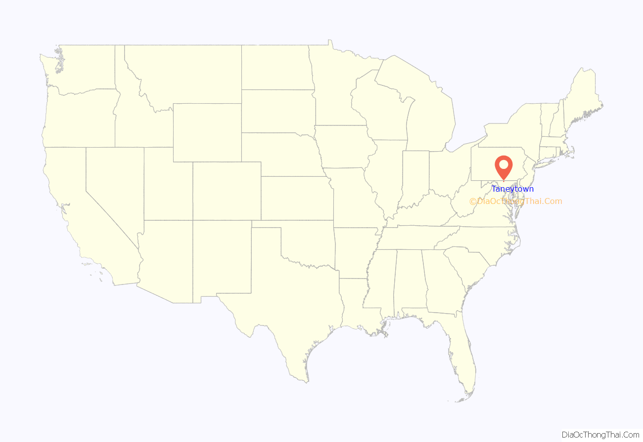
Taneytown location map. Where is Taneytown city?
History
Taneytown was founded in 1754 and became the seat of Taneytown Hundred in colonial Frederick County. Taneytown takes its name from Raphael Taney, a recipient of one of the first land grants in the area, though Taney likely never lived in the city that bears his name. U.S. Supreme Court Justice Roger Brooke Taney, author of the Dred Scott decision, born in 1777, shares a common ancestor with him, but likely never visited the town or had any connection. When Carroll County was formed on 19 January 1837, Taneytown Hundred and Taneytown were included.
Much of the city was added to the National Register of Historic Places as the Taneytown Historic District in 1986.
There is a Steve Earle song called “Taneytown” on his album El Corazon.
Taneytown Road Map
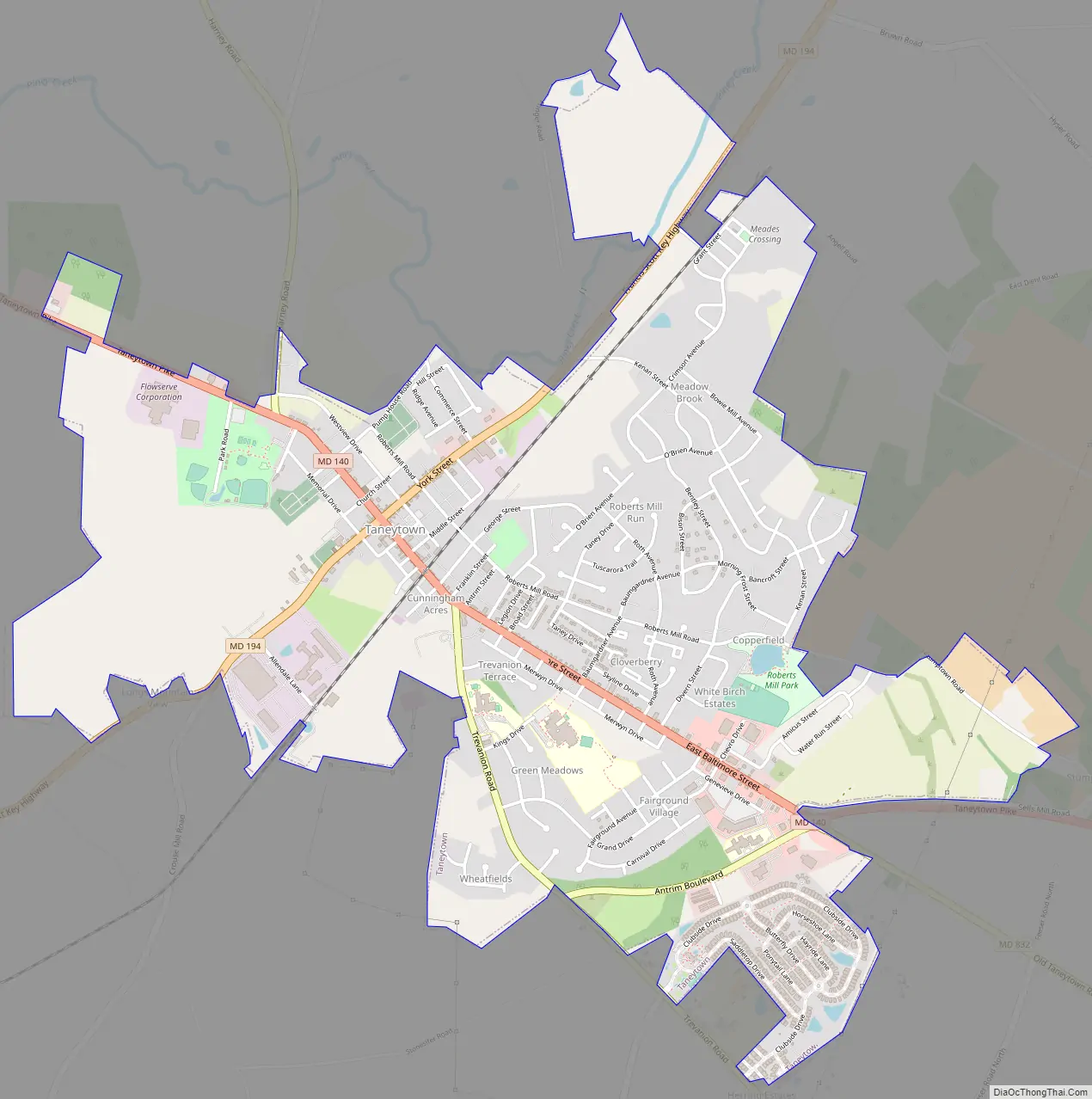
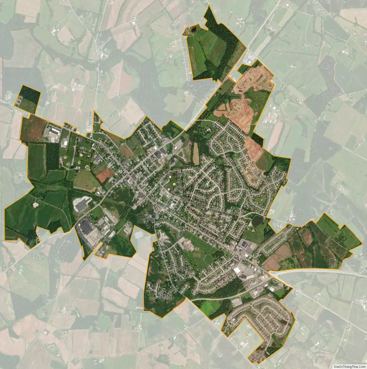
Taneytown city Satellite Map
Geography
Taneytown is located at 39°39′26″N 77°10′14″W / 39.65722°N 77.17056°W / 39.65722; -77.17056 (39.657099, -77.170627).
According to the United States Census Bureau, the city has a total area of 3.05 square miles (7.90 km), of which 3.04 square miles (7.87 km) is land and 0.01 square miles (0.03 km) is water.
See also
Map of Maryland State and its subdivision: Map of other states:- Alabama
- Alaska
- Arizona
- Arkansas
- California
- Colorado
- Connecticut
- Delaware
- District of Columbia
- Florida
- Georgia
- Hawaii
- Idaho
- Illinois
- Indiana
- Iowa
- Kansas
- Kentucky
- Louisiana
- Maine
- Maryland
- Massachusetts
- Michigan
- Minnesota
- Mississippi
- Missouri
- Montana
- Nebraska
- Nevada
- New Hampshire
- New Jersey
- New Mexico
- New York
- North Carolina
- North Dakota
- Ohio
- Oklahoma
- Oregon
- Pennsylvania
- Rhode Island
- South Carolina
- South Dakota
- Tennessee
- Texas
- Utah
- Vermont
- Virginia
- Washington
- West Virginia
- Wisconsin
- Wyoming