Goose Creek is the largest city in Berkeley County in the U.S. state of South Carolina. The population was 45,946 at the 2020 census. Most of the Naval Weapons Station Charleston is in Goose Creek. As defined by the U.S. Office of Management and Budget, and used only by the U.S. Census Bureau and other federal agencies for statistical purposes, Goose Creek is included within the Charleston–North Charleston–Summerville Metropolitan Area and the Charleston–North Charleston Urbanized Area.
| Name: | Goose Creek city |
|---|---|
| LSAD Code: | 25 |
| LSAD Description: | city (suffix) |
| State: | South Carolina |
| County: | Berkeley County, Charleston County |
| Incorporated: | 1961 |
| Elevation: | 46 ft (14 m) |
| Total Area: | 42.84 sq mi (110.95 km²) |
| Land Area: | 42.35 sq mi (109.67 km²) |
| Water Area: | 0.49 sq mi (1.28 km²) |
| Total Population: | 45,946 |
| Population Density: | 1,085.01/sq mi (418.93/km²) |
| ZIP code: | 29445 |
| Area code: | 843, 854 |
| FIPS code: | 4529815 |
| GNISfeature ID: | 1231332 |
| Website: | www.cityofgoosecreek.com |
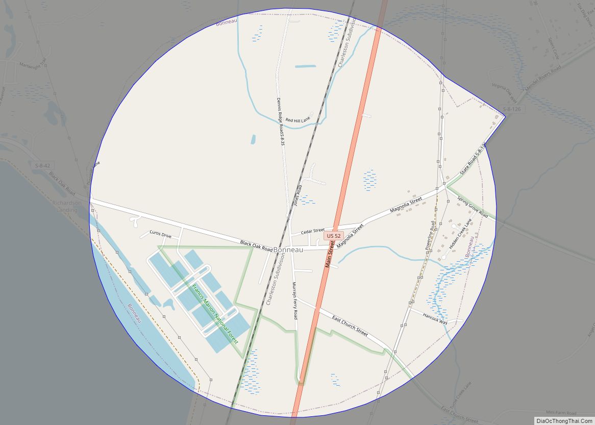
Online Interactive Map
Click on ![]() to view map in "full screen" mode.
to view map in "full screen" mode.
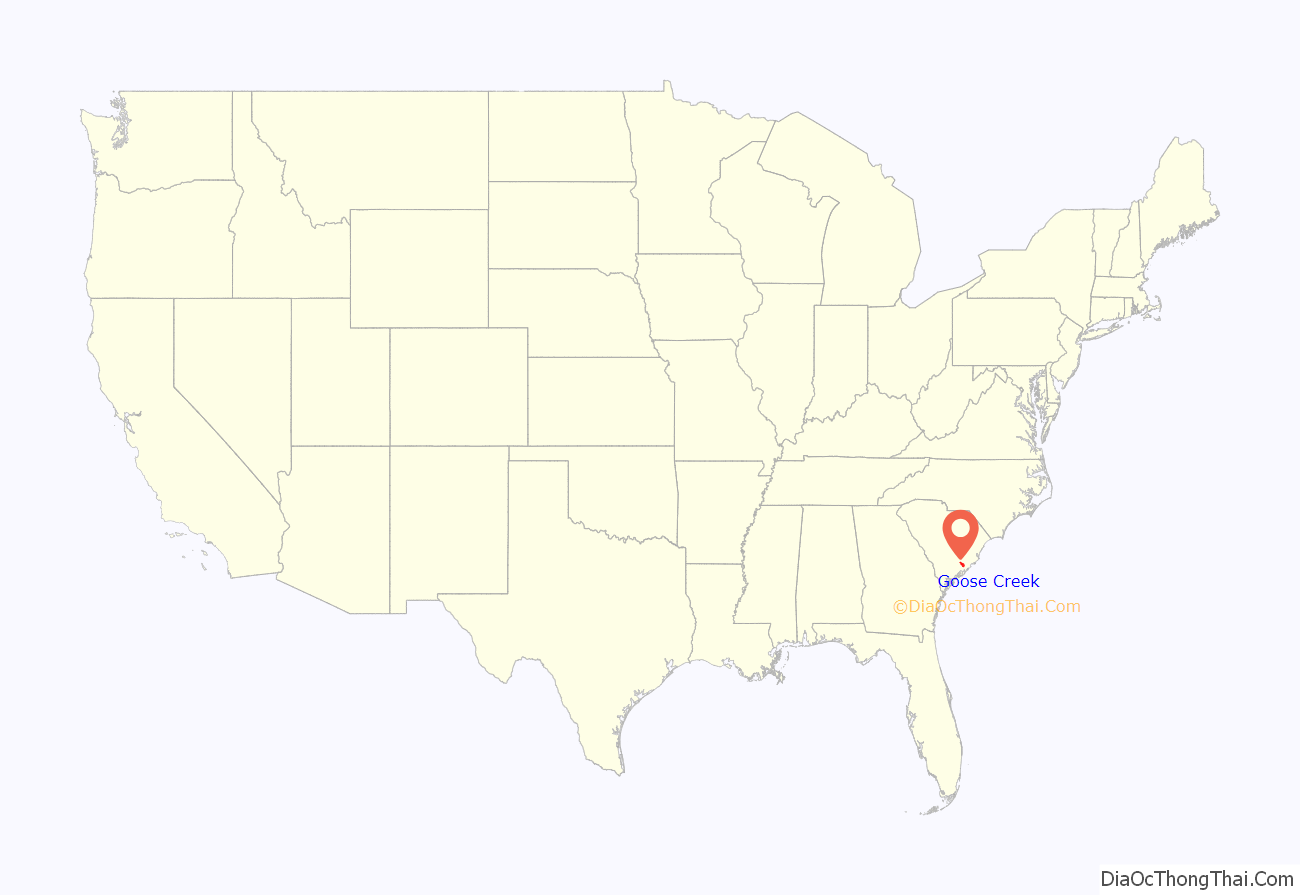
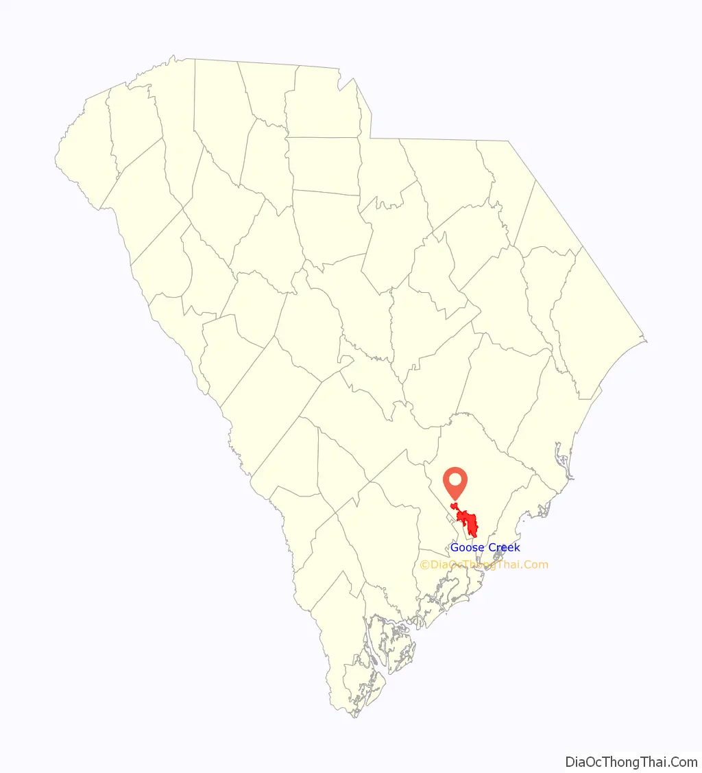
Goose Creek location map. Where is Goose Creek city?
History
Although the city of Goose Creek was established in 1961, its history dates back many centuries. In the 1670s the Etiwan moved to the area to escape the Westo, seeking protection among the plantations of early colonists who were often referred to as the “Goose Creek men”, mostly settled a few miles north of Charleston near a stream called Goose Creek, a tributary of the Cooper River. The Goose Creek men became leaders of the early Indian trade, and by the 1690s many held important offices in the colonial government. At first the Goose Creek men dealt mainly in Indian slaves, while later the deerskin trade dominated. Several colonial governors were Goose Creek men, such as James Moore and Robert Daniell. Other prominent men included brothers Daniel and Pierre Bacot.
The Otranto Plantation Indigo Vats and St. James Church are listed on the National Register of Historic Places.
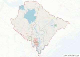
Goose Creek Road Map
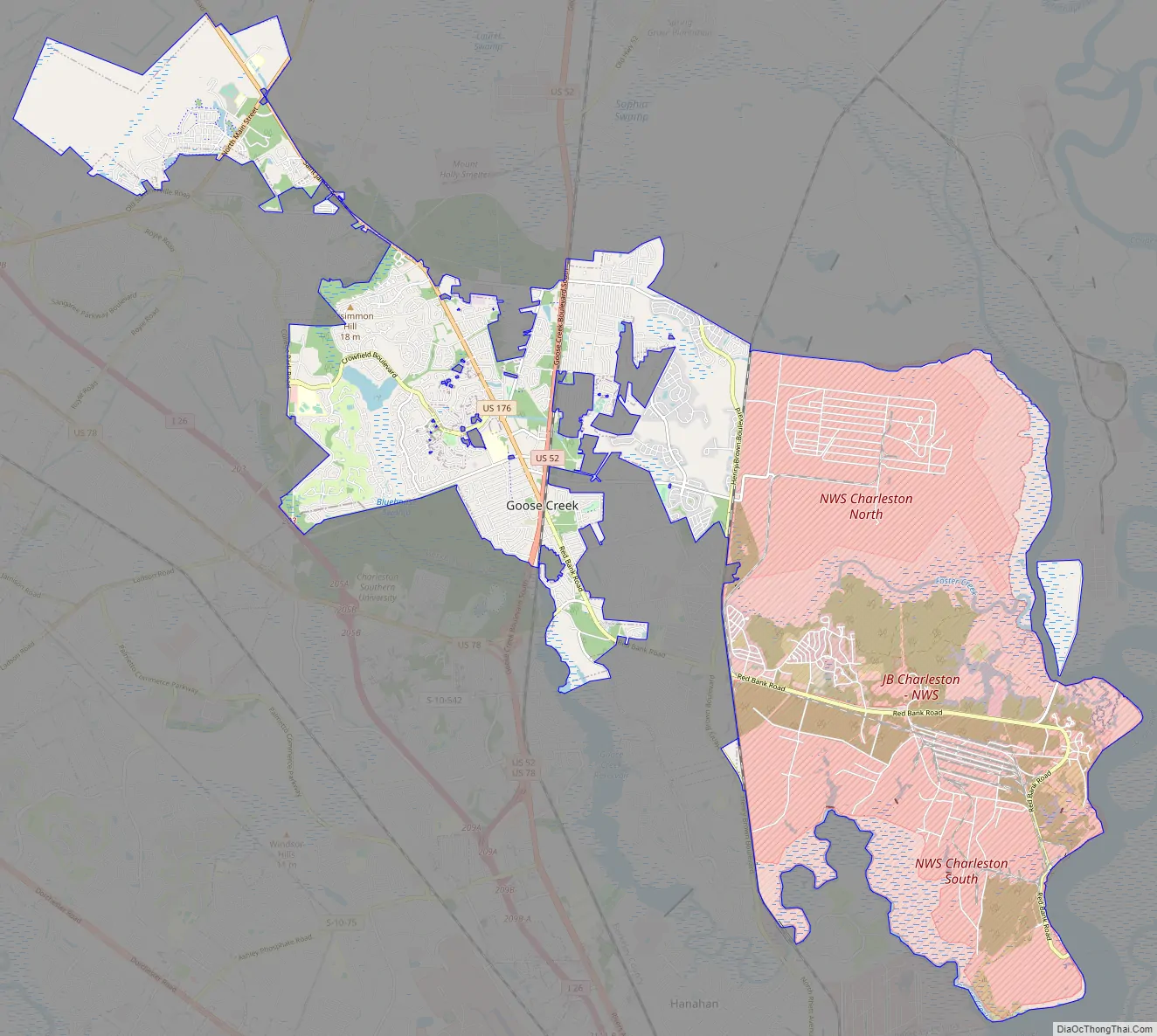
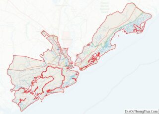
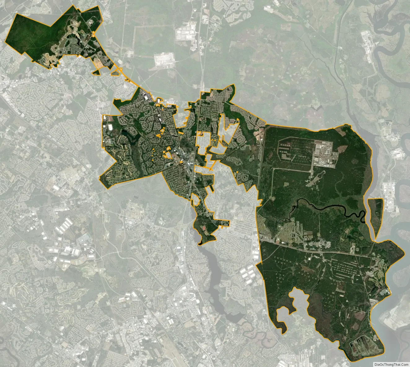
Goose Creek city Satellite Map
Geography
Goose Creek is located in southern Berkeley County at 33°0′N 80°2′W / 33.000°N 80.033°W / 33.000; -80.033 (32.9955, -80.0289). It is bordered to the east by the Cooper River and the Back River, to the southeast by an outer portion of the city of Charleston, to the southwest by the city of Hanahan and (farther to the west) the city of North Charleston in Charleston County, and to the west by the unincorporated community of Ladson.
According to the United States Census Bureau, the city has a total area of 40.8 square miles (105.8 km), of which 40.1 square miles (103.8 km) is land and 0.77 square miles (2.0 km), or 1.88%, is water.
See also
Map of South Carolina State and its subdivision:- Abbeville
- Aiken
- Allendale
- Anderson
- Bamberg
- Barnwell
- Beaufort
- Berkeley
- Calhoun
- Charleston
- Cherokee
- Chester
- Chesterfield
- Clarendon
- Colleton
- Darlington
- Dillon
- Dorchester
- Edgefield
- Fairfield
- Florence
- Georgetown
- Greenville
- Greenwood
- Hampton
- Horry
- Jasper
- Kershaw
- Lancaster
- Laurens
- Lee
- Lexington
- Marion
- Marlboro
- McCormick
- Newberry
- Oconee
- Orangeburg
- Pickens
- Richland
- Saluda
- Spartanburg
- Sumter
- Union
- Williamsburg
- York
- Alabama
- Alaska
- Arizona
- Arkansas
- California
- Colorado
- Connecticut
- Delaware
- District of Columbia
- Florida
- Georgia
- Hawaii
- Idaho
- Illinois
- Indiana
- Iowa
- Kansas
- Kentucky
- Louisiana
- Maine
- Maryland
- Massachusetts
- Michigan
- Minnesota
- Mississippi
- Missouri
- Montana
- Nebraska
- Nevada
- New Hampshire
- New Jersey
- New Mexico
- New York
- North Carolina
- North Dakota
- Ohio
- Oklahoma
- Oregon
- Pennsylvania
- Rhode Island
- South Carolina
- South Dakota
- Tennessee
- Texas
- Utah
- Vermont
- Virginia
- Washington
- West Virginia
- Wisconsin
- Wyoming