Atglen is a borough in Chester County, Pennsylvania, United States. According to the 2020 census, its population is 1,311.
| Name: | Atglen borough |
|---|---|
| LSAD Code: | 21 |
| LSAD Description: | borough (suffix) |
| State: | Pennsylvania |
| County: | Chester County |
| Elevation: | 489 ft (149 m) |
| Total Area: | 0.88 sq mi (2.28 km²) |
| Land Area: | 0.88 sq mi (2.27 km²) |
| Water Area: | 0.01 sq mi (0.02 km²) |
| Total Population: | 1,313 |
| Population Density: | 1,500.57/sq mi (579.65/km²) |
| ZIP code: | 19310 |
| Area code: | 610 |
| FIPS code: | 4203384 |
| Website: | http://www.atglen.org |
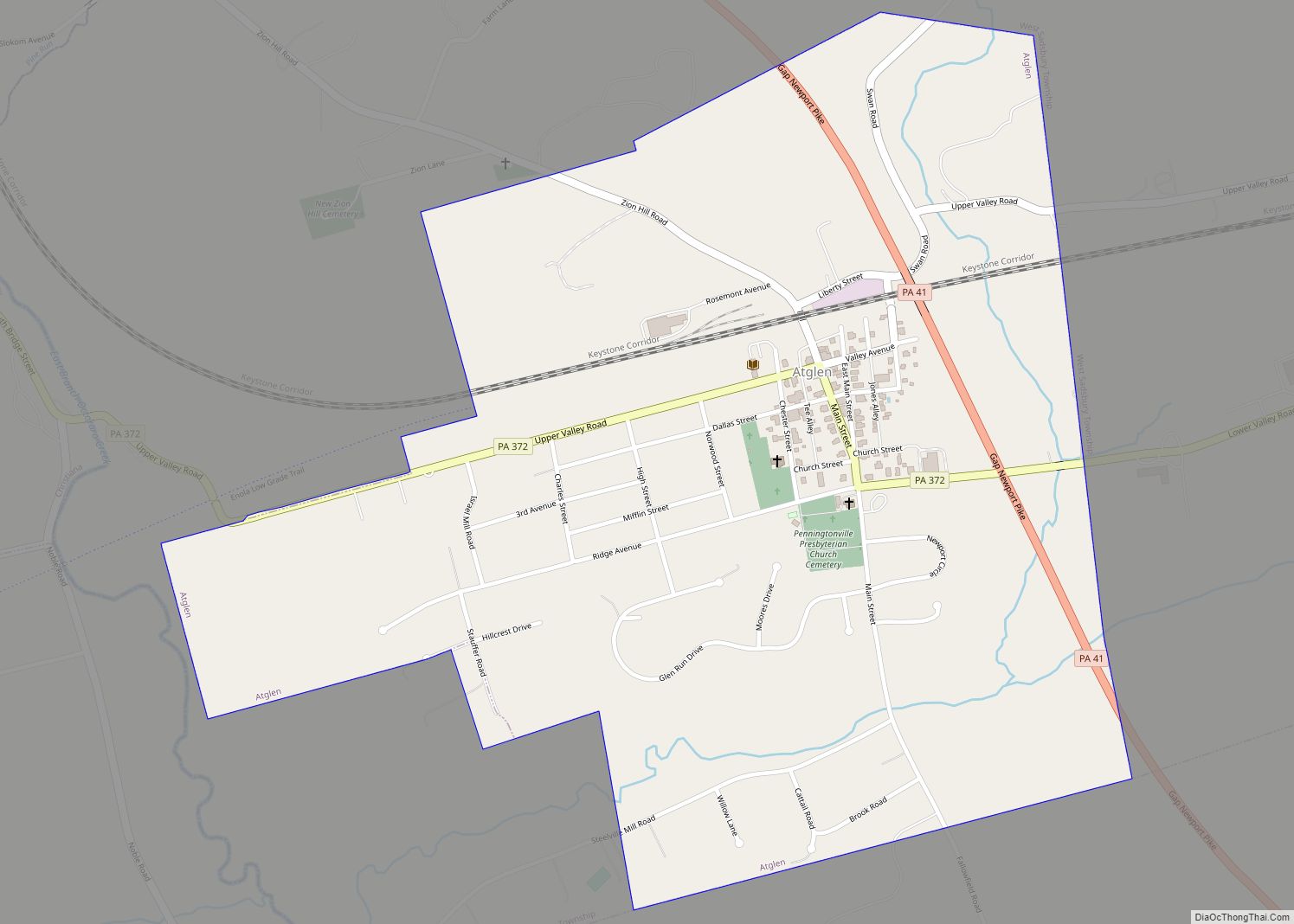
Online Interactive Map
Click on ![]() to view map in "full screen" mode.
to view map in "full screen" mode.
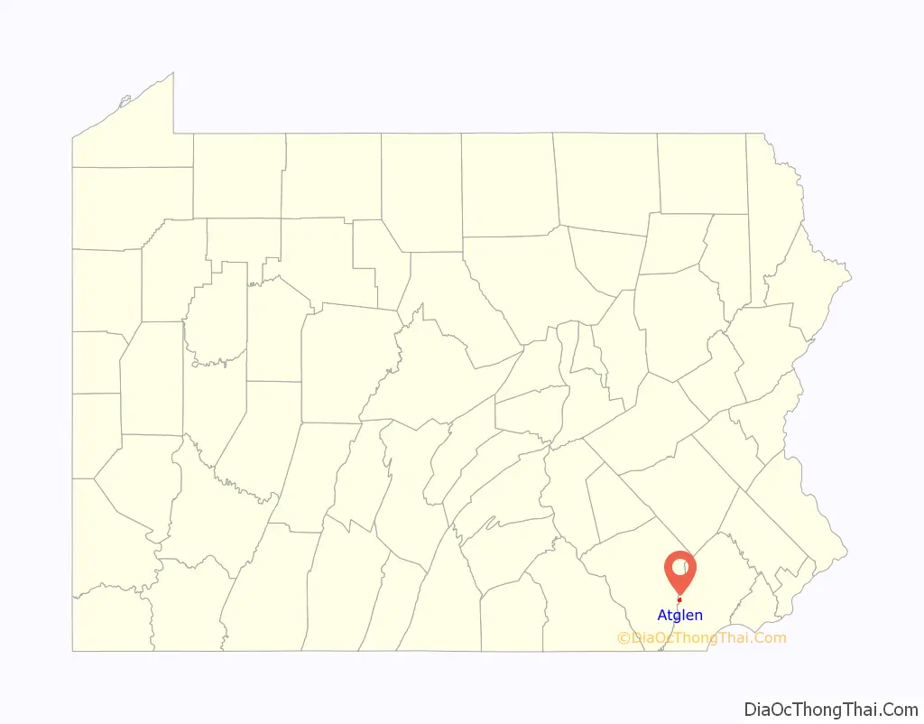
Atglen location map. Where is Atglen borough?

History
The area now known as Atglen was originally a wilderness. Native Americans made paths which cut across this area when they traveled from Paxtang (present day Harrisburg) to present day New Castle, Delaware to trade with the Swedes and later the English. The Great Minquas Path was one of these trails.
In 1717, Sadsbury Township was organized. It covered a large territory, including in whole or in part the present-day townships of Sadsbury, West Sadsbury, West Caln, Valley, East Fallowfield, West Fallowfield, and Highland; the boroughs of Atglen, Parkesburg, Modena, and South Coatesville; the city of Coatesville; and parts of Lancaster County. In August 1728, several inhabitants petitioned the court to separate Sadsbury from Fallowfield because of the former’s size. In November of that year, the township was subdivided into East and West Sadsbury, and in 1729, upon the division of Chester County into Lancaster and Chester counties, the line between the two divisions of the township was made to conform to the county line.
Drawn by the township’s farmland during the mid-18th century, more settlers arrived to Atglen. The Native Americans’ trails became horse tracks and later wagon tracks as farmers shipped their goods to market in Philadelphia; Newport, Delaware; and New Castle, Delaware. The old Provincial Highway, as authorized by the government, was laid out in 1730. Newport Road, leading to the ore mines at Cornwall in Lebanon County, was laid out in 1796.
In 1720, Presbyterians formed the area’s earliest organized religious group: what is known today as the Upper Octorara Presbyterian Church. They were followed by the Quakers who in 1724 founded the Sadsbury Meeting House. A year later, English settlers formed St. John’s Church.
Andrew Moore (1688–1753), who had been influential with Samuel Miller in founding Sadsbury Meeting House, built a tub mill on his property.
The original settlement in the town’s current location was known as Penningtonville, and a post office by that name was established there in 1842. However, by the 1870s, the name Atglen was in common usage. In 1876, the court in West Chester made an official decree incorporating the village of Penningtonville as the “Borough of Atglen.”
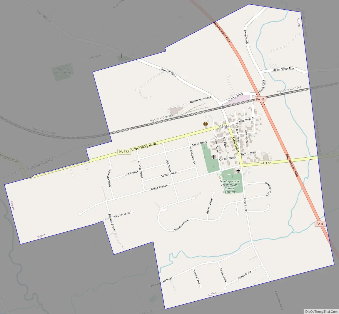
Atglen Road Map
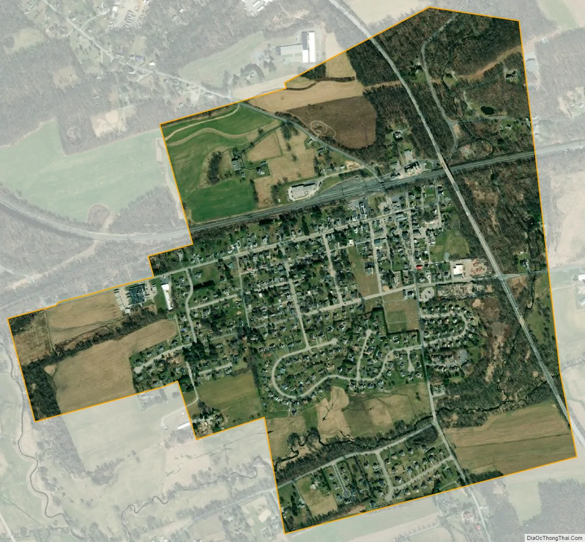
Atglen city Satellite Map
Geography
Atglen is located at 39°56′53″N 75°58′26″W / 39.94806°N 75.97389°W / 39.94806; -75.97389 (39.948106, -75.973887).
According to the United States Census Bureau, the borough has a total area of 0.9 square miles (2.3 km), all land.
See also
Map of Pennsylvania State and its subdivision:- Adams
- Allegheny
- Armstrong
- Beaver
- Bedford
- Berks
- Blair
- Bradford
- Bucks
- Butler
- Cambria
- Cameron
- Carbon
- Centre
- Chester
- Clarion
- Clearfield
- Clinton
- Columbia
- Crawford
- Cumberland
- Dauphin
- Delaware
- Elk
- Erie
- Fayette
- Forest
- Franklin
- Fulton
- Greene
- Huntingdon
- Indiana
- Jefferson
- Juniata
- Lackawanna
- Lancaster
- Lawrence
- Lebanon
- Lehigh
- Luzerne
- Lycoming
- Mc Kean
- Mercer
- Mifflin
- Monroe
- Montgomery
- Montour
- Northampton
- Northumberland
- Perry
- Philadelphia
- Pike
- Potter
- Schuylkill
- Snyder
- Somerset
- Sullivan
- Susquehanna
- Tioga
- Union
- Venango
- Warren
- Washington
- Wayne
- Westmoreland
- Wyoming
- York
- Alabama
- Alaska
- Arizona
- Arkansas
- California
- Colorado
- Connecticut
- Delaware
- District of Columbia
- Florida
- Georgia
- Hawaii
- Idaho
- Illinois
- Indiana
- Iowa
- Kansas
- Kentucky
- Louisiana
- Maine
- Maryland
- Massachusetts
- Michigan
- Minnesota
- Mississippi
- Missouri
- Montana
- Nebraska
- Nevada
- New Hampshire
- New Jersey
- New Mexico
- New York
- North Carolina
- North Dakota
- Ohio
- Oklahoma
- Oregon
- Pennsylvania
- Rhode Island
- South Carolina
- South Dakota
- Tennessee
- Texas
- Utah
- Vermont
- Virginia
- Washington
- West Virginia
- Wisconsin
- Wyoming