West Chester is a borough and the county seat of Chester County, Pennsylvania, United States. Located within the Philadelphia metropolitan area, the borough had a population of 18,461 at the 2010 census. West Chester is the mailing address for most of its neighboring townships. When calculated by mailing address, the population as of the 2010 U.S. Census was 108,696, which would make it the 10th largest city by mailing address in the state of Pennsylvania.
Much of the West Chester University of Pennsylvania North Campus and the Chester County government are located within the borough. The center of town is located at the intersection of Market and High Streets.
| Name: | West Chester borough |
|---|---|
| LSAD Code: | 21 |
| LSAD Description: | borough (suffix) |
| State: | Pennsylvania |
| County: | Chester County |
| Elevation: | 446 ft (136 m) |
| Total Area: | 1.85 sq mi (4.78 km²) |
| Land Area: | 1.85 sq mi (4.78 km²) |
| Water Area: | 0.00 sq mi (0.00 km²) |
| Total Population: | 18,671 |
| Population Density: | 10,114.30/sq mi (3,904.69/km²) |
| Area code: | 484, 610 |
| FIPS code: | 4282704 |
| Website: | west-chester.com |
Online Interactive Map
Click on ![]() to view map in "full screen" mode.
to view map in "full screen" mode.
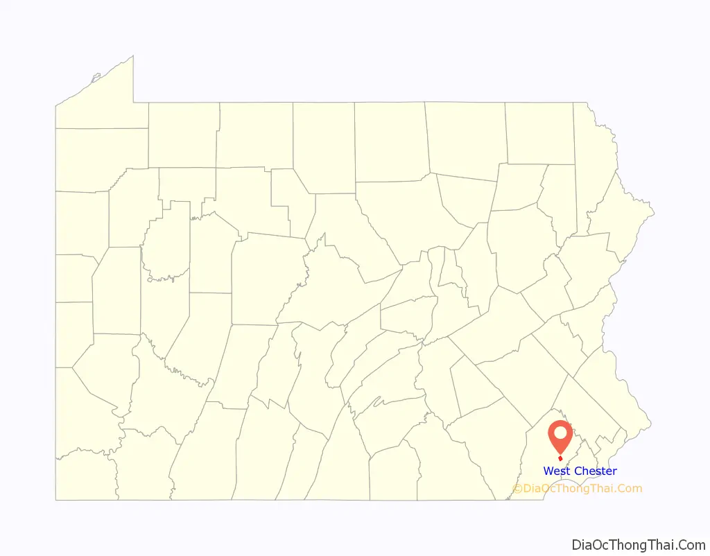
West Chester location map. Where is West Chester borough?

History
The area was originally known as Turk’s Head—after the inn of the same name located in what is now the center of the borough. West Chester has been the seat of government in Chester County since 1786 when the seat was moved from nearby Chester in what is now Delaware County. The borough was incorporated in 1799. In the heart of town is its courthouse, a classical revival building designed in the 1840s by Thomas U. Walter, one of the architects for the Capitol in Washington, D.C. In the 18th century West Chester was a center of clockmaking. Irish revolutionary Wolfe Tone briefly lived in West Chester during his exile. In the late 19th century the Hoopes, Bro. and Darlington company became a major wheelworks, first for wagons and later automobiles. In the early 20th century, an important industry was the Sharples cream separator company. In the late 20th century, Commodore International, one of the pioneers of home computers, giving its headquarters as West Chester, was located approximately a mile northeast of the borough.
The West Chester Downtown Historic District was listed on the National Register of Historic Places in 1985. Other listed buildings are the Bank of Chester County, Buckwalter Building, Butler House, Chester County Courthouse, William Everhart Buildings, Farmers and Mechanics Building, First Presbyterian Church of West Chester, New Century Clubhouse, Joseph Rothrock House, Sharples Homestead, Sharples Separator Works, Warner Theater, West Chester Boarding School for Boys, and components of West Chester State College Quadrangle Historic District.
West Chester Road Map
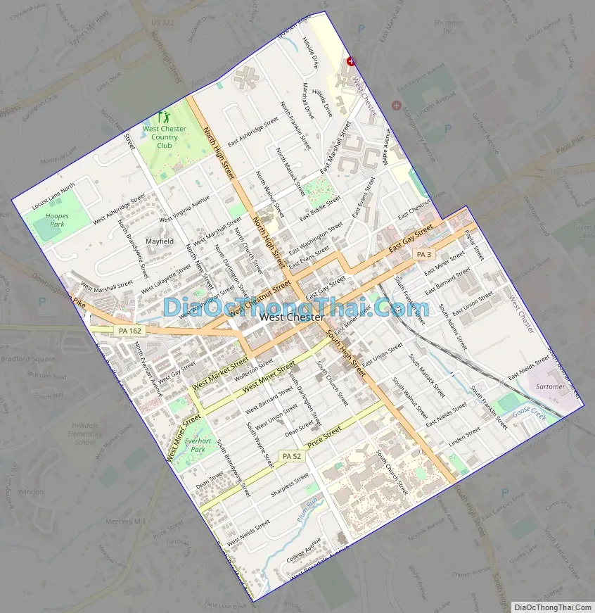
West Chester city Satellite Map

Geography
West Goshen Township borders West Chester to the north, south, and east, while East Bradford Township borders West Chester to the west. The borough straddles the Brandywine Creek and Chester Creek watersheds. It is located 25 miles (40 km) west of Philadelphia and 17 miles (27 km) north of Wilmington, Delaware.
According to the United States Census Bureau, the borough has a total area of 1.8 square miles (5 km), all land.
Climate
As with much of southeastern Pennsylvania east of the Appalachian mountains, West Chester lies in the transition zone between the humid continental (Köppen: Dfa) and humid subtropical (Köppen: Cfa) climate zones, with generally more characteristics of the former than the latter. Summers are hot and humid and winters are cold but variable. Annual high temperatures average between 39.0 °F (3.9 °C) and 85.4 °F (29.7 °C), annual low temperatures average between 22.2 °F (−5.4 °C) and 64.4 °F (18.0 °C), with the record high being 105 °F (41 °C), and record low being −16 °F (−27 °C).
Annual precipitation averages 46.7 inches (119 cm), and annual snowfall averages 27.7 inches (70 cm).
See also
Map of Pennsylvania State and its subdivision:- Adams
- Allegheny
- Armstrong
- Beaver
- Bedford
- Berks
- Blair
- Bradford
- Bucks
- Butler
- Cambria
- Cameron
- Carbon
- Centre
- Chester
- Clarion
- Clearfield
- Clinton
- Columbia
- Crawford
- Cumberland
- Dauphin
- Delaware
- Elk
- Erie
- Fayette
- Forest
- Franklin
- Fulton
- Greene
- Huntingdon
- Indiana
- Jefferson
- Juniata
- Lackawanna
- Lancaster
- Lawrence
- Lebanon
- Lehigh
- Luzerne
- Lycoming
- Mc Kean
- Mercer
- Mifflin
- Monroe
- Montgomery
- Montour
- Northampton
- Northumberland
- Perry
- Philadelphia
- Pike
- Potter
- Schuylkill
- Snyder
- Somerset
- Sullivan
- Susquehanna
- Tioga
- Union
- Venango
- Warren
- Washington
- Wayne
- Westmoreland
- Wyoming
- York
- Alabama
- Alaska
- Arizona
- Arkansas
- California
- Colorado
- Connecticut
- Delaware
- District of Columbia
- Florida
- Georgia
- Hawaii
- Idaho
- Illinois
- Indiana
- Iowa
- Kansas
- Kentucky
- Louisiana
- Maine
- Maryland
- Massachusetts
- Michigan
- Minnesota
- Mississippi
- Missouri
- Montana
- Nebraska
- Nevada
- New Hampshire
- New Jersey
- New Mexico
- New York
- North Carolina
- North Dakota
- Ohio
- Oklahoma
- Oregon
- Pennsylvania
- Rhode Island
- South Carolina
- South Dakota
- Tennessee
- Texas
- Utah
- Vermont
- Virginia
- Washington
- West Virginia
- Wisconsin
- Wyoming