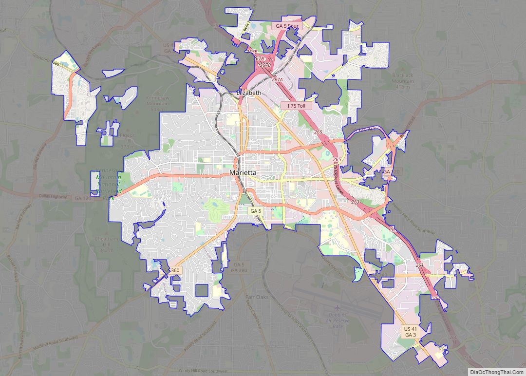
Marietta is a city in and the county seat of Cobb County, Georgia, United States. At the 2020 census, the city had a population of 60,972. The 2019 estimate was 60,867, making it one of Atlanta‘s largest suburbs. Marietta is the fourth largest of the principal cities by population of the Atlanta metropolitan area.
| Name: | Marietta city |
|---|---|
| LSAD Code: | 25 |
| LSAD Description: | city (suffix) |
| State: | Georgia |
| County: | Cobb County |
| Incorporated: | 1852; 171 years ago (1852) |
| Elevation: | 1,129 ft (344 m) |
| Total Area: | 23.53 sq mi (60.94 km²) |
| Land Area: | 23.45 sq mi (60.74 km²) |
| Water Area: | 0.08 sq mi (0.20 km²) |
| Total Population: | 60,972 |
| Population Density: | 2,599.86/sq mi (1,003.80/km²) |
| Area code: | 770/678/470 |
| FIPS code: | 1349756 |
| GNISfeature ID: | 0317694 |
| Website: | www.mariettaga.gov |
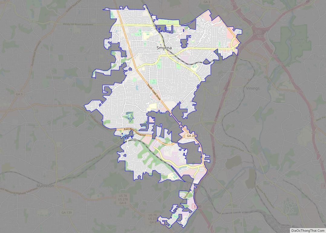
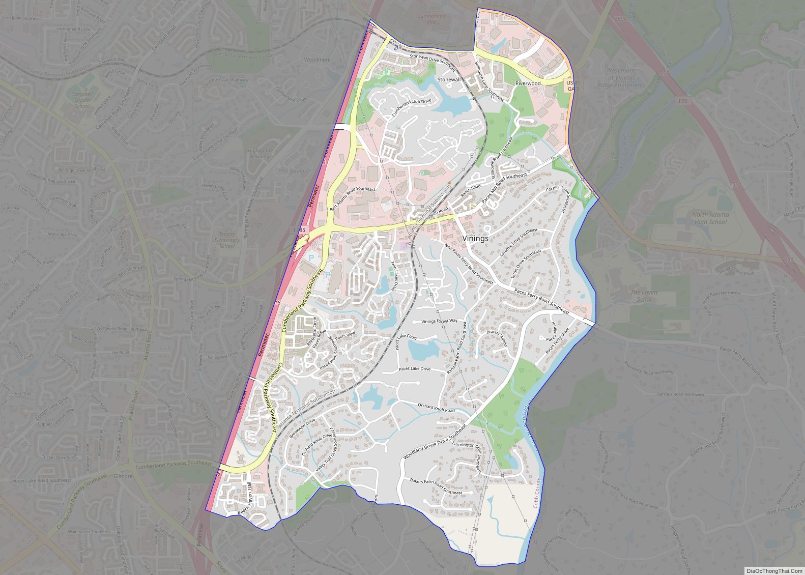
Online Interactive Map
Click on ![]() to view map in "full screen" mode.
to view map in "full screen" mode.
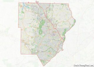
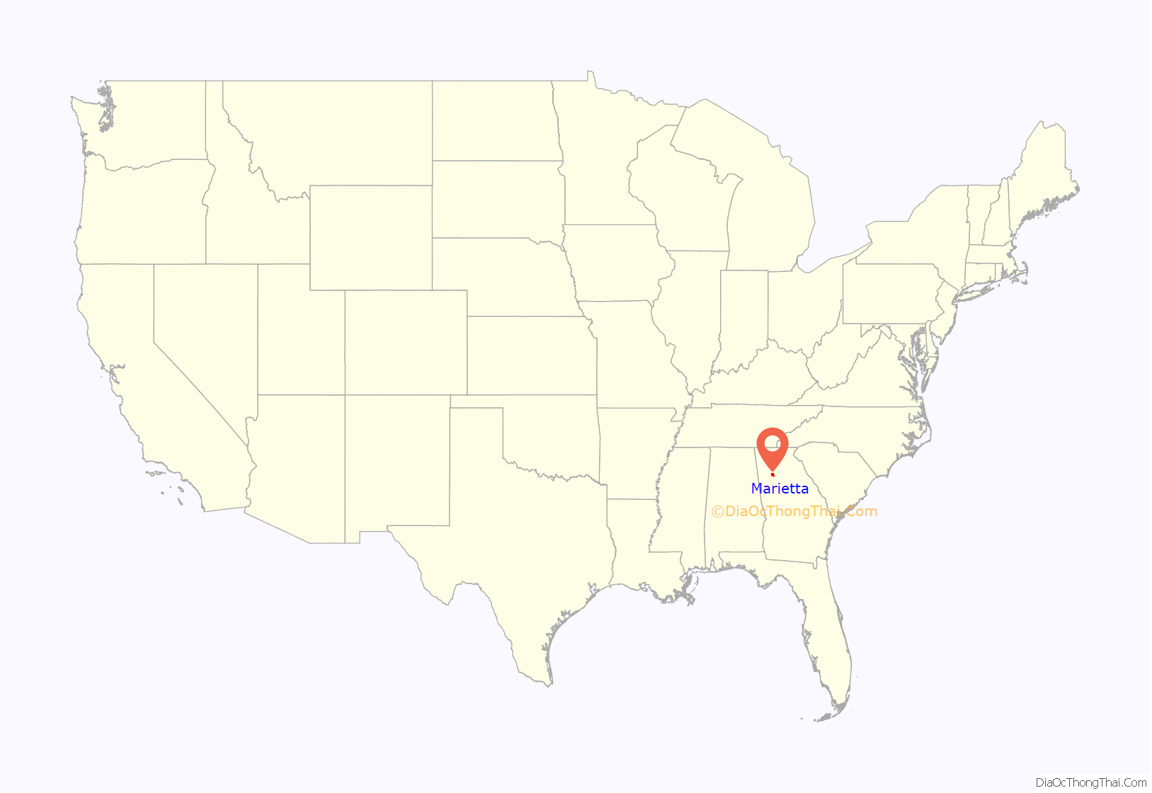
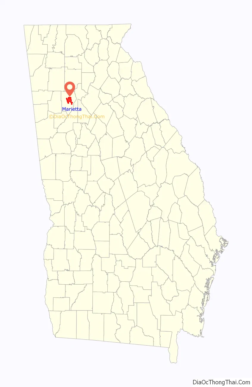
Marietta location map. Where is Marietta city?
History
Etymology
The origin of the name is uncertain. It is believed that the city was named for Mary Cobb, the wife of the U.S. Senator and Superior Court judge Thomas Willis Cobb. The county is named for Cobb.
Early settlers
Homes were built by early settlers near the Cherokee town of Big Shanty (now Kennesaw) before 1824. The first plot was laid out in 1833. Like most towns, Marietta had a square (Marietta Square) in the center with a courthouse. The Georgia General Assembly legally recognized the community on December 19, 1834.
Built in 1838, Oakton House is the oldest continuously occupied residence in Marietta. The original barn, milk house, smokehouse and well house remain on the property. The gardens contain the boxwood parterre from the 1870s. Oakton was Major General Loring’s headquarters during the Battle of Kennesaw Mountain in 1864.
Marietta was initially selected as the hub for the new Western and Atlantic Railroad and business boomed. By 1838, roadbed and trestles had been built north of the city. In 1840, political wrangling stopped construction for a time and, in 1842, the railroad’s new management moved the hub from Marietta to an area that became Atlanta. In 1850, when the railroad began operation, Marietta shared in the resulting prosperity.
The businessman and politician John Glover arrived in 1848. A popular figure, Glover was elected mayor when the city incorporated in 1852. Another early resident was Carey Cox, a physician, who promoted a “water cure” that attracted tourists to the area. The Cobb County Medical Society recognizes him as the county’s first physician.
The Georgia Military Institute was built in 1851 and the first bank opened in 1855. During the 1850s, fire destroyed much of the city on three separate occasions.
Civil War
By the time the Civil War began in 1861, Marietta had recovered from the fires.
In April 1862, James Andrews, a civilian working with the Union Army, came to Marietta, along with a small party of Union soldiers dressed in civilian clothing. The group spent the night in the Fletcher House hotel (later known as the Kennesaw House and now the home of the Marietta Museum of History) located immediately in front of the Western and Atlantic Railroad. Andrews and his men, who later became known as the Raiders, planned to seize a train and proceed north toward the city of Chattanooga, destroying the railroad on their way. They hoped, in so doing, to isolate Chattanooga from Atlanta and bring about the downfall of the Confederate stronghold. The Raiders boarded a waiting train on the morning of April 12, 1862, along with other passengers. Shortly after, the train made a scheduled stop in the town of Big Shanty, now known as Kennesaw. When the other passengers alighted for breakfast, Andrews and the Raiders stole the engine and the car behind it, which carried the fuel. The engine, called The General, and Andrews’ Raiders had begun the episode now known as the Great Locomotive Chase. Andrews and the Raiders failed in their mission. He and all of his men were caught within two weeks, including two men who had arrived late and missed the hijacking. All were tried as spies, convicted and hanged.
General William Tecumseh Sherman invaded the town during the Atlanta Campaign in summer 1864. In November 1864, General Hugh Kilpatrick set the town ablaze, the first strike in Sherman’s March to the Sea. Sherman’s troops crossed the Chattahoochee River at a shallow section known as the Palisades, after burning the Marietta Paper Mills near the mouth of Sope Creek.
The Marietta Confederate Cemetery, with the graves of over 3,000 Confederate soldiers killed during the Battle of Atlanta, is located in the city.
Education
In 1892, the city established a public school system. It included a Marietta High School and Waterman Street School for white students. A school for black students was also created on Lemon Street. The state of Georgia did not provide a high school for black students until 1924 when Booker T. Washington High School (Georgia) opened in Atlanta, after decades of black citizens requesting educational resources.
20th century
Leo Frank was lynched at 1200 Roswell Road just east of Marietta on August 17, 1915. Frank, a Jewish-American superintendent of the National Pencil Company in Atlanta, had been convicted on August 25, 1913, of the murder of one of his factory workers, 13-year-old Mary Phagan. The murder and trial, sensationalized in the local press, portrayed Frank as sexually depraved and captured the public’s attention. An eleventh-hour commutation by Governor John Slaton of Frank’s death sentence to life imprisonment because of problems with the case against him created great local outrage. A mob threatened the governor to the extent that the Georgia National Guard had to be called to defend him and he left the state immediately with his political career over. Another mob, systematically organized for the purpose, abducted Frank from prison, drove him to Marietta and hanged him. The leaders of the abduction included past, current and future elected local, county and state officials. There were two state legislators, the mayor, a former governor, a clergyman, two former Superior Court justices and an ex-sheriff. In reaction, Jewish activists created the Anti-Defamation League, to work to educate Americans about Jewish life and culture and to prevent anti-Semitism.
The Big Chicken was developed in Marietta in 1963.
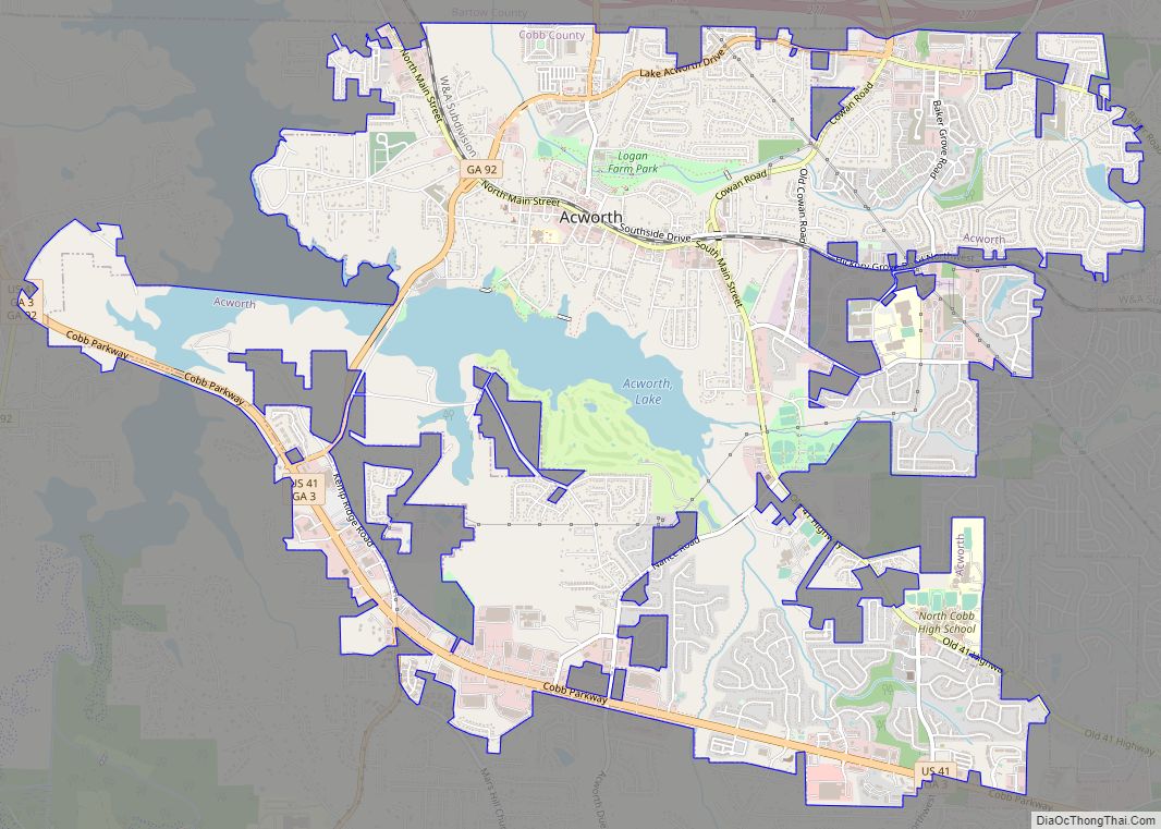
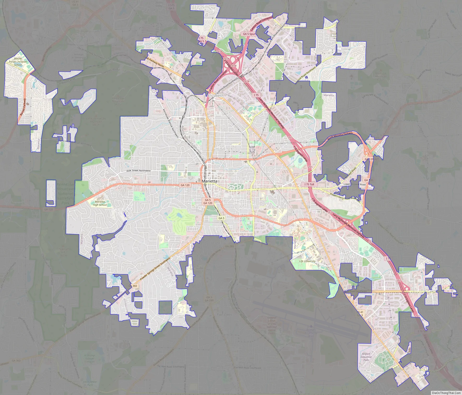
Marietta Road Map
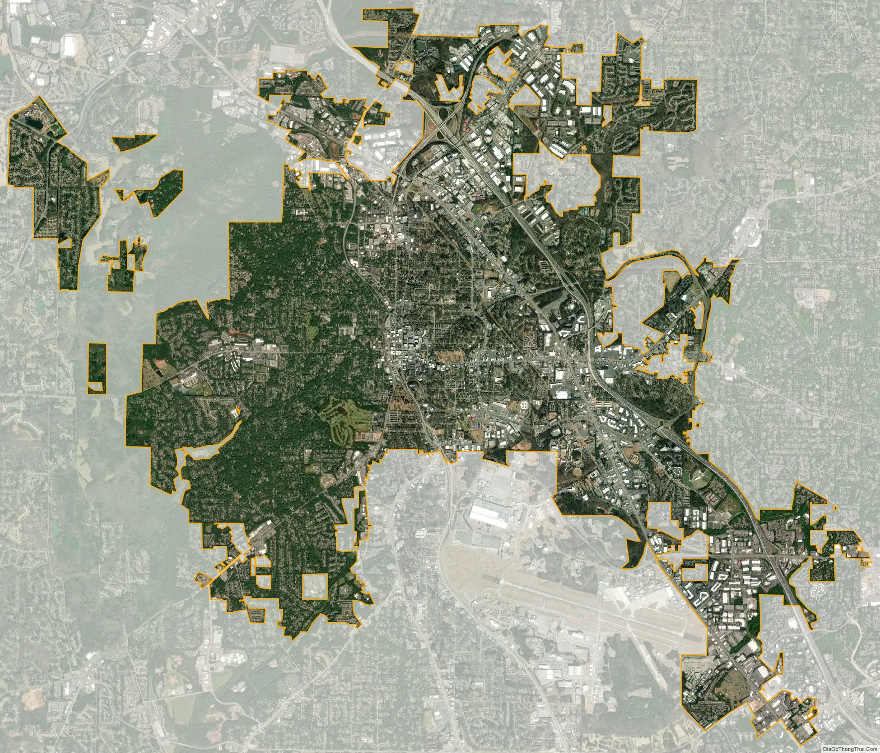
Marietta city Satellite Map
Geography
Located near the center of Cobb County, between Kennesaw to the northwest and Smyrna to the southeast. U.S. Route 41 and State Route 3 run through the city northeast of downtown as Cobb Parkway, and Interstate 75 runs parallel to it through the eastern part of Marietta, with access from exits 261, 263, 265, and 267. Downtown Atlanta is 20 miles (32 km) to the southeast, and Cartersville is 24 miles (39 km) to the northwest.
According to the United States Census Bureau, Marietta has a total area of 23.2 square miles (60.0 km), of which 23.1 square miles (59.8 km) is land and 0.077 square miles (0.2 km), or 0.38%, is water.
Climate
Marietta has a humid subtropical climate (Köppen climate classification Cfa).
Marietta falls under the USDA 7b Plant Hardiness zone.
See also
Map of Georgia State and its subdivision:- Appling
- Atkinson
- Bacon
- Baker
- Baldwin
- Banks
- Barrow
- Bartow
- Ben Hill
- Berrien
- Bibb
- Bleckley
- Brantley
- Brooks
- Bryan
- Bulloch
- Burke
- Butts
- Calhoun
- Camden
- Candler
- Carroll
- Catoosa
- Charlton
- Chatham
- Chattahoochee
- Chattooga
- Cherokee
- Clarke
- Clay
- Clayton
- Clinch
- Cobb
- Coffee
- Colquitt
- Columbia
- Cook
- Coweta
- Crawford
- Crisp
- Dade
- Dawson
- Decatur
- DeKalb
- Dodge
- Dooly
- Dougherty
- Douglas
- Early
- Echols
- Effingham
- Elbert
- Emanuel
- Evans
- Fannin
- Fayette
- Floyd
- Forsyth
- Franklin
- Fulton
- Gilmer
- Glascock
- Glynn
- Gordon
- Grady
- Greene
- Gwinnett
- Habersham
- Hall
- Hancock
- Haralson
- Harris
- Hart
- Heard
- Henry
- Houston
- Irwin
- Jackson
- Jasper
- Jeff Davis
- Jefferson
- Jenkins
- Johnson
- Jones
- Lamar
- Lanier
- Laurens
- Lee
- Liberty
- Lincoln
- Long
- Lowndes
- Lumpkin
- Macon
- Madison
- Marion
- McDuffie
- McIntosh
- Meriwether
- Miller
- Mitchell
- Monroe
- Montgomery
- Morgan
- Murray
- Muscogee
- Newton
- Oconee
- Oglethorpe
- Paulding
- Peach
- Pickens
- Pierce
- Pike
- Polk
- Pulaski
- Putnam
- Quitman
- Rabun
- Randolph
- Richmond
- Rockdale
- Schley
- Screven
- Seminole
- Spalding
- Stephens
- Stewart
- Sumter
- Talbot
- Taliaferro
- Tattnall
- Taylor
- Telfair
- Terrell
- Thomas
- Tift
- Toombs
- Towns
- Treutlen
- Troup
- Turner
- Twiggs
- Union
- Upson
- Walker
- Walton
- Ware
- Warren
- Washington
- Wayne
- Webster
- Wheeler
- White
- Whitfield
- Wilcox
- Wilkes
- Wilkinson
- Worth
- Alabama
- Alaska
- Arizona
- Arkansas
- California
- Colorado
- Connecticut
- Delaware
- District of Columbia
- Florida
- Georgia
- Hawaii
- Idaho
- Illinois
- Indiana
- Iowa
- Kansas
- Kentucky
- Louisiana
- Maine
- Maryland
- Massachusetts
- Michigan
- Minnesota
- Mississippi
- Missouri
- Montana
- Nebraska
- Nevada
- New Hampshire
- New Jersey
- New Mexico
- New York
- North Carolina
- North Dakota
- Ohio
- Oklahoma
- Oregon
- Pennsylvania
- Rhode Island
- South Carolina
- South Dakota
- Tennessee
- Texas
- Utah
- Vermont
- Virginia
- Washington
- West Virginia
- Wisconsin
- Wyoming