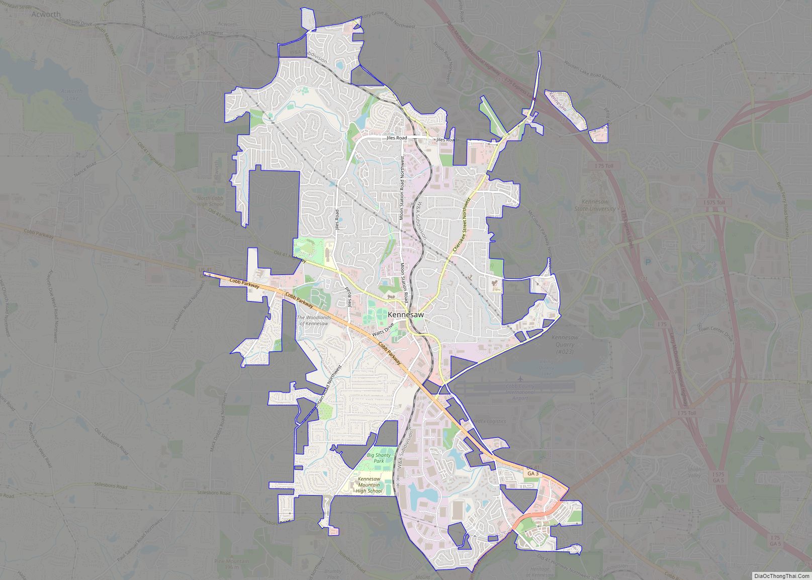
Kennesaw is a suburban city northwest of Atlanta in Cobb County, Georgia, United States, located within the greater Atlanta metropolitan area. Known from its original settlement in the 1830s until 1887 as Big Shanty, it became Kennesaw under its 1887 charter. According to the 2010 census, Kennesaw had a population of 29,783, but in 2019 it had a population of 34,077 showing a 14.4% increase in population over the past decade. Kennesaw has an important place in railroad history. During the Civil War, Kennesaw was the staging ground for the Great Locomotive Chase on April 12, 1862.
| Name: | Kennesaw city |
|---|---|
| LSAD Code: | 25 |
| LSAD Description: | city (suffix) |
| State: | Georgia |
| County: | Cobb County |
| Incorporated: | September 21, 1887 |
| Elevation: | 1,089 ft (332 m) |
| Total Area: | 9.82 sq mi (25.43 km²) |
| Land Area: | 9.71 sq mi (25.16 km²) |
| Water Area: | 0.10 sq mi (0.26 km²) |
| Total Population: | 33,036 |
| Population Density: | 3,400.51/sq mi (1,312.88/km²) |
| ZIP code: | 30144/30152 |
| Area code: | 770/678/470 |
| FIPS code: | 1343192 |
| GNISfeature ID: | 0316387 |
| Website: | www.kennesaw-ga.gov |
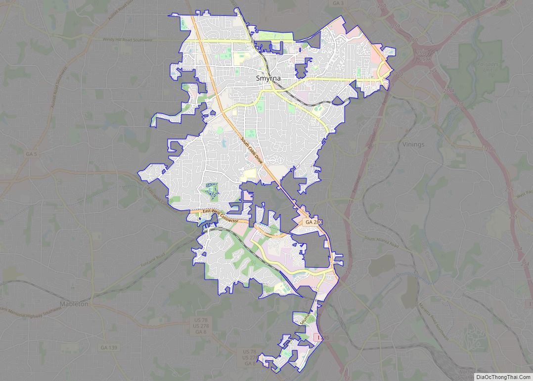
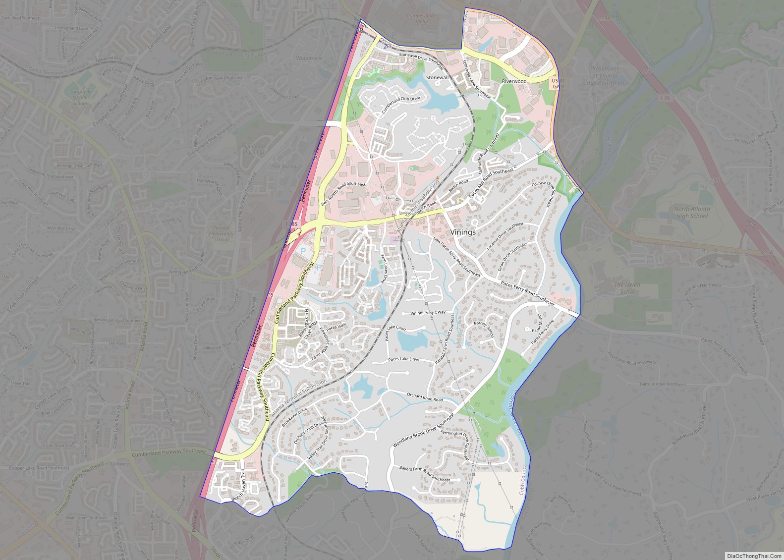
Online Interactive Map
Click on ![]() to view map in "full screen" mode.
to view map in "full screen" mode.
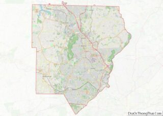
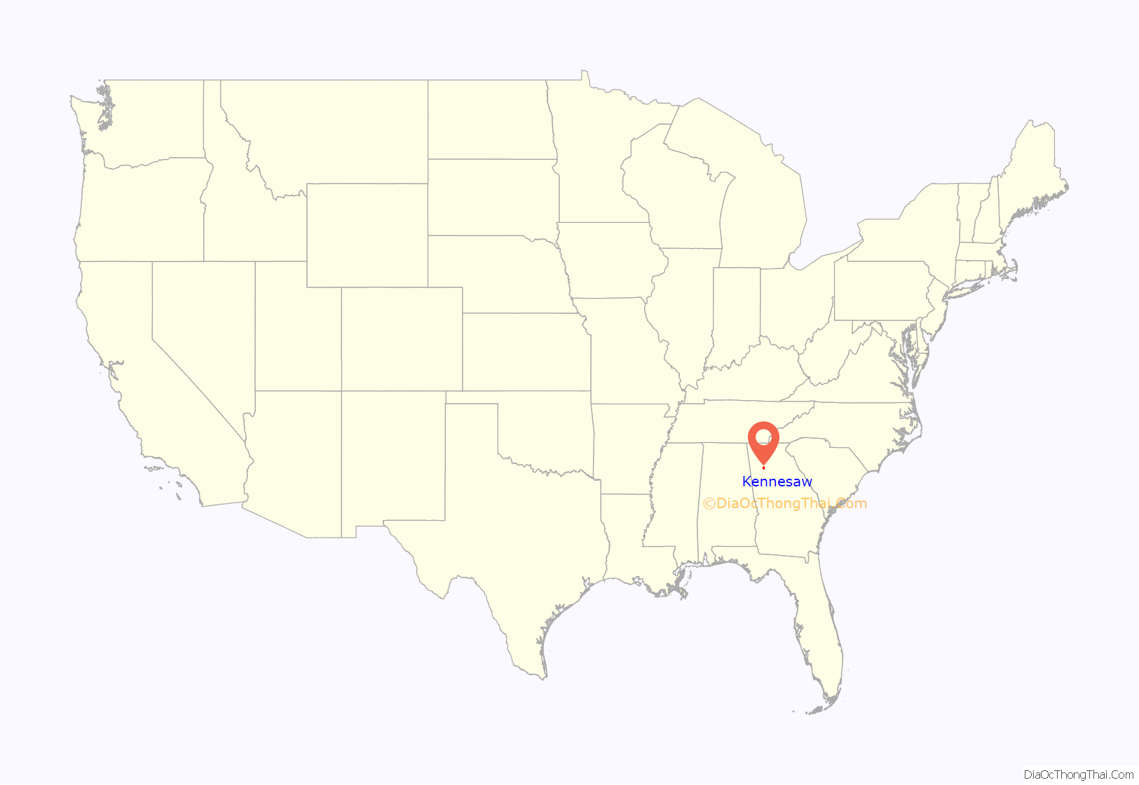
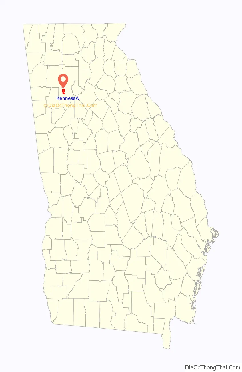
Kennesaw location map. Where is Kennesaw city?
History
As the Western and Atlantic Railroad was being built in the late 1830s, shanty towns arose to house the workers. These were near a big spring. A grade up from the Etowah River became known as “the big grade to the shanties”, then “Big Shanty Grade”, and finally “Big Shanty”.
Civil War
Camp MacDonald, a training camp, was located there from 1861 to 1863.
During the Civil War, Big Shanty was the site of major fighting in the Battle of Kennesaw Mountain, part of the larger Atlanta Campaign. Kennesaw Mountain National Battlefield Park, located southeast of the city limits, now contains many of these historic areas. Much of the surrounding land has been developed, and many of the buried artifacts have been searched for and taken by people with metal detectors. Some artifacts of the Civil War are still on display in the visitor center of Kennesaw Mountain.
Later history
L.C. Chalker purchased a 1.25-acre (0.51 ha) tract of land adjacent to the Kennesaw Cemetery from J.W. Ellis in 1934, which was sold for burial purposes. Chalker purchased another 1 acre (0.40 ha) adjacent to the first parcel in 1948, which was also to be used for a cemetery. The Chalker family managed these portions of the cemetery until they were sold to the City of Kennesaw in the mid-1950s. The earliest known burial is the infant Lucius B. Summers, who was interred in 1863. Other grave markers date as far back as the 1860s to the 1890s. Civil War veterans are buried here. The Kennesaw Cemetery is still in use.
In March 2004, First Lady Laura Bush designated Kennesaw a Preserve America Community.
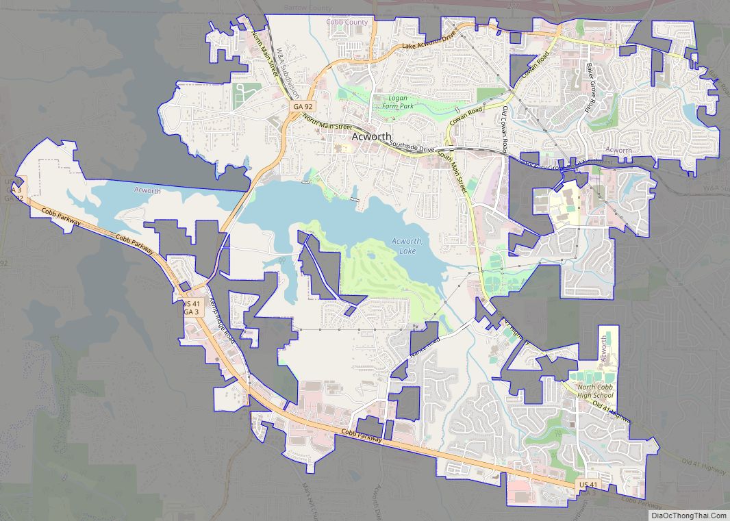
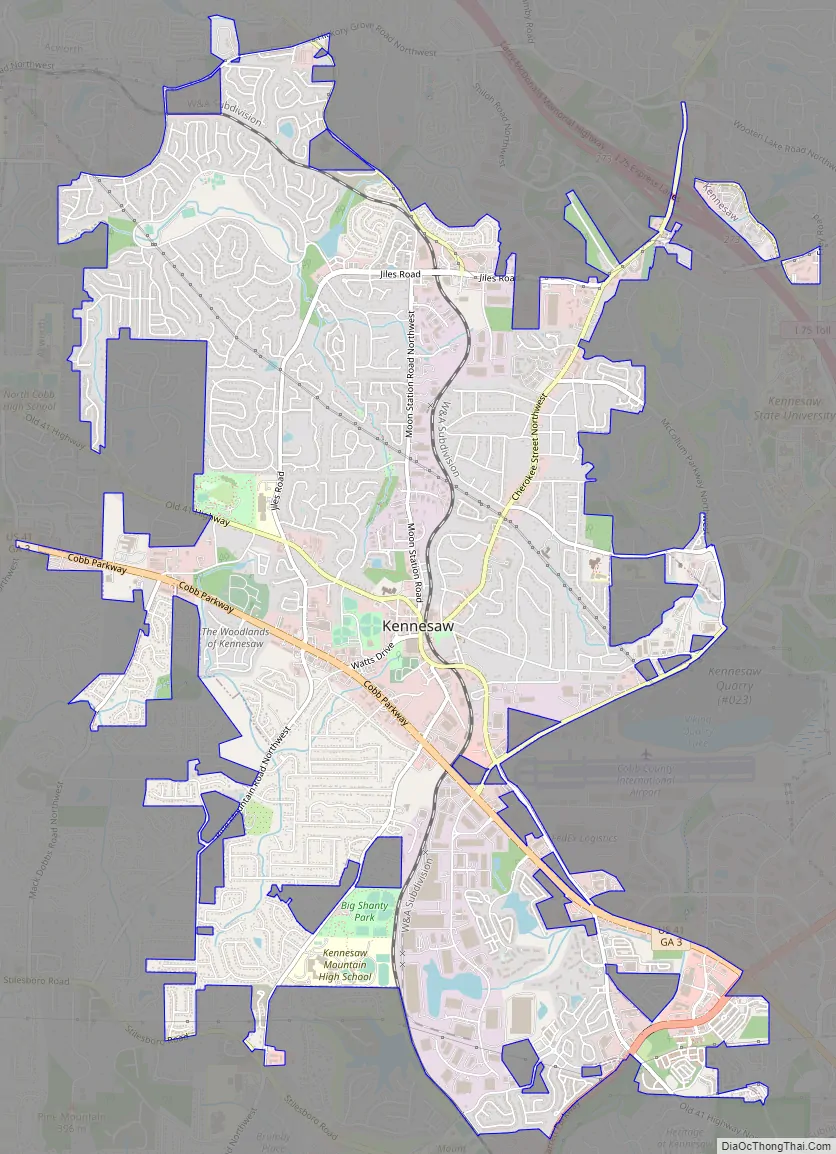
Kennesaw Road Map
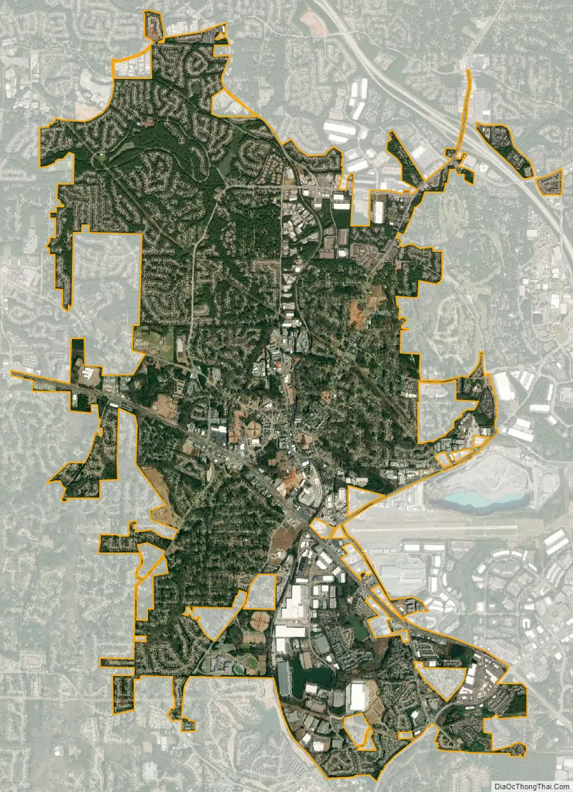
Kennesaw city Satellite Map
Geography
Kennesaw is located in northwestern Cobb County, bordered by the city of Acworth to the northwest. Kennesaw Mountain is located southeast of the city limits in the battlefield park. Its summit is the highest point in the Atlanta metro area, at an elevation of 1,808 feet (551 m) above sea level. The city was renamed for the mountain.
U.S. Route 41 and State Route 3 pass through the city as Cobb Parkway, leading southeast 7 miles (11 km) to Marietta and northwest 17 miles (27 km) to Cartersville. Interstate 75 passes just northeast of the city limits, with access from exits 269, 271, and 273. Via I-75, downtown Atlanta is 27 miles (43 km) to the southeast, and Chattanooga, Tennessee, is 94 miles (151 km) northwest.
The iconic peaks of Kennesaw Mountain are visible from the bridge over Interstate 75 that crosses over the city limits of Kennesaw.
According to the United States Census Bureau, Kennesaw has a total area of 9.5 square miles (24.7 km), of which 9.4 square miles (24.4 km) is land and 0.12 square miles (0.3 km), or 1.08%, is water.
Climate
Kennesaw has a humid subtropical climate (Köppen climate classification Cfa). On November 22, 1992, an F-4 tornado caused 34 injuries.
See also
Map of Georgia State and its subdivision:- Appling
- Atkinson
- Bacon
- Baker
- Baldwin
- Banks
- Barrow
- Bartow
- Ben Hill
- Berrien
- Bibb
- Bleckley
- Brantley
- Brooks
- Bryan
- Bulloch
- Burke
- Butts
- Calhoun
- Camden
- Candler
- Carroll
- Catoosa
- Charlton
- Chatham
- Chattahoochee
- Chattooga
- Cherokee
- Clarke
- Clay
- Clayton
- Clinch
- Cobb
- Coffee
- Colquitt
- Columbia
- Cook
- Coweta
- Crawford
- Crisp
- Dade
- Dawson
- Decatur
- DeKalb
- Dodge
- Dooly
- Dougherty
- Douglas
- Early
- Echols
- Effingham
- Elbert
- Emanuel
- Evans
- Fannin
- Fayette
- Floyd
- Forsyth
- Franklin
- Fulton
- Gilmer
- Glascock
- Glynn
- Gordon
- Grady
- Greene
- Gwinnett
- Habersham
- Hall
- Hancock
- Haralson
- Harris
- Hart
- Heard
- Henry
- Houston
- Irwin
- Jackson
- Jasper
- Jeff Davis
- Jefferson
- Jenkins
- Johnson
- Jones
- Lamar
- Lanier
- Laurens
- Lee
- Liberty
- Lincoln
- Long
- Lowndes
- Lumpkin
- Macon
- Madison
- Marion
- McDuffie
- McIntosh
- Meriwether
- Miller
- Mitchell
- Monroe
- Montgomery
- Morgan
- Murray
- Muscogee
- Newton
- Oconee
- Oglethorpe
- Paulding
- Peach
- Pickens
- Pierce
- Pike
- Polk
- Pulaski
- Putnam
- Quitman
- Rabun
- Randolph
- Richmond
- Rockdale
- Schley
- Screven
- Seminole
- Spalding
- Stephens
- Stewart
- Sumter
- Talbot
- Taliaferro
- Tattnall
- Taylor
- Telfair
- Terrell
- Thomas
- Tift
- Toombs
- Towns
- Treutlen
- Troup
- Turner
- Twiggs
- Union
- Upson
- Walker
- Walton
- Ware
- Warren
- Washington
- Wayne
- Webster
- Wheeler
- White
- Whitfield
- Wilcox
- Wilkes
- Wilkinson
- Worth
- Alabama
- Alaska
- Arizona
- Arkansas
- California
- Colorado
- Connecticut
- Delaware
- District of Columbia
- Florida
- Georgia
- Hawaii
- Idaho
- Illinois
- Indiana
- Iowa
- Kansas
- Kentucky
- Louisiana
- Maine
- Maryland
- Massachusetts
- Michigan
- Minnesota
- Mississippi
- Missouri
- Montana
- Nebraska
- Nevada
- New Hampshire
- New Jersey
- New Mexico
- New York
- North Carolina
- North Dakota
- Ohio
- Oklahoma
- Oregon
- Pennsylvania
- Rhode Island
- South Carolina
- South Dakota
- Tennessee
- Texas
- Utah
- Vermont
- Virginia
- Washington
- West Virginia
- Wisconsin
- Wyoming