Buchanan is a city and the county seat of Haralson County, Georgia, United States. The population was 1,104 at the 2010 census, up from 941 at the 2000 census.
Locally, the city’s name is pronounced Buck-HAN-uhn.
| Name: | Buchanan city |
|---|---|
| LSAD Code: | 25 |
| LSAD Description: | city (suffix) |
| State: | Georgia |
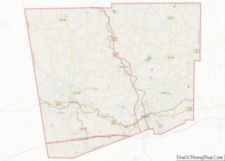
| County: | Haralson County |
| Elevation: | 1,243 ft (379 m) |
| Total Area: | 1.70 sq mi (4.40 km²) |
| Land Area: | 1.49 sq mi (3.86 km²) |
| Water Area: | 0.21 sq mi (0.54 km²) |
| Total Population: | 938 |
| Population Density: | 629.95/sq mi (243.15/km²) |
| ZIP code: | 30113 |
| Area code: | 770 |
| FIPS code: | 1311616 |
| GNISfeature ID: | 0354892 |
| Website: | buchananga.com |
Online Interactive Map
Click on ![]() to view map in "full screen" mode.
to view map in "full screen" mode.
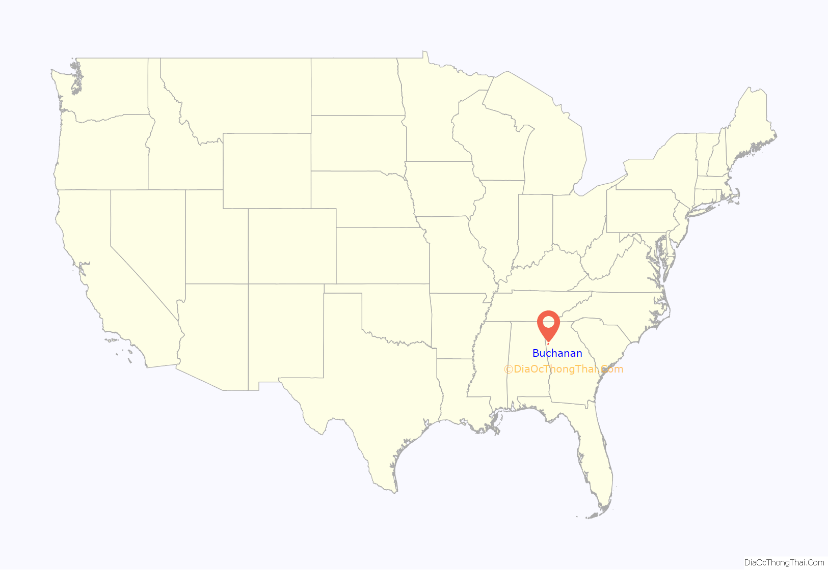
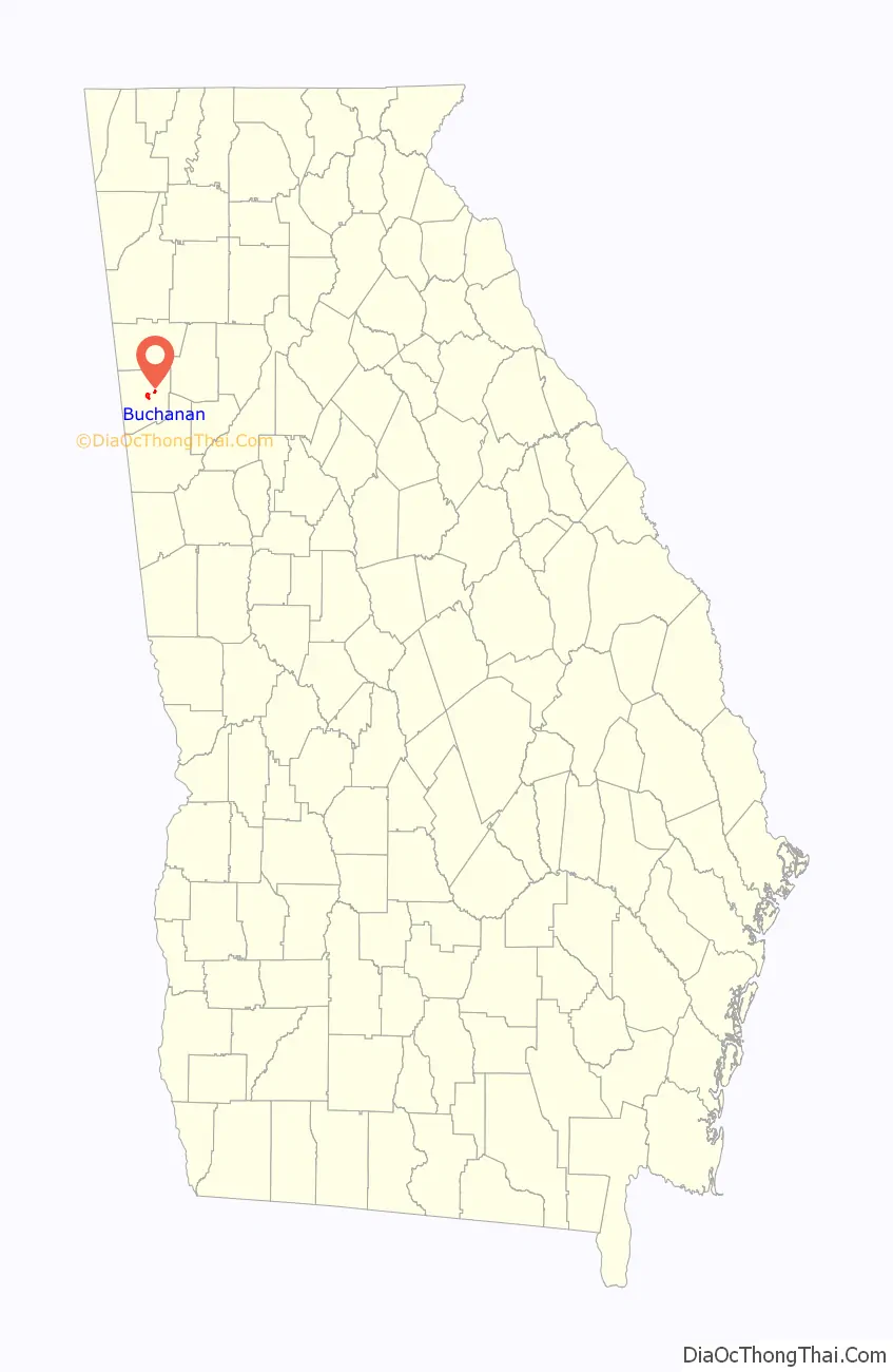
Buchanan location map. Where is Buchanan city?
History
Buchanan was founded in 1856 as seat of the newly formed Haralson County. It was named for United States President James Buchanan. Buchanan was incorporated as a town in 1857 and as a city in 1902.
It is home of one of few one-room schoolhouses surviving in Georgia, the Little Creek One-room Schoolhouse. The state had about 7,000 of them in 1900.
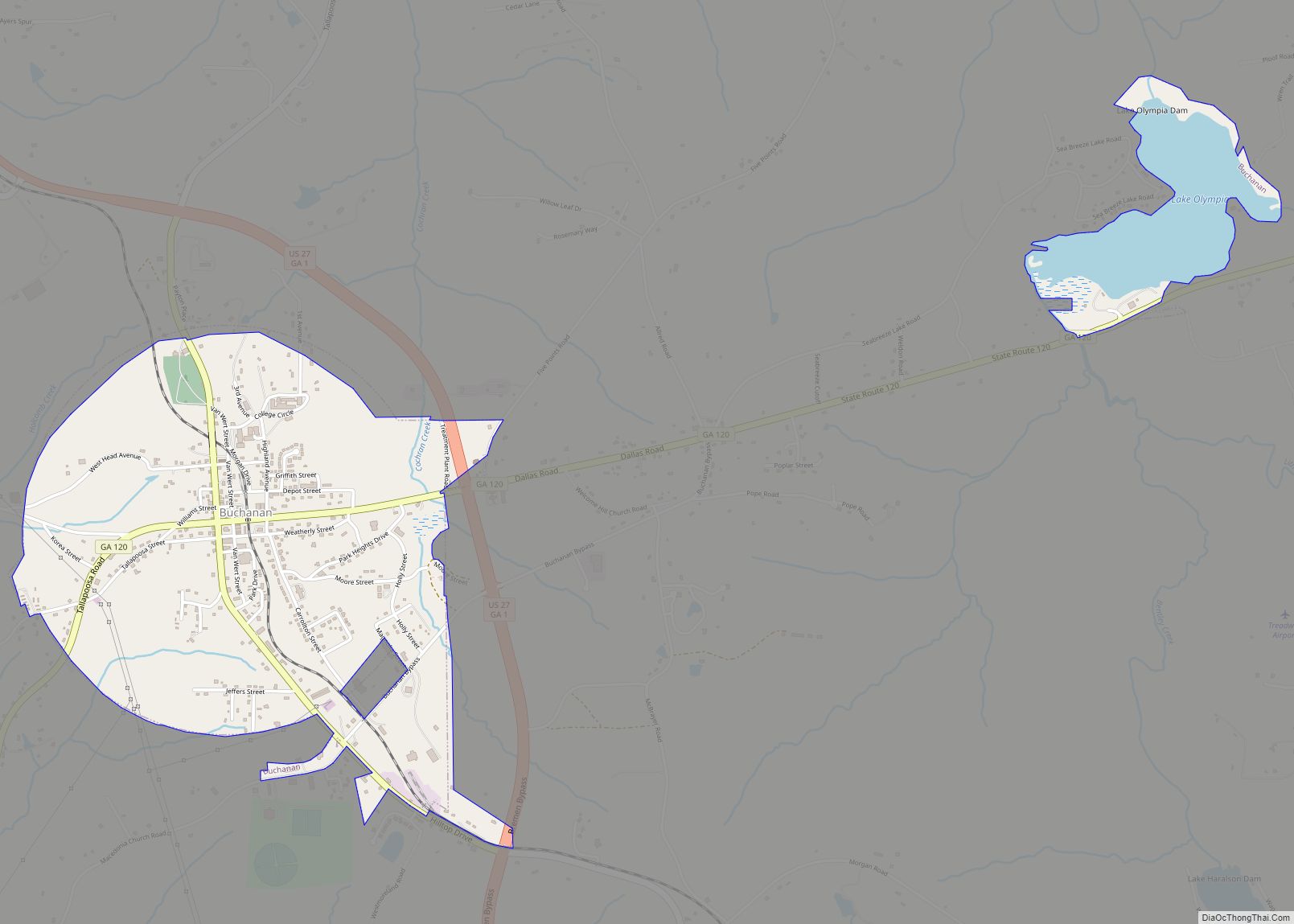
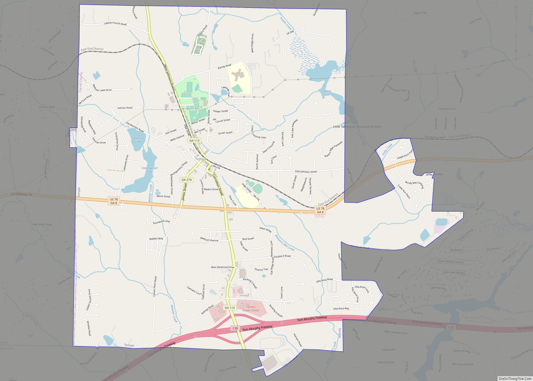
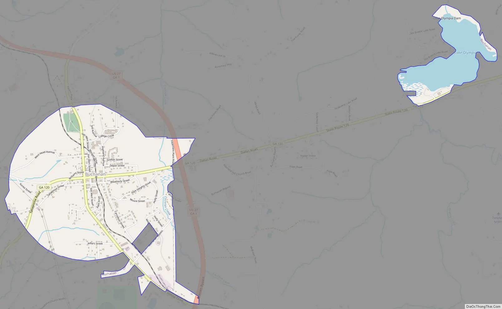
Buchanan Road Map
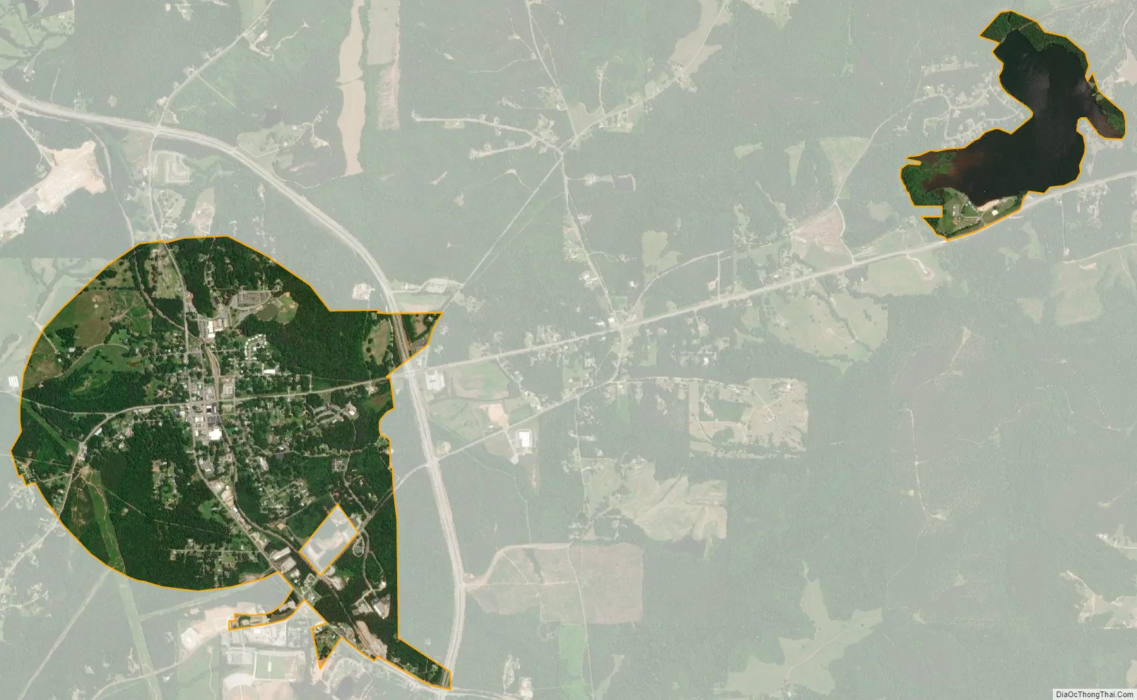
Buchanan city Satellite Map
Geography
Buchanan is located just east of the center of Haralson County at 33°48′6″N 85°11′1″W / 33.80167°N 85.18361°W / 33.80167; -85.18361 (33.801726, -85.183506). U.S. Route 27 bypasses the city to the east, leading north 16 miles (26 km) to Cedartown and south 6 miles (10 km) to Bremen.
According to the United States Census Bureau, Buchanan has a total area of 1.7 square miles (4.4 km), of which 1.5 square miles (3.8 km) are land and 0.2 square miles (0.5 km), or 12.42%, are water.
See also
Map of Georgia State and its subdivision:- Appling
- Atkinson
- Bacon
- Baker
- Baldwin
- Banks
- Barrow
- Bartow
- Ben Hill
- Berrien
- Bibb
- Bleckley
- Brantley
- Brooks
- Bryan
- Bulloch
- Burke
- Butts
- Calhoun
- Camden
- Candler
- Carroll
- Catoosa
- Charlton
- Chatham
- Chattahoochee
- Chattooga
- Cherokee
- Clarke
- Clay
- Clayton
- Clinch
- Cobb
- Coffee
- Colquitt
- Columbia
- Cook
- Coweta
- Crawford
- Crisp
- Dade
- Dawson
- Decatur
- DeKalb
- Dodge
- Dooly
- Dougherty
- Douglas
- Early
- Echols
- Effingham
- Elbert
- Emanuel
- Evans
- Fannin
- Fayette
- Floyd
- Forsyth
- Franklin
- Fulton
- Gilmer
- Glascock
- Glynn
- Gordon
- Grady
- Greene
- Gwinnett
- Habersham
- Hall
- Hancock
- Haralson
- Harris
- Hart
- Heard
- Henry
- Houston
- Irwin
- Jackson
- Jasper
- Jeff Davis
- Jefferson
- Jenkins
- Johnson
- Jones
- Lamar
- Lanier
- Laurens
- Lee
- Liberty
- Lincoln
- Long
- Lowndes
- Lumpkin
- Macon
- Madison
- Marion
- McDuffie
- McIntosh
- Meriwether
- Miller
- Mitchell
- Monroe
- Montgomery
- Morgan
- Murray
- Muscogee
- Newton
- Oconee
- Oglethorpe
- Paulding
- Peach
- Pickens
- Pierce
- Pike
- Polk
- Pulaski
- Putnam
- Quitman
- Rabun
- Randolph
- Richmond
- Rockdale
- Schley
- Screven
- Seminole
- Spalding
- Stephens
- Stewart
- Sumter
- Talbot
- Taliaferro
- Tattnall
- Taylor
- Telfair
- Terrell
- Thomas
- Tift
- Toombs
- Towns
- Treutlen
- Troup
- Turner
- Twiggs
- Union
- Upson
- Walker
- Walton
- Ware
- Warren
- Washington
- Wayne
- Webster
- Wheeler
- White
- Whitfield
- Wilcox
- Wilkes
- Wilkinson
- Worth
- Alabama
- Alaska
- Arizona
- Arkansas
- California
- Colorado
- Connecticut
- Delaware
- District of Columbia
- Florida
- Georgia
- Hawaii
- Idaho
- Illinois
- Indiana
- Iowa
- Kansas
- Kentucky
- Louisiana
- Maine
- Maryland
- Massachusetts
- Michigan
- Minnesota
- Mississippi
- Missouri
- Montana
- Nebraska
- Nevada
- New Hampshire
- New Jersey
- New Mexico
- New York
- North Carolina
- North Dakota
- Ohio
- Oklahoma
- Oregon
- Pennsylvania
- Rhode Island
- South Carolina
- South Dakota
- Tennessee
- Texas
- Utah
- Vermont
- Virginia
- Washington
- West Virginia
- Wisconsin
- Wyoming