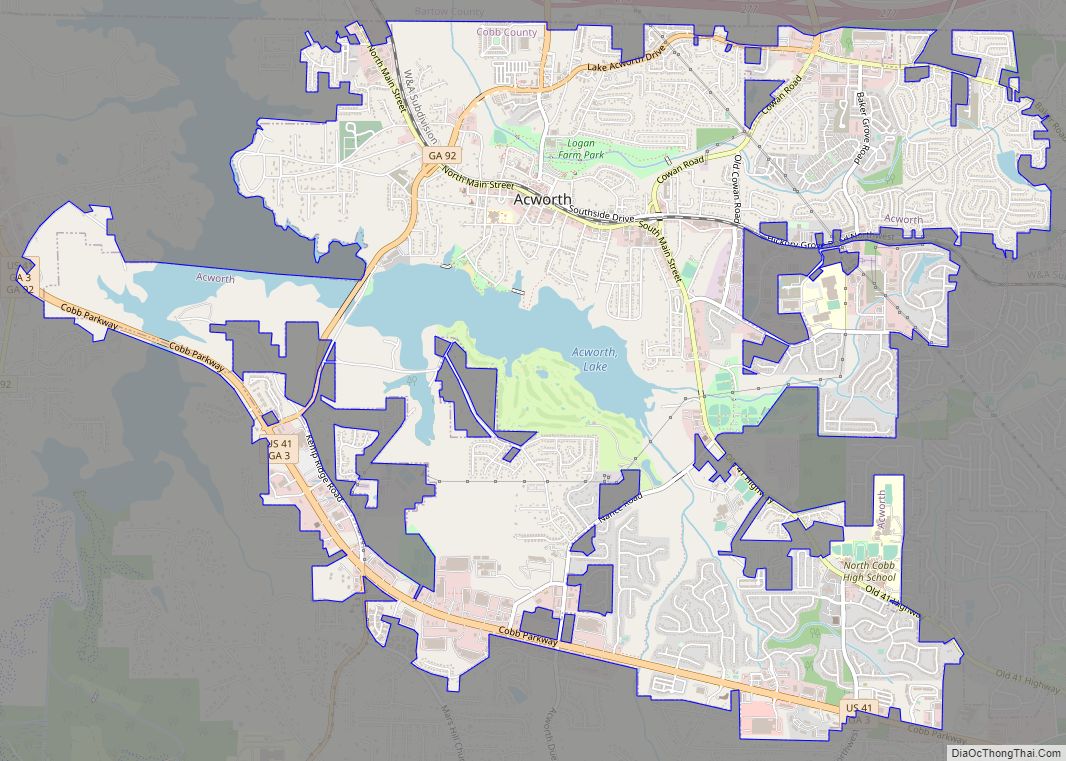
Acworth is a city in Cobb County, Georgia, United States. It is part of the Atlanta metropolitan area. The 2019 estimate for Acworth’s population is 22,818. As of the 2010 census, this city had a population of 20,425, up from 13,422 in 2000. Acworth is located in the foothills of the North Georgia mountains along the southeastern banks of Lake Acworth and Lake Allatoona on the Etowah River. Unincorporated areas known as Acworth extend into Bartow, Cherokee and Paulding counties.
Acworth’s is often referred to as “the Lake City” because of its proximity to Lake Allatoona and Lake Acworth.
| Name: | Acworth city |
|---|---|
| LSAD Code: | 25 |
| LSAD Description: | city (suffix) |
| State: | Georgia |
| County: | Cobb County |
| Incorporated: | 1840 |
| Total Area: | 9.79 sq mi (25.36 km²) |
| Land Area: | 9.09 sq mi (23.54 km²) |
| Water Area: | 0.70 sq mi (1.81 km²) |
| Total Population: | 22,440 |
| Population Density: | 2,468.65/sq mi (953.11/km²) |
| ZIP code: | 30101, 30102 |
| FIPS code: | 1300408 |
| Website: | www.acworth.org |
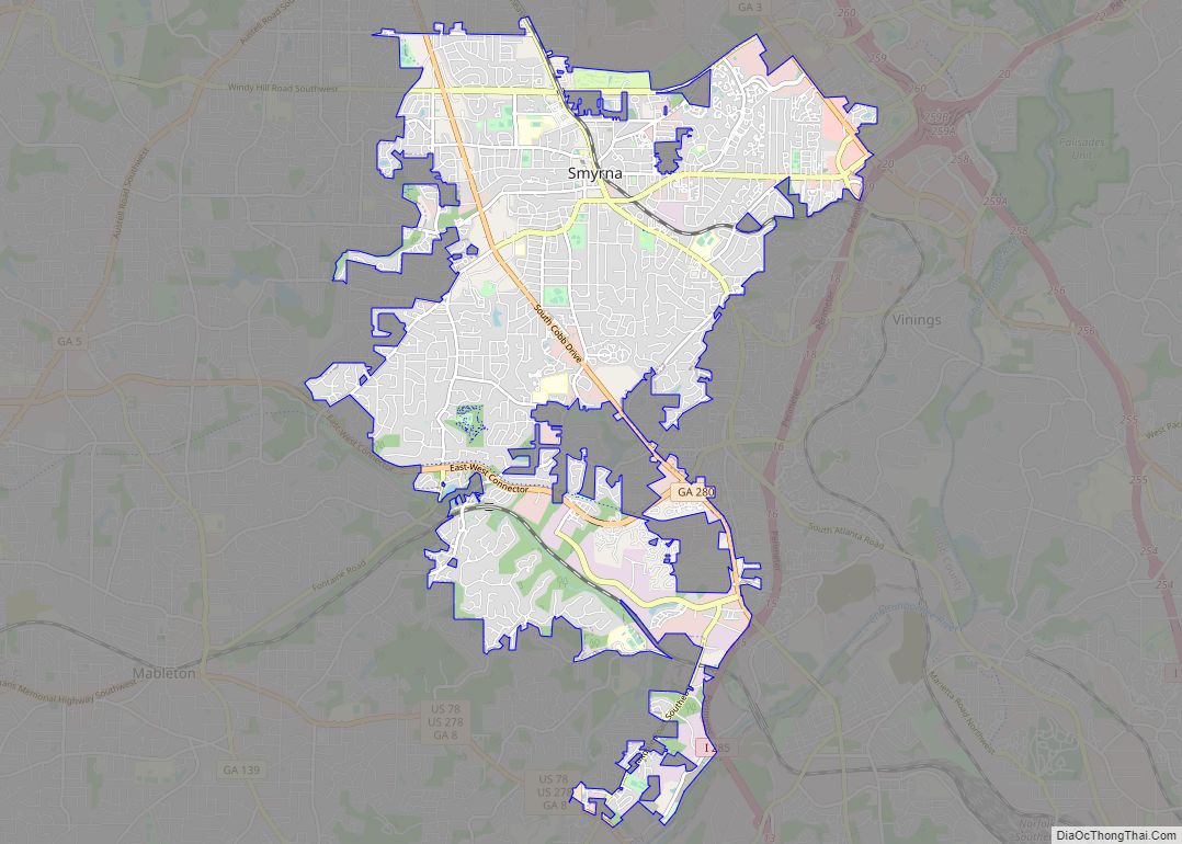
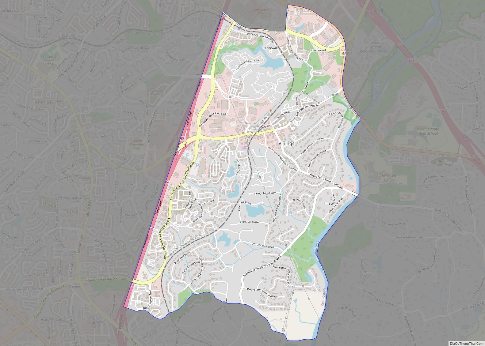
Online Interactive Map
Click on ![]() to view map in "full screen" mode.
to view map in "full screen" mode.
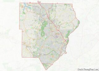
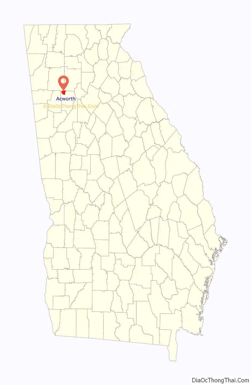
Acworth location map. Where is Acworth city?

History
Like the rest of Cobb County, the area now containing Acworth was carved out of the former Cherokee Nation in 1831 after the natives were expelled.
The Western and Atlantic Railroad was completed through town in 1840. A watering station for the locomotives was established there.
The town received its current name in 1843 from Western & Atlantic Railroad engineer Joseph L. Gregg, who named it for his hometown of Acworth, New Hampshire, which was named for the former Royal Navy Surveyor Sir Jacob Acworth.
Telegraph lines reached the town in 1851.
A private school was opened for white students in 1852. A newer private school operated from 1899 to 1935, when they integrated with the Cobb County School District. Until 1935, high school students from Acworth paid tuition to attend. Students outside the town were subsidized by the Cobb County School Board. Black students were educated separately in a grammar school. The closest Black high school was in Atlanta. Later, students were bused by the county to a segregated school in Marietta.
Acworth was incorporated on December 1, 1860.
Volunteers to fight in the Civil War enlisted in what became Company A (“Acworth Infantry”) in the 18th Georgia Volunteer Infantry and Company C (“Invincibles”) in the 41st Georgia Volunteer Infantry.
The town was captured by the Union June 6, 1864. The city was called “Little Shanty” by the Union troops, to contrast it with the next town south, “Big Shanty”, since renamed Kennesaw. The town was under martial law during the six months of occupation. On November 13, 1864, the town was burned down by the army of General W. T. Sherman, sparing 12 homes and one church; its citizens were left destitute.
The town had nearly recovered by the 1880s. Cotton farming in the area peaked from the 1890s through the 1920s. Low prices during the Great Depression resulted in a cessation of cotton farming in the area and throughout Cobb County.
During segregation, the railroad tracks served as a racial divide, with African Americans living to the northeast of the tracks and the whites to the southwest. There were few common public events. When a movie theater was erected in the 1930s, Blacks were allowed to access the balcony from a separate entrance. Whites sat on the main floor.
Volunteers formed a fire department in 1907.
There were eventually a total of three textile mills in town from 1905 through the 1980s. They employed about 800 workers at their peak.
In 1926, Main Street was paved. When the entire Dixie Highway (old U.S. Route 41 and part of the Cherokee Peachtree Trail) was paved in 1929, over 800 tourist vehicles entered the city daily.
When the Etowah River was dammed, forming Lake Allatoona, citizens feared that land near the town would become a swamp. They successfully petitioned for a second dam, resulting in Lake Acworth in the 1950s. This became a tourist attraction.
The town made a major improvement in its water and sewage lines in the late 1940s.
The city elected its first woman mayor, Mary McCall, in 1956 and 1961–66.
African-American students were schooled separately from white children until 1967.
Acworth was recognized as a 2010 All-America City Award winner by the National Civic League.
In 2011, the filming of several scenes for the Footloose remake took place in downtown Acworth. The Acworth Presbyterian Church was used as the primary church, and the house of Mayor Tommy Allegood was used as Julianne Hough’s character’s home.
In 2017, the city was the site of the WWA Wakeboarding National Championship.
Acworth Road Map

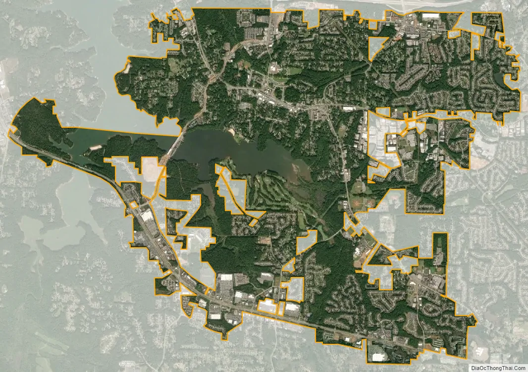
Acworth city Satellite Map
Geography
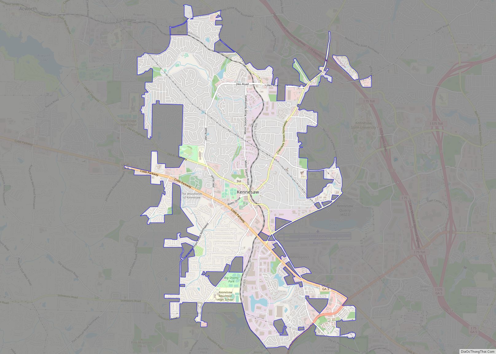
Acworth is located in the foothills of the North Georgia mountains along the southeastern banks of Lake Acworth and Lake Allatoona on the Etowah River. It is bordered by the city of Kennesaw to the southeast and by Bartow and Cherokee counties to the north.
Interstate 75 runs through the northern part of the city in Cherokee and Bartow counties, with access from exits 277 and 278. Via I-75, downtown Atlanta is 34 mi (55 km) southeast, and Chattanooga, Tennessee, is 88 mi (142 km) northwest. U.S. Route 41 and Georgia State Route 92 also run through the city, with GA-92 leading east 12 mi (19 km) to Woodstock, and south 18 mi (29 km) to Hiram. US-41 runs to the west of the city, leading southeast 6 mi (9.7 km) to Kennesaw, Georgia and northwest 12 mi (19 km) to Cartersville.
According to the United States Census Bureau, the city has a total area of 8.8 square miles (22.7 km), of which 8.3 square miles (21.4 km) is land and 0.54 square miles (1.4 km), or 6.05%, is water.
Unincorporated areas considered Acworth for mailing purposes extend into southeast Bartow County, southwest Cherokee County, and northeast Paulding County. Some of the incorporated portions of Acworth east of Nance Road and Acworth Due West Road have a Kennesaw mailing address.
See also
Map of Georgia State and its subdivision:- Appling
- Atkinson
- Bacon
- Baker
- Baldwin
- Banks
- Barrow
- Bartow
- Ben Hill
- Berrien
- Bibb
- Bleckley
- Brantley
- Brooks
- Bryan
- Bulloch
- Burke
- Butts
- Calhoun
- Camden
- Candler
- Carroll
- Catoosa
- Charlton
- Chatham
- Chattahoochee
- Chattooga
- Cherokee
- Clarke
- Clay
- Clayton
- Clinch
- Cobb
- Coffee
- Colquitt
- Columbia
- Cook
- Coweta
- Crawford
- Crisp
- Dade
- Dawson
- Decatur
- DeKalb
- Dodge
- Dooly
- Dougherty
- Douglas
- Early
- Echols
- Effingham
- Elbert
- Emanuel
- Evans
- Fannin
- Fayette
- Floyd
- Forsyth
- Franklin
- Fulton
- Gilmer
- Glascock
- Glynn
- Gordon
- Grady
- Greene
- Gwinnett
- Habersham
- Hall
- Hancock
- Haralson
- Harris
- Hart
- Heard
- Henry
- Houston
- Irwin
- Jackson
- Jasper
- Jeff Davis
- Jefferson
- Jenkins
- Johnson
- Jones
- Lamar
- Lanier
- Laurens
- Lee
- Liberty
- Lincoln
- Long
- Lowndes
- Lumpkin
- Macon
- Madison
- Marion
- McDuffie
- McIntosh
- Meriwether
- Miller
- Mitchell
- Monroe
- Montgomery
- Morgan
- Murray
- Muscogee
- Newton
- Oconee
- Oglethorpe
- Paulding
- Peach
- Pickens
- Pierce
- Pike
- Polk
- Pulaski
- Putnam
- Quitman
- Rabun
- Randolph
- Richmond
- Rockdale
- Schley
- Screven
- Seminole
- Spalding
- Stephens
- Stewart
- Sumter
- Talbot
- Taliaferro
- Tattnall
- Taylor
- Telfair
- Terrell
- Thomas
- Tift
- Toombs
- Towns
- Treutlen
- Troup
- Turner
- Twiggs
- Union
- Upson
- Walker
- Walton
- Ware
- Warren
- Washington
- Wayne
- Webster
- Wheeler
- White
- Whitfield
- Wilcox
- Wilkes
- Wilkinson
- Worth
- Alabama
- Alaska
- Arizona
- Arkansas
- California
- Colorado
- Connecticut
- Delaware
- District of Columbia
- Florida
- Georgia
- Hawaii
- Idaho
- Illinois
- Indiana
- Iowa
- Kansas
- Kentucky
- Louisiana
- Maine
- Maryland
- Massachusetts
- Michigan
- Minnesota
- Mississippi
- Missouri
- Montana
- Nebraska
- Nevada
- New Hampshire
- New Jersey
- New Mexico
- New York
- North Carolina
- North Dakota
- Ohio
- Oklahoma
- Oregon
- Pennsylvania
- Rhode Island
- South Carolina
- South Dakota
- Tennessee
- Texas
- Utah
- Vermont
- Virginia
- Washington
- West Virginia
- Wisconsin
- Wyoming