Map of Syria

Map of Syria

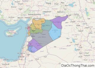
Syria occupies an area of around 185,180 sq. km in the Arabian Peninsula. In general terms, Syria is a flat desert plateau, dissected by mountains with a narrow coastal plain to the west that fronts the Mediterranean Sea. The coastline of Syria is around 180 km long and features sandy bays, low cliffs, and rocky … Read more

Map of Somalia

Map of Somalia

Located in the Horn of Africa, Somalia occupies an area of 637,657 sq. km.  As observed on the physical map above, the terrain of the country features plains, plateaus, and highlands.  A large part of the Somali peninsula is a tableland. To the extreme north, a narrow semidesert coastal plain that varies in width from … Read more

Map of Western Sahara

Map of Western Sahara

Western Sahara is located in North Africa, bordering the Atlantic Ocean. It is nearly entirely covered by the Sahara Desert, the largest desert in the world. Subsequently, the landscape is mostly low, flat desert representing one of the Earth’s most inhospitable areas. Wadis or dry river beds that sometimes have intermittent flowing rivers dot the landscape in many … Read more

Map of New Caledonia

Map of New Caledonia

The main island of New Caledonia– Grande Terre is cigar-shaped and has rugged mountain ranges running from north to south and rising at two high peaks. The island’s highest point is Mont Panié at an elevation of 1,628m is located in the northeast; while Mont Humboldt at an elevation of 1,618m is located in the … Read more

Map of French Polynesia

Map of French Polynesia

Covering a total land area of 4,167 sq.km (1,609 sq mi) and spread over a vast area about the size of Europe, the widely scattered 118 islands and atolls of French Polynesia is an overseas collectivity of France and are divided into 5 island groups: the Austral, Gambier, Marquesas, Society and Tuamotu archipelagos; in the south-central Pacific Ocean. These island groups can … Read more

Map of Gibraltar

Map of Gibraltar

Covering an area of only 6.7 sq. km, the British Overseas Territory of Gibraltar is located at the southern edge of the Iberian Peninsula in southwestern Europe. As marked on the map by an upright yellow triangle, the Rock of Gibraltar is the most significant landmark of the region. This spectacular rock monolith rises to … Read more

Map of British Virgin Islands

Map of British Virgin Islands

Covering a total area of only 153 sq. km, the British Virgin Islands is a British Overseas Territory located in the northeastern Caribbean. As observed on the map, the British Virgin Islands comprises of 4 large islands namely, Tortola, Anegada, Virgin Gorda, and Jost Van Dyke; along with 50 smaller islands and islets. Most of … Read more

Map of Anguilla

Map of Anguilla

Ringed by coral reefs and white sand beaches, Anguilla (a British Overseas Territory), is a mostly flat, low-lying island of coral and limestone;  located in the north-eastern Caribbean Sea, east of Puerto Rico and US Virgin Islands. As observed on the physical map of Anguilla above, there are no permanent rivers or streams on the … Read more

Map of Wallis & Futuna

Map of Wallis & Futuna

Covering a land area of 142.42 sq.km (54.99 sq mi), Wallis and Futuna Islands is an overseas collectivity of France, located in the south Pacific Ocean. The territory comprises of 3 principal volcanic islands and several small islets, split into two island groups the Wallis Islands and the Futuna Islands. Located on the Futuna Island is the island … Read more

Map of Cook Islands

Map of Cook Islands

Covering a total land area of 240 sq. km, the Cook Islands are a group of 15 small islands that are spread over 2 million sq. km in the South Pacific Ocean. The 15 islands are geographically divided into the Northern and Southern island groups. As can be observed on the map above, the northern islands are mostly … Read more

Map of Montserrat

Map of Montserrat

Montserrat is a British Overseas Territory and a part of the Leeward Islands chain in the Caribbean. It has an area of 102 sq. km (39 sq mi). This mountainous, pear-shaped island is currently increasing in size because of the build up of volcanic deposits on the southeast coast. The island is measured at 16km (10 miles) … Read more

Map of Falkland Islands (Islas Malvinas)

Map of Falkland Islands (Islas Malvinas)

The Falkland Islands covers a total area of 12,173 sq.km (4,700 sq mi), and are an overseas territory of the United Kingdom in South Atlantic Ocean. As observed on the physical map above, The Falkland Islands are an archipelago comprised of two large islands (East Falkland and West Falkland) and several hundred smaller ones, that are ringed … Read more