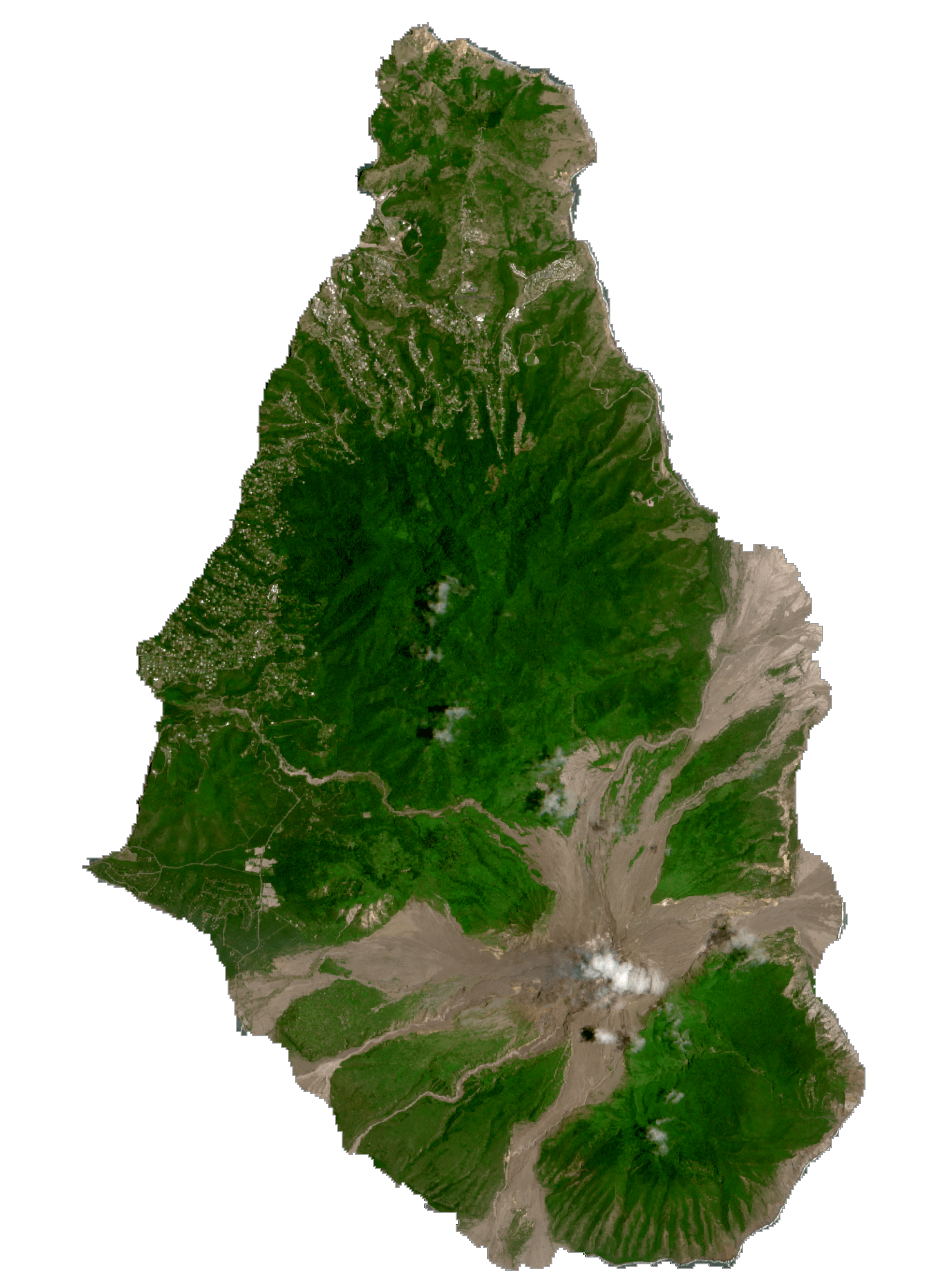
Montserrat is a British Overseas Territory and a part of the Leeward Islands chain in the Caribbean. It has an area of 102 sq. km (39 sq mi). This mountainous, pear-shaped island is currently increasing in size because of the build up of volcanic deposits on the southeast coast.
The island is measured at 16km (10 miles) long and 11km (7 miles) wide, with rock cliffs rising 15 to 30 m (50-100ft) above the sea and smooth bottomed sandy beaches scattered among coves on the west ( Caribbean) side of the island.
The island’s highest point is located in the Soufriere Hills, but a definitive height is unavailable due to the consistent eruptions of the volcano. Scattered small streams drains the northern reaches of the island.
| Flag: |  |
|---|---|
| Legal Name: | Montserrat |
| Capital Value: | Plymouth; note – Plymouth was abandoned in 1997 because of volcanic activity; interim government buildings have been built at Brades Estate, the de facto capital, in the Carr’s Bay/Little Bay vicinity at the northwest end of Montserrat |
| Official languages: | English |
| Demonym(s): | Montserratian |
| Government: | Parliamentary dependency under a constitutional monarchy |
| Legislature: | Legislative Assembly |
| Total Area: | 102 km² |
| Land Area: | 102 km² |
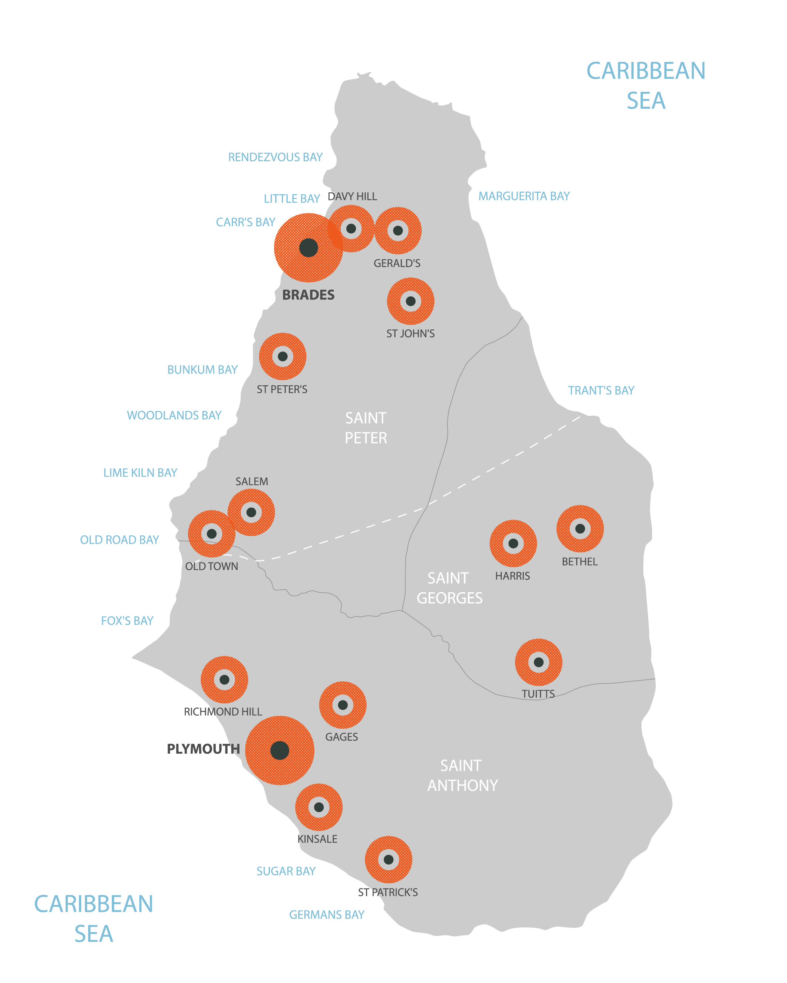
| Population: | 5,315 |
| Density: | 46/km (119.1/sq mi) (not ranked) |
| Currency Value: | East Caribbean dollars (XCD) |
| Driving side: | left |
| Calling code: | +1-664 |
| Internet TLD: | .ms |
Discover the beauty of Montserrat from the comfort of your home with this map of the British Overseas Territory. This satellite imagery map showcases the island’s settlements, exclusive zone, islands, points, highways, roads, streams, mountains, and airports. Explore the Caribbean Sea with a few clicks and get to know Montserrat like never before!
Online Interactive Political Map
Click on ![]() to view map in "full screen" mode.
to view map in "full screen" mode.
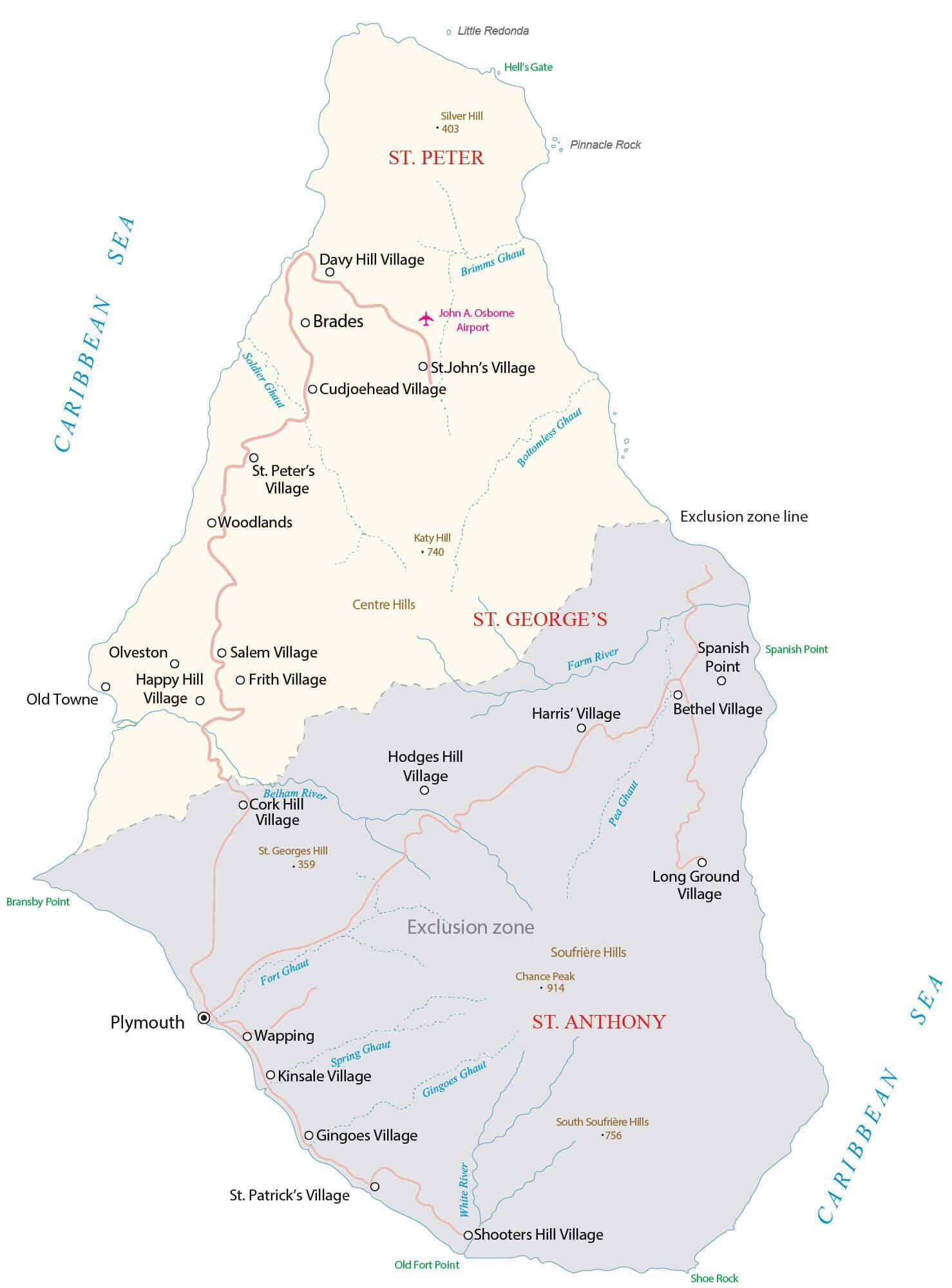
Montserrat is divided into 3 parishes. The parishes are: Saint Anthony, Saint Georges and Saint Peter.
Located on the south western coast of the island was Plymouth – the capital and the only port of the island country. The volcanic eruptions led to the complete destruction of the entire city and hence the administrative capital was relocated to Brades – the newly-built capital and the largest city of Montserrat; located in the north western part of the island.
Location Maps
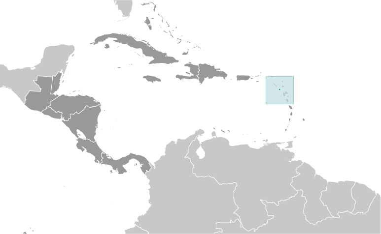
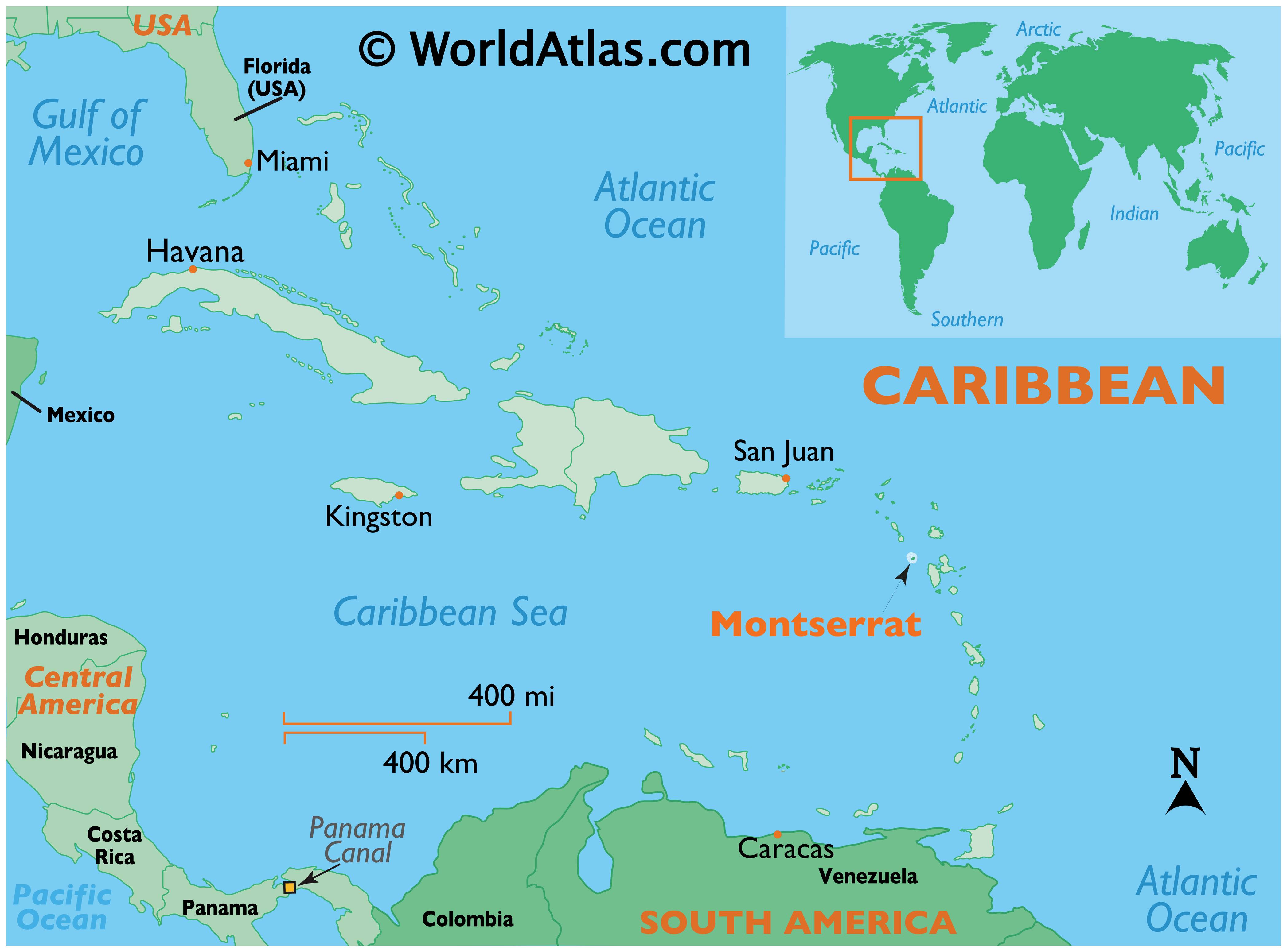
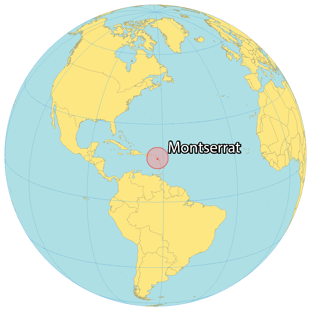
Where is Montserrat?
Montserrat is an island and British Overseas Territory in the Caribbean Sea. It is composed of one large single island, split by the “exclusion zone” due to volcanic activity. On September 22, 1997, the eruption of the Soufrière Hills volcano destroyed the southern half of the island, including its roads, capital city, and airport. This event led to more than half of the Montserrat people abandoning the island.
Montserrat covers a total area of 102 square kilometers (39 sq mi). It is larger than Anguilla but smaller than the British Virgin Islands. In addition, Montserrat includes several small off-shore islands, such as Little Redonda to the north and Pinnacle Rock and Statue Rock to the east.
High Definition Political Map of Montserrat
History
Pre-colonial era
Archaeological field work in 2012 in Montserrat’s Centre Hills indicated there was an Archaic (pre-Arawak) occupation between 2000–500 BCE. Later coastal sites show the presence of the Saladoid culture (until 550 CE). The native Caribs are believed to have called the island Alliouagana, meaning ‘Land of the Prickly Bush’.
In 2016, nine petroglyphs were discovered by local residents hiking in a wooded area near Soldier Ghaut. Another was discovered in 2018 in the same area of the island. The carvings are believed to be 1000-1500 years old.
Early European period
In November 1493, Christopher Columbus passed Montserrat in his second voyage, after being told that the island was unoccupied due to raids by the Caribs.
A number of Irishmen settled in Monsterrat in 1632. Most came from nearby Saint Kitts at the instigation of the island’s governor Thomas Warner, with more settlers arriving later from Virginia. The first settlers “appear to have been cultivators, each working his own little farm”.
The preponderance of Irish in the first wave of European settlers led a leading legal scholar to remark that a “nice question” is whether the original settlers took with them the law of the Kingdom of Ireland insofar as it differed from the law of the Kingdom of England.
The Irish being historical allies of the French, especially in their dislike of the English, invited the French to claim the island in 1666, although no troops were sent by France to maintain control. However, the French did attack and briefly occupy the island in the late 1660s; it was captured shortly afterwards by the English and English control of the island was confirmed under the Treaty of Breda the following year. Despite the seizing by force of the island by the English, the island’s legal status is that of a “colony acquired by settlement”.
A neo-feudal colony developed amongst the so-called “redlegs”. The colonists began to transport Sub-Saharan African slaves for labour, as was common to most Caribbean islands. The colonists built an economy based on the production of sugar, rum, arrowroot and sea island cotton, cultivated on large plantations by slave labour. By the late 18th century, numerous plantations had been developed on the island.
18th century
There was a brief French attack on Montserrat in 1712. On 17 March 1768, a slave rebellion failed but their efforts were remembered. Slavery was abolished in 1834. In 1985, the people of Montserrat made St Patrick’s Day a ten-day public holiday to commemorate the uprising. Festivities celebrate the culture and history of Montserrat in song, dance, food and traditional costumes.
In 1782, during the American Revolutionary War, as America’s first ally, France captured Montserrat in their war of support of the Americans. The French, not intent on truly colonising the island, then agreed to return the island to Great Britain under the 1783 Treaty of Paris.
New crops and politics
Britain abolished slavery in Montserrat and its other territories effective August 1834.
During the nineteenth century, falling sugar prices had an adverse effect on the island’s economy, as Brazil and other nations competed in the trade.
The first lime tree orchards on the island were planted in 1852 by a local planter Mr Burke. Later, in 1857, the British philanthropist Joseph Sturge bought a sugar estate to prove it was economically viable to employ paid labour rather than slaves. Numerous members of the Sturge family bought additional land. In 1869, the family established the Montserrat Company Limited and planted Key lime trees, started the commercial production of lime juice, with more than 100,000 gallons produced annually by 1895, set up a school, and sold parcels of land to the inhabitants of the island. The pure lime juice was transported in casks to England where it was clarified and bottled by Evans, Sons & Co, of Liverpool, with a trade mark on each bottle intended to guarantee quality to the public.
Much of Montserrat came to be owned by smallholders.
From 1871 to 1958, Montserrat was administered as part of the federal crown colony of the British Leeward Islands, becoming a province of the short-lived West Indies Federation from 1958 to 1962. The first Chief Minister of Montserrat was William Henry Bramble of the Montserrat Labour Party from 1960 to 1970; he worked to promote labour rights and boost tourism to the island, and Montserrat’s original airport was named in his honour. However, Bramble’s son Percival Austin Bramble was critical of the way tourist facilities were being constructed, and he subsequently set up his own party (the Progressive Democratic Party) which went on to win the 1970 Montserratian general election, with Percival Bramble serving as Chief Minister from 1970 to 1978. The period 1978 to 1991 was dominated politically by Chief Minister John Osborne and his People’s Liberation Movement; his brief flirtation with possibly declaring independence never materialised.
On 10 May 1991, the Caribbean Territories order came into force, formally abolishing the death penalty for murder on Montserrat.
Corruption allegations within the PLM party resulted in the collapse of the Osborne government in 1991, with Reuben Meade becoming the new chief minister. As a result, early elections were called.
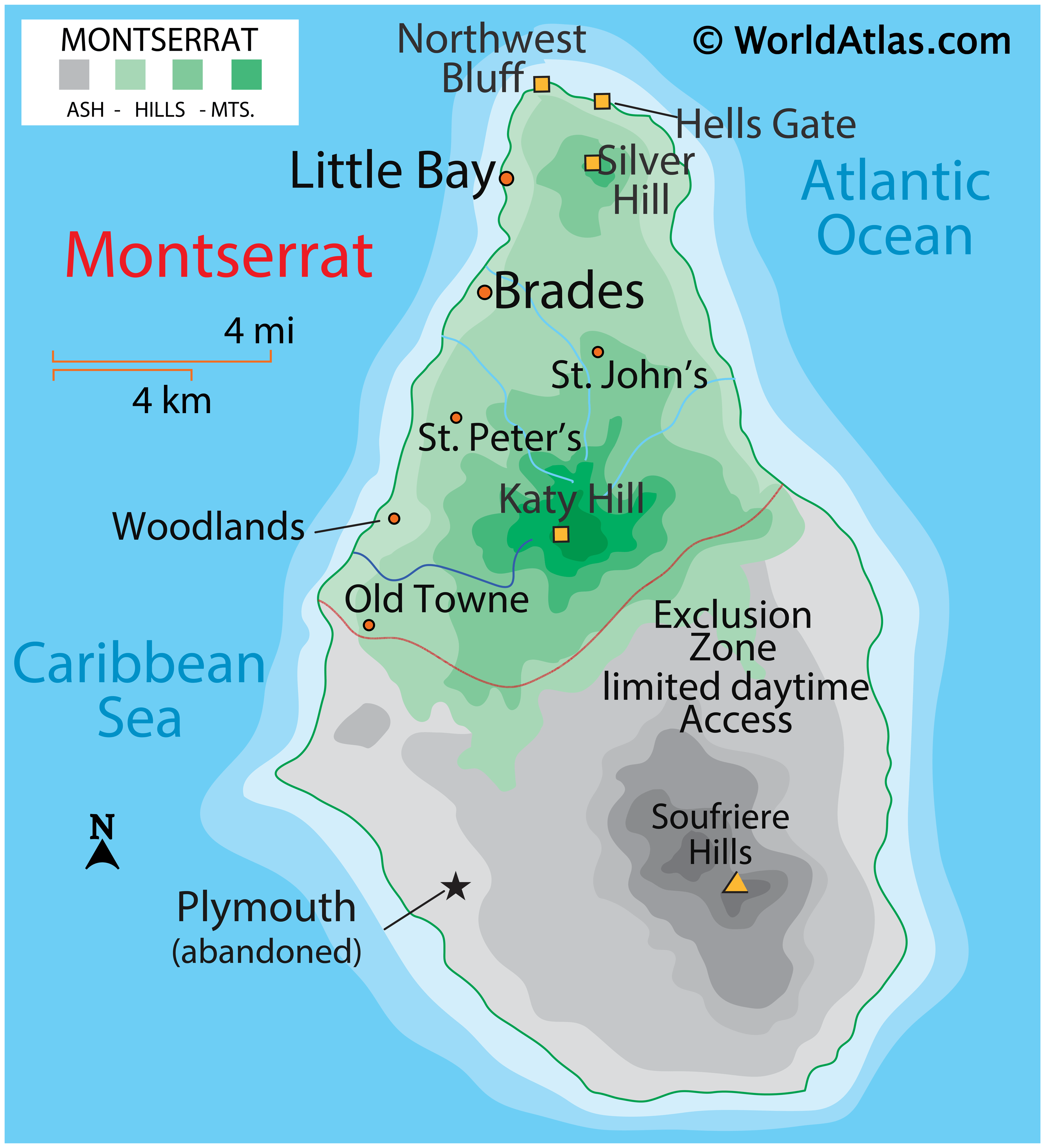
In 1995, Montserrat was devastated by the catastrophic volcanic eruptions of the Soufrière Hills, which destroyed the capital city of Plymouth, and necessitated the evacuation of a large part of the island. Many Montserratians emigrated abroad, mainly to the United Kingdom, though in recent years some have started returning. The eruptions rendered the entire southern half of the island uninhabitable, and it is currently designated an Exclusion Zone with restricted access.
Criticism of the Montserratian government’s response to the disaster led to the resignation of Chief Minister Bertrand Osborne in 1997, after only a year in office, and being replaced by David Brandt who remained in office until 2001. Since leaving office, Brandt has been the subject of multiple criminal investigation into alleged sex offences with minors. He was found guilty of six counts of sexual exploitation and sentenced to fifteen years in July 2021.
John Osborne returned as Chief Minister following victory in the 2001 election, being ousted by Lowell Lewis of the Montserrat Democratic Party in 2006. Reuben Meade returned to office in 2009 to 2014; during his term the post of Chief Minister was replaced with that of Premier.
In the autumn of 2017, Montserrat was not hit by Hurricane Irma and sustained only minor damage from Hurricane Maria.
Since November 2019, Easton Taylor-Farrell of the Movement for Change and Prosperity party has been the island’s Premier.
Physical Map of Montserrat
Geography
The island of Montserrat is located approximately 25 miles (40 km) south-west of Antigua, 13 miles (21 km) south-east of Redonda (a small island owned by Antigua and Barbuda), and 35 miles (56 km) north-west of the French overseas region of Guadeloupe. Beyond Redonda lies Nevis (part of St Kitts and Nevis), about 30 miles (48 km) to the north-west. It comprises 104 km (40 sq mi) and is gradually increasing owing to the buildup of volcanic deposits on the south-east coast. The island is 16 km (9.9 mi) long and 11 km (6.8 mi) wide and consists of a mountainous interior surrounded by a flatter littoral region, with rock cliffs rising 15 to 30 m (49 to 98 ft) above the sea and a number of smooth bottomed sandy beaches scattered among coves on the western (Caribbean Sea) side of the island. The major mountains are (from north to south) Silver Hill, Katy Hill in the Centre Hills range, the Soufrière Hills and the South Soufrière Hills. The Soufrière Hills volcano is the island’s highest point; its pre-1995 height was 915 metres (3,002 ft), however it has now grown due post-eruption due to the creation of a lava dome, with its current height being estimated at 1,050 metres (3,440 ft).
The 2011 estimate by the CIA indicates that 30% of the island’s land is classified as agricultural, 20% as arable, 25% as forest and the balance as “other”.
Montserrat has a few tiny off-shore islands, such as Little Redonda off its north coast and Pinnacle Rock and Statue Rock off its east.
Volcano and exclusion zone
In July 1995, Montserrat’s Soufrière Hills volcano, dormant for centuries, erupted and soon buried the island’s capital, Plymouth, in more than 12 metres (39 ft) of mud, destroyed its airport and docking facilities, and rendered the southern part of the island, now termed the exclusion zone, uninhabitable and not safe for travel. The southern part of the island was evacuated and visits are severely restricted. The exclusion zone also includes two sea areas adjacent to the land areas of most volcanic activity.
After the destruction of Plymouth and disruption of the economy, more than half of the population left the island, which also lacked housing. During the late 1990s, additional eruptions occurred. On 25 June 1997, a pyroclastic flow travelled down Mosquito Ghaut. This pyroclastic surge could not be restrained by the ghaut and spilled out of it, killing 19 people who were in the (officially evacuated) Streatham village area. Several others in the area suffered severe burns.
In recognition of the disaster, in 1998, the people of Montserrat were granted full residency rights in the United Kingdom, allowing them to migrate if they chose. British citizenship was granted in 2002.
For a number of years in the early 2000s, the volcano’s activity consisted mostly of infrequent ventings of ash into the uninhabited areas in the south. The ash falls occasionally extended into the northern and western parts of the island. In the most recent period of increased activity at the Soufrière Hills volcano, from November 2009 through February 2010, ash vented and there was a vulcanian explosion that sent pyroclastic flows down several sides of the mountain. Travel into parts of the exclusion zone was occasionally allowed, though only by a licence from the Royal Montserrat Police Force. Since 2014 the area has been split into multiple subzones with varying entry and use restrictions, based on volcanic activity: some areas even being (in 2020) open 24 hours and inhabited. The most dangerous zone, which includes the former capital, remains forbidden to casual visitors due to volcanic and other hazards, especially due to the lack of maintenance in destroyed areas. It is legal to visit this area when accompanied by a government-authorized guide.
The northern part of Montserrat has largely been unaffected by volcanic activity, and remains lush and green. In February 2005, Princess Anne officially opened what is now called the John A. Osborne Airport in the north. Since 2011, it handles several flights daily operated by Fly Montserrat Airways. Docking facilities are in place at Little Bay, where the new capital town is being constructed; the new government centre is at Brades, a short distance away.
Wildlife
Montserrat, like many isolated islands, is home to rare, endemic plant and animal species. Work undertaken by the Montserrat National Trust in collaboration with the Royal Botanic Gardens, Kew has centred on the conservation of pribby (Rondeletia buxifolia) in the Centre Hills region. Until 2006, this species was known only from one book about the vegetation of Montserrat. In 2006, conservationists also rescued several plants of the endangered Montserrat orchid (Epidendrum montserratense) from dead trees on the island and installed them in the security of the island’s botanic garden.
Montserrat is also home to the critically endangered giant ditch frog (Leptodactylus fallax), known locally as the mountain chicken, found only in Montserrat and Dominica. The species has undergone catastrophic declines due to the amphibian disease Chytridiomycosis and the volcanic eruption in 1997. Experts from Durrell Wildlife Conservation Trust have been working with the Montserrat Department of Environment to conserve the frog in-situ in a project called “Saving the Mountain Chicken”, and an ex-situ captive breeding population has been set up in partnership with Durrell Wildlife Conservation Trust, Zoological Society of London, Chester Zoo, Parken Zoo, and the Governments of Montserrat and Dominica. Releases from this programme have already taken place in a hope to increase the numbers of the frog and reduce extinction risk from Chytridiomycosis.
The national bird is the endemic Montserrat oriole (Icterus oberi). The IUCN Red List classifies it as vulnerable, having previously listed it as critically endangered. Captive populations are held in several zoos in the UK including: Chester Zoo, London Zoo, Jersey Zoo and Edinburgh Zoo.
The Montserrat galliwasp (Diploglossus montisserrati), a type of lizard, is endemic to Montserrat and is listed on the IUCN Red List as critically endangered. A species action plan has been developed for this species.
In 2005, a biodiversity assessment for the Centre Hills was conducted. To support the work of local conservationists, a team of international partners, including Durrell Wildlife Conservation Trust, Royal Botanic Gardens, Kew, Royal Society for the Protection of Birds and Montana State University, carried out extensive surveys and collected biological data. Researchers from Montana State University found that the invertebrate fauna was particularly rich on the island. The report found that the number of invertebrate species known to occur in Montserrat is 1241. The number of known beetle species is 718 species from 63 families. It is estimated that 120 invertebrates are endemic to Montserrat.
Montserrat is known for its coral reefs and its caves along the shore. These caves house many species of bats, and efforts are underway to monitor and protect the ten species of bats from extinction.
The Montserrat tarantula (Cyrtopholis femoralis) is the only species of tarantula native to the island. It was first bred in captivity at the Chester Zoo in August 2016.
Climate
Montserrat has a tropical rainforest climate (Af according to the Köppen climate classification) with the temperature being warm and consistent year-round, and lots of precipitation. Summer and autumn are wetter because of Atlantic hurricanes.
Montserrat Satellite Map