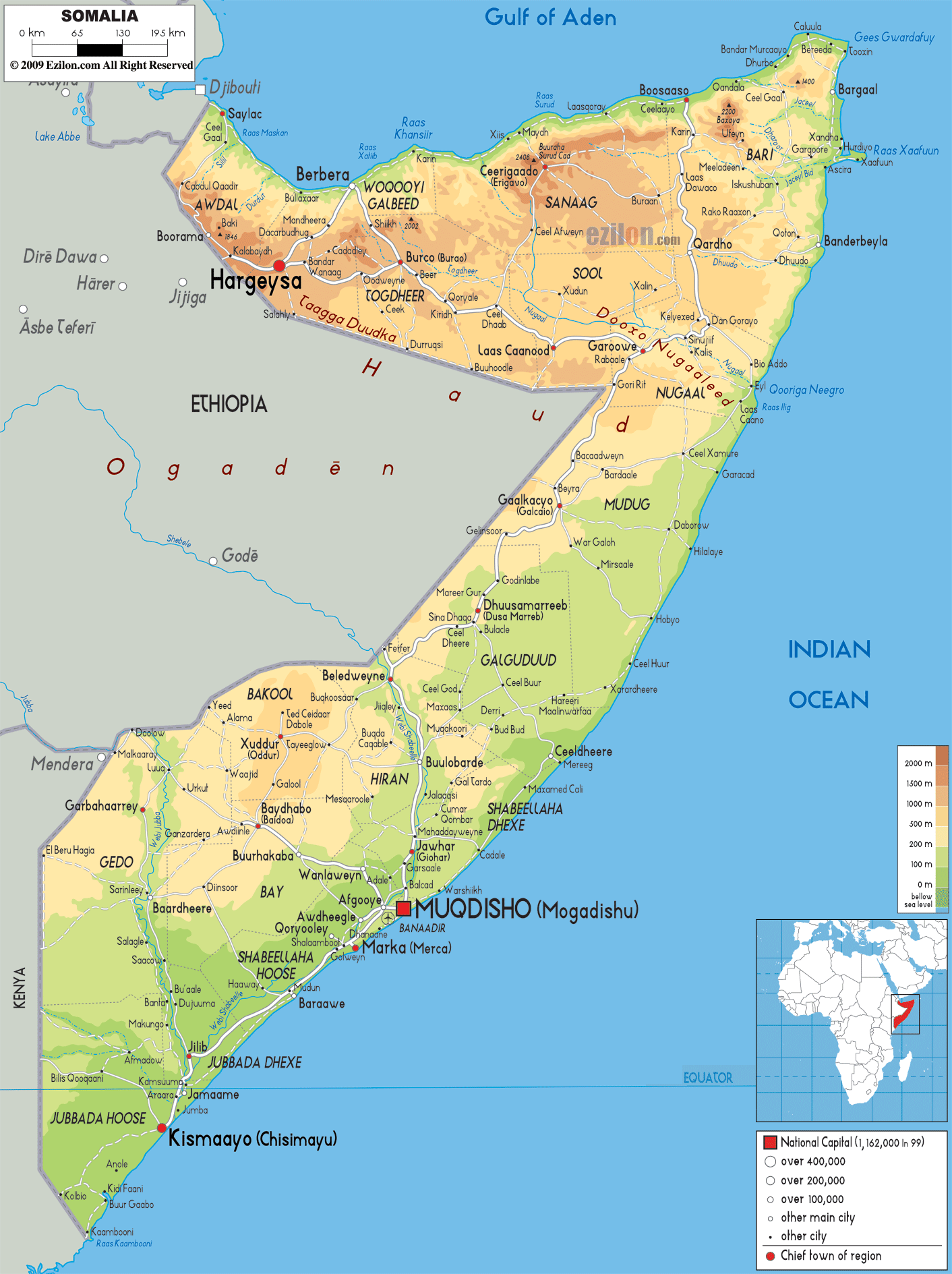
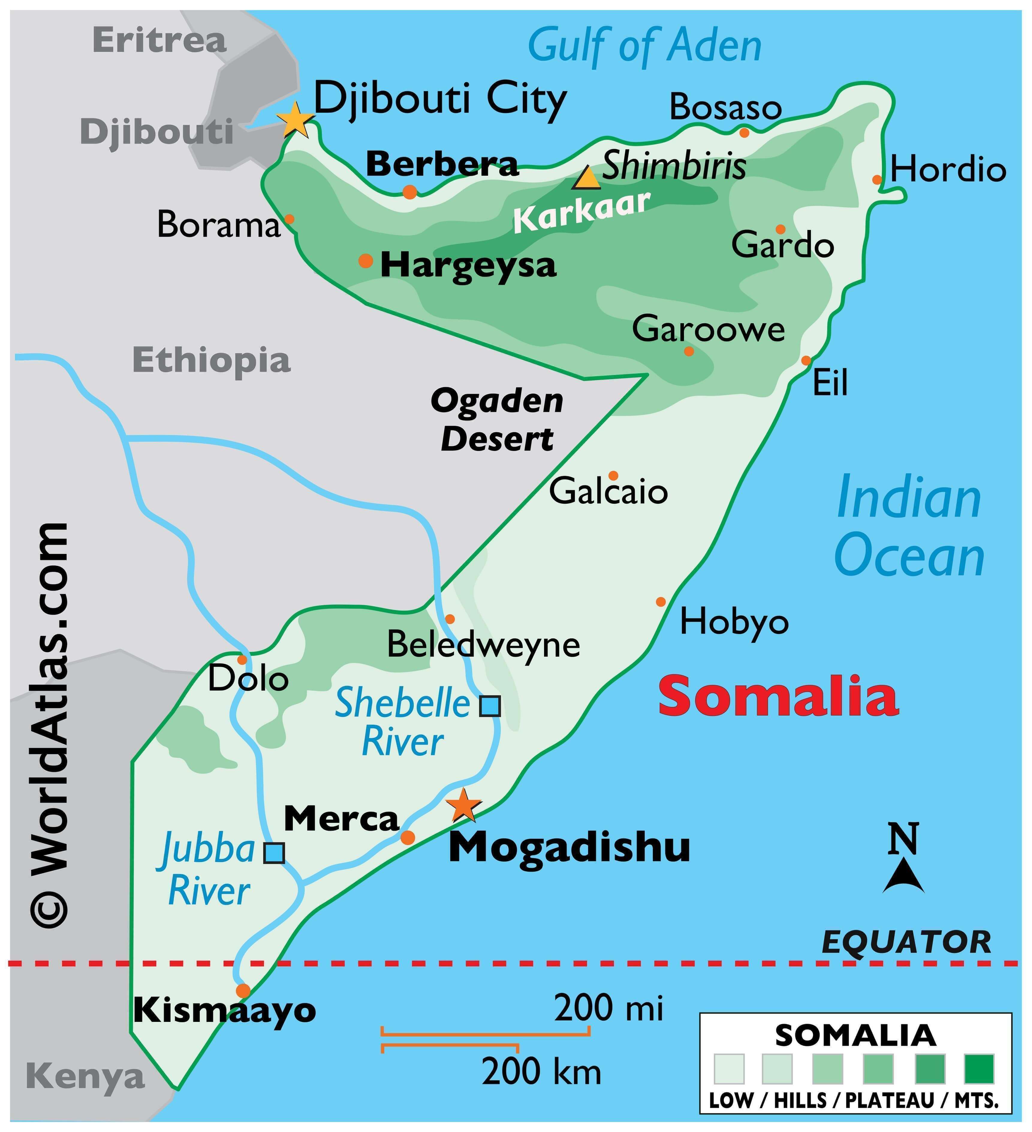
Located in the Horn of Africa, Somalia occupies an area of 637,657 sq. km. As observed on the physical map above, the terrain of the country features plains, plateaus, and highlands.
A large part of the Somali peninsula is a tableland. To the extreme north, a narrow semidesert coastal plain that varies in width from around 12 km in the west to only 2 km in the east, borders the Gulf of Aden. It is called Guban. Beyond this plain is the maritime mountain range of the Karkaar Mountains (marked on the map) hosting the highest point in the country, the 2,460 m tall Mount Shimbiris. The range extends from the country’s border with Ethiopia in the west up to the tip of the Horn of Africa.
Southwards are broad plateau lands lacking perennial rivers that gradually drop in elevation to the east towards the Indian Ocean.
Alluvial plains are located further south and separated from the southern coast by a massive belt of ancient sand dunes that extend from Kismaayoto to Hobyo.
Most of the plateaus of Somalia are dissected by deep river valleys that have rivers flowing in the wet season but remain dry at other times of the year. These rivers drain into the Indian Ocean. The only perennial rivers of the country are the Jubba and the Shabeelle to the south of the country. Both have been marked on the map.
| Flag: |  |
|---|---|
| Legal Name: | Federal Republic of Somalia |
| Capital Value: | Mogadishu |
| Official languages: | Somali, Arabic |
| Demonym(s): | Somali |
| Government: | Federal parliamentary republic |
| Legislature: | Federal Parliament |
| Total Area: | 637,657 km² |
| Land Area: | 627,337 km² |
| Water Area: | 10,320 km² |
| Population: | 15,442,905 |
| Density: | 27.2/km (70.4/sq mi) (199th) |
| Currency Value: | Somali shillings (SOS) |
| Driving side: | right |
| Calling code: | +252 |
| Internet TLD: | .so |
Explore the wonders of Somalia with this interactive map. Discover the country’s diverse landscape, from the Ogo Mountains in the north to the central plains in the south. See the major cities, towns, rivers, lakes, and roads that make up the country. Satellite imagery and a terrain map provide an in-depth look at the region.
Online Interactive Political Map
Click on ![]() to view map in "full screen" mode.
to view map in "full screen" mode.
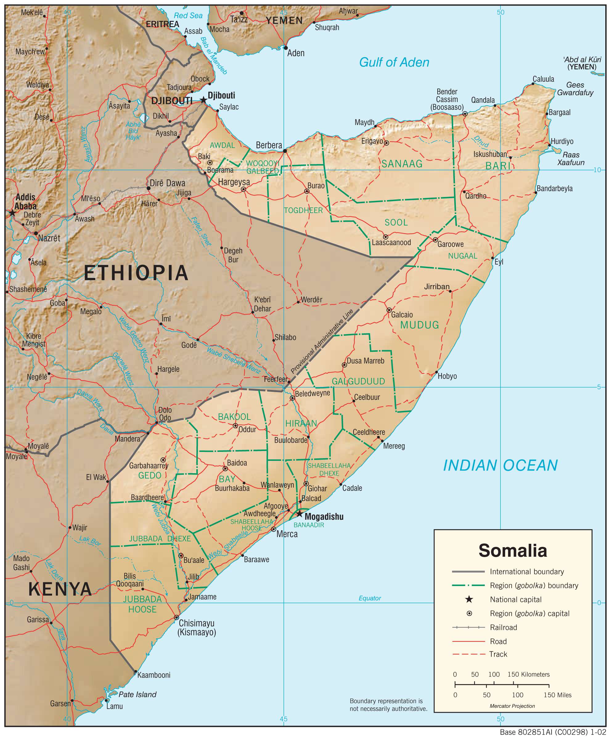
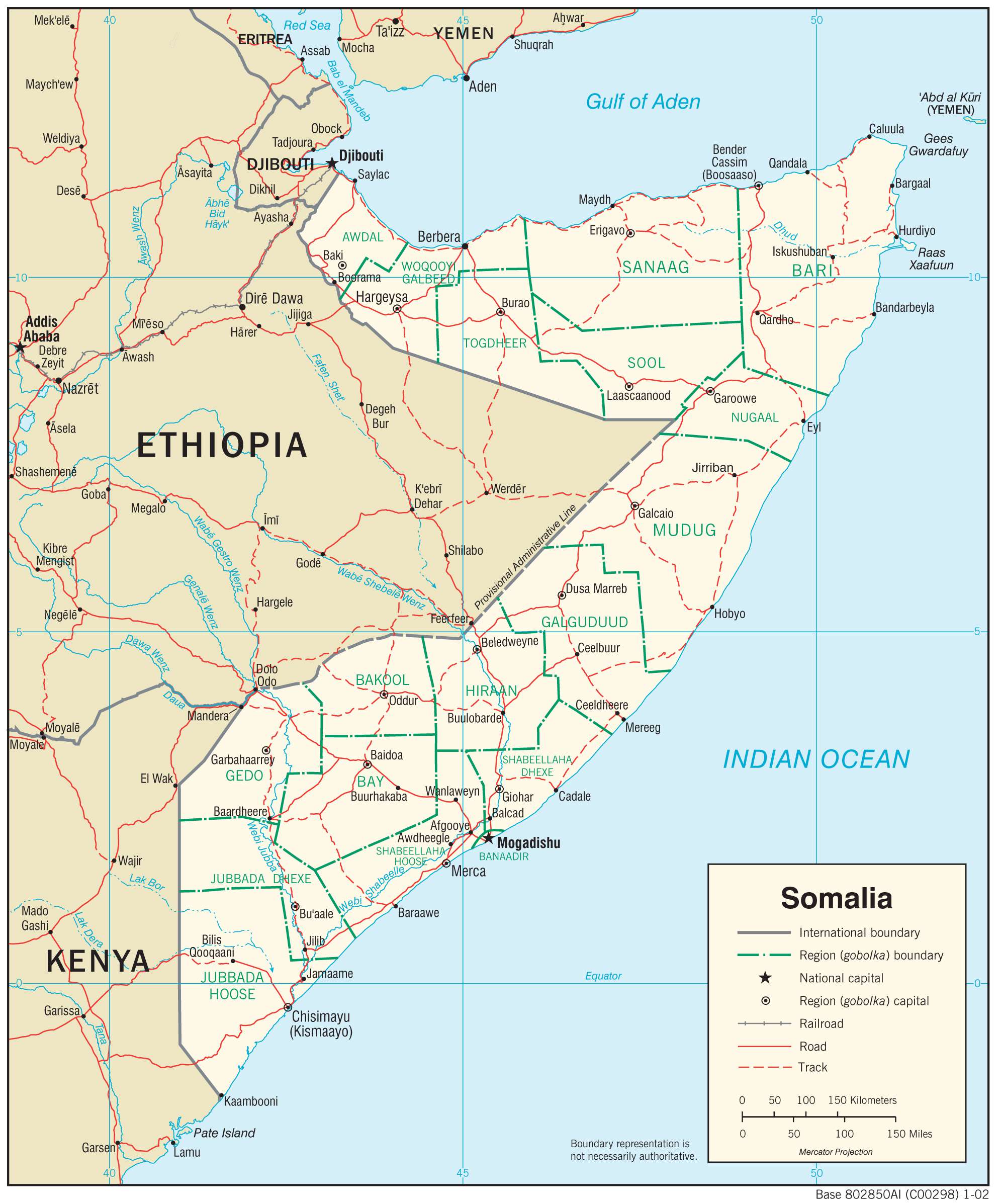
The ongoing Civil War in Somalia has resulted in the country going through great turmoil. As such, the political divisions of the country have gone through several changes in recent times and possibly will undergo further changes in the future until the war dies down and a permanent solution is devised.
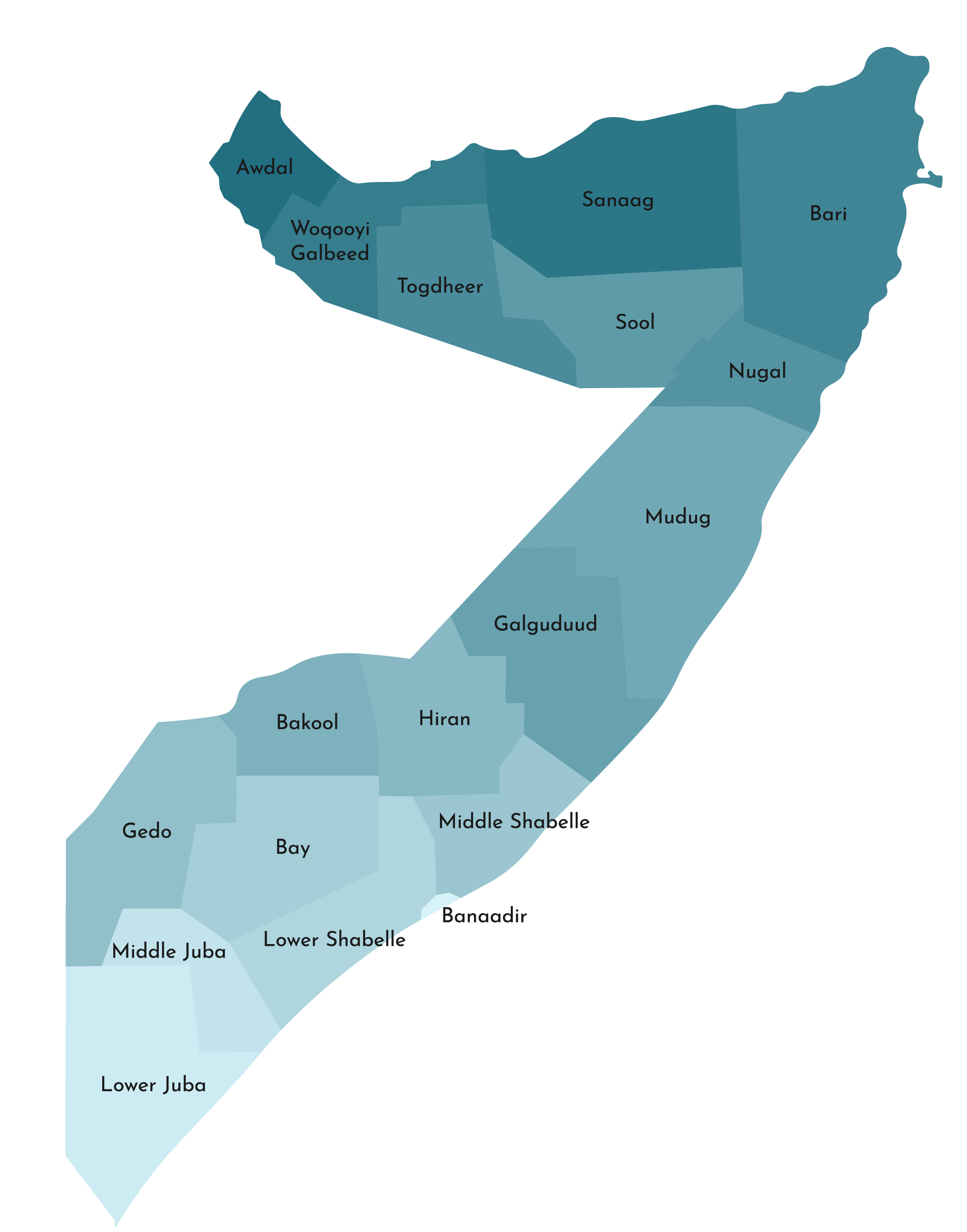
As of 2016, the Republic of Somalia was made up of the five federal member states of Galmudug, Hirshabelle, Jubaland, Puntland, and South West.
These states are divided into eighteen administrative divisions called regions or gobolka as shown in the map above. In alphabetical order, these are Awdal, Bakool, Banaadir, Bari, Bay, Galguduud, Gedo, Hiiraan, Jubbada Dhexe (Middle Jubba), Jubbada Hoose (Lower Jubba), Mudug, Nugaal, Sanaag, Shabeellaha Dhexe (Middle Shabeelle), Shabeellaha Hoose (Lower Shabeelle), Sool, Togdheer, Woqooyi Galbeed.
These regions are further subdivided into districts.
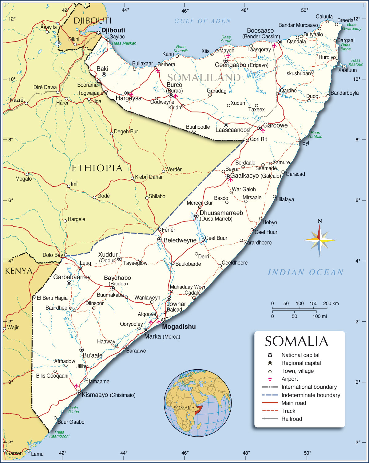
Mogadishu is the capital of Somalia and is located in the Banaadir Region of the country.
Location Maps
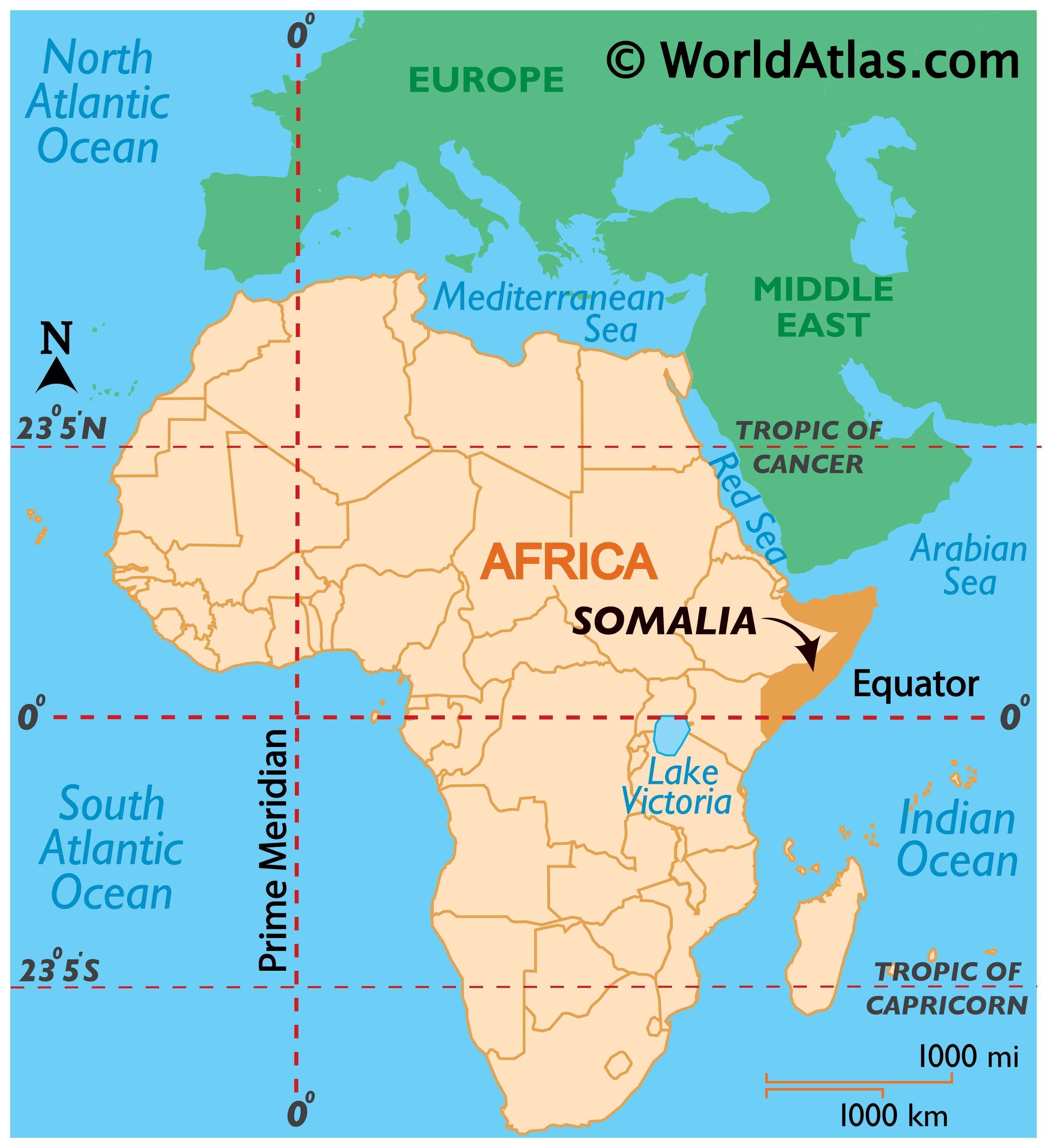
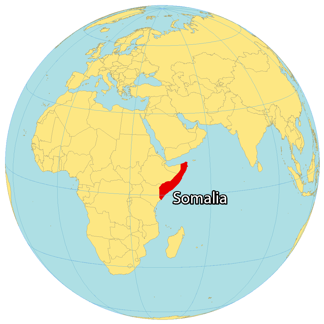
Where is Somalia?
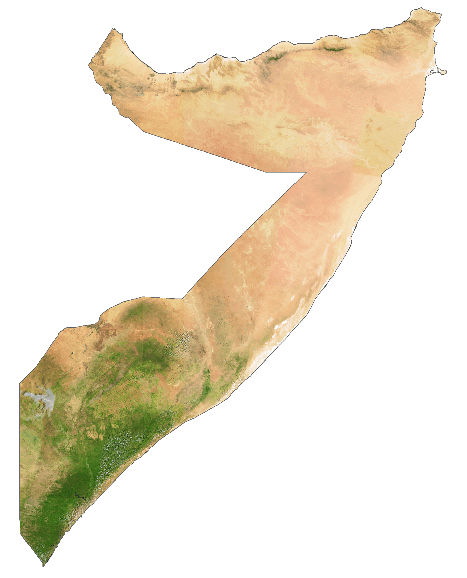
Somalia is located in Eastern Africa, within the Horn of Africa region. It’s bordered by Kenya to the southwest, Ethiopia to the west and Djibouti to the northwest. Somalia has the longest coastline of any other African country, measuring 3,333 kilometers (2071 mi) along the Gulf of Aden and the Indian Ocean. The capital and largest city is Mogadishu, and other major cities include Beledweyne, Marka, and Jamaame. The overall shape of the country resembles the number “7”.

High Definition Political Map of Somalia

Physical Map of Somalia
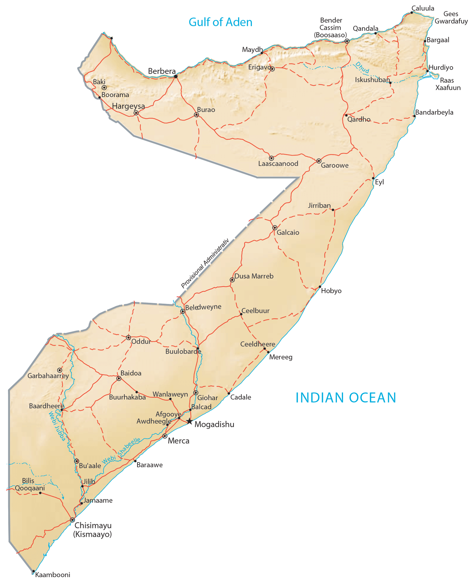
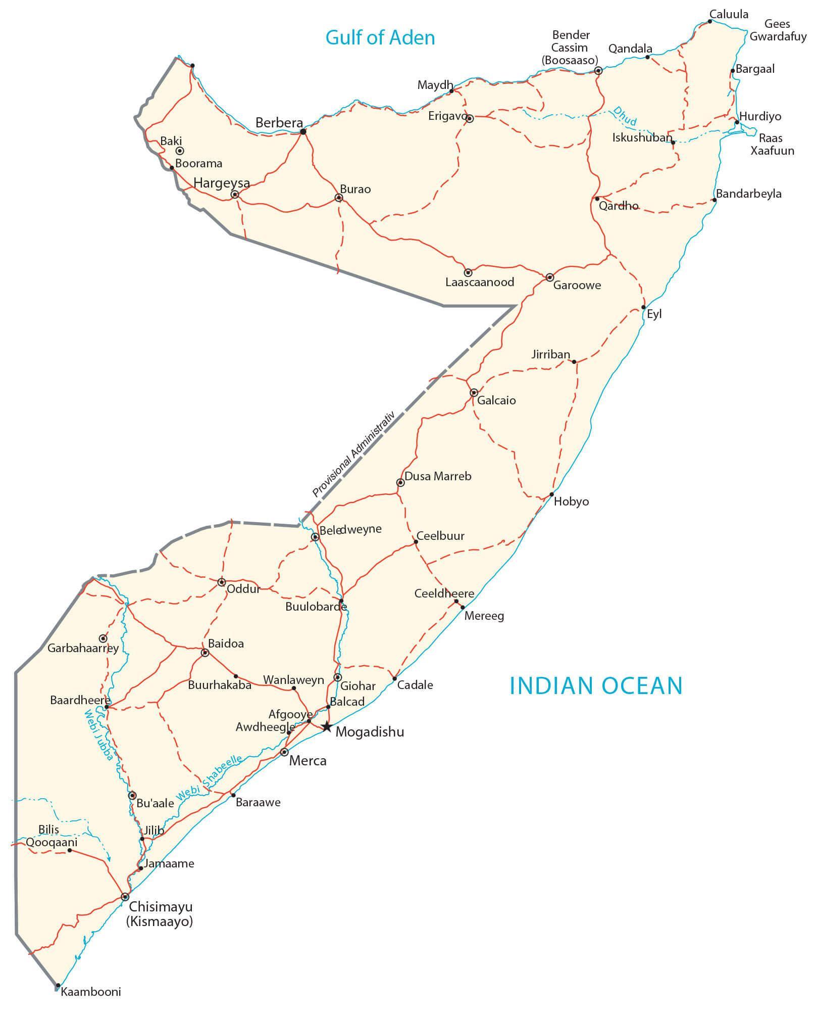
Transportation Map of Somalia
Somalia Satellite Map