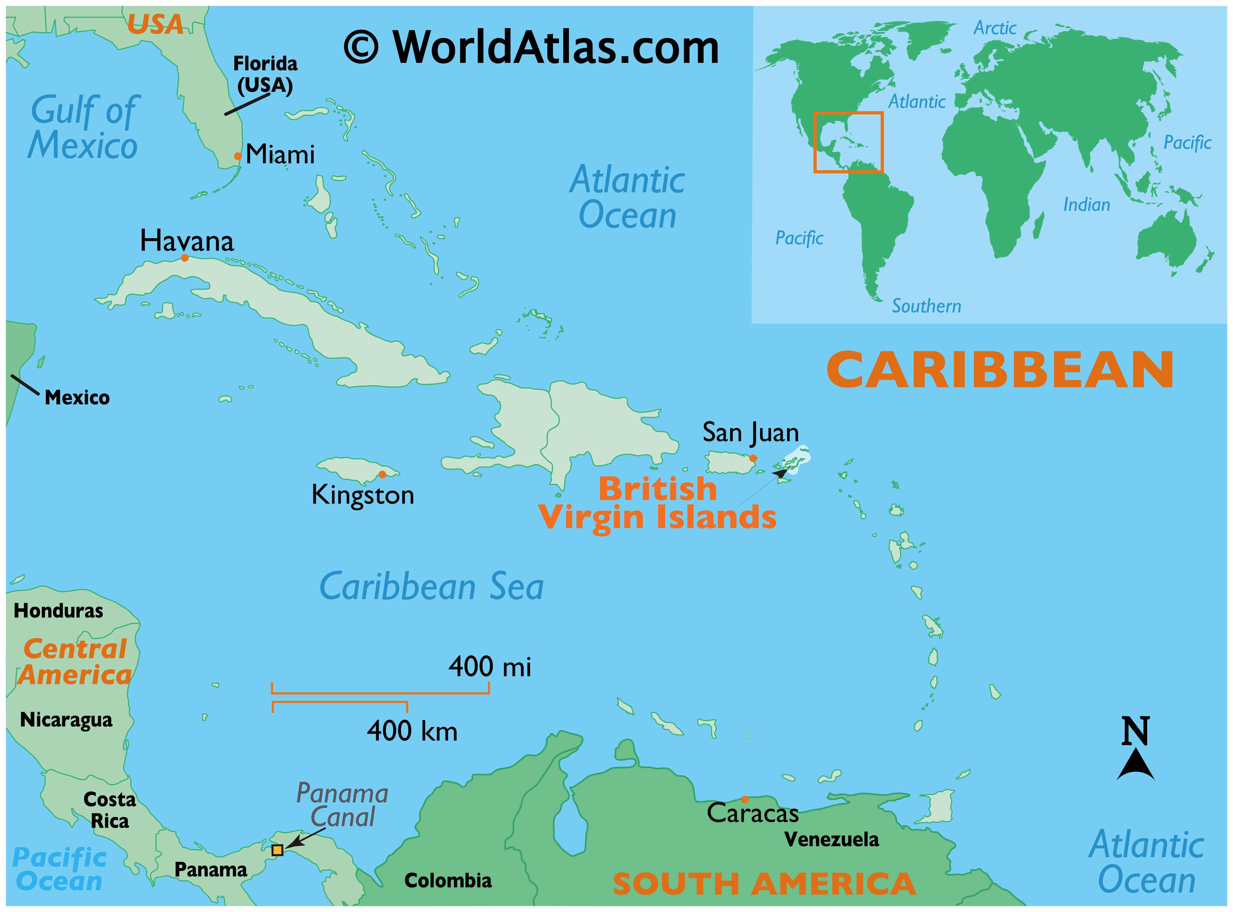
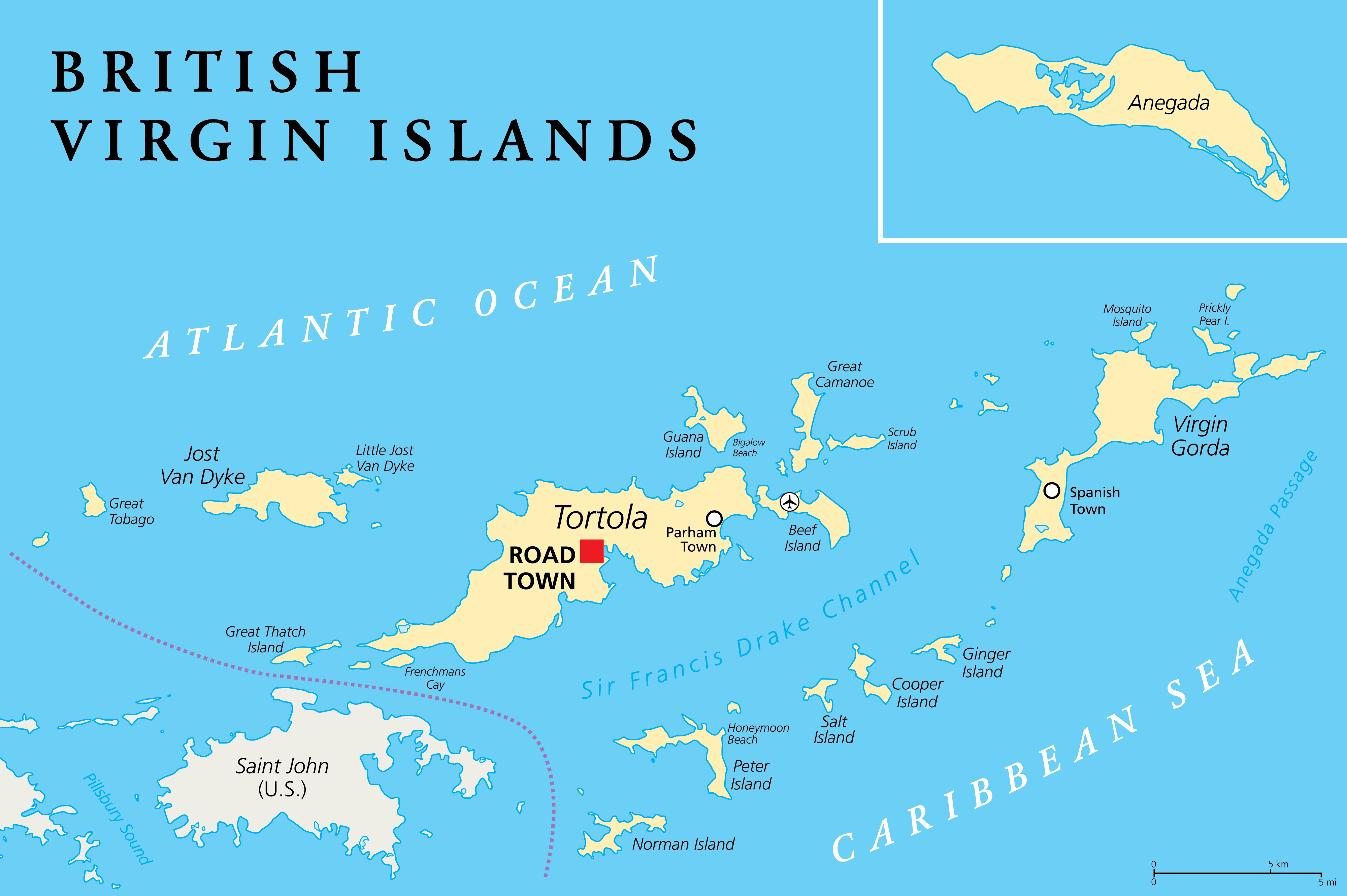
Covering a total area of only 153 sq. km, the British Virgin Islands is a British Overseas Territory located in the northeastern Caribbean.
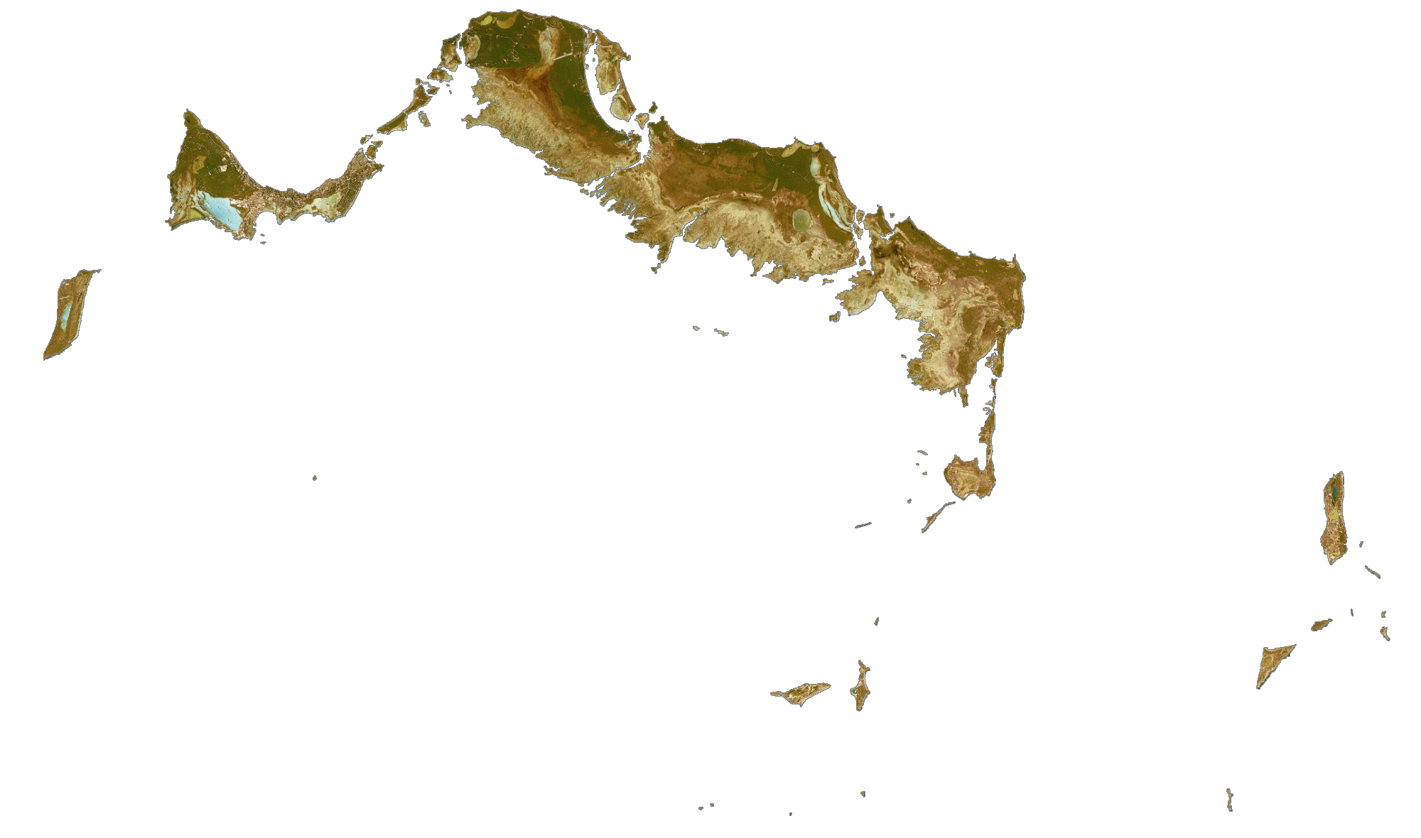
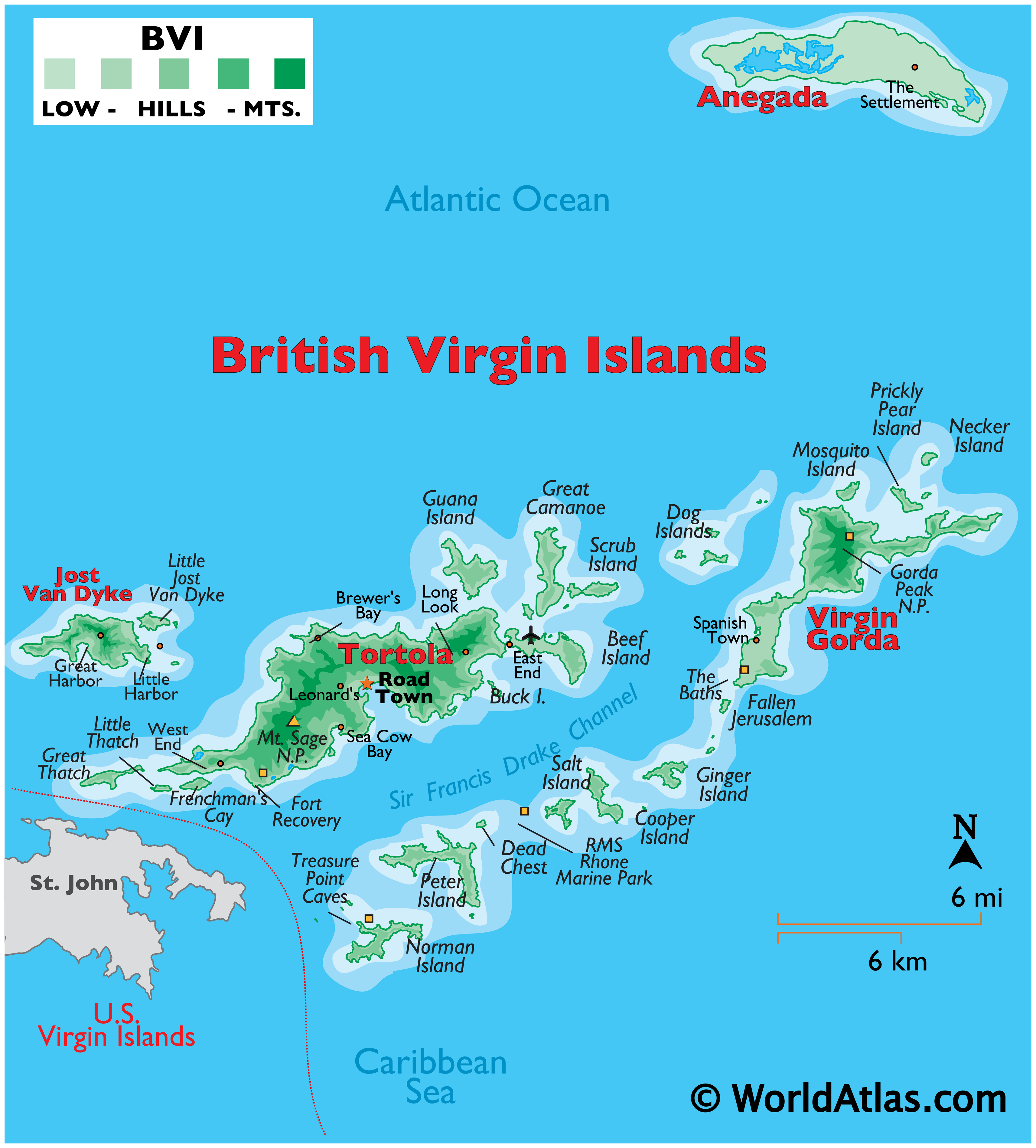
As observed on the map, the British Virgin Islands comprises of 4 large islands namely, Tortola, Anegada, Virgin Gorda, and Jost Van Dyke; along with 50 smaller islands and islets. Most of the islands are volcanic in origin and have a hilly, rugged terrain. The island of Anegada is geologically distinct from the rest of the group and is a flat island composed of limestone and coral. Located on the island of Tortola, to the southwest of Road Town is the volcanic peak -Mount Sage, which is also the territory’s highest point at 1,709ft (521m). There are no rivers in the British Virgin Islands. The territory’s lowest point is at the Caribbean Sea (0m).
| Flag: |  |
|---|---|
| Legal Name: | British Virgin Islands |
| Capital Value: | Road Town |
| Official languages: | English |
| Demonym(s): |
|
| Government: | Parliamentary dependency under a constitutional monarchy |
| Legislature: | House of Assembly |
| Total Area: | 151 km² |
| Land Area: | 151 km² |
| Population: | 30,030 |
| Density: | 260/km (673.4/sq mi) (68th) |
| Currency Value: | US Dollar (USD) |
| Driving side: | left |
| Calling code: | +1-284 |
| Internet TLD: | .vg |
Explore the British Virgin Islands with this detailed map! This map of the BVI includes satellite imagery, settlements, seaports, bays, islands, points, harbors, and its international airport. Get a bird’s eye view of the island nation in the Caribbean Sea with this satellite imagery map of the British Virgin Islands.
Online Interactive Political Map
Click on ![]() to view map in "full screen" mode.
to view map in "full screen" mode.
Being an Overseas Territory of the United Kingdom, the British Virgin Islands do not have any major administrative divisions.
Covering a total area of only 153 sq. km, the British Virgin Islands comprises of 4 large islands namely, Tortola, Anegada, Virgin Gorda, and Jost Van Dyke; along with 50 smaller islands and islets. Situated in the center of the southern coast of Tortola Island is Road Town – the capital of the British Virgin Islands. It serves as the principal town, port, and tourist center of the British Virgin Islands.
Location Maps
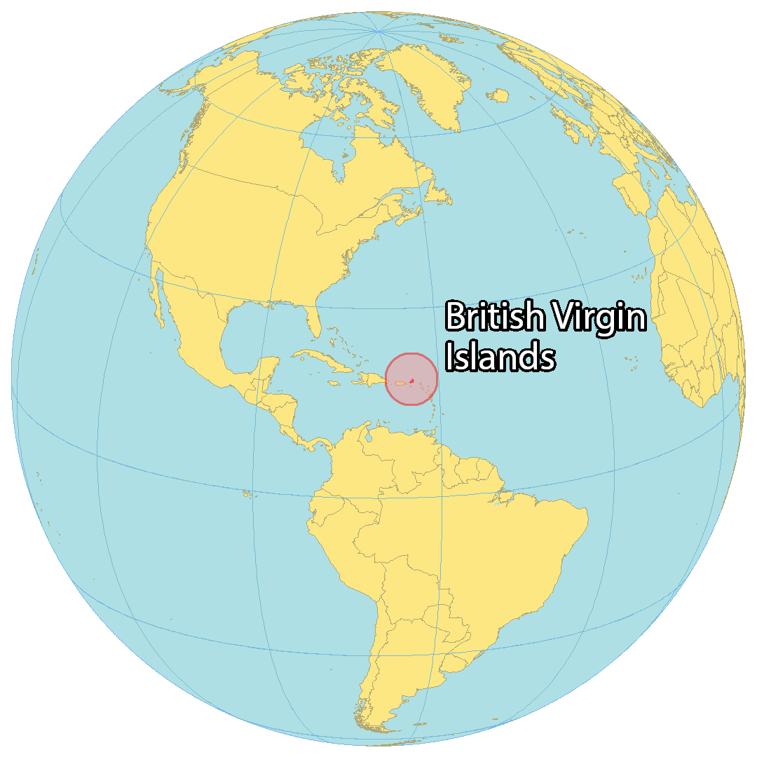
Where is British Virgin Islands?
The British Virgin Islands is a Caribbean Sea territory located near the US Virgin Islands and Puerto Rico to the west. It’s comprised of four main islands and fifty smaller islands and cays. Tortola is the largest and most central island, with Virgin Gorda to the east, Jost Van Dyke to the west, and Anegada about 25 kilometers to the east.
Road Town, the capital and largest city, is located on the island of Tortola. Spanish Town is the second largest settlement and is found on Virgin Gorda.
The British Virgin Islands are popular among sailors, beachgoers, divers, and those who appreciate offshore banking. The main international airport is the Terrance B. Lettsome International Airport, located on Beef Island in the east.

High Definition Political Map of British Virgin Islands

History
It is generally thought that the Virgin Islands were first settled by the Arawak from South America around 100 BC to AD 200, though there is some evidence of Amerindian presence on the islands as far back as 1500 BC. The Arawaks inhabited the islands until the 15th century when they were displaced by the more aggressive Caribs, a tribe from the Lesser Antilles islands.
The first European sighting of the Virgin Islands was by the Spanish expedition of Christopher Columbus in 1493 on his second voyage to the Americas, who gave the islands their modern name.
The Spanish Empire claimed the islands by discovery in the early 16th century, but never settled them, and subsequent years saw the English, Dutch, French, Spanish, and Danish all jostling for control of the region, which became a notorious haunt for pirates. There is no record of any native Amerindian population in the British Virgin Islands during this period; it is thought that they either fled to safer islands or were killed.
The Dutch established a permanent settlement on the island of Tortola by 1648, frequently clashing with the Spanish who were based on nearby Puerto Rico. In 1672, the English captured Tortola from the Dutch, and the English annexation of Anegada and Virgin Gorda followed in 1680. Meanwhile, over the period 1672–1733, the Danish gained control of the nearby islands of Saint Thomas, Saint John and Saint Croix (i.e. the modern US Virgin Islands).
The British islands were considered principally a strategic possession. The British introduced sugar cane which was to become the main crop and source of foreign trade, and large numbers of slaves were forcibly brought from Africa to work on the sugar cane plantations. The islands prospered economically until the middle of the nineteenth century, when a combination of the abolition of slavery in the British Empire in 1834, a series of disastrous hurricanes, and the growth in the sugar beet crop in Europe and the United States significantly reduced sugar cane production and led to a period of economic decline.
In 1917, the United States purchased the Danish Virgin Islands for US$25 million, renaming them the United States Virgin Islands. Economic linkages with the US islands prompted the British Virgin Islands to adopt the US dollar as its currency in 1959.
The British Virgin Islands were administered variously as part of the British Leeward Islands or with St. Kitts and Nevis, with an administrator representing the British Government on the islands. The islands gained separate colony status in 1960 and became autonomous in 1967 under the new post of Chief Minister. Since the 1960s, the islands have diversified away from their traditionally agriculture-based economy towards tourism and financial services, becoming one of the wealthiest areas in the Caribbean. The constitution of the islands was amended in 1977, 2004 and 2007, giving them greater local autonomy.
In 2017 Hurricane Irma struck the islands, causing four deaths and immense damage.
Physical Map of British Virgin Islands
Geography
The British Virgin Islands comprise around 60 tropical Caribbean islands, ranging in size from the largest, Tortola, being 20 km (12 mi) long and 5 km (3 mi) wide, to tiny uninhabited islets, altogether about 150 square kilometres (58 square miles) in extent. They are located in the Virgin Islands archipelago, a few miles east of the US Virgin Islands, and about 95 km (59 mi) from the Puerto Rican mainland. About 150 km (93 mi) east south-east lies Anguilla. The North Atlantic Ocean lies to the east of the islands, and the Caribbean Sea lies to the west. Most of the islands are volcanic in origin and have a hilly, rugged terrain. The highest point is Mount Sage on Tortola at 521m. Anegada is geologically distinct from the rest of the group, being a flat island composed of limestone and coral. The British Virgin Islands contain the Leeward Islands moist forests and Leeward Islands xeric scrub terrestrial ecoregions.
British Virgin Islands Satellite Map