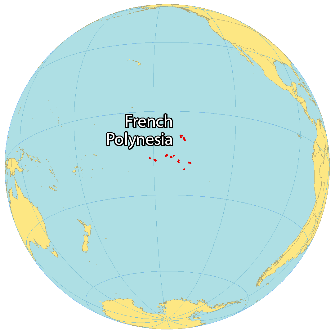
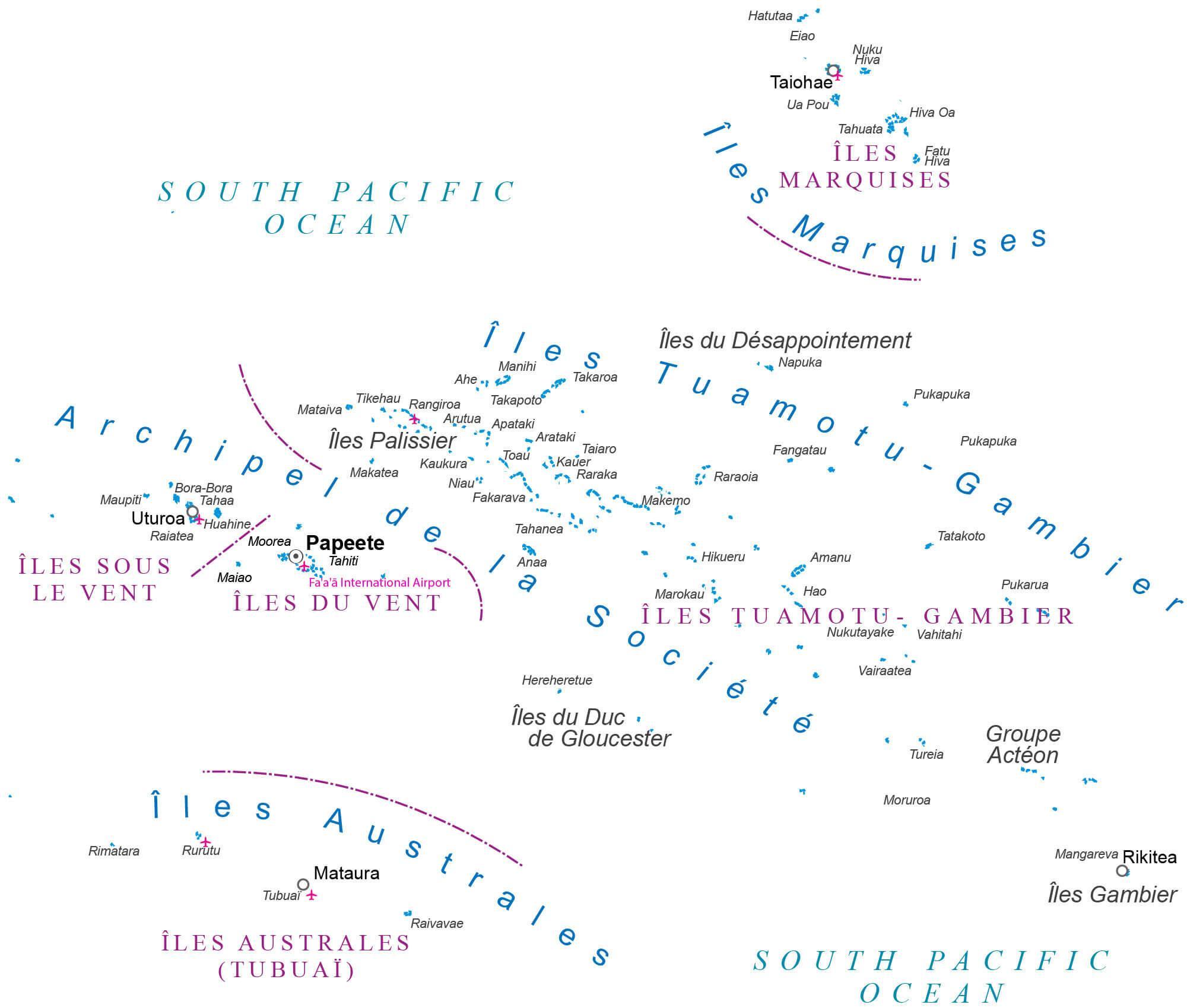
Covering a total land area of 4,167 sq.km (1,609 sq mi) and spread over a vast area about the size of Europe, the widely scattered 118 islands and atolls of French Polynesia is an overseas collectivity of France and are divided into 5 island groups: the Austral, Gambier, Marquesas, Society and Tuamotu archipelagos; in the south-central Pacific Ocean. These island groups can be seen on the physical map of French Polynesia above.
Scattered over 965,255 sq. miles (2,500,000 sq.km) of ocean, most of the islands of French Polynesia are volcanic in origin and fringed by coral reefs. Of these islands, the Society archipelago is certainly the most famous. It includes the stunning islands of Bora Bora, Moorea and Tahiti – and like the enchanting Marquesas in the northeast – most are lush, dark green specs of land, volcanic in origin, with jagged-edged peaks jutting boldly into the sky. The tuamotu archipelago (in contrast to the other groups) includes only low-lying coral atolls (78 in all), and of these, only a handful have passable inlets into their central lagoons. Rangiroa, the largest coral atoll in French Polynesia, is famed for its natural beauty, and remains a favorite of travellers from across the globe. The Austral and Gambier islands in the south are lightly populated, as most are still uninhabited. The highest point of French Polynesia is Mont Orohena, which peaks at an elevation of 7,352 ft (2,241m). the lowest point is the Pacific Ocean (0m).
| Flag: | 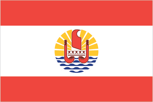 |
|---|---|
| Legal Name: | Overseas Lands of French Polynesia |
| Capital Value: | Papeete (located on Tahiti) |
| Official languages: | French |
| Demonym(s): | French Polynesian |
| Government: | Devolved parliamentary dependency |
| Legislature: | Assembly of French Polynesia |
| Total Area: | 4,167 km² |
| Land Area: | 3,827 km² |
| Water Area: | 340 km² |
| Population: | 279,287 |
| Density: | 79/km (204.6/sq mi) (130th) |
| Currency Value: | Comptoirs Francais du Pacifique francs (XPF) |
| Driving side: | right |
| Calling code: | +689 |
| Internet TLD: | .pf |
Discover the beauty of French Polynesia with this map! This detailed map includes satellite imagery of settlements, seaports, bays, islands, points, harbors, and the international airport of the island nation. From the lush greenery of the islands to the crystal blue waters of the South Pacific Ocean, this map will show you why French Polynesia is so beloved by tourists and locals alike.
Online Interactive Political Map
Click on ![]() to view map in "full screen" mode.
to view map in "full screen" mode.
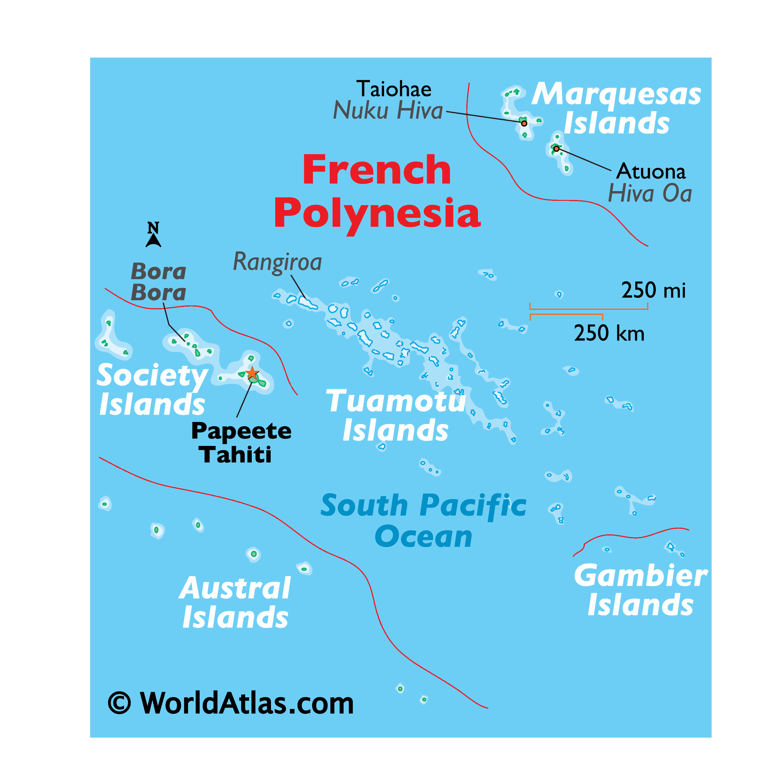
French Polynesia (officially, the collectivity of French Polynesia) is divided into 5 administrative subdivisions (subdivisions administratives, sing. subdivision administrative) and 48 communes. The administrative subdivisions are: lles Australes (Austral Islands), lles du Vent (Windward Islands), lles Marquises (Marquesas Islands), lles Sous-le-Vent (Leeward Islands) and lles Tuamotu-Gambier. [Note: The Leeward Islands and the Windward Islands together make up the Society Islands (lles de la Societe)]. The communes are further subdivided into communes associeés.
Covering a total land area of 4,167 sq.km, French Polynesia is an overseas collectivity of France and comprises of 118 small islands and atolls, scattered across the south-central Pacific Ocean. Out of these 118 islands and atolls, 67 of them are inhabited; among which Tahiti – located in the Society Islands is the most populous. Located on the northwestern coast of Tahiti is, Papeete – the capital, of French Polynesia. It is the administrative, industrial, commercial and financial center of the island territory. Papeete is one of the largest urban centers in the South Pacific region and its excellent harbor serves as the chief port and trading center for transpacific ships. It is also a major tourism hub of the French Polynesia islands. Faaa is the largest city of the island.
Location Maps
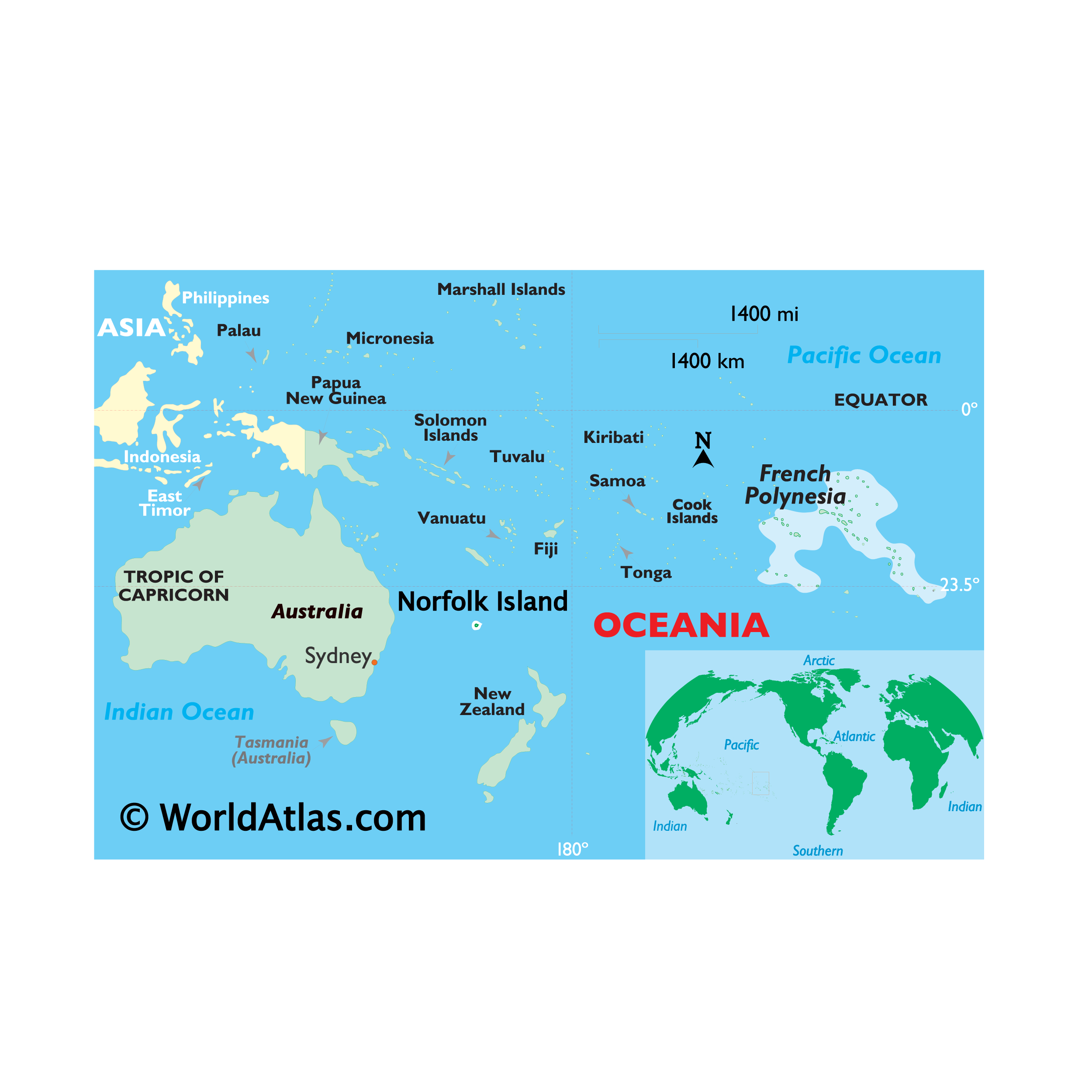
Where is French Polynesia?
French Polynesia is a multi-island overseas territory of France consisting of 118 islands and atolls extending for more than 2,000 kilometers (1,242 mi). These islands are situated in the South Pacific Ocean, 550 kilometers (342 mi) south of Kiribati. It comprises five separate groups of islands, including the Tuamotu Archipelago in the center, the Society Islands to the west, the Austral Islands to the southwest, the Gambier Island to the southeast, and the Marquesas Islands to the northeast.
More than half of the islands are inhabited, with the island of Tahiti in the Society Islands group hosting more than two-thirds of the population. The three major communities in French Polynesia are Faaa (the largest), Punaauia, and Papeete, the capital of French Polynesia. The country has a total area of 4,167 square kilometers (1,609 sq mi). In comparison, it is larger than Samoa but smaller than Trinidad and Tobago. French Polynesia is located in the middle of the Pacific Ocean, and the highest point is Mount Orohena on Tahiti, which is 2,237 meters (7,339 ft) tall.
High Definition Political Map of French Polynesia
History
Anthropologists and historians believe the Great Polynesian Migration commenced around 1500 BC as Austronesian peoples went on a journey using celestial navigation to find islands in the South Pacific Ocean. The first islands of French Polynesia to be settled were the Marquesas Islands in about 200 BC. The Polynesians later ventured southwest and discovered the Society Islands around AD 300.
European encounters began in 1521 when Portuguese explorer Ferdinand Magellan, sailing at the service of the Spanish Crown, sighted Puka-Puka in the Tuāmotu-Gambier Archipelago. In 1606 another Spanish expedition under Pedro Fernandes de Queirós sailed through Polynesia sighting an inhabited island on 10 February which they called Sagitaria (or Sagittaria), probably the island of Rekareka to the southeast of Tahiti. In 1722, Dutchman Jakob Roggeveen while on an expedition sponsored by the Dutch West India Company, charted the location of six islands in the Tuamotu Archipelago and two islands in the Society Islands, one of which was Bora Bora.
British explorer Samuel Wallis became the first European navigator to visit Tahiti in 1767. French explorer Louis Antoine de Bougainville also visited Tahiti in 1768, while British explorer James Cook arrived in 1769, and observed the transit of Venus. He would stop in Tahiti again in 1773 during his second voyage to the Pacific, and once more in 1777 during his third and last voyage before being killed in Hawaii.
In 1772, the Spanish Viceroy of Peru Don Manuel de Amat ordered a number of expeditions to Tahiti under the command of Domingo de Bonechea who was the first European to explore all of the main islands beyond Tahiti. A short-lived Spanish settlement was created in 1774, and for a time some maps bore the name Isla de Amat after Viceroy Amat. Christian missions began with Spanish priests who stayed in Tahiti for a year. Protestants from the London Missionary Society settled permanently in Polynesia in 1797.
King Pōmare II of Tahiti was forced to flee to Mo’orea in 1803; he and his subjects were converted to Protestantism in 1812. French Catholic missionaries arrived on Tahiti in 1834; their expulsion in 1836 caused France to send a gunboat in 1838. In 1842, Tahiti and Tahuata were declared a French protectorate, to allow Catholic missionaries to work undisturbed. The capital of Papeetē was founded in 1843. In 1880, France annexed Tahiti, changing the status from that of a protectorate to that of a colony. The island groups were not officially united until the establishment of the French protectorate in 1889.
After France declared a protectorate over Tahiti in 1842 and fought a war with Tahiti (1844–1847), the British and French signed the Jarnac Convention in 1847, declaring that the kingdoms of Raiatea, Huahine and Bora Bora were to remain independent from both powers and that no single chief was to be allowed to reign over the entire archipelago. France eventually broke the agreement, and the islands were annexed and became a colony in 1888 (eight years after the Windward Islands) after many native resistances and conflicts called the Leewards War, lasting until 1897.
In the 1880s, France claimed the Tuamotu Archipelago, which formerly belonged to the Pōmare Dynasty, without formally annexing it. Having declared a protectorate over Tahuata in 1842, the French regarded the entire Marquesas Islands as French. In 1885, France appointed a governor and established a general council, thus giving it the proper administration for a colony. The islands of Rimatara and Rūrutu unsuccessfully lobbied for British protection in 1888, so in 1889 they were annexed by France. Postage stamps were first issued in the colony in 1892. The first official name for the colony was Établissements de l’Océanie (Establishments in Oceania); in 1903 the general council was changed to an advisory council and the colony’s name was changed to Établissements Français de l’Océanie (French Establishments in Oceania).
In 1940, the administration of French Polynesia recognised the Free French Forces and many Polynesians served in World War II. Unknown at the time to the French and Polynesians, the Konoe Cabinet in Imperial Japan on 16 September 1940 included French Polynesia among the many territories which were to become Japanese possessions, as part of the “Eastern Pacific Government-General” in the post-war world. However, in the course of the war in the Pacific the Japanese were not able to launch an actual invasion of the French islands.
In 1946, Polynesians were granted French citizenship and the islands’ status was changed to an overseas territory; the islands’ name was changed in 1957 to Polynésie Française (French Polynesia). In 1962, France’s early nuclear testing ground in Algeria was no longer usable when Algeria became independent and the Moruroa atoll in the Tuamotu Archipelago was selected as the new testing site; tests were conducted underground after 1974. In 1977, French Polynesia was granted partial internal autonomy; in 1984, the autonomy was extended. French Polynesia became a full overseas collectivity of France in 2003.
In September 1995, France stirred up widespread protests by resuming nuclear testing at Fangataufa atoll after a three-year moratorium. The last test was on 27 January 1996. On 29 January 1996, France announced that it would accede to the Comprehensive Test Ban Treaty, and no longer test nuclear weapons.
French Polynesia was relisted in the United Nations list of non-self-governing territories in 2013, making it eligible for a UN-backed independence referendum. The relisting was made after the indigenous opposition was voiced and supported by the Polynesian Leaders Group, Pacific Conference of Churches, Women’s International League for Peace and Freedom, Non-Aligned Movement, World Council of Churches, and Melanesian Spearhead Group.
Physical Map of French Polynesia
Geography
The islands of French Polynesia make up a total land area of 3,521 square kilometres (1,359 sq mi), scattered over more than 2,000 kilometres (1,200 mi) of ocean. There are 121 islands in French Polynesia and many more islets or motus around atolls. The highest point is Mount Orohena on Tahiti.
It is made up of five archipelagos. The largest and most populated island is Tahiti, in the Society Islands. The archipelagos are:
Aside from Tahiti, some other important atolls, islands, and island groups in French Polynesia are: Ahē, Bora Bora, Hiva ‘Oa, Huahine, Mai’ao, Maupiti, Meheti’a, Mo’orea, Nuku Hiva, Raiatea, Taha’a, Tetiaroa, Tupua’i and Tūpai.
French Polynesia is home to four terrestrial ecoregions: Marquesas tropical moist forests, Society Islands tropical moist forests, Tuamotu tropical moist forests, and Tubuai tropical moist forests.