The Falkland Islands covers a total area of 12,173 sq.km (4,700 sq mi), and are an overseas territory of the United Kingdom in South Atlantic Ocean. As observed on the physical map above, The Falkland Islands are an archipelago comprised of two large islands (East Falkland and West Falkland) and several hundred smaller ones, that are ringed by a rugged coastline, and for the most part are hilly, rocky and covered with low shrubs and coarse grass. The two large islands are separated by Falkland Sound.
Hills and low mountains cover the central areas of both large islands, including the Wickham Heights and Hornsby ranges. The archipelago’s highest point, as marked on the map by an upright yellow triangle on the map is Mount Usborne at 2,312ft (705m) housed on East Falkland. The lowest point is the Atlantic Ocean. Shallow streams, ponds and tiny lakes cover a very small percentage of the land, while the drowned river valleys form protected natural harbors along the islands coast.
| Legal Name: | Falkland Islands (Islas Malvinas) |
|---|---|
| Capital Value: | Stanley |
| Official languages: | English |
| Demonym(s): | Falkland Islander, Falklander |
| Government: | Devolved parliamentary dependency under a constitutional monarchy |
| Legislature: | Legislative Assembly |
| Total Area: | 12,173 km² |
| Land Area: | 12,173 km² |
| Population: | 3,198 |
| Density: | 0.30/km (0.8/sq mi) (not ranked) |
| Currency Value: | Falkland pounds (FKP) |
| Driving side: | left |
| Calling code: | +500 |
| Internet TLD: | .fk |
Location Maps
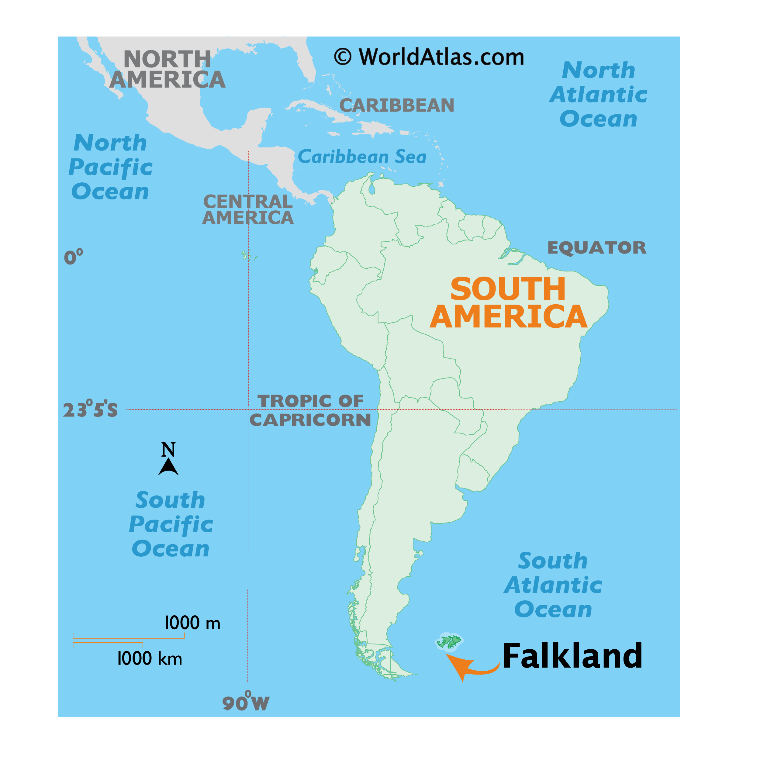
Where is Falkland Islands (Islas Malvinas)?
High Definition Political Map of Falkland Islands (Islas Malvinas)

History
Although Fuegians from Patagonia may have visited the Falkland Islands in prehistoric times, the islands were uninhabited when Europeans first explored them. European claims of discovery date back to the 16th century, but no consensus exists on whether early explorers sighted the Falklands or other islands in the South Atlantic. The first undisputed landing on the islands is attributed to English captain John Strong, who, en route to Peru and Chile’s littoral in 1690, explored the Falkland Sound and noted the islands’ water and game.
The Falklands remained uninhabited until the 1764 establishment of Port Louis on East Falkland by French captain Louis Antoine de Bougainville and the 1766 foundation of Port Egmont on Saunders Island by British captain John MacBride. Whether or not the settlements were aware of each other’s existence is debated by historians. In 1766, France surrendered its claim on the Falklands to Spain, which renamed the French colony Puerto Soledad the following year. Problems began when Spain detected and captured Port Egmont in 1770. War was narrowly avoided by its restitution to Britain in 1771.
The British and Spanish settlements coexisted in the archipelago until 1774, when Britain’s new economic and strategic considerations led it to voluntarily withdraw from the islands, leaving a plaque claiming the Falklands for King George III. Spain’s Viceroyalty of the Río de la Plata became the only governmental presence in the territory. West Falkland was left abandoned, and Puerto Soledad became mostly a prison camp. Amid the British invasions of the Río de la Plata during the Napoleonic Wars in Europe, the islands’ governor evacuated the archipelago in 1806; Spain’s remaining colonial garrison followed suit in 1811, except for gauchos and fishermen who remained voluntarily.
Thereafter the archipelago was visited only by fishing ships; its political status was undisputed until 1820, when Colonel David Jewett, an American privateer working for the United Provinces of the Río de la Plata, informed anchored ships about Buenos Aires’ 1816 claim to Spain’s territories in the South Atlantic. Since the islands had no permanent inhabitants, in 1823 Buenos Aires granted German-born merchant Luis Vernet permission to conduct fishing activities and exploit feral cattle in the archipelago. Vernet settled at the ruins of Puerto Soledad in 1826, and accumulated resources on the islands until the venture was secure enough to bring settlers and form a permanent colony. Buenos Aires named Vernet military and civil commander of the islands in 1829, and he attempted to regulate sealing to stop the activities of foreign whalers and sealers. Vernet’s venture lasted until a dispute over fishing and hunting rights led to a raid by the American warship USS Lexington in 1831, when United States Navy commander Silas Duncan declared the dissolution of the island’s government.
Buenos Aires attempted to retain influence over the settlement by installing a garrison, but a mutiny in 1832 was followed the next year by the arrival of British forces who reasserted Britain’s rule. The Argentine Confederation (headed by Buenos Aires Governor Juan Manuel de Rosas) protested against Britain’s actions, and Argentine governments have continued since then to register official protests against Britain. The British troops departed after completing their mission, leaving the area without formal government. Vernet’s deputy, the Scotsman Matthew Brisbane, returned to the islands that year to restore the business, but his efforts ended after, amid unrest at Port Louis, gaucho Antonio Rivero led a group of dissatisfied individuals to murder Brisbane and the settlement’s senior leaders; survivors hid in a cave on a nearby island until the British returned and restored order. In 1840, the Falklands became a Crown colony and Scottish settlers subsequently established an official pastoral community. Four years later, nearly everyone relocated to Port Jackson, considered a better location for government, and merchant Samuel Lafone began a venture to encourage British colonisation.
Stanley, as Port Jackson was soon renamed, officially became the seat of government in 1845. Early in its history Stanley had a negative reputation due to cargo-shipping losses; only in emergencies would ships rounding Cape Horn stop at the port. Nevertheless the Falklands’ geographic location proved ideal for ship repairs and the “Wrecking Trade”, the business of selling and buying shipwrecks and their cargoes. Aside from this trade, commercial interest in the archipelago was minimal due to the low-value hides of the feral cattle roaming the pastures. Economic growth began only after the Falkland Islands Company, which bought out Lafone’s failing enterprise in 1851, successfully introduced Cheviot sheep for wool farming, spurring other farms to follow suit. The high cost of importing materials, combined with the shortage of labour and consequent high wages, meant the ship repair trade became uncompetitive. After 1870 it declined as the replacement of sail ships by steamships was accelerated by the low cost of coal in South America; by 1914, with the opening of the Panama Canal, the trade effectively ended. In 1881, the Falkland Islands became financially independent of Britain. For more than a century, the Falkland Islands Company dominated the trade and employment of the archipelago; in addition, it owned most housing in Stanley, which greatly benefited from the wool trade with the UK.
In the first half of the 20th century the Falklands served an important role in Britain’s territorial claims to subantarctic islands and a section of Antarctica. The Falklands governed these territories as the Falkland Islands Dependencies starting in 1908, and retained them until their dissolution in 1985. The Falklands also played a minor role in the two world wars as a military base aiding control of the South Atlantic. In the First World War Battle of the Falkland Islands in December 1914 a Royal Navy fleet defeated an Imperial German squadron. In the Second World War, following the December 1939 Battle of the River Plate, the battle-damaged HMS Exeter steamed to the Falklands for repairs. In 1942, a battalion en route to India was redeployed to the Falklands as a garrison amid fears of a Japanese seizure of the archipelago. After the war ended, the Falklands economy was affected by declining wool prices and the political uncertainty resulting from the revived sovereignty dispute between the United Kingdom and Argentina.
Simmering tensions between the UK and Argentina increased during the second half of the century, when Argentine President Juan Perón asserted sovereignty over the archipelago. The sovereignty dispute intensified during the 1960s, shortly after the United Nations passed a resolution on decolonisation which Argentina interpreted as favourable to its position. In 1965, the UN General Assembly passed Resolution 2065, calling for both states to conduct bilateral negotiations to reach a peaceful settlement of the dispute. From 1966 until 1968, the UK confidentially discussed with Argentina the transfer of the Falklands, assuming its judgement would be accepted by the islanders. An agreement on trade ties between the archipelago and the mainland was reached in 1971 and, consequently, Argentina built a temporary airfield at Stanley in 1972. Nonetheless, Falklander dissent, as expressed by their strong lobby in the UK Parliament, and tensions between the UK and Argentina effectively limited sovereignty negotiations until 1977.
Concerned at the expense of maintaining the Falkland Islands in an era of budget cuts, the UK again considered transferring sovereignty to Argentina in the early Thatcher government. Substantive sovereignty talks again ended by 1981, and the dispute escalated with passing time. In April 1982 the Falklands War began when Argentine military forces invaded the Falklands and other British territories in the South Atlantic, briefly occupying them until a UK expeditionary force retook the territories in June. After the war the UK expanded its military presence, building RAF Mount Pleasant and increasing the size of its garrison. The war also left some 117 minefields containing nearly 20,000 mines of various types, including anti-vehicle and anti-personnel mines. Due to the large number of deminer casualties, initial attempts to clear the mines ceased in 1983. Demining operations recommenced in 2009 and were completed in October 2020.
Based on Lord Shackleton’s recommendations, the Falklands diversified from a sheep-based monoculture into an economy of tourism and, with the establishment of the Falklands exclusive economic zone, fisheries. The road network was also made more extensive, and the construction of RAF Mount Pleasant allowed access to long haul flights. Oil exploration also began in the 2010s, with indications of possible commercially exploitable deposits in the Falklands basin. Landmine clearance work restarted in 2009, in accordance with the UK’s obligations under the Ottawa Treaty, and Sapper Hill Corral was cleared of mines in 2012, allowing access to an important historical landmark for the first time in 30 years. Argentina and the UK re-established diplomatic relations in 1990, but neither has agreed on the terms of future sovereignty discussions.
Physical Map of Falkland Islands (Islas Malvinas)

Geography
The Falkland Islands have a land area of 4,700 sq mi (12,000 km) and a coastline estimated at 800 mi (1,300 km). The archipelago consists of two main islands, West Falkland and East Falkland, and 776 smaller islands. The islands are predominantly mountainous and hilly, with the major exception being the depressed plains of Lafonia (a peninsula forming the southern part of East Falkland). The Falklands consists of continental crust fragments resulting from the break-up of Gondwana and the opening of the South Atlantic that began 130 million years ago. The islands are located in the South Atlantic Ocean, on the Patagonian Shelf, about 300 mi (480 km) east of Patagonia in southern Argentina.
The Falklands’ approximate location is latitude 51°40′ – 53°00′ S and longitude 57°40′ – 62°00′ W. The archipelago’s two main islands are separated by the Falkland Sound, and its deep coastal indentations form natural harbours. East Falkland houses Stanley (the capital and largest settlement), the UK military base at RAF Mount Pleasant, and the archipelago’s highest point: Mount Usborne, at 2,313 ft (705 m). Outside of these significant settlements is the area colloquially known as “Camp”, which is derived from the Spanish term for countryside (Campo).
The climate of the islands is cold, windy, and humid maritime. Variability of daily weather is typical throughout the archipelago. Rainfall is common over half of the year, averaging 610 mm (24 in) in Stanley, and sporadic light snowfall occurs nearly all year. The temperature has historically stayed between 21.1 and −11.1 °C (70.0 and 12.0 °F) in Stanley, with mean monthly temperatures varying from 9 °C (48 °F) early in the year to −1 °C (30 °F) in July. Strong westerly winds and cloudy skies are common. Although numerous storms are recorded each month, conditions are normally calm.