Map of Slovenia

Map of Slovenia

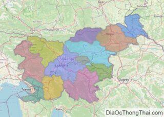
Slovenia occipies an area of 20,271 sq. km in Central Europe. As observed on the physical map above, Slovenia has a highly elevated terrain with over 40% of the country being mountainous. The country can be roughly divided into four physigraphic regions. The Alps extend across the northern and northwestern parts of the country. The … Read more

Map of Lebanon

Map of Lebanon

The topography of Lebanon can be distinguished into four distinct physiographic regions as observed on the physical map of the country above. The narrow and discontinuous coastal plain along the Mediterranean Sea features both sandy bays and rocky beaches.  Further inland and rising from the coast is the Lebanon Mountain range that is around 100 … Read more

Map of Libya

Map of Libya

With an area of 1,759,541 sq. km, the North African country of Libya, is the fourth largest country in the continent. As observed on the physical map of Libya, most of the country’s terrain is barren and features flat to undulating plains, plateaus, and depressions.Several highlands dot the landscape, but there are almost no true … Read more

Map of Serbia

Map of Serbia

Serbia, a landlocked country located in the Balkan Peninsula’s central region. Including the disputed territory of Kosovo, Serbia’s area is 88,361 km2(34,116 sq mi). However, excluding Kosovo, Serbia has an area of 77,474 km2(29,913 sq mi). As observed on the physical map of Serbia, the rugged mountains, hills and valleys of the Dinaric Alps slice through Serbia west of the Morava … Read more

Map of Azerbaijan

Map of Azerbaijan

Azerbaijan is a country covering 86,600 km2 (33,400 sq mi) in the Caucasus region of Eurasia.  As observed on the physical map of Azerbaijan, the country his highly mountainous. The Caucasus Mountains cover the north and central regions of the country. Here, many snow-capped peaks exceed 12,000 ft. The highest point in the country, Baza-Dyuzi … Read more

Map of Democratic Republic of the Congo

Map of Democratic Republic of the Congo

The Democratic Republic of the Congo occupies an area of 2,345,409 sq. km in Central Africa. It is the largest country in sub-Saharan Africa. The physical map above illustrates the country of the Democratic Republic of Congo, with the massive expanse of the Congo Rainforest, the second-largest rainforest in the world after the Amazon. Most of … Read more

Map of Jordan

Map of Jordan

Jordan occupies an area of around 91,880 sq. km in Southwest Asia.  As observed on the physical map above, the country can be divided into three main physiographic regions.  The desert region includes the eastward extensions of the Syrian and the Ard As Sawwan Deserts and covers over four-fifths of the country.  To the west … Read more

Map of Bolivia

Map of Bolivia

Bolivia is a landlocked nation located in west-central South America. Covering an area of 1,098,581 sq.km (424,164 sq mi), Bolivia is the 5th largest country in South America and the largest landlocked nation in the Southern Hemisphere. As observed on the physical map of Bolivia above, the country’s western half is covered by the Andes – as … Read more

Map of Turkmenistan

Map of Turkmenistan

The landlocked Central Asian country of Turkmenistan occupies an area of 488,100 sq. km. It has a 1,786 km long border with the Caspian Sea, the world’s largest inland water body, to the west. As observed on the physical map of Turkmenistan, most of the topography of the country is dominated by the flat Garagum … Read more

Map of Tunisia

Map of Tunisia

Tunisia is a North African country with a total area of 163,610 sq. km and a coastline of 1,148 km on the Mediterranean Sea to the north. Despite its relatively small size that is about the size of the US state of Wisconsin, Tunisia’s north-south extent lends it great environmental diversity. The country has a … Read more

Map of Cameroon

Map of Cameroon

Cameroon is a Central African country covering an area of 475,442 sq. km.  Cameroon is sometimes called “Africa in miniature” as it features a variety of geographical regions like mountains, desert, savanna, rainforest, and coastal plains.  The physical map above illustrates the country of Cameroon, from the low and marshy coastal area in the south … Read more

Map of Bahrain

Map of Bahrain

Bahrain is an archipelagic nation with a total territory of around 780 sq. km in the Persian Gulf. The main island of Al Bahrayn accounts for about 78% of the country’s territory. Many important petroleum fields of the Middle East surround this island. 33 additional islands are also part of the country. As observed on … Read more